
Off-Road Trails
Near Mertzon, Texas
Off-Road Trails Near Mertzon, Texas
Discover the best offroad trails near you. Browse trail maps, check difficulty ratings, and find your next adventure — whether you're looking for a quick ride or an all-day expedition.
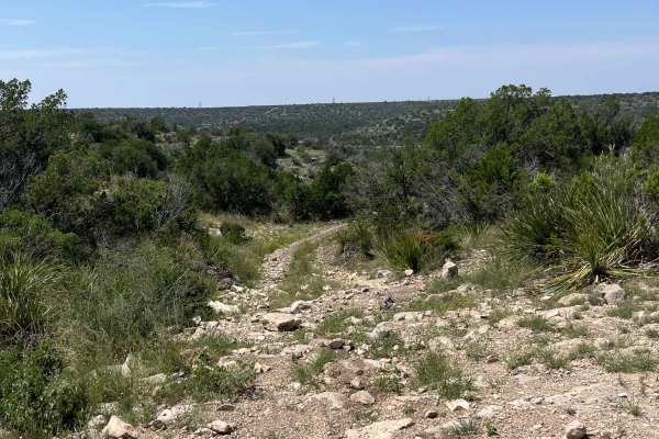
Twin Buttes OHV Trail
This trail is a well marked, one directional ATV and dirt bike track with a long loop and a short loop. The long loop is meant for dirt bikes only as some of the obstacles and trails are too narrow for an ATV. The short track is wide enough for an ATV, but gets rough and off-camber in some areas. Th...
Learn more about Twin Buttes OHV Trail
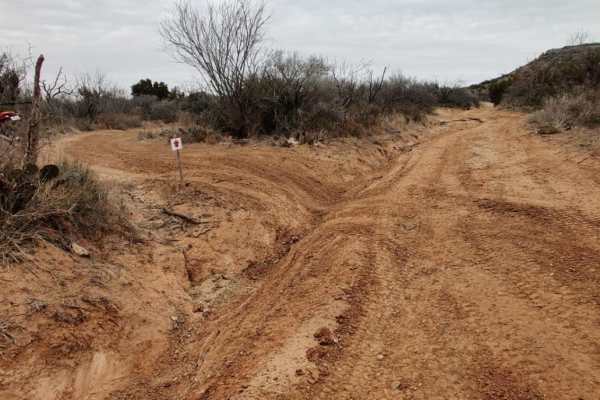
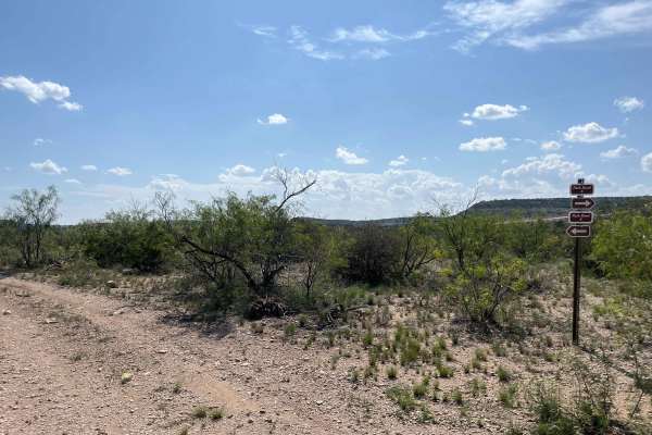
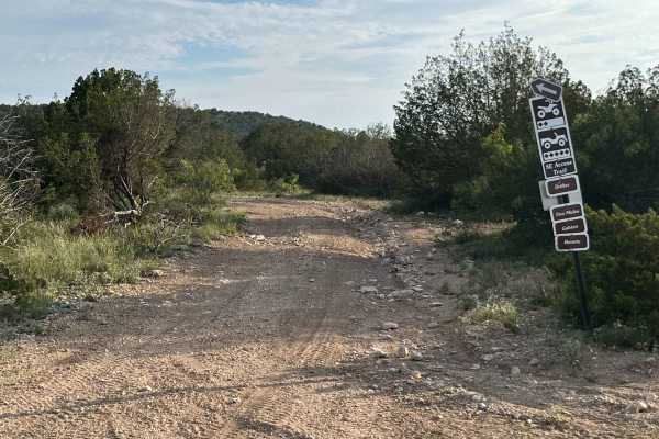
Park Road 5 - PR5
Park Road 5 is an accessible dirt trail for all vehicles, found at the end of Park Road 1. It winds through open desert terrain with some light ruts, low vegetation, and scenic views, connecting to Park Road 4. The trail includes a side junction with Escondido Trail and is marked by clear signage an...
Learn more about Park Road 5 - PR5
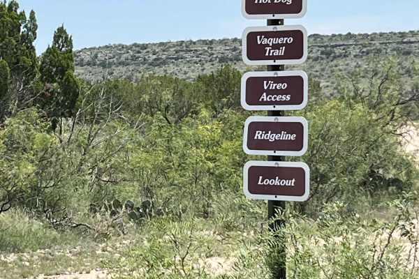
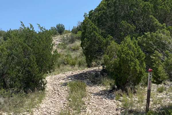
Vaquero Trail - V-28
Vaquero Trail is a loop rated 4 out of 10, running mostly along a mountain ridgeline with great views. The route starts and finishes on Park Road 1, with a mild climb, rocky and hard-packed dirt sections, and clear signage at all trail forks. This trail is ideal for riders wanting scenic ridge drivi...
Learn more about Vaquero Trail - V-28
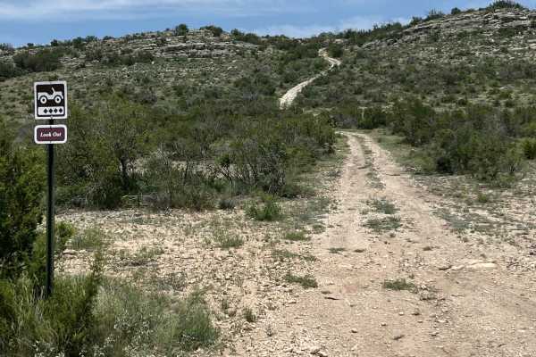
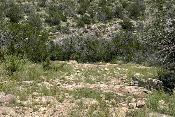
Lookout Trail - V29
Lookout Trail is a challenging off-road route starting from Vaquero Trail, featuring an elevation gain of 183 feet as it ascends rocky terrain toward the summit before looping back to rejoin Vaquero Trail. This short but technical trail demands a capable 4WD vehicle with high ground clearance due to...
Learn more about Lookout Trail - V29
V-38 Horseshoe Basin
Traveling up the draw-up V-32 Viero Access Trail, you will come upon numerous solid limestone basins and ledges varying from two feet to six feet. Along the trail, you will encounter loose limestone rocks up to 3' in diameter. You will crest on top of the mesa onto V-28 Vaquero Trail with great view...
Learn more about V-38 Horseshoe Basin
V-33 Wright's Way
V-33 Wright’s Way is primarily used as a bypass line, as it is one of the easier trails compared to the surrounding routes. The trail is relatively short and begins as a dirt road before gradually transitioning into a brief section through the trees. As you continue, you will encounter a moderately ...
Learn more about V-33 Wright's Way
Willhemakeit
Willhemakeit is an advanced trail that is part of the Escondido Draw Recreation Area trail system. The area is mainly made up of Canyons climbing up in elevation of up to 250' from the floor to the top of 6 Mesas. Rock is mainly limestone with loose soil, the main obstacle is the limestone caprock. ...
Learn more about Willhemakeit
Ridgeline Trail - V35
Ridgeline Trail is a level 2 route that branches off from Vaquero Trail, featuring mostly smooth surfaces with scattered rocks and gentle inclines. The trail is accessible for all vehicle types and offers wide open views of the surrounding ridges and valleys, making it an enjoyable and scenic drive ...
Learn more about Ridgeline Trail - V35
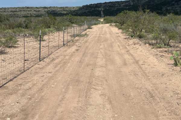
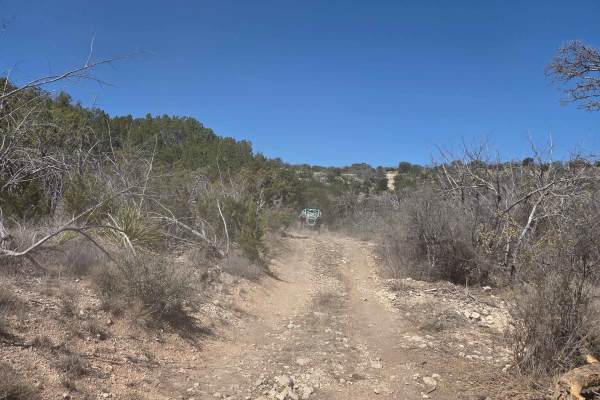
Park Road 4 - PR4
Park Road 4 is a wide, gravel and dirt trail cutting through scenic brushy hills and open country, suitable for all vehicle types. Starting from the intersection of Park Road 1 and 3, it has gentle curves, clear signage, and lightly rocky sections, making for an easy, accessible drive with open view...
Learn more about Park Road 4 - PR4
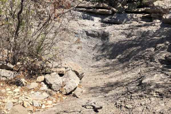
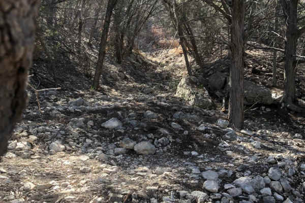
Skull Canyon - V25
Skull Canyon is an extreme off-road trail that delivers a demanding adventure from start to finish. The route begins at the bottom, where you drive through a dry creek bed strewn with small rocks. As you progress further into the canyon, the trail’s technical difficulty ramps up quickly, with the te...
Learn more about Skull Canyon - V25

Barrel Course Way
Barrel Course Way is a short, easily navigable dirt trail providing direct access from Park Road 1 to the Barrel Course arena. The route features gentle curves, minimal elevation change, and is suitable for all vehicle types. Following this trail will lead you back to Park Road 1 and where the above...
Learn more about Barrel Course Way
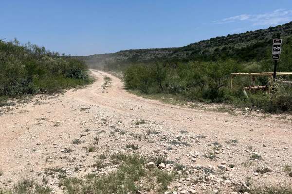
Park Road 8 - PR8
Park Road 8 is an easy, flat, and well-maintained dirt and gravel trail suitable for any vehicle, with no obstacles or challenging terrain along the route. The road winds through the open Texas brush country, eventually ending at an oil well in the area known as Skull Canyon, making it accessible an...
Learn more about Park Road 8 - PR8
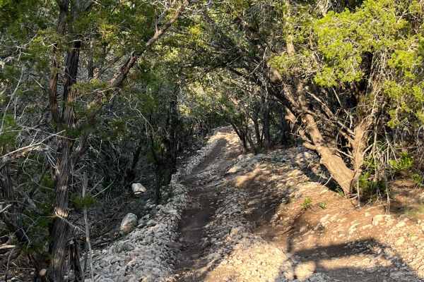
Wall Street - A2
Wall Street is a moderate off-road trail featuring a 330 foot elevation change, tight tree-lined turns, and frequent maneuvering over rocky terrain. The route offers beautiful Texas hill country views with technical climbs and descents requiring careful navigation between trees and around switchback...
Learn more about Wall Street - A2
Southeast Access - V22
Southeast Access Trail is an easy off-road route, a little over half a mile long with less than 200 feet of elevation change. The trail consists mostly of lightly rocky terrain and gentle slopes, with no climbs or obstacles, making it suitable for 2WD vehicles. It dead ends at Wall Street Trail, wit...
Learn more about Southeast Access - V22
Buckhorn Trail - V26
Buckhorn Trail offers a scenic ride along the hilltop rim, providing phenomenal views of the park’s landscape throughout the journey. The trail features a couple of very small rock ledges, but these obstacles are easily tackled with most vehicle types, making this stretch inviting and fun for a wide...
Learn more about Buckhorn Trail - V26
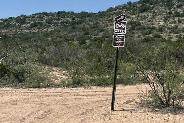
Ausley Way - V6
Ausley Way is a tactical, difficult trail featuring loose rocks, ledges, and off-camber terrain surrounded by cedar trees. A well-marked winch point is provided to help vehicles overcome the steepest obstacles and slick limestone shelves, making this route suitable only for experienced drivers with ...
Learn more about Ausley Way - V6
Gabion Trail - V13
Gabion Trail is a short but exceptionally tough off-road trail, covering just over a third of a mile with a dramatic 161-foot elevation gain packed into about 100 yards. The route features steep, rocky climbs, uneven ledges, and loose rock sections requiring high-clearance 4x4 vehicles. A winch may ...
Learn more about Gabion Trail - V13
Pipeline Bypass - V12BP
Pipeline Bypass is an extremely challenging off-road trail rated at level 8 difficulty that demands advanced driving skills and specialized equipment. The route climbs 114 feet in a very short stretch, beginning with a steep ascent littered with large loose boulders and uneven rocky terrain that tes...
Learn more about Pipeline Bypass - V12BP
Southeast Rim Trail - V20
The Southeast Rim Trail is a scenic and rugged 2.5-mile track in this park, featuring an overall elevation change of 250 feet across its length. This route runs close to the property line fence, offering wide open views, beautiful sunsets, and glimpses of the surrounding terrain and wildlife, includ...
Learn more about Southeast Rim Trail - V20
Pipline - V12
Pipeline Trail is a challenging off-road route that closely follows an old, retired pipeline laid above ground for most of its length. The trail features very steep ascents and descents with extremely loose rocks, requiring careful tire placement and throttle control for safe passage. Riders will en...
Learn more about Pipline - V12
ATV trails near Mertzon, Texas
Explore ATV-friendly trails near you. These trails are accessible for vehicles up to 50 inches wide, perfect for ATVs and smaller off-road machines.
Twin Buttes OHV Trail
This trail is a well marked, one directional ATV and dirt bike track with a long loop and a short loop. The long loop is meant for dirt bikes only as some of the obstacles and trails are too narrow for an ATV. The short track is wide enough for an ATV, but gets rough and off-camber in some areas. Th...
Learn more about Twin Buttes OHV Trail
Park Road 5 - PR5
Park Road 5 is an accessible dirt trail for all vehicles, found at the end of Park Road 1. It winds through open desert terrain with some light ruts, low vegetation, and scenic views, connecting to Park Road 4. The trail includes a side junction with Escondido Trail and is marked by clear signage an...
Learn more about Park Road 5 - PR5
Vaquero Trail - V-28
Vaquero Trail is a loop rated 4 out of 10, running mostly along a mountain ridgeline with great views. The route starts and finishes on Park Road 1, with a mild climb, rocky and hard-packed dirt sections, and clear signage at all trail forks. This trail is ideal for riders wanting scenic ridge drivi...
Learn more about Vaquero Trail - V-28
Lookout Trail - V29
Lookout Trail is a challenging off-road route starting from Vaquero Trail, featuring an elevation gain of 183 feet as it ascends rocky terrain toward the summit before looping back to rejoin Vaquero Trail. This short but technical trail demands a capable 4WD vehicle with high ground clearance due to...
Learn more about Lookout Trail - V29
UTV/side-by-side trails near Mertzon, Texas
Find UTV and side-by-side trails near you. These trails accommodate vehicles up to 60 inches wide, ideal for UTVs, side-by-sides, and wider off-road rigs.
Park Road 5 - PR5
Park Road 5 is an accessible dirt trail for all vehicles, found at the end of Park Road 1. It winds through open desert terrain with some light ruts, low vegetation, and scenic views, connecting to Park Road 4. The trail includes a side junction with Escondido Trail and is marked by clear signage an...
Learn more about Park Road 5 - PR5
Vaquero Trail - V-28
Vaquero Trail is a loop rated 4 out of 10, running mostly along a mountain ridgeline with great views. The route starts and finishes on Park Road 1, with a mild climb, rocky and hard-packed dirt sections, and clear signage at all trail forks. This trail is ideal for riders wanting scenic ridge drivi...
Learn more about Vaquero Trail - V-28
Lookout Trail - V29
Lookout Trail is a challenging off-road route starting from Vaquero Trail, featuring an elevation gain of 183 feet as it ascends rocky terrain toward the summit before looping back to rejoin Vaquero Trail. This short but technical trail demands a capable 4WD vehicle with high ground clearance due to...
Learn more about Lookout Trail - V29
V-33 Wright's Way
V-33 Wright’s Way is primarily used as a bypass line, as it is one of the easier trails compared to the surrounding routes. The trail is relatively short and begins as a dirt road before gradually transitioning into a brief section through the trees. As you continue, you will encounter a moderately ...
Learn more about V-33 Wright's Way
The onX Offroad Difference
onX Offroad combines trail photos, descriptions, difficulty ratings, width restrictions, seasonality, and more in a user-friendly interface. Available on all devices, with offline access and full compatibility with CarPlay and Android Auto. Discover what you're missing today!
Open Trail Map