
Off-Road Trails
Near Fall River, Nova Scotia
Off-Road Trails Near Fall River, Nova Scotia
Discover the best offroad trails near you. Browse trail maps, check difficulty ratings, and find your next adventure — whether you're looking for a quick ride or an all-day expedition.
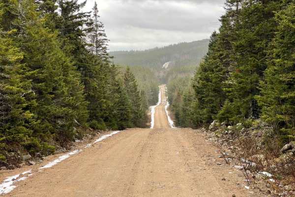
Sandy Lake Road to Golden Lake
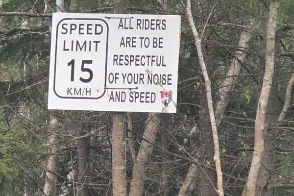
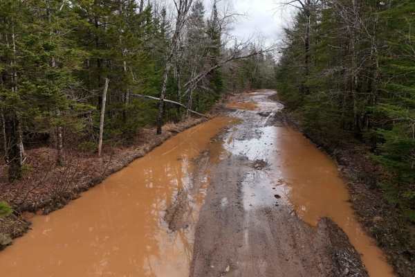
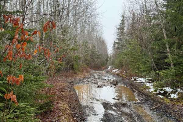
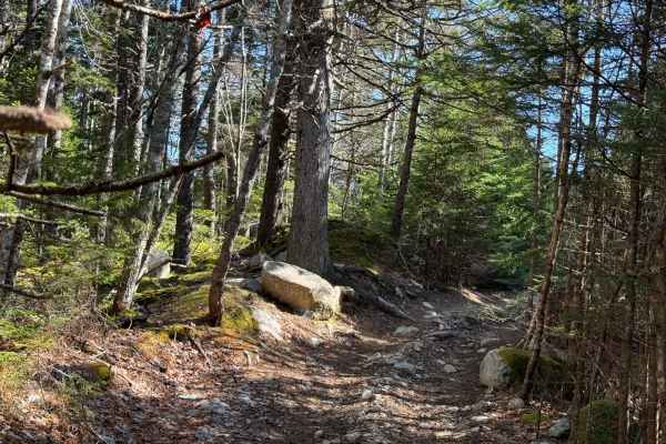
Sandy Lake Road is an old rocky dirt road that leads to a few lakes and to Crown Land where Golden Lake is situated. Two trails take you to Golden Lake. The first trail takes you to one end of the lake, but it is not on crown land, and this marked trail is on crown land. When going down Sandy Lake R...
Learn more about Sandy Lake Road to Golden Lake
5 K
The 5 K trail goes from Sandy Lake Road to the windmills in Beaver Bank, Nova Scotia. The trail starts on crown land and then goes to the Barrett Lumber property. 5 K is a mix of gravel and rough terrain with very rough sections, then back to gravel when you hit the windmills. Use caution when enter...
Learn more about 5 K
Scott Paper Conector
Scott paper connector is an easy trail to drive but does have a few rocky sections and the odd mud hole, some of the mud holes are deeper on one side than the other, so just be aware of that, and in saying that,' you wouldn't want to take your moms car down this trail. In the winter, this area of tr...
Learn more about Scott Paper Conector
Scott Paper Road
Scott Paper Road, located off Monte Vista Road near Enfield, Nova Scotia, is a historic dirt road named after the Scott Paper Company, which operated extensively in the province. This road was originally used for logging operations and now provides access to scenic trails in the area. A key highligh...
Learn more about Scott Paper Road
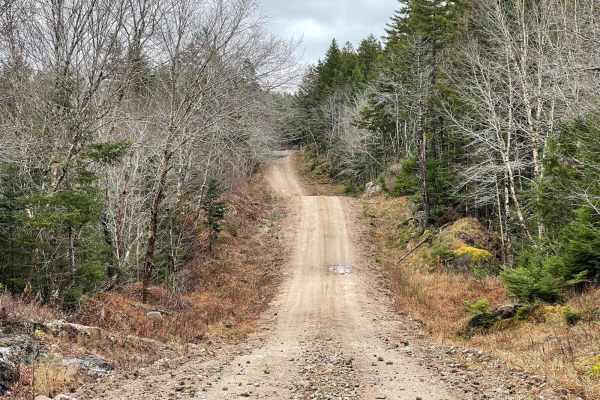
Renfrew Road
Renfrew Road is a captivating trail that winds through the historic Renfrew Gold District, offering a blend of easy and challenging terrain. Starting at the corner of Monte Vista Road and the paved section of Renfrew Road in Enfield, the trail stretches westward to Old Renfrew Road near HWY 354 in U...
Learn more about Renfrew Road
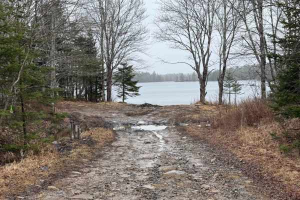
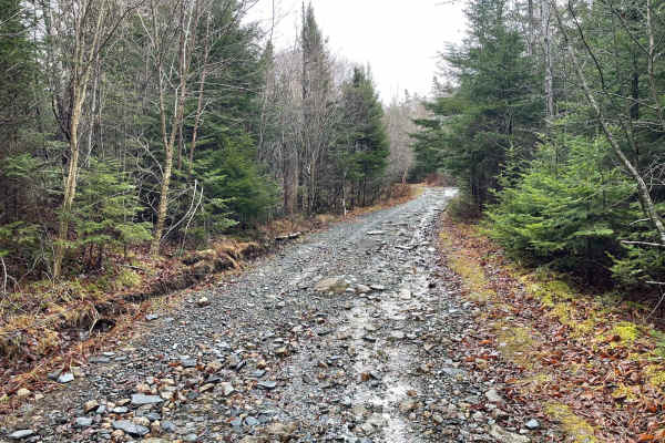
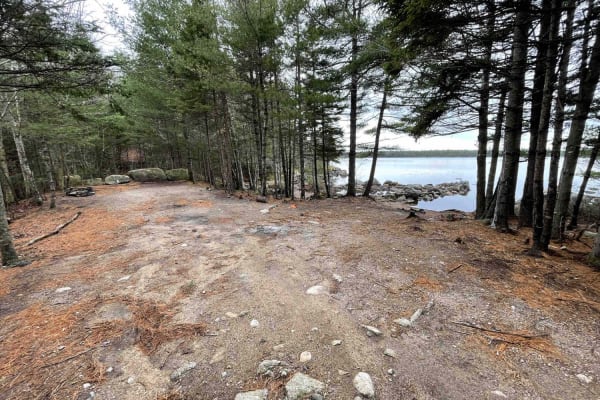
Rockey Lake Trail
The Rocky Lake Trail is an easy route that stretches from the northern tip of Jim Horne Lake to Renfrew Crossroads, situated in the heart of the former Renfrew Gold District community. This trail is primarily composed of hard-packed dirt, with sections featuring washouts, large puddles, and small mu...
Learn more about Rockey Lake Trail
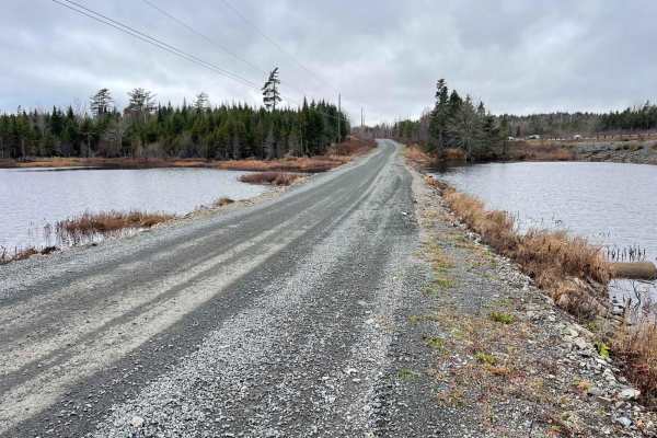
Service Road HAN 101-01
Service Road HAN 101-01 is a well-maintained, two-lane gravel road that runs parallel to Highway 101 along the northern edge of the former Bowater-Mersey lands, now part of Nova Scotia Crown Land. Starting in Ellershouse off Williams Road, this road provides access to numerous trails, locally known ...
Learn more about Service Road HAN 101-01
Pockwock Falls Trail
Pockwock Falls Trail, also known as Bowater Mersey to Pockwock Road, is officially named Old Kemptown Road. This primitive road in Halifax Regional Municipality is accessed from Pockwock Road in Hammonds Plains and leads to the former Bowater Mersey lands and its trail system. The trail is very wash...
Learn more about Pockwock Falls Trail
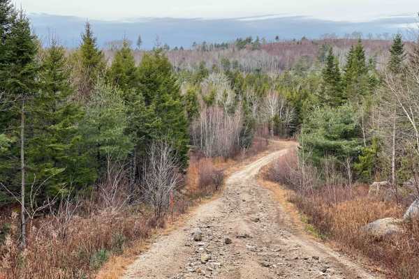
Kavanough Road
Leading from Beaver Bank Road (HWY 354) into the Renfrew Gold District, Kavanough Road starts as a hard-packed single-lane dirt road. At the Witmore Road intersection, 1.8 km in, the road deteriorates quickly. This historic road is heavily used and unmaintained, featuring large, exposed rocks, rock ...
Learn more about Kavanough Road
Pipeline Road Trail
Pipeline Road Trail is a partially maintained route running north-south, located east of Big Indian Lake within the former Bowater-Mersey lands. Ideal for beginners, this hard-packed logging road allows for an enjoyable drive without risking damage to your vehicle. The southern half features a two-l...
Learn more about Pipeline Road Trail
Ingramport Connector
The Ingramport Connector is a two-lane gravel road running parallel to Highway 103, stretching from Ingramport Road to Hiking Trail Road. This road is essential for accessing a multitude of trails in the Mersey Trail system and is currently the quickest route to the south end of Hiking Trail Road du...
Learn more about Ingramport Connector
Dynamite Trail
Dynamite Trail is a short, easy trail connecting Hiking Trail Road and Tote Road. Starting from Hiking Trail Road, you'll encounter a washed-out rocky hill climb, adding a bit of excitement. Midway through the trail, there's a small clearing, perfect for a quick break. Between the clearing and Tote ...
Learn more about Dynamite Trail
Tote Road
Starting from the southern end, Tote Road is a narrow, hard-packed dirt trail formerly used as a logging road. The trail is unmaintained and well-worn, with heavy brush guaranteeing pinstriping for most vehicles. While the road occasionally opens up, it remains tight, with some sections featuring la...
Learn more about Tote Road
Beeswanger Trail
Running from north to south, Beeswanger Trail is an unmaintained road that crosses private property and enters Nova Scotia Crown Land (Please stay on the trail!) The first 3.3 miles are mostly a tight trail with some rock gardens and a few washouts that are passable by Jeep but can be challenging i...
Learn more about Beeswanger Trail
Connor Lakes Trail
Connor Lakes Trail is an unmaintained, hard-packed dirt road that was once used for logging. It stretches for 4 km from Two Mile Lake Road to Ingramport Connector, winding around Big Connor Lake and Little Connor Lake. The trail is one vehicle wide, with several places to pass. The hills are washed ...
Learn more about Connor Lakes Trail
King Lake Trail
This Trail has three distinct sections: The northern 2.6 km of the King Lake Trail, which includes the scenic Dawson Falls, is situated on private property. This section is a partially maintained former logging road that is easily passable with any vehicle. However, the last stretch can get quite na...
Learn more about King Lake Trail
Two Mile Lake Road
Two Mile Lake Road runs north-south in the Bowater Mersey trail system, starting from the southern end of Ingramport Road and ending at Two Mile Lake. The trail begins as a wide, well-maintained gravel road with a new bridge over the Ingram River. After the bridge, the next 3 km is an active logging...
Learn more about Two Mile Lake Road
Ingramport Road
Ingramport Road is a maintained, hard-packed dirt road that is two vehicles wide for most of its length, though it narrows slightly at the north end. Travelers should be cautious of washouts after heavy rains. There is one bridge in slight disrepair, so use caution when crossing. This road serves as...
Learn more about Ingramport Road
Hiking Trail Road
Hiking Trail Road is a well-maintained, hard-packed dirt road and an active forestry road. The southern 1.5 km section, stretching from the end of Bowater Mersey Road to Pipeline Road Trail, is currently disconnected due to a washed-out bridge, with replacement scheduled for late 2024 to early 2025....
Learn more about Hiking Trail Road
Shady Lake Trail
Shady Lake Trail is a single-vehicle-wide path with hard-packed dirt and loose rock. While there are a few washouts along the trail, it remains passable with caution. A gate warns of an unsafe bridge, but it appears to have been repaired. South of this bridge, the trail narrows and has more washouts...
Learn more about Shady Lake Trail
ATV trails near Fall River, Nova Scotia
Explore ATV-friendly trails near you. These trails are accessible for vehicles up to 50 inches wide, perfect for ATVs and smaller off-road machines.
Sandy Lake Road to Golden Lake
Sandy Lake Road is an old rocky dirt road that leads to a few lakes and to Crown Land where Golden Lake is situated. Two trails take you to Golden Lake. The first trail takes you to one end of the lake, but it is not on crown land, and this marked trail is on crown land. When going down Sandy Lake R...
Learn more about Sandy Lake Road to Golden Lake
5 K
The 5 K trail goes from Sandy Lake Road to the windmills in Beaver Bank, Nova Scotia. The trail starts on crown land and then goes to the Barrett Lumber property. 5 K is a mix of gravel and rough terrain with very rough sections, then back to gravel when you hit the windmills. Use caution when enter...
Learn more about 5 K
Scott Paper Conector
Scott paper connector is an easy trail to drive but does have a few rocky sections and the odd mud hole, some of the mud holes are deeper on one side than the other, so just be aware of that, and in saying that,' you wouldn't want to take your moms car down this trail. In the winter, this area of tr...
Learn more about Scott Paper Conector
Scott Paper Road
Scott Paper Road, located off Monte Vista Road near Enfield, Nova Scotia, is a historic dirt road named after the Scott Paper Company, which operated extensively in the province. This road was originally used for logging operations and now provides access to scenic trails in the area. A key highligh...
Learn more about Scott Paper Road
UTV/side-by-side trails near Fall River, Nova Scotia
Find UTV and side-by-side trails near you. These trails accommodate vehicles up to 60 inches wide, ideal for UTVs, side-by-sides, and wider off-road rigs.
Sandy Lake Road to Golden Lake
Sandy Lake Road is an old rocky dirt road that leads to a few lakes and to Crown Land where Golden Lake is situated. Two trails take you to Golden Lake. The first trail takes you to one end of the lake, but it is not on crown land, and this marked trail is on crown land. When going down Sandy Lake R...
Learn more about Sandy Lake Road to Golden Lake
5 K
The 5 K trail goes from Sandy Lake Road to the windmills in Beaver Bank, Nova Scotia. The trail starts on crown land and then goes to the Barrett Lumber property. 5 K is a mix of gravel and rough terrain with very rough sections, then back to gravel when you hit the windmills. Use caution when enter...
Learn more about 5 K
Scott Paper Conector
Scott paper connector is an easy trail to drive but does have a few rocky sections and the odd mud hole, some of the mud holes are deeper on one side than the other, so just be aware of that, and in saying that,' you wouldn't want to take your moms car down this trail. In the winter, this area of tr...
Learn more about Scott Paper Conector
Scott Paper Road
Scott Paper Road, located off Monte Vista Road near Enfield, Nova Scotia, is a historic dirt road named after the Scott Paper Company, which operated extensively in the province. This road was originally used for logging operations and now provides access to scenic trails in the area. A key highligh...
Learn more about Scott Paper Road
The onX Offroad Difference
onX Offroad combines trail photos, descriptions, difficulty ratings, width restrictions, seasonality, and more in a user-friendly interface. Available on all devices, with offline access and full compatibility with CarPlay and Android Auto. Discover what you're missing today!
Open Trail Map