
Off-Road Trails Near Deschutes River Woods, Oregon
Off-Road Trails Near Deschutes River Woods, Oregon
Discover the best offroad trails near you. Browse trail maps, check difficulty ratings, and find your next adventure — whether you're looking for a quick ride or an all-day expedition.
Aspen Boat Launch and Day-Use
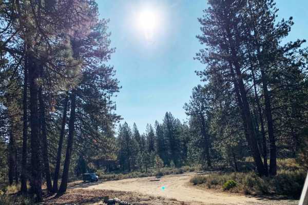
A short bumpy dirt road through the trees leads down to a day-use parking area and this site accesses the Deschutes River as well as has access to the Deschutes River Trail. Most of the trail surface is dirt but it does appear some sections used to be paved, the transitions between the old pavement ...
Learn more about Aspen Boat Launch and Day-Use
Big Burn Road
Big Burn Road is one of the primary routes between Cascade Lakes Highway and NW Skyliners Road. It is an easy trail with no obstacles and is mainly used as an entry point to smaller surrounding trails. Phil’s Trailhead bike paths zig-zag across Big Burn Road, so be cautious of cyclists. The trail is...
Learn more about Big Burn Road
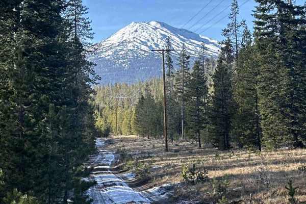
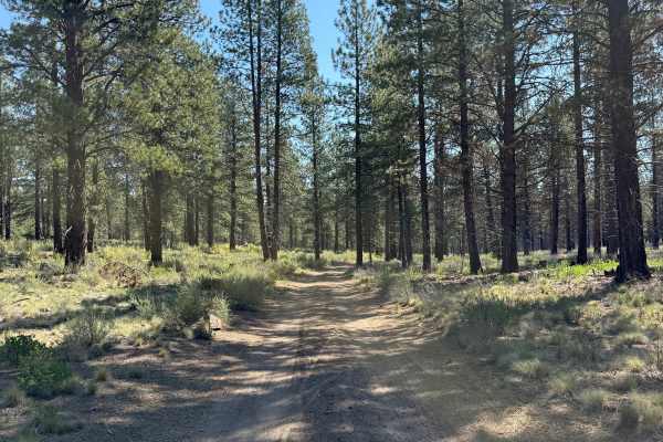
FS 4100-490
This trail follows a Forest Service road beneath power lines and offers a wide range of obstacles, including easy to intermediate whoops, mild rock gardens, and manageable hill climbs and descents. Terrain varies from soft to hard dirt depending on the season, with a mix of straight sections and mor...
Learn more about FS 4100-490
Arnold Ice Cave to Lava Butte
This route, for the most part, follows China Hat Road from the point at which it turns to gravel. Later as you head to the South and West, near Paulina Lake, the roads become narrow and more challenging (toward Lava Butte & HWY97). However - none of the trail is difficult.
Learn more about Arnold Ice Cave to Lava Butte
Forest Road 4100-000
This is a very wide Forest Service Road that is accessible to all vehicle types. The surface is gravel during spring, summer, and fall, with the potential for snow cover at times in winter. It offers an easy forest drive with access to many connecting trails of varying difficulty, and downed trees a...
Learn more about Forest Road 4100-000
Bessie to Lava
Easy-going connector trail between Bessie Butte in the China Hat area, to the Lava Cast Forest. During the summer months, this is a beautiful, relatively tame way to get between these two areas. It's a bit narrow in places, depending on growth. But, with relatively low traffic, it's a great spot to ...
Learn more about Bessie to Lava
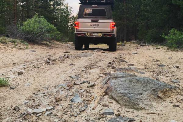
Forest Road 4130-000
This trail consists of dirt, mud, and gravel during spring, summer, and fall, with snow covering portions of the route at times in winter. Terrain is generally uneven and basic, with occasional deeper ruts, uphill sections, and minor washouts. Low-clearance 4WD and AWD vehicles may have difficulty i...
Learn more about Forest Road 4130-000
Forest Road 4613-000
This starts out as a basic forest service road. wide, flat, easy uphills. It is a bit choppy at first, but smooths out over time. As it moves along, it gets a little narrower but is still more than wide enough for full-size cars/trucks. There aren't any major obstacles of concern under normal condit...
Learn more about Forest Road 4613-000
Lava Cast Forest Trail
Just off highway 97 turn onto Sugar Pine Butte Road. Down this trail you will find beautiful lava roads freckled with juniper trees and forests. Gravel washboard roads with mild hill climbs and descents are easy for stock rigs and passable by high clearance 2WD during dry months when snow has passed...
Learn more about Lava Cast Forest Trail
FS 4133-000
This is a pretty easy, basic, forest service road. You will encounter mostly dirt, but it could be muddy and snow-covered at times, depending on the time of year. As with any Forest Service road or trail period, you should always be cautious of downed trees on the road. This is a pretty easy trail, ...
Learn more about FS 4133-000
Sisters to Tumalo Falls via Trout Creek Butte
This route is a great detour when traveling between Bend and Sisters Oregon. On one end you'll find easy access to Tumalo Falls and on the other easy access to the town of Sisters. Along the way you'll pass three creeks lake and wrap around the base of Trout Creek Butte. Along the way you'll encount...
Learn more about Sisters to Tumalo Falls via Trout Creek Butte
FS 4140-000
This is a pretty fun Forest Service road. Mostly dirt with some small, fairly easy rock gardens, but they are very passable for all ages and experience levels. Will encounter mud after heavy rains and some snow in the winter months. Roads are rutted at times, and as always, be cautious and prepared ...
Learn more about FS 4140-000
Lava Cast Forest 9720
Lava Cast forest road 9720 is a 8.5 mile gravel road that winds through the Deschutes National Forest eventually bringing you to the Lava Cast Forest loop trail. This trail is a one-mile loop that leads you through the 6,000-year-old lava flows that once took over this area. The facilities here are ...
Learn more about Lava Cast Forest 9720
Lava Top Butte Caves
This trail leads to the closest point to Lava Top Butte. There are some lava tubes nearby that are worth checking out. There are several caves along a straight line due north of 43.87986, -121.2113. This is not a maintained fire road. It is best-attempted mid to late spring to allow ample snowmelt.
Learn more about Lava Top Butte Caves
Bearwallow Butte
This is a fun trail up to a radio tower. Just above the tower, there is a large rock ledge that offers a cool view of the City of Bend below. There is an access gate that is closed at times but even the lower area on the way up offers a cool view.
Learn more about Bearwallow Butte
Fuzztail Butte Trail
Coming in off of 97 North on either Lava Cast Road (the long way) or North Paulina Road (easier) you'll be met with washboard roads--you might as well air down. Once you're off the roads and on the trail, things will get narrow but not too rough. Some ups and downs may have you wondering if it will ...
Learn more about Fuzztail Butte Trail
24
Trail 24 is a 3.8-mile route accessible on its east end from Trail 25 (a fence blocks access directly from China Hat Road). It is slightly more technical than the surrounding trails, with several rockier sections and moderate elevation changes. The east end begins with a short, steep descent over la...
Learn more about 24
Edison #34-4-2
This is an advanced, slow-going trail in the Edison Butte OHV Trail System. Sharp lava rock, large rock obstacles/gardens, off-camber sections, and several steep climbs will be encountered. Airing down, 4L, and high clearance are highly recommended. When mapped in mid-July, the trail eventually beca...
Learn more about Edison #34-4-2
Todd Lake TH
Todd Lake TH is a mixed dirt and gravel trail starting from Cascade Lakes Scenic Highway (Co Hwy 46) that connects to Skyliners Rd. After the Todd Lake Day Use area, only 4wd is recommended. Although most of the trail is two vehicles wide, there are many sections where you should expect to pull off ...
Learn more about Todd Lake TH
East Fort Rock - OHV Trail 10
This was a mostly easy trail with some shorter technical areas. The terrain was mostly loose dirt and sand. There were loose rocks and some small rock gardens throughout, but nothing of major difficulty. There were a few uphills and downhills, but again, nothing majorly difficult. There were a lot o...
Learn more about East Fort Rock - OHV Trail 10
ATV trails near Deschutes River Woods, Oregon
Explore ATV-friendly trails near you. These trails are accessible for vehicles up to 50 inches wide, perfect for ATVs and smaller off-road machines.
Big Burn Road
Big Burn Road is one of the primary routes between Cascade Lakes Highway and NW Skyliners Road. It is an easy trail with no obstacles and is mainly used as an entry point to smaller surrounding trails. Phil’s Trailhead bike paths zig-zag across Big Burn Road, so be cautious of cyclists. The trail is...
Learn more about Big Burn Road
FS 4100-490
This trail follows a Forest Service road beneath power lines and offers a wide range of obstacles, including easy to intermediate whoops, mild rock gardens, and manageable hill climbs and descents. Terrain varies from soft to hard dirt depending on the season, with a mix of straight sections and mor...
Learn more about FS 4100-490
Forest Road 4100-000
This is a very wide Forest Service Road that is accessible to all vehicle types. The surface is gravel during spring, summer, and fall, with the potential for snow cover at times in winter. It offers an easy forest drive with access to many connecting trails of varying difficulty, and downed trees a...
Learn more about Forest Road 4100-000
Bessie to Lava
Easy-going connector trail between Bessie Butte in the China Hat area, to the Lava Cast Forest. During the summer months, this is a beautiful, relatively tame way to get between these two areas. It's a bit narrow in places, depending on growth. But, with relatively low traffic, it's a great spot to ...
Learn more about Bessie to Lava
UTV/side-by-side trails near Deschutes River Woods, Oregon
Find UTV and side-by-side trails near you. These trails accommodate vehicles up to 60 inches wide, ideal for UTVs, side-by-sides, and wider off-road rigs.
Big Burn Road
Big Burn Road is one of the primary routes between Cascade Lakes Highway and NW Skyliners Road. It is an easy trail with no obstacles and is mainly used as an entry point to smaller surrounding trails. Phil’s Trailhead bike paths zig-zag across Big Burn Road, so be cautious of cyclists. The trail is...
Learn more about Big Burn Road
FS 4100-490
This trail follows a Forest Service road beneath power lines and offers a wide range of obstacles, including easy to intermediate whoops, mild rock gardens, and manageable hill climbs and descents. Terrain varies from soft to hard dirt depending on the season, with a mix of straight sections and mor...
Learn more about FS 4100-490
Forest Road 4100-000
This is a very wide Forest Service Road that is accessible to all vehicle types. The surface is gravel during spring, summer, and fall, with the potential for snow cover at times in winter. It offers an easy forest drive with access to many connecting trails of varying difficulty, and downed trees a...
Learn more about Forest Road 4100-000
Bessie to Lava
Easy-going connector trail between Bessie Butte in the China Hat area, to the Lava Cast Forest. During the summer months, this is a beautiful, relatively tame way to get between these two areas. It's a bit narrow in places, depending on growth. But, with relatively low traffic, it's a great spot to ...
Learn more about Bessie to Lava
The onX Offroad Difference
onX Offroad combines trail photos, descriptions, difficulty ratings, width restrictions, seasonality, and more in a user-friendly interface. Available on all devices, with offline access and full compatibility with CarPlay and Android Auto. Discover what you're missing today!
Open Trail Map