
Off-Road Trails Near Crooked River Ranch, Oregon
Off-Road Trails Near Crooked River Ranch, Oregon
Discover the best offroad trails near you. Browse trail maps, check difficulty ratings, and find your next adventure — whether you're looking for a quick ride or an all-day expedition.
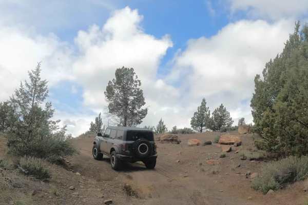
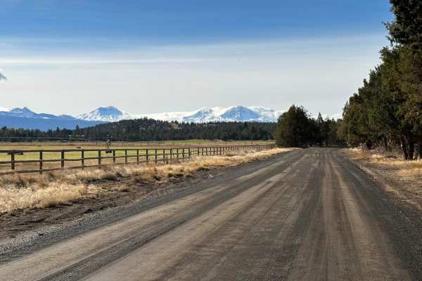
Alder Springs
Rough dirt and rock road accessing Alder Springs Trailhead and Wychus Creek. This road passes through a seasonal gate (and then through a private land easement) to access a section of the Crooked River National Grasslands, which is closed seasonally to protect large game winter range. Additional det...
Learn more about Alder Springs
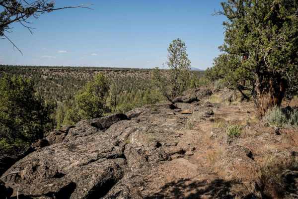
99
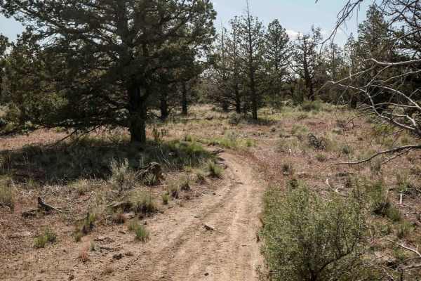
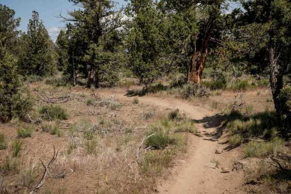
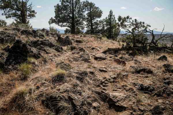
Trail 99 winds through low alpine terrain with tight curves among juniper trees and features numerous embedded rocks and ledge obstacles, making it an intermediate route. The trail has more elevation gain in the middle of the route, compared to surrounding trails, with small climbs and descents ofte...
Learn more about 99
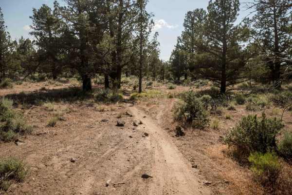
NF-5740
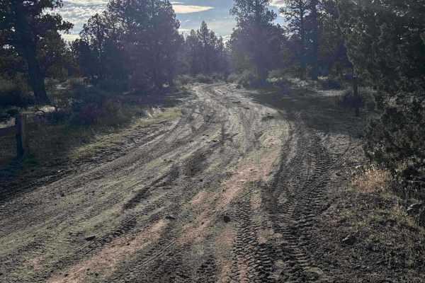
This is a dirt road used to access Gray Butte and the adjacent Henderson Flats OHV system from US-97. This area is popular with equestrians, hikers, mountain bikers, and the UTV and moto crowd, all using nearby trails specific to the different activities. Expect traffic. It's occasionally snowbound ...
Learn more about NF-5740
Haystack Overlook
This is a combination of gravel roads and dirt two-track accessing the Crooked River National Grasslands from nearby Madras. It is named after a spur that accesses a hill with a great overlook of nearby Haystack Reservoir. There are multiple cattle gates along this track and throughout the area. Mak...
Learn more about Haystack Overlook
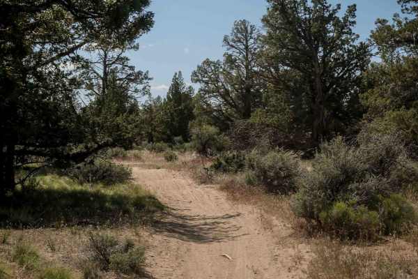
71
Trail 71 is a 4.5-mile narrow singletrack winding through the eastern half of the Buckhorn trail system. It traverses low alpine and high desert terrain dominated by sagebrush and junipers. Riders should be prepared for scraggly tree branches extending into the trail, scattered loose and embedded ro...
Learn more about 71
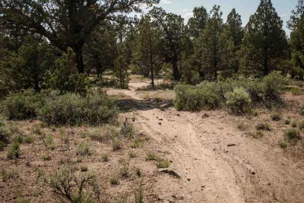
75
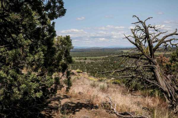
Trail 75 is a 1.6-mile loop starting from the intersection with Trail 74, running along a flat mesa top with expansive valley views, especially as it rides along the mesa's edge. The trail includes tight sections weaving between trees and areas with more embedded rock, providing a mix of flow and te...
Learn more about 75
NF-5730
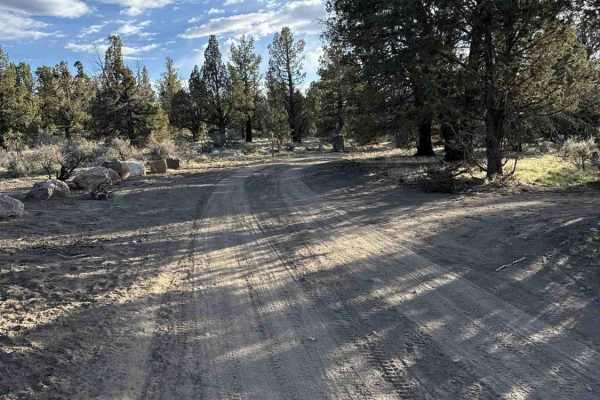
Easy, unmaintained dirt road accessing Gray Butte Trailhead and other nearby trails in the Crooked River National Grasslands just West of Gray Butte. There are numerous dispersed camping spots along this road often used by climbers visiting nearby Smith Rocks. This road climbs up over 4000', so expe...
Learn more about NF-5730
Gray Butte - NF-5700
This is an unmaintained dirt road accessing Gray Butte Trailhead and other nearby trails in the Crooked River National Grasslands just north of Gray Butte. There are numerous dispersed camping spots along this road often used by climbers visiting nearby Smith Rocks. This road climbs up over 4,000 fe...
Learn more about Gray Butte - NF-5700
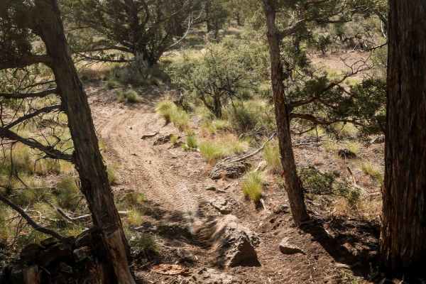
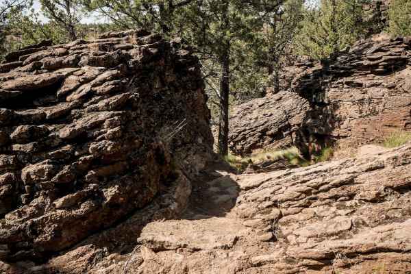
92
Trail 92 is a double black diamond route in the trail system, due to large boulders and consistent embedded rock throughout. It begins with big obstacles right away from the west end, including a two-foot boulder face and several drop-offs. The route winds tightly along a hillside beside massive roc...
Learn more about 92
74
Trail 74 is a 1.6-mile route beginning on a flat mesa top with easy dirt terrain. The trail crosses Trail 73 and a few roads before a semi-steep descent off the mesa near the intersection with Trail 73. It features whoops and mostly smooth dirt with scattered loose rocks. The landscape includes juni...
Learn more about 74
73
Trail 73 is an easy 1.7-mile single-track connector between Trails 75 and 72. The trail features mostly dirt terrain with scattered embedded and loose rocks, along with lots of whoops. The profile is very gradual with small hills up and down. Trail 73 crosses Trail 74 about halfway through.
Learn more about 73
91
Trail 91 winds tightly through junipers along the flat top of a mesa, offering a fast and flowy ride with plenty of tight maneuvers. The trail surface is mostly smooth dirt, with occasional embedded rocks adding some light technical elements. It's a fun, engaging single track that keeps riders activ...
Learn more about 91
72
Trail 72 is an almost 3-mile-long dirt bike-only route that runs between Trails 71 and 74. It features tight curves and requires precise maneuvering through trees, with narrow gaps that might catch your handlebars if not careful. The trail is mostly smooth dirt with small jagged rocks scattered thro...
Learn more about 72
93
Trail 93, rated double black diamond, is one of the most challenging trails in the Buckhorn system. Starting off the 4x4 Buckhorn Loop, it includes fast, flowy stretches through high desert terrain mixed with numerous moderate to difficult rock obstacles. Riders will encounter multiple series of led...
Learn more about 93
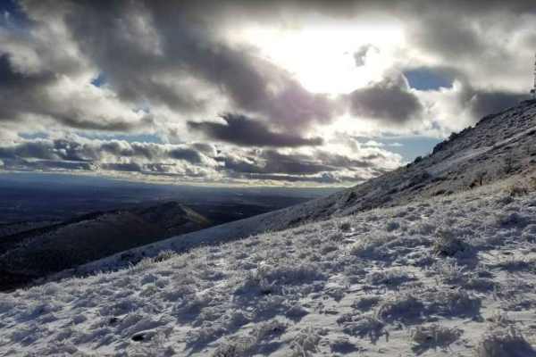
Gray Butte Summit
Steep, rocky road accessing the communications towers on Gray Butte. This road starts at Gray Butte Saddle at roughly 3700 feet and climbs to almost 5100 feet at the summit. The gate at the lower end is occasionally locked. There are dispersed camping spots on this road near the Gray Butte Saddle Tr...
Learn more about Gray Butte Summit
95
Trail 95 is a long, 2.7-mile easy single track that weaves narrowly through bushes across flat high desert terrain. The trail features tight curves and minor scattered rocks, but remains gradual with only a few small hills up and down, making it accessible for riders seeking a relaxed and scenic rou...
Learn more about 95

Buckhorn Loop
Fun little loop trail from/to the Buckhorn Staging Area. Our group had Riders of all ages and Bike sizes, from 50cc to 800cc, and even some Elite Coleman Minibikes! All are welcome in this trail system full of sandy trails and rock gardens. The Staging area has bathrooms, picnic tables, and great ar...
Learn more about Buckhorn Loop
94
Trail 94 is a double black diamond route and one of the most difficult trails in the Buckhorn OHV area. It features small climbs and descents through high desert hills, with tight curves winding between juniper trees. Riders will encounter rock ledges 1-2 feet high, sometimes positioned beside trees...
Learn more about 94

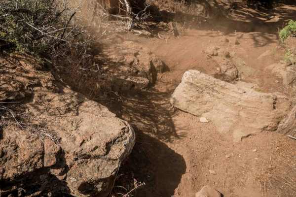
84
This trail consists mostly of dirt, which can be loose at times and sandy. Depending on the time of year, you could encounter mud or snow. There are many rock gardens and loose rocks along with a large rock obstacle along the trail. There are a few whoops mixed in and tight trees at times. It is a f...
Learn more about 84
97
Trail 97 begins at the intersection with Trail 96 and runs as a narrow single track through high desert terrain with junipers and sagebrush. The trail features sharp, jagged embedded rocks that are easy to ride over, along with occasional larger embedded rocks forming small ledges and drop-offs unde...
Learn more about 97
ATV trails near Crooked River Ranch, Oregon
Explore ATV-friendly trails near you. These trails are accessible for vehicles up to 50 inches wide, perfect for ATVs and smaller off-road machines.
Buckhorn Loop
Fun little loop trail from/to the Buckhorn Staging Area. Our group had Riders of all ages and Bike sizes, from 50cc to 800cc, and even some Elite Coleman Minibikes! All are welcome in this trail system full of sandy trails and rock gardens. The Staging area has bathrooms, picnic tables, and great ar...
Learn more about Buckhorn Loop
84
This trail consists mostly of dirt, which can be loose at times and sandy. Depending on the time of year, you could encounter mud or snow. There are many rock gardens and loose rocks along with a large rock obstacle along the trail. There are a few whoops mixed in and tight trees at times. It is a f...
Learn more about 84
82
This is a shorter, more technical trail with many rock gardens and some tighter trees. It opens up for brief periods but should probably not be traversed by anything larger than an ATV. Terrain is mostly dirt, but could be muddy or snow-covered at times, depending on the time of year. I had cell ser...
Learn more about 82
83
This trail in mainly dirt that is loose at times and mixed with sand at times as well. Depending on the time of year, it has the possibility of being muddy or snow-covered. There are frequent loose rocks and rock gardens throughout with 1 more challenging rock obstacle. You will encounter small whoo...
Learn more about 83
UTV/side-by-side trails near Crooked River Ranch, Oregon
Find UTV and side-by-side trails near you. These trails accommodate vehicles up to 60 inches wide, ideal for UTVs, side-by-sides, and wider off-road rigs.
83
This trail in mainly dirt that is loose at times and mixed with sand at times as well. Depending on the time of year, it has the possibility of being muddy or snow-covered. There are frequent loose rocks and rock gardens throughout with 1 more challenging rock obstacle. You will encounter small whoo...
Learn more about 83
Barr Road Cut Through
A rad way to get from Tumalo to the Cline Butte Trail System. This is an unmaintained road that is the fun route between Tumalo and Sisters or Redmond. Generally plenty of friendly people along the way that helps out the less equipped. Cline Butte offers trails for all vehicle types and technical te...
Learn more about Barr Road Cut Through
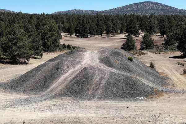
Cline Buttes Flow Trail
Fun, flowy, banked turns leading to an abandoned quarry. Some slight rock garden areas to pass through at the beginning of the trail. Once you get to the quarry, you can challenge your vehicle on a handful of natural obstacles and check out the shooting area on the south/east of the quarry.
Learn more about Cline Buttes Flow Trail
Cline Butte Trail 31
This is a really fun trail to hit with almost any vehicle. Sprinter-type vans would be too tall for some of the low-hanging trees. Starting out at the staging area, travel West across the rocky powerline road until you hit the trailhead. The trail consists of rock gardens and fast sandy flow trails.
Learn more about Cline Butte Trail 31
The onX Offroad Difference
onX Offroad combines trail photos, descriptions, difficulty ratings, width restrictions, seasonality, and more in a user-friendly interface. Available on all devices, with offline access and full compatibility with CarPlay and Android Auto. Discover what you're missing today!
Open Trail Map