
Off-Road Trails in Chihuahua
Discover off-road trails in Chihuahua
Off-Road Trails in Chihuahua
Discover the best off-road trails in Chihuahua. Browse trail maps, check difficulty ratings, and find your next adventure — whether you're looking for a quick ride or an all-day expedition.
Terlingua Abaja
A short, but beautifully scenic route to the ghost town of Terlingua Abaja. This is an out-and-back trail with minor off-camber, switchbacks, and rough, rocky areas. There are three campsites available at the end of this trail;TA 1 being furthest West;TA 2 middle;TA3 furthest East. There is ample ro...
Learn more about Terlingua Abaja
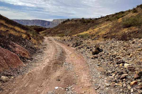
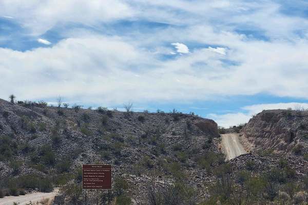
Paint Gap Road
This is a trail off of Maverick Road (one of the main roads going through Big Bend National Park). You begin on gravel for the first portion of the trail. About halfway through you enter a more rocky terrain. Though the trail is only 7.3 miles in and out you are going pretty slow because it is a bit...
Learn more about Paint Gap Road
Old Maverick Road
Old Maverick Road is a more direct alternative from Panther Junction Road to Santa Elena Canyon. It is also the route to access Rattlesnake Mountain, Ocotillo Grove, and Terlingua Abaja campsites. It is primarily a washboard, gravel road providing fantastic views of the Chisos and desert flora. Plea...
Learn more about Old Maverick Road
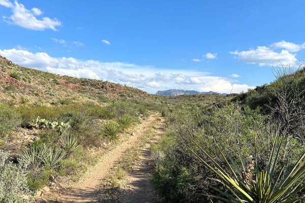
Javelin Road
This is a meandering dirt road through the high desert and hills of Big Bend Ranch State Park. This is the most direct route to Madrid Falls Overlook & Chorro Vista Campground. One of, if not the most, scenic views in the park. The road is not heavily traveled and relatively unmaintained, and narrow...
Learn more about Javelin Road
River Road West
River Road West follows the Rio Grande in the southwestern area of the Big Bend National Park backcountry. Along the trail, you will find various established backcountry camping sites. These sites do require reservations, so please check with park staff or online at recreation.gov. This trail primar...
Learn more about River Road West
Pinto Canyon Road
Pinto Canyon Road is a mostly graded dirt road suitable for almost all vehicles, but even for the serious off-road driver, the scenery makes it worth it. Pinto Canyon Road starts where the pavement of RM2810 ends, 32 miles southwest of downtown Marfa, Texas. It then descends through Pinto Canyon to ...
Learn more about Pinto Canyon Road
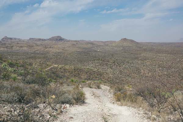
Canyon Road
Canyon Road is a maintained dirt road in the Christmas Mountains area of Big Bend. Canyon Road travels through scenic desert landscapes with mountains and plenty of cactus and brush along the way. There are no challenges on this road, so enjoy it for the scenery and the fact that it's one of the fe...
Learn more about Canyon Road
Christmas Mountain Trail
Christmas Mountain is the premier 4x4 trail in the Big Bend area! You start at the Terlingua Ranch Lodge and traverse up the mountain with numerous switchbacks and steep drop-offs. There's nothing technical about this trail, but there are some rocky areas and steep sections with loose gravel that mi...
Learn more about Christmas Mountain Trail
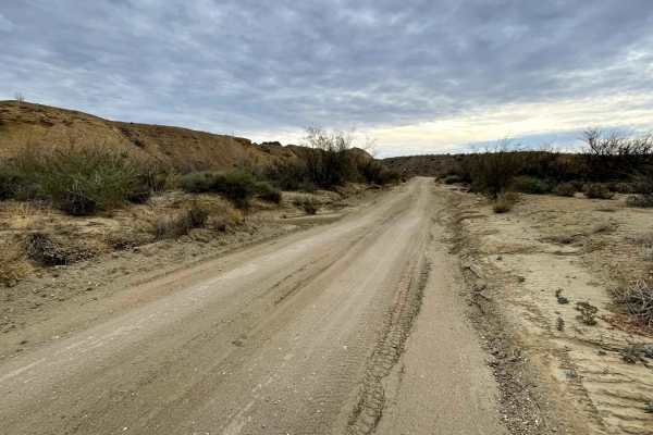
North County Road
North County Road is one of only a few publicly accessible roads in the magnificent Terlingua Ranch Subdivision. Being a county road, it is fairly well-maintained and smooth with no need for 4WD or high clearance. North County Road, however, has some spectacular desert scenery and follows along Terl...
Learn more about North County Road
South County Road
South County Road is one of only a few public dirt roads through the Terlingua Ranch Subdivision. It is a mostly smooth road without any obstacles but excellent desert scenery. All of the property along South County Road is private property, so please do not get out and trespass.
Learn more about South County Road
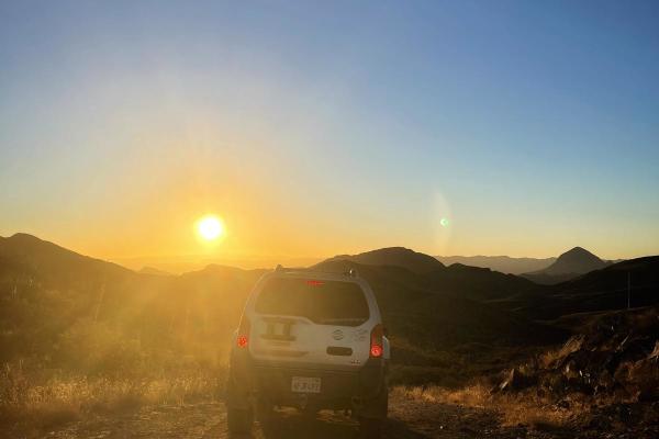
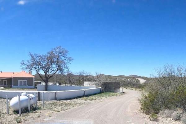
Abandoned Resort
This is an amazing drive in the Terlingua ranch area. This public road takes you deep in to the desert where there's a hidden gem. The remnants of an abandoned Resort and what looks like a 100-year-old dam. The journey will be a slow and steady one on this gravel, rocky desert mountain road. With a ...
Learn more about Abandoned Resort

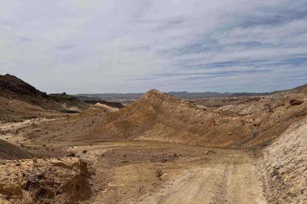
BBRSP Fresno Canyon Rd.
Fresno Canyon Road is open only to street-legal, high-clearance 4WD vehicles. The route offers a scenic descent into the canyon along the western edge of the Solitario. For more than two miles, the road follows the creek bed itself, which Park Rangers recommend as the preferred passage. The drive be...
Learn more about BBRSP Fresno Canyon Rd.
BBRSP Madrid Falls Road
Street Legal vehicles only. This 5 mile stretch is an out and back 4WD High Clearance two track, that ends at the Madrid Falls Hiking Trailhead and the Chorro Vista camp site. Along this road are 5 other spurs that all end at designated camp sites. The first mile is the steepest incline of the wh...
Learn more about BBRSP Madrid Falls Road
BBRSP Cat Spring Road
Cat Spring is a 4WD High Clearance Unmaintained Road that offers two water springs along its way. Cat Spring and Chupadero Spring. This road is primarily a two-track and is not maintained. Nature is reclaiming the road back, and very seldom is it ever driven. The ruins at the Chupadero Spring hold ...
Learn more about BBRSP Cat Spring Road

BBRSP West Casa Ramon
Street legal vehicles only. A permit is required from the Ranch Visitor Centers. West Casa Ramon is a two-track road through the rocky area of the North Cienega region and has a designated campsite near the south end of the road. The campsite is located at an old set of pens with a large water tank....
Learn more about BBRSP West Casa Ramon

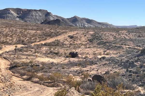
BBRSP Lower Alamito Road
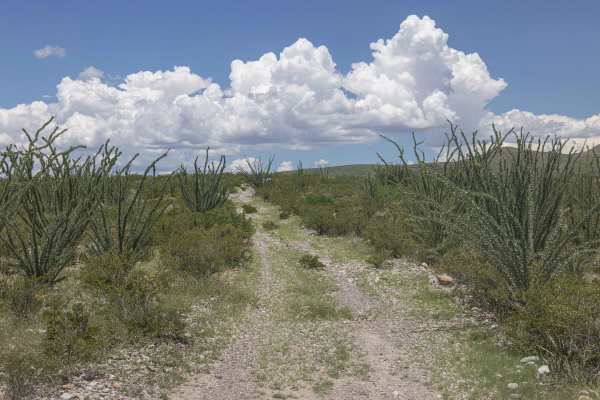
Lower Alamito is a high-clearance 4WD Unmaintained road that wanders through some very large Ocotillo plants that resemble forests of Saguaro cactus. In bloom, these plants display a brilliant red flower-type bud. The Ocotillo can live over 100 years. Lower Alamito Rd follows in a sandy wash, of wh...
Learn more about BBRSP Lower Alamito Road
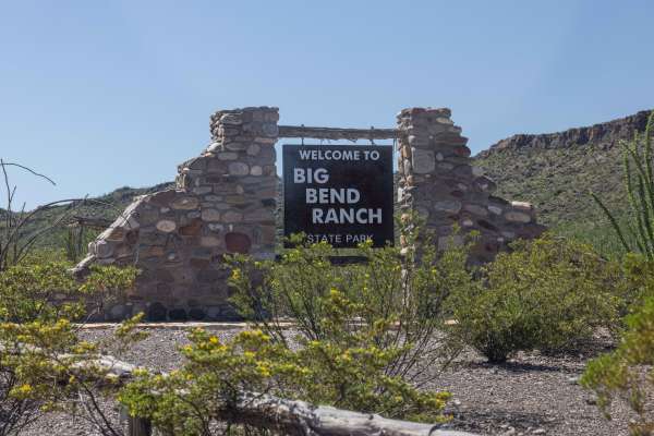
BBRSP Main Road
The main road into the park is a graded road, and 2WD High Clearance is recommended. Street legal vehicles ONLY in the park. This is the only way in and out of the park. There are some washes that can make the road unpassable during heavy rains, but wait it out, and as the water subsides, the wash ...
Learn more about BBRSP Main Road
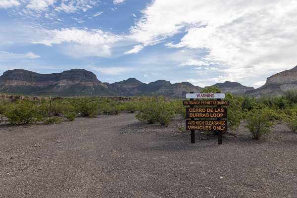
BBRSP - Las Burras Loop
This trail is non-maintained, and 4WD High Clearance is recommended. Las Burras Loop is a nice two-track that leads to the base of a mesa that contains plenty of historic art. The road follows a dry creek bed for a short time. Hiking parking is available at the north end of the loop. This is a great...
Learn more about BBRSP - Las Burras Loop
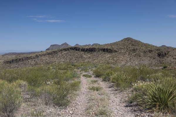
BBRSP - Oso Loop
4WD High Clearance, Street Legal Only. Oso Loop is a clean two-track that provides access to two other roads that host views and designated camping sites. Rolling hills and long views are what to be expected on this road. The Agua Adentro Pens campsite is at the West entrance of this road. Active ho...
Learn more about BBRSP - Oso Loop
BBRSP - Tres Papalotes Tanks Road
This trail requires 4WD, High Clearance, and is non-maintained. This road is a through road with an off-camber hill climb to the tanks. There is a section of deep wash running down the road with a crude bypass cut past this part. Articulation will carry most past this part. The two-track is narrow,...
Learn more about BBRSP - Tres Papalotes Tanks Road
ATV trails in Chihuahua
Explore ATV-friendly trails in Chihuahua. These trails are accessible for vehicles up to 50 inches wide, perfect for ATVs and smaller off-road machines.
Javelin Road
This is a meandering dirt road through the high desert and hills of Big Bend Ranch State Park. This is the most direct route to Madrid Falls Overlook & Chorro Vista Campground. One of, if not the most, scenic views in the park. The road is not heavily traveled and relatively unmaintained, and narrow...
Learn more about Javelin Road
Abandoned Resort
This is an amazing drive in the Terlingua ranch area. This public road takes you deep in to the desert where there's a hidden gem. The remnants of an abandoned Resort and what looks like a 100-year-old dam. The journey will be a slow and steady one on this gravel, rocky desert mountain road. With a ...
Learn more about Abandoned Resort
UTV/side-by-side trails in Chihuahua
Find UTV and side-by-side trails in Chihuahua. These trails accommodate vehicles up to 60 inches wide, ideal for UTVs, side-by-sides, and wider off-road rigs.
Javelin Road
This is a meandering dirt road through the high desert and hills of Big Bend Ranch State Park. This is the most direct route to Madrid Falls Overlook & Chorro Vista Campground. One of, if not the most, scenic views in the park. The road is not heavily traveled and relatively unmaintained, and narrow...
Learn more about Javelin Road
The onX Offroad Difference
onX Offroad combines trail photos, descriptions, difficulty ratings, width restrictions, seasonality, and more in a user-friendly interface. Available on all devices, with offline access and full compatibility with CarPlay and Android Auto. Discover what you're missing today!
Open Trail Map