
Dirt Bike Trails
Near Woodville Farm Labor Camp, California
Explore All Dirt Bike Trails Near Woodville Farm Labor Camp, California
Dirt Bike Trails Near Woodville Farm Labor Camp, California
Discover the best dirt bike trails near you. Browse trail maps, check difficulty ratings, and find your next adventure — whether you're looking for a quick ride or an all-day expedition.
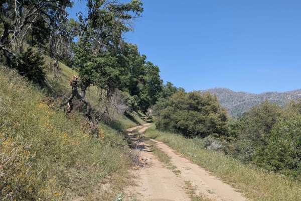
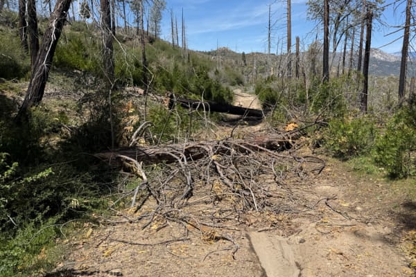
Chute Springs - FS 23S68
Chute Springs FS 23S68 departs from Highway M504 and runs along a shelf road high above the valley and canyon below through Sequoia National Forest. The trail is lined with oak and pine trees, green grass, and other bushes, with overgrown grass encroaching on the trail in sections. Evidence of the 2...
Learn more about Chute Springs - FS 23S68
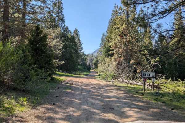
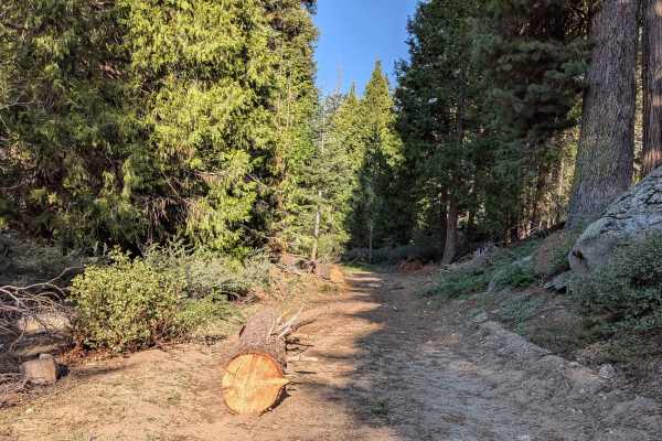
Horse Meadow Creek - FS 22S04
Horse Meadow Creek FS 22S04 departs from Highway M504 and cuts through a large pine forest within Sequoia National Forest, reaching Horse Meadow a couple of miles in. The meadow provides a natural destination and a pleasant open contrast to the dense pine forest along the approach. Dispersed camping...
Learn more about Horse Meadow Creek - FS 22S04
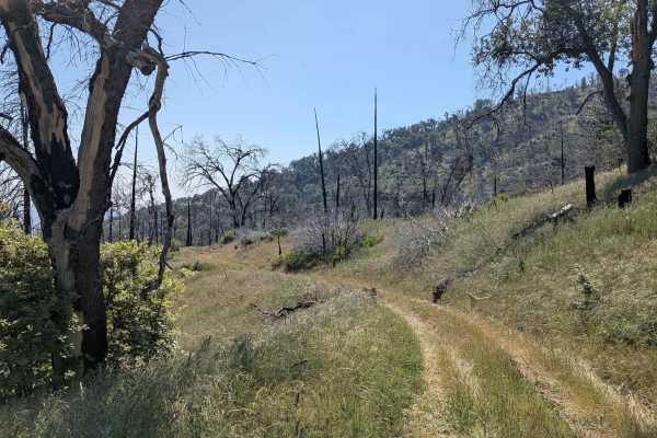
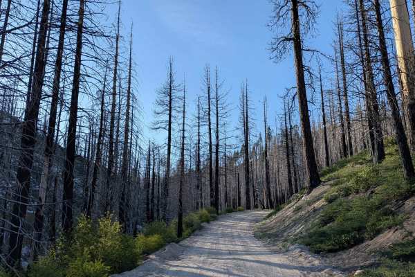
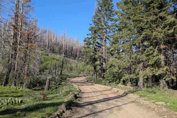
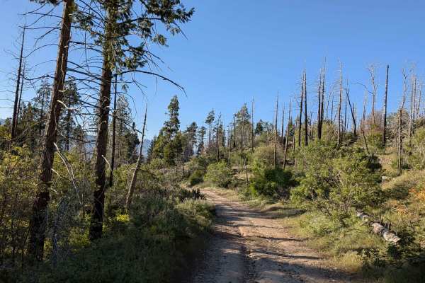
Starvation Creek - FS 23S65
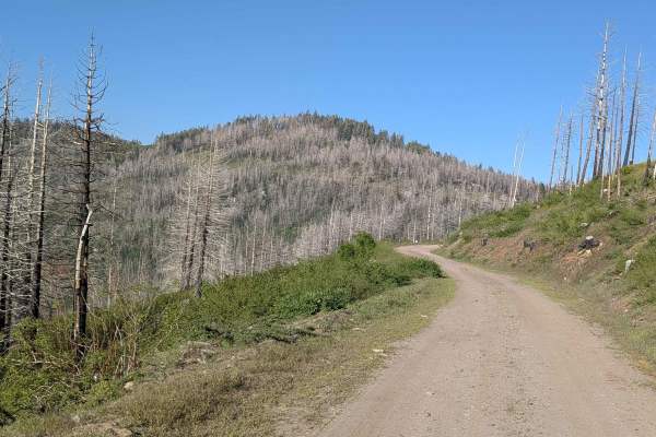
Starvation Creek FS 23S65 winds through rolling hills within Sequoia National Forest through what was once a mature forest, now heavily impacted by the 2021 Windy Fire. Most of the trees along the route are burned, giving the landscape an open and stark character. Overgrown grass has taken over much...
Learn more about Starvation Creek - FS 23S65
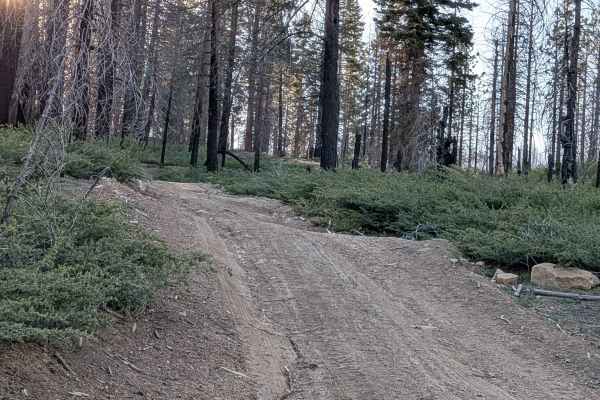
Forks - FS 23S62
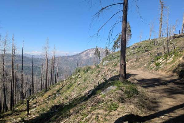
Forks FS 23S62 branches off Parker Forks and climbs aggressively through Sequoia National Forest pine trees before transitioning onto a shelf road with a deep embankment dropping hundreds of feet to the valley floor below. Evidence of the 2021 Windy Fire is visible throughout. Note that the final th...
Learn more about Forks - FS 23S62
Parker Forks - FS 22S18
Parker Forks FS 22S18 departs from the Great Western Divide Highway and follows Parker Meadow Creek through Sequoia National Forest to a nice meadow at the trail's end. The mixed surface of sand, dirt, and ash is a direct reflection of the heavy impact of the 2021 Windy Fire, evidence of which is vi...
Learn more about Parker Forks - FS 22S18
Redwood Meadow - FS 22S13
Redwood Meadow FS 22S13 departs from Highway M90 and drops nearly 300 feet over just over a mile, serving as a connector trail to the Long Meadow Campground Loop. The trail cuts through a couple of small creek crossings and passes through an area with active tree cleanup underway following the 2016 ...
Learn more about Redwood Meadow - FS 22S13
Mule Peak South - FS 22S03
Mule Peak South FS 22S03 begins off Highway M90, where the first 1.25 miles have been graded and covered with gravel by the Forest Service to improve drainage and traction. Beyond that, the surface transitions to hard-packed dirt with muddy spots in sections. The trail winds through tall pine trees ...
Learn more about Mule Peak South - FS 22S03
Jack Ranch - FS 24S05
Jack Ranch FS24S05 departs from Capinero and climbs 366 feet in just over 3 miles along a shelf road tracing the White River through Dark Canyon. The route is enclosed by very thick pine trees within Sequoia National Forest throughout. Small waterfalls appear along the trail, and the White River Cam...
Learn more about Jack Ranch - FS 24S05
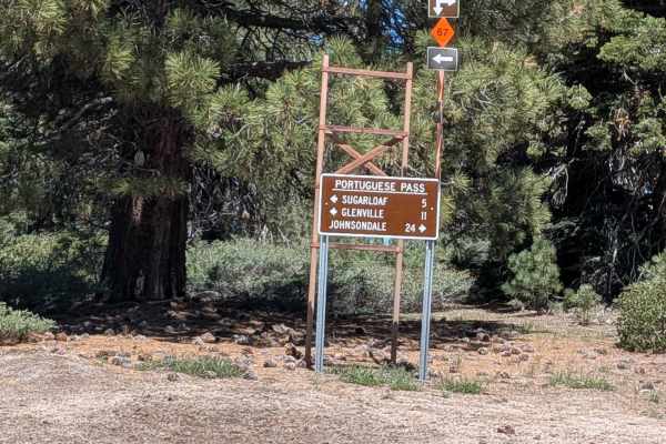
Sugarloaf
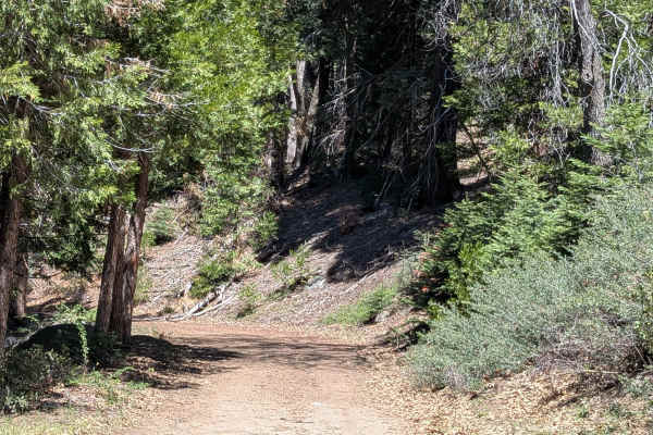
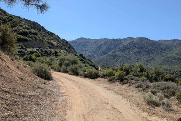
Sugarloaf departs from the village of Sugarloaf and climbs over 1,400 feet in just under 4 miles up to Portuguese Pass and Portuguese Meadows Road, serving as a key artery providing access to numerous trails in the surrounding network. The trail winds along the canyon with beautiful views of the for...
Learn more about Sugarloaf
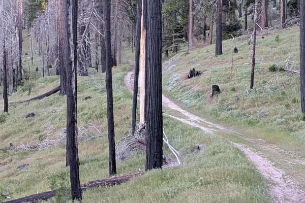
Fir Camp - FS 24S22
Fir Camp FS 24S22 is a short trail climbing to Fir Camp Saddle while also serving as a useful cutoff connector between Sugarloaf Road and Guernsey FS 24S29. The trail runs along a shelf road lined with large pine trees, with remnants of the 2016 Cedar Forest Fire visible throughout. Nice views of th...
Learn more about Fir Camp - FS 24S22
Sunday Peak Trail
Sunday Peak Trail is a short out-and-back departing from Portuguese Meadow Road into a beautiful and remote corner of Sequoia National Forest near Sunday Peak. The trail runs along a shelf road through pine trees, with the heavy aftermath of the 2021 French Fire visible in the form of numerous burne...
Learn more about Sunday Peak Trail
Rincon - FS 22S51
Rincon FS 22S51 runs parallel to Sherman Pass Road, rolling up and down dirt hills with dramatic views of the canyon below and surrounding mountains, including Brush Creek and Brush Creek Falls. The trail eventually drops into the valley, where additional trails branch off for further exploration, a...
Learn more about Rincon - FS 22S51
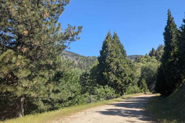
Green for Greenhorn
This is a great, flowy dirt road that offers some of the best views overlooking the Kern River Valley area. The path follows the natural curves of the mountainside, giving you plenty of chances to look out over the landscape as you ride. It’s a smooth and scenic stretch that feels very open, though ...
Learn more about Green for Greenhorn
Calf Creek - FS 25516
Calf Creek (FS 25S16) departs from Portuguese Meadow and climbs near Black Mountain Saddle at 6,250 feet in elevation. It is a 8.5 miles of out-and-back travel through dense pine forest. The trail is lined with numerous old, dead trees that have been pushed to the sides of the road, requiring occasi...
Learn more about Calf Creek - FS 25516
Black Mountain Saddle - FS 32E59
Black Mountain Saddle (FS 32E59) branches off Calf Creek and pushes through a grass and pine forest corridor within Sequoia National Forest, much of which bears heavy evidence of the 2021 French Fire. The trail is now a 3-mile out-and-back as the connecting trail at the far end no longer exists, mak...
Learn more about Black Mountain Saddle - FS 32E59

Black Mountain - FS 32E360
Black Mountain FS 32E360 winds through grass and tall pine trees within Sequoia National Forest, climbing over 500 feet and dropping over 200 feet in just under 2 miles. Evidence of the 2021 French Fire is visible throughout. Views of the surrounding hillsides and mountains open up as the trail gain...
Learn more about Black Mountain - FS 32E360
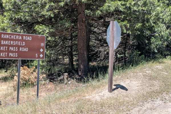
Basket Pass - FS 26S05
Basket Pass (FS 26S05) departs from Rancheria Road South and runs along a shelf road through pine forest within Sequoia National Forest, with beautiful views opening up over the valley below toward the Bakersfield area. Occasional large boulders punctuate the pine-lined corridor. The trail crosses P...
Learn more about Basket Pass - FS 26S05
Pettit - FS 26S37
Pettitt (FS 26S03) runs 6 miles from Basket Pass down to Rancheria Road South, dropping 900 feet and gaining 437 feet along a varied course through the thick Sequoia National Forest. The trail is lined with a mix of pine and oak trees, with occasional boulder fields adding visual interest along the ...
Learn more about Pettit - FS 26S37
Rhymes - FS 26S19
Rhymes FS 26S19 branches off Rancheria Road North and runs along a shelf road for the majority of its length, with a significant drop off into the canyon below throughout. The hard-packed dirt surface is consistent, and the trail is open to all vehicle types. Evidence of the 2021 French Fire is visi...
Learn more about Rhymes - FS 26S19
Cookes Peak - FS 25S21
Cookes Peak (FS 25S21) departs and returns to Rancheria Road North, running along a shelf road with consistent views down into Lake Isabella, the valley below, and the mountains across the way. The dirt and sand surface narrows to as little as one vehicle wide in places. Evidence of the 2021 French ...
Learn more about Cookes Peak - FS 25S21
ATV trails near Woodville Farm Labor Camp, California
Explore ATV-friendly trails near you. These trails are accessible for vehicles up to 50 inches wide, perfect for ATVs and smaller off-road machines.
Chute Springs - FS 23S68
Chute Springs FS 23S68 departs from Highway M504 and runs along a shelf road high above the valley and canyon below through Sequoia National Forest. The trail is lined with oak and pine trees, green grass, and other bushes, with overgrown grass encroaching on the trail in sections. Evidence of the 2...
Learn more about Chute Springs - FS 23S68
Horse Meadow Creek - FS 22S04
Horse Meadow Creek FS 22S04 departs from Highway M504 and cuts through a large pine forest within Sequoia National Forest, reaching Horse Meadow a couple of miles in. The meadow provides a natural destination and a pleasant open contrast to the dense pine forest along the approach. Dispersed camping...
Learn more about Horse Meadow Creek - FS 22S04
Starvation Creek - FS 23S65
Starvation Creek FS 23S65 winds through rolling hills within Sequoia National Forest through what was once a mature forest, now heavily impacted by the 2021 Windy Fire. Most of the trees along the route are burned, giving the landscape an open and stark character. Overgrown grass has taken over much...
Learn more about Starvation Creek - FS 23S65
Forks - FS 23S62
Forks FS 23S62 branches off Parker Forks and climbs aggressively through Sequoia National Forest pine trees before transitioning onto a shelf road with a deep embankment dropping hundreds of feet to the valley floor below. Evidence of the 2021 Windy Fire is visible throughout. Note that the final th...
Learn more about Forks - FS 23S62
UTV/side-by-side trails near Woodville Farm Labor Camp, California
Find UTV and side-by-side trails near you. These trails accommodate vehicles up to 60 inches wide, ideal for UTVs, side-by-sides, and wider off-road rigs.
Chute Springs - FS 23S68
Chute Springs FS 23S68 departs from Highway M504 and runs along a shelf road high above the valley and canyon below through Sequoia National Forest. The trail is lined with oak and pine trees, green grass, and other bushes, with overgrown grass encroaching on the trail in sections. Evidence of the 2...
Learn more about Chute Springs - FS 23S68
Horse Meadow Creek - FS 22S04
Horse Meadow Creek FS 22S04 departs from Highway M504 and cuts through a large pine forest within Sequoia National Forest, reaching Horse Meadow a couple of miles in. The meadow provides a natural destination and a pleasant open contrast to the dense pine forest along the approach. Dispersed camping...
Learn more about Horse Meadow Creek - FS 22S04
Starvation Creek - FS 23S65
Starvation Creek FS 23S65 winds through rolling hills within Sequoia National Forest through what was once a mature forest, now heavily impacted by the 2021 Windy Fire. Most of the trees along the route are burned, giving the landscape an open and stark character. Overgrown grass has taken over much...
Learn more about Starvation Creek - FS 23S65
Forks - FS 23S62
Forks FS 23S62 branches off Parker Forks and climbs aggressively through Sequoia National Forest pine trees before transitioning onto a shelf road with a deep embankment dropping hundreds of feet to the valley floor below. Evidence of the 2021 Windy Fire is visible throughout. Note that the final th...
Learn more about Forks - FS 23S62
The onX Offroad Difference
onX Offroad combines trail photos, descriptions, difficulty ratings, width restrictions, seasonality, and more in a user-friendly interface. Available on all devices, with offline access and full compatibility with CarPlay and Android Auto. Discover what you're missing today!
Open Trail Map