
Dirt Bike Trails
Near Syracuse, Utah
Explore All Dirt Bike Trails Near Syracuse, Utah
Dirt Bike Trails Near Syracuse, Utah
Discover the best dirt bike trails near you. Browse trail maps, check difficulty ratings, and find your next adventure — whether you're looking for a quick ride or an all-day expedition.

Farmington Firebreak Road
This is a short firebreak road that starts at the base of Farmington Canyon and dead ends shortly after a creek crossing. There are signs at the trailhead warning about a gate ahead, but this doesn't mean the road is closed; it just means you can't drive to the road that is after the gate. This trai...
Learn more about Farmington Firebreak Road
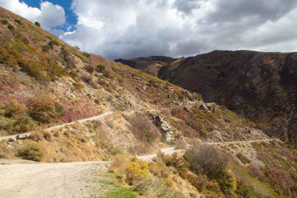
Farmington Canyon Trail
This trail is an easy well maintained road that starts in Farmington and heads up the canyon to where it ends at the start of Francis Peak Road and Skyline Drive. This trail stays about 2 vehicles wide but some spots may require larger vehicles to back up in order to find a good place to pass and ca...
Learn more about Farmington Canyon Trail
Smith Lakes
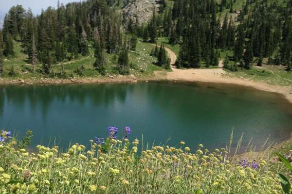
Choose your method of travel: foot, ATV, horse, truck or other. All are fun and acceptable (within reason). ATVs and motorcycles are king on this trail. You can rip down the trails at a good speed and enjoy the bends and jumps. Trucks with good clearance can bounce all the way to the third lake, if...
Learn more about Smith Lakes
Holmes Creek Road (FR 260)
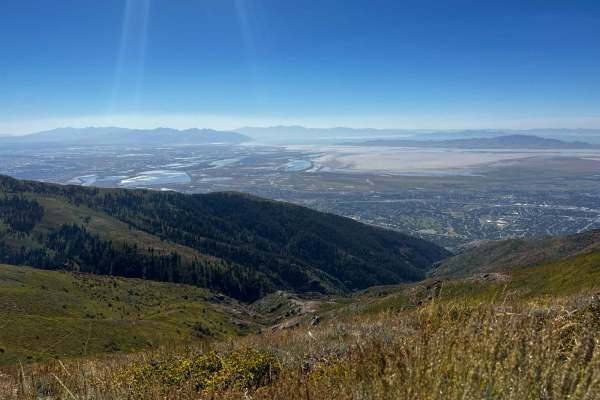
Holmes Creek Road starts at the end of Francis Peak Road as a very narrow, very rocky shelf road. There are not many areas to pull off for other vehicles, so proceed cautiously. As with many of the roads in the area, there are several blind curves. Due to larger, loose rocks, deep washouts, and eros...
Learn more about Holmes Creek Road (FR 260)
Steed Canyon Overlook
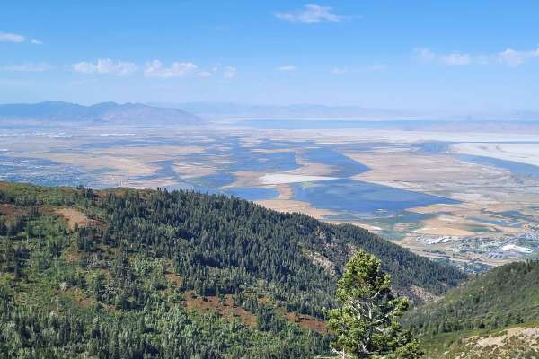
This route follows a tight road along the side of a mountain to where it pops out onto the ridge and down to an overlook of Steed Canyon and out across the valley. The road is extremely tight along the mountain, where it is off-camber and a shelf road. Full-size vehicles will most likely not fit, an...
Learn more about Steed Canyon Overlook
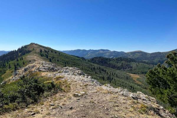
Gold Hill
Due to its narrowness and winding turns through the trees, this trail was recently fenced off and gated for 50" and smaller vehicles. The north end begins with a steep scramble up a crumbly rock face. Although there are a few routes up the rocks, there is really only one that can be done without win...
Learn more about Gold Hill
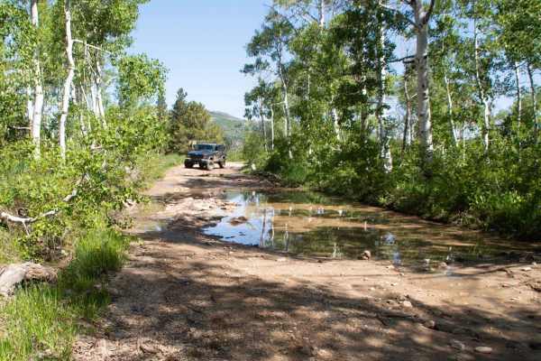
Farmington Flats
This is an OHV route across Farmington Flats that starts at Bountiful Campground and loops around to Francis Peak Road. This trail has difficulty mainly due to the numerous deep mudholes that exist along the trail, which can be up to 3 feet deep depending on the time of year. The trail is generally ...
Learn more about Farmington Flats
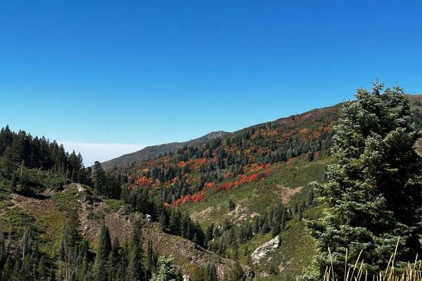
Francis Peak Road (FS 009)
Francis Peak Road continues up from the intersection of Farmington Canyon Road and Skyline Drive. The route is very scenic, as you will have views from both sides of the mountain. Along the route, you will see multiple areas for camping. There are also two large areas for group parking that include ...
Learn more about Francis Peak Road (FS 009)
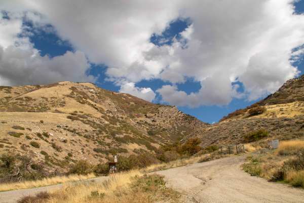
South Duel Creek Trail
This trail is a short spur off of Centerville Firebreak Road that leads you to the Offroad Bowl Trails as well as the trailhead for South Duel Creek hiking trail. This trail is easy with the surface consisting of gravel for the entire length. There is an optional obstacle at the final turn before yo...
Learn more about South Duel Creek Trail
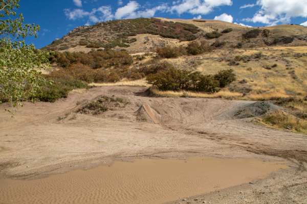
Centerville Offroad Bowl Lower Trail
This trail is a part of the Centerville Offroad system and traverses a bowl area comprised of 2 main routes going through the bowl. This route is the lower route, which, due to this being a bowl, tends to be muddy and wet as water pools in the bottom. The deepest of these mudholes is around 2 Feet d...
Learn more about Centerville Offroad Bowl Lower Trail
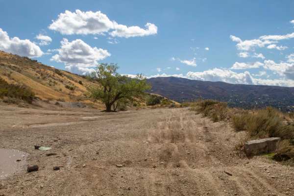
Centerville Offroad Bowl Upper Trail
This trail follows the west rim of the Centerville Offroad Bowl. The upper trail is tight in some spots and has a couple of spots that are off-camber. This upper section is a good bypass for the sections of the lower bowl that are filled with mud too deep to traverse, but the surface is covered in w...
Learn more about Centerville Offroad Bowl Upper Trail
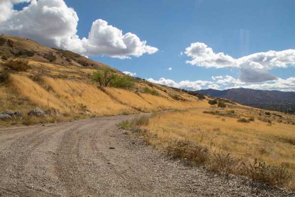
Centerville Offroad Bowl Return
This trail takes you from the South end of the Offroad Bowl and loops around the outside back to South Duel Creek Trail. This trail is relatively tame as it follows the hillside with only a couple of spots that may cause difficulty, those being the exit/entrance from the bowl being tight, and a spot...
Learn more about Centerville Offroad Bowl Return
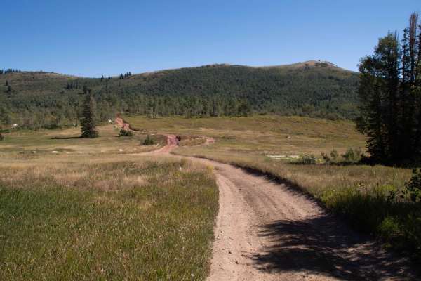
Foundation Loop (FR 80257-A)
This short trail is rough and rocky with deep ruts, mudholes, steep inclines, and a creek crossing that will require 4WD. This is a scenic trail that travels through a grove of aspens where there is a picnic table as well as short brush with mountain views all around. This trail is a great trail to ...
Learn more about Foundation Loop (FR 80257-A)
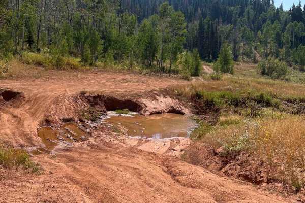
Arthur's Fork
Arthur's Fork is a short, scenic four-wheel-drive trail ideal for intermediate offroaders seeking stunning high-elevation views and a bit of a challenge along the Wasatch Range. Branching off from the Farmington Canyon Loop, this roughly one-mile route quickly introduces drivers to rocky, rutted sur...
Learn more about Arthur's Fork
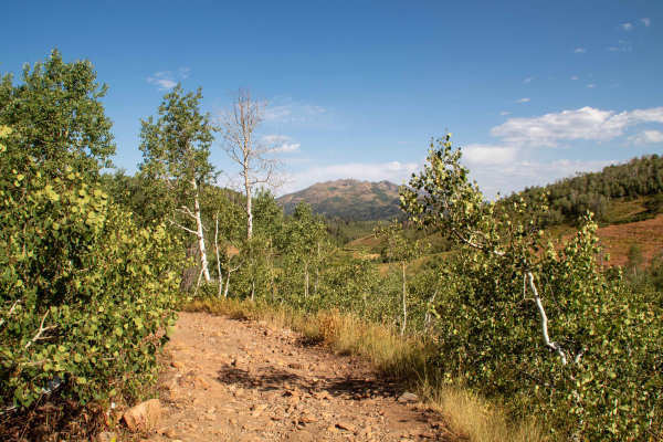
Chicken Creek
Chicken Creek is a short, scenic off-road trail ideal for ATV and dirt bike riders seeking a tight, forested route with beautiful vistas overlooking Farmington Flats. Spanning approximately 0.77 miles with an elevation gain of 203 feet, the trail branches off Farmington Flats and heads south through...
Learn more about Chicken Creek
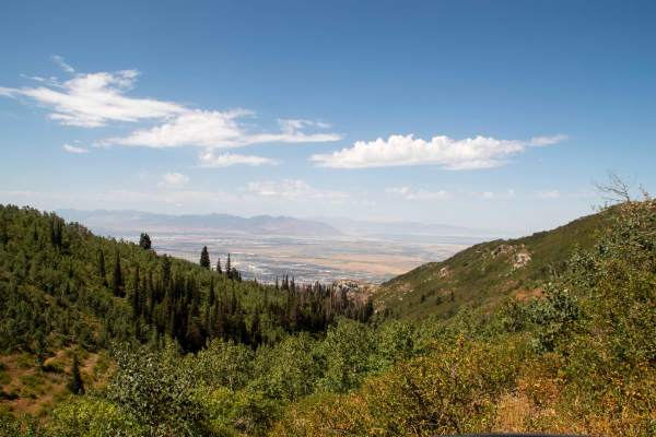
Lower Parish Creek
This trail is steep, rocky, and overgrown as it winds its way along ridges and down hillsides just West of Parish Creek. This trail is extremely tight, and larger vehicles may not fit and should expect pinstriping and potentially having to clear branches out of the way to continue past. There are ve...
Learn more about Lower Parish Creek
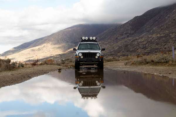
Centerville Firebreak Road
Centerville Firebreak Road runs from Bountiful to Farmington, following the benches above the neighborhoods. It is an easy, scenic drive that makes for a great short trip between Ward and Farmington Canyons. The road runs along the benches, staying high enough to overlook the valley and Antelope Isl...
Learn more about Centerville Firebreak Road
Parish Creek
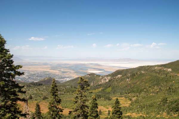
This short trail branches off of Skyline Drive and runs basically parallel to it, heading down to Parish Creek. This trail is an easy scenic drive through the trees, with the only real worry being the overgrown bushes along the sides of the trail and a few low-hanging branches. This trail is open fr...
Learn more about Parish Creek
Coldwater Peak (6087)
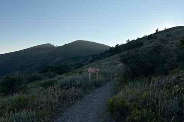
Coldwater Peak is a short single-track trail that connects Skyline South and Lewis Peak trails. It runs west to east and side-hills across one of the peaks in this area. The track is very narrow without much room for picking a line. The plants along the trail are mostly short, but in some areas, tre...
Learn more about Coldwater Peak (6087)
Ward Canyon Road
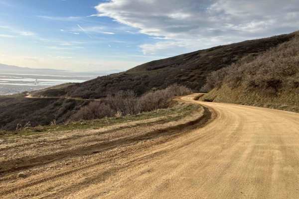
Ward Canyon Road is an easy, scenic dirt and gravel route ideal for beginners, families, and those seeking quick access to sweeping views of the Great Salt Lake and Antelope Island. Spanning approximately 4.7 miles with a steady climb of about 1,679 feet, the trail begins near the landmark white Bou...
Learn more about Ward Canyon Road
ATV trails near Syracuse, Utah
Explore ATV-friendly trails near you. These trails are accessible for vehicles up to 50 inches wide, perfect for ATVs and smaller off-road machines.
Farmington Firebreak Road
This is a short firebreak road that starts at the base of Farmington Canyon and dead ends shortly after a creek crossing. There are signs at the trailhead warning about a gate ahead, but this doesn't mean the road is closed; it just means you can't drive to the road that is after the gate. This trai...
Learn more about Farmington Firebreak Road
Farmington Canyon Trail
This trail is an easy well maintained road that starts in Farmington and heads up the canyon to where it ends at the start of Francis Peak Road and Skyline Drive. This trail stays about 2 vehicles wide but some spots may require larger vehicles to back up in order to find a good place to pass and ca...
Learn more about Farmington Canyon Trail
Smith Lakes
Choose your method of travel: foot, ATV, horse, truck or other. All are fun and acceptable (within reason). ATVs and motorcycles are king on this trail. You can rip down the trails at a good speed and enjoy the bends and jumps. Trucks with good clearance can bounce all the way to the third lake, if...
Learn more about Smith Lakes
Holmes Creek Road (FR 260)
Holmes Creek Road starts at the end of Francis Peak Road as a very narrow, very rocky shelf road. There are not many areas to pull off for other vehicles, so proceed cautiously. As with many of the roads in the area, there are several blind curves. Due to larger, loose rocks, deep washouts, and eros...
Learn more about Holmes Creek Road (FR 260)
UTV/side-by-side trails near Syracuse, Utah
Find UTV and side-by-side trails near you. These trails accommodate vehicles up to 60 inches wide, ideal for UTVs, side-by-sides, and wider off-road rigs.
Farmington Firebreak Road
This is a short firebreak road that starts at the base of Farmington Canyon and dead ends shortly after a creek crossing. There are signs at the trailhead warning about a gate ahead, but this doesn't mean the road is closed; it just means you can't drive to the road that is after the gate. This trai...
Learn more about Farmington Firebreak Road
Farmington Canyon Trail
This trail is an easy well maintained road that starts in Farmington and heads up the canyon to where it ends at the start of Francis Peak Road and Skyline Drive. This trail stays about 2 vehicles wide but some spots may require larger vehicles to back up in order to find a good place to pass and ca...
Learn more about Farmington Canyon Trail
Holmes Creek Road (FR 260)
Holmes Creek Road starts at the end of Francis Peak Road as a very narrow, very rocky shelf road. There are not many areas to pull off for other vehicles, so proceed cautiously. As with many of the roads in the area, there are several blind curves. Due to larger, loose rocks, deep washouts, and eros...
Learn more about Holmes Creek Road (FR 260)
Steed Canyon Overlook
This route follows a tight road along the side of a mountain to where it pops out onto the ridge and down to an overlook of Steed Canyon and out across the valley. The road is extremely tight along the mountain, where it is off-camber and a shelf road. Full-size vehicles will most likely not fit, an...
Learn more about Steed Canyon Overlook
The onX Offroad Difference
onX Offroad combines trail photos, descriptions, difficulty ratings, width restrictions, seasonality, and more in a user-friendly interface. Available on all devices, with offline access and full compatibility with CarPlay and Android Auto. Discover what you're missing today!
Open Trail Map