
Dirt Bike Trails
Near Sullivan, Missouri
Explore All Dirt Bike Trails Near Sullivan, Missouri
Dirt Bike Trails Near Sullivan, Missouri
Discover the best dirt bike trails near you. Browse trail maps, check difficulty ratings, and find your next adventure — whether you're looking for a quick ride or an all-day expedition.
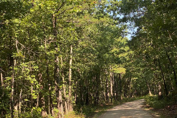
Bass River Scenic Route
This is a beautiful ride through Mark Twain National Forest on the northern portion of the Potosi district. There are lots of opportunities for photos and enjoying the scenery. You are likely to see deer and other animals along the route. Make sure to bring your swim trunks for a dip in the Huzzah C...
Learn more about Bass River Scenic Route
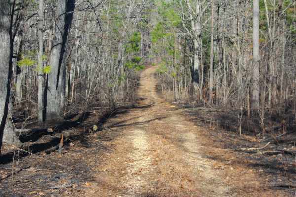
Hidden Pond Spur A - FS 2607A
Hidden Pond Spur A (FS 2607A) is a natural dirt and gravel forest service road within the Potosi Unit of Mark Twain National Forest. The Spur Road begins going south off the far western section of the FS 2607, just a couple of hundred feet before the main road's legal end. The Spur Road quickly narr...
Learn more about Hidden Pond Spur A - FS 2607A
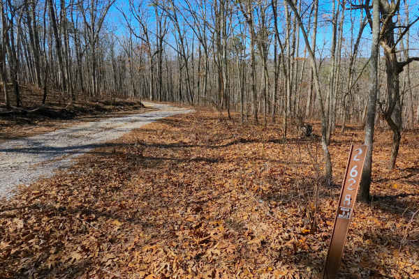
Shirley Ridge - FS 2628
Shirley Ridge (FS 2628) is a maintained gravel forest service road within the Potosi Unit of Mark Twain National Forest. The road begins at Berryman Road and the upper ridge it rests on, heading northwest, going downhill rapidly at first, only to shift towards a milder downhill grade before rising o...
Learn more about Shirley Ridge - FS 2628
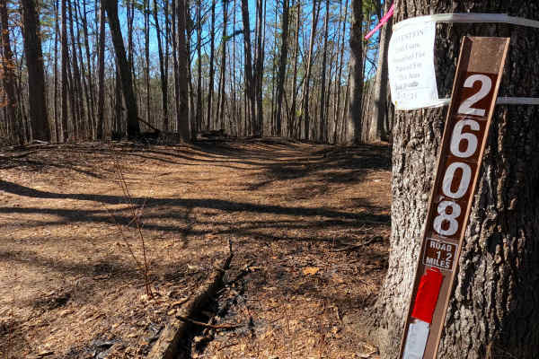
Billys Branch - FS 2608
Billy's Branch (FS 2608) is a natural dirt and gravel road within the Potosi Unit of Mark Twain National Forest. The road begins at Berryman Road and the upper ridge it rests on, heading northwest, going downhill, crossing over natural rock poking out of the surface, with mild rutting to meet a smal...
Learn more about Billys Branch - FS 2608
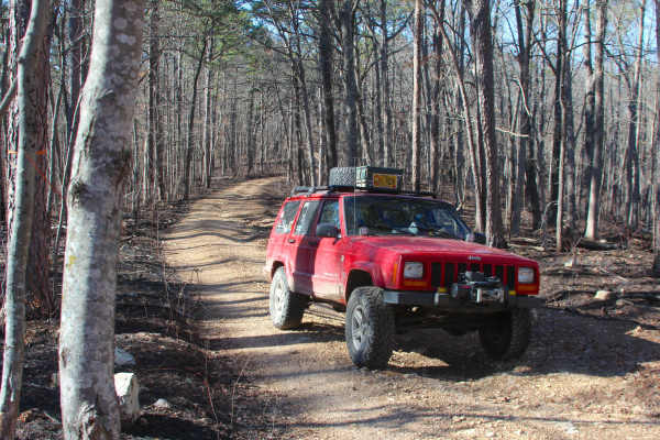
Hidden Pond - FS 2607
Hidden Pond (FS 2607) is a natural dirt and gravel forest service road within the Potosi Unit of Mark Twain National Forest. The road begins at Berryman Road and the upper ridge it rests on, heading northwest, going downhill, featuring loose coarse gravel, natural cobbles, and erosion-ruts to the co...
Learn more about Hidden Pond - FS 2607
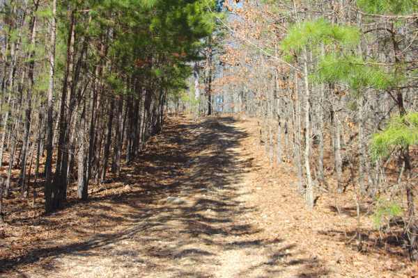
Kemlin Hollow - FS 2627
Kemlin Hollow (FS 2627) is a natural gravel and dirt road within the Potosi Unit of Mark Twain National Forest. The road begins at Berryman Road and the upper ridge it rests on, heading south, first riding on generally flat ground, to the point the trail narrows into a pine-filled downhill with smal...
Learn more about Kemlin Hollow - FS 2627
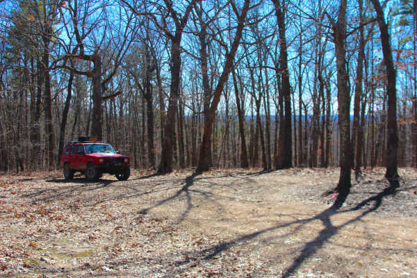
Clear Creek North Side - FS 2269
Clear Creek North Side (FS 2269) is a dirt and gravel forest service road within the Potosi Unit of Mark Twain National Forest. The dirty natural gravel surface track heads south from the Floyd Tower Road ridge, going into the treelines at a slight downhill grade to the middle section of the trail t...
Learn more about Clear Creek North Side - FS 2269

Huzzah Creek Train Tunnel
As you travel along, you weave in and out of the Mark Twain Forest. You'll start near one of the areas for camping and floating outfitters (Eagle Hurst Ranch), popular during the summer. The Huzzah is a great natural waterway for canoeing. This route will take you deep into the forest and to Davisvi...
Learn more about Huzzah Creek Train Tunnel
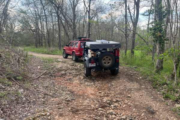
Courtois Cemetery - FS 2878
Courtois Cemetery (FS 2878) is a nature gravel and dirt forest service road within the Potosi Unit of Mark Twain National Forest. Courtios (pronounced Coat-A-Way) Cemetery begins at Missouri Route 8 heading north, first crossing a low water bridge creek crossing, before arriving at the actual Courto...
Learn more about Courtois Cemetery - FS 2878
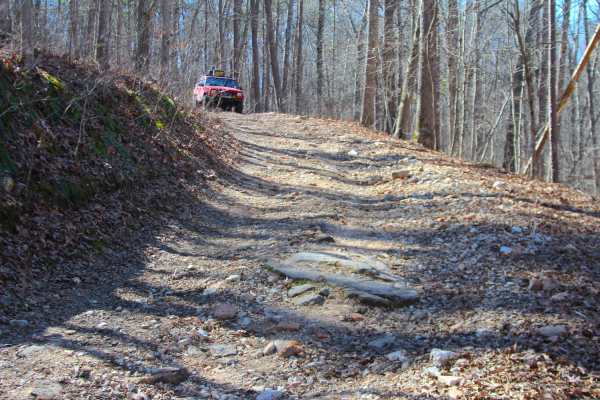
Coffman Hollow - FS 2907
Coffman Hollow (FS 2907) is a natural dirt, coarse gravel, and natural rock forest service road within the Potosi Unit of Mark Twain National Forest. Coffman Hollow heads west off the FS 2438, going along the raised ridge, slowly shedding off elevation downhill for the first mile, traversing small w...
Learn more about Coffman Hollow - FS 2907
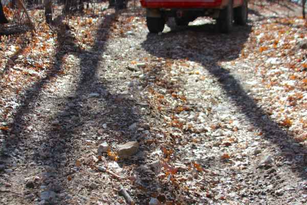
Flatwoods Spur B - FS 2438B
Flatwoods Spur B (FS 2438B) is a natural dirt and gravel forest service road within the Potosi Unit of Mark Twain National Forest. The Flatwoods Spur B heads north from the main road, Flatwoods FS 2438, heading into the woods along the ridge going north and then east from the main ridge. The road ha...
Learn more about Flatwoods Spur B - FS 2438B
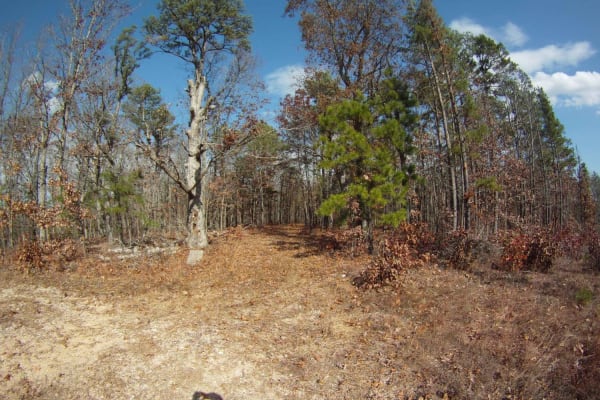
Allen Branch FS 4004
Very easy up to the power line. It's a road. Easy access to a place to hike, camp, or hunt. Particularly to hike or hunt the power-line cut. After the power lines, it's a trail for about 125 yards. Towards the top staying to the left will connect to CR 605 [AKA Jinkerson Road which is paved] which c...
Learn more about Allen Branch FS 4004
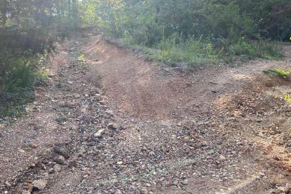
Parole Dam Trail
This is a forest trail that takes you the fun way to Parole Dam. There's a good downhill rocky section (tougher going back up)-there is a bypass, but the extra credit lines require good ground clearance. Shortly after exiting the trail, you will arrive at the Parole Dam area with opportunities for s...
Learn more about Parole Dam Trail
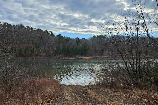
Stringtown Branch - FSR 2550
Forest Service Road 2550, also known as Springtown Branch, is a gravel/dirt trail connecting Pigeon Roost Road and Forest Service Road 2695. This trail parallels Parole Lake and offers some good views of the lake. Any vehicle with high clearance will be able to access this trail without issue.
Learn more about Stringtown Branch - FSR 2550
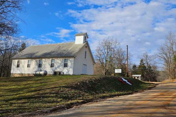
Palmer North - FSR 2695
Forest Service Road 2695 (Palmer North) connects Palmer Road and Pigeon Roost Road. At the trailhead near Palmer Road, you'll encounter the historic Palmer Church, established in 1840. The majority of the trail is a well-maintained gravel road, though there are a couple of small washouts (less than ...
Learn more about Palmer North - FSR 2695
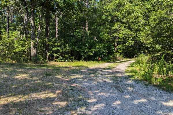
Palmer Mine - FSR 2382
Palmer Mine Trail begins as a well-maintained forest service road winding through the scenic Mark Twain National Forest, gradually descending into the valley towards Hazel Creek. At 1 mile into the trail, adventurers reach a spacious open campsite area complete with a rock fire ring. Beyond this poi...
Learn more about Palmer Mine - FSR 2382
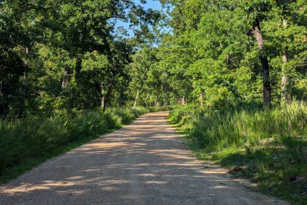
Old Tiff Mill - FSR 2423
Forest Service Road 2423 is a well-maintained gravel road in the Potosi District of the Mark Twain National Forest. FSR 2423 connects to FSR 2919, which provides access to Howell Lake and Howell Mine Dam. It can be accessed by almost any vehicle and should not require four-wheel drive.
Learn more about Old Tiff Mill - FSR 2423
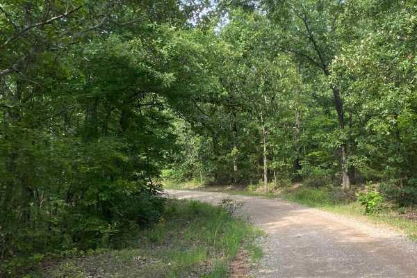
Palmer Lake Loop
The first puddle at the start of the trail is normally passable for any vehicle. There is potential water on the road and loose gravel back in the dam area of the loop. Otherwise, the trail boasts very moderate terrain with a lot of photo opportunities. 4-low is helpful in the back area as there are...
Learn more about Palmer Lake Loop
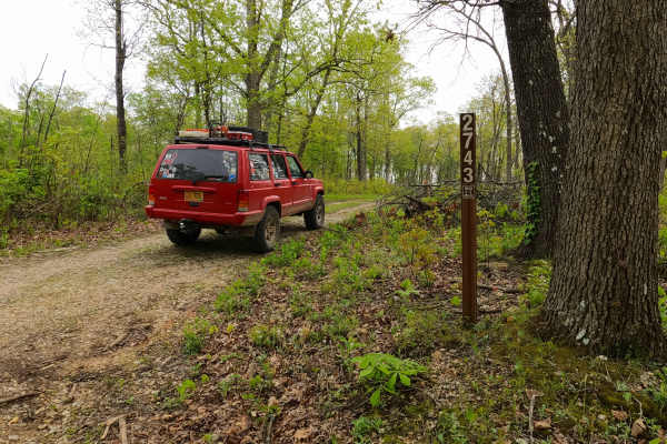
North James - FS 2743
North James (FS 2743) is a low-standard gravel forest service road within the Mark Twain National Forest Potosi Unit. North James features a short annual season of use from November 7th to November 30th, during deer season. The road is 0.9 of a mile long, starting from the hilltop along the Crooked ...
Learn more about North James - FS 2743
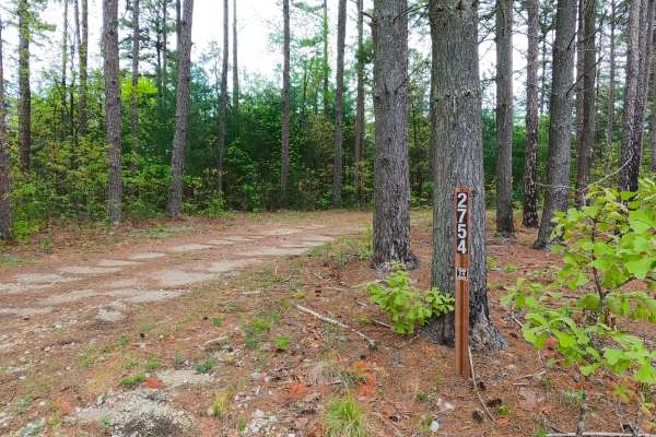
James Ridge - FS 2754
James Ridge FS 2754, is a semi-maintained gravel forest road within the Salem Unit of Mark Twain National Forest. The road features a ridge-top ride on the hill with James Branch Creek to the south and Chandler Hollow/Lost Lake to the east. Along the way, there are small water collection spots, surf...
Learn more about James Ridge - FS 2754
ATV trails near Sullivan, Missouri
Explore ATV-friendly trails near you. These trails are accessible for vehicles up to 50 inches wide, perfect for ATVs and smaller off-road machines.
Bass River Scenic Route
This is a beautiful ride through Mark Twain National Forest on the northern portion of the Potosi district. There are lots of opportunities for photos and enjoying the scenery. You are likely to see deer and other animals along the route. Make sure to bring your swim trunks for a dip in the Huzzah C...
Learn more about Bass River Scenic Route
Hidden Pond Spur A - FS 2607A
Hidden Pond Spur A (FS 2607A) is a natural dirt and gravel forest service road within the Potosi Unit of Mark Twain National Forest. The Spur Road begins going south off the far western section of the FS 2607, just a couple of hundred feet before the main road's legal end. The Spur Road quickly narr...
Learn more about Hidden Pond Spur A - FS 2607A
Shirley Ridge - FS 2628
Shirley Ridge (FS 2628) is a maintained gravel forest service road within the Potosi Unit of Mark Twain National Forest. The road begins at Berryman Road and the upper ridge it rests on, heading northwest, going downhill rapidly at first, only to shift towards a milder downhill grade before rising o...
Learn more about Shirley Ridge - FS 2628
Billys Branch - FS 2608
Billy's Branch (FS 2608) is a natural dirt and gravel road within the Potosi Unit of Mark Twain National Forest. The road begins at Berryman Road and the upper ridge it rests on, heading northwest, going downhill, crossing over natural rock poking out of the surface, with mild rutting to meet a smal...
Learn more about Billys Branch - FS 2608
UTV/side-by-side trails near Sullivan, Missouri
Find UTV and side-by-side trails near you. These trails accommodate vehicles up to 60 inches wide, ideal for UTVs, side-by-sides, and wider off-road rigs.
Bass River Scenic Route
This is a beautiful ride through Mark Twain National Forest on the northern portion of the Potosi district. There are lots of opportunities for photos and enjoying the scenery. You are likely to see deer and other animals along the route. Make sure to bring your swim trunks for a dip in the Huzzah C...
Learn more about Bass River Scenic Route
Hidden Pond Spur A - FS 2607A
Hidden Pond Spur A (FS 2607A) is a natural dirt and gravel forest service road within the Potosi Unit of Mark Twain National Forest. The Spur Road begins going south off the far western section of the FS 2607, just a couple of hundred feet before the main road's legal end. The Spur Road quickly narr...
Learn more about Hidden Pond Spur A - FS 2607A
Shirley Ridge - FS 2628
Shirley Ridge (FS 2628) is a maintained gravel forest service road within the Potosi Unit of Mark Twain National Forest. The road begins at Berryman Road and the upper ridge it rests on, heading northwest, going downhill rapidly at first, only to shift towards a milder downhill grade before rising o...
Learn more about Shirley Ridge - FS 2628
Billys Branch - FS 2608
Billy's Branch (FS 2608) is a natural dirt and gravel road within the Potosi Unit of Mark Twain National Forest. The road begins at Berryman Road and the upper ridge it rests on, heading northwest, going downhill, crossing over natural rock poking out of the surface, with mild rutting to meet a smal...
Learn more about Billys Branch - FS 2608
The onX Offroad Difference
onX Offroad combines trail photos, descriptions, difficulty ratings, width restrictions, seasonality, and more in a user-friendly interface. Available on all devices, with offline access and full compatibility with CarPlay and Android Auto. Discover what you're missing today!
Open Trail Map