
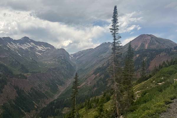
Dirt Bike Trails
Near Somerset, Colorado
Explore All Dirt Bike Trails Near Somerset, Colorado
Dirt Bike Trails Near Somerset, Colorado
Discover the best dirt bike trails near you. Browse trail maps, check difficulty ratings, and find your next adventure — whether you're looking for a quick ride or an all-day expedition.
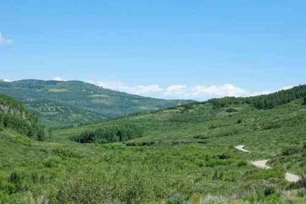
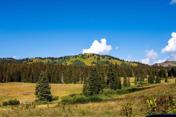
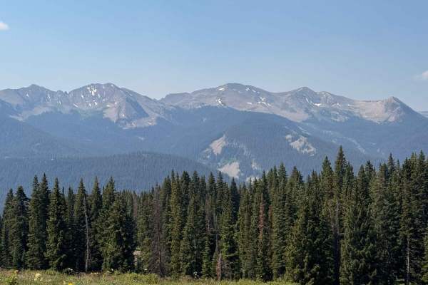
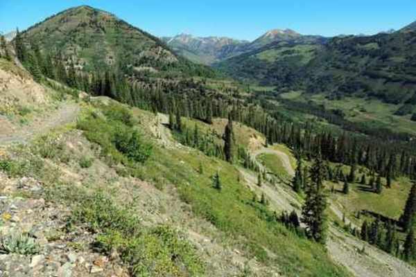
Overland Reservoir
This is a scenic graded road over Grand Mesa between Paonia and Collbran, easy enough to be done in a passenger car. Overland Reservoir is owned by Overland Ditch and Reservoir Company, founded in 1903 as a mutual ditch company to serve agricultural farmers primarily in the Redlands Mesa area of Del...
Learn more about Overland Reservoir
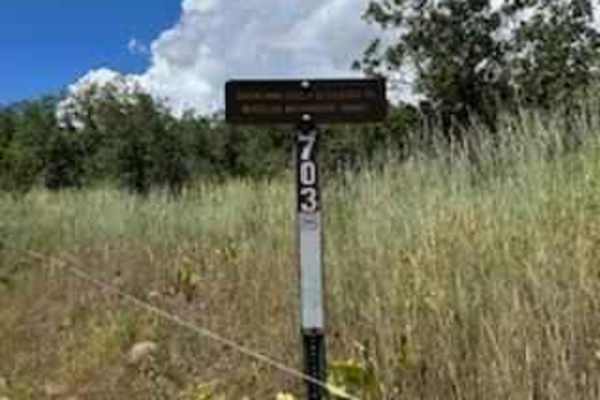
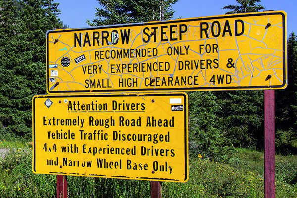
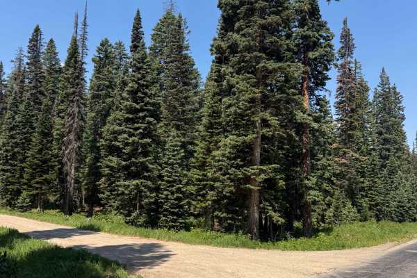
Holly Terror Road - FS 703
This road travels down through the pine forest, it is rocky and at times muddy, it is also very narrow in spots that a full-size vehicle might have a hard time squeezing through. With narrower vehicle mirrors had to be folded in to get through. About halfway down the trail you will have to cross thr...
Learn more about Holly Terror Road - FS 703
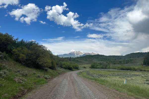
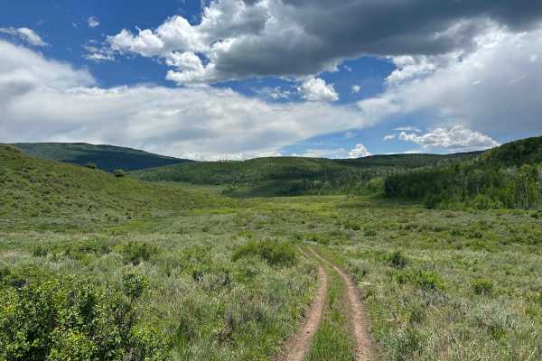
Buzzard Divide Road - FS#265
Buzzard Divide Road is a graded gravel road that provides easy access from CO-133 to the Grand Mesa and eventually to the town of Collbran. The road begins with a short easement through private land, and then winds through open meadows and aspen forests before reaching other accessible forest roads....
Learn more about Buzzard Divide Road - FS#265
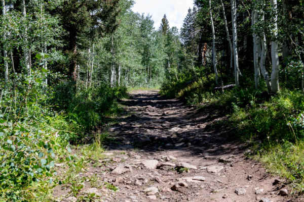
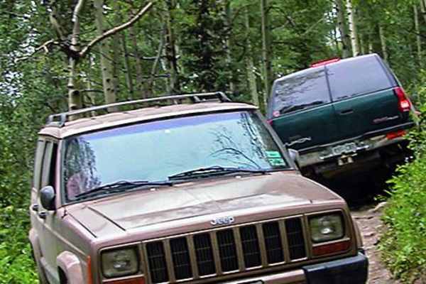
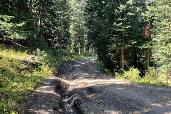
Ellington Creek Road/ FR 128
Ellington Creek Road is also known by the locals as Cunningham Road. The road is rocky and narrow and would have to be tight in places in the trees for full-size trucks, and after wet weather, there are places with muddy holes to get through. The road travels up through forested areas of pines and a...
Learn more about Ellington Creek Road/ FR 128
Leroux Creek Road - FS 128
Easy Forest service road that winds up at the lower elevations through gamble oaks then as you climb up in elevation into aspen groves and as you reach the top of the Grand Mesa you will be in Pine/Aspens/meadows with several small lakes that can be fished. There are also many dispersed camping spot...
Learn more about Leroux Creek Road - FS 128
Schofield Pass
This route takes you over Schofield Pass. You're sure to run into some tourists around Crystal Mill, which is a very popular tourist destination. The run through Crystal Canyon will take you to Devil's Punchbowl, a swimming pool of water underneath a majestic waterfall.
Learn more about Schofield Pass
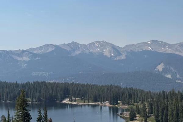
Irwin Lodge Road
This road offers gorgeous overlook views of Lake Irwin and provides access to the Scarp Ridge Hiking Trail. It does end at private property, so be sure to park in the correct areas for the hike and respect private property boundaries. Most stock vehicles will be able to handle this road, but it is b...
Learn more about Irwin Lodge Road
Lead King Basin
This is a classic off-road trail that offers great scenery and beautiful seasonal colors. For a loop, take this trail with Devil's Punchbowl. Unlicensed vehicles are permitted and can stage just south of the fire station.
Learn more about Lead King Basin
Green Lake Spur
This is a quick and easy road out to more camping and the start of the Dyke Trail. Absolutely gorgeous views up here and easy access to these camp spots. The road itself features minor dips and bumps, but large vehicles and trailers can make it back here with no issue. The route ends at private prop...
Learn more about Green Lake Spur
Bracken Road
Bracken Road is an offshoot of Kebler Pass that offers campsites along the way down to an open meadow. This road is rough and features many large dips, tight trees, and small rock obstacles. The entire road is like this from start to finish. You will need clearance for this road, especially to make ...
Learn more about Bracken Road
Porter Cutoff - FS 535
Porter Cutoff is an alternate route that makes its way up to Porter Mountain while following the rolling foothills and low sagebrush rather than aspen trees. It is a very easy trail, especially in the downhill direction. It is just a fun trail to cruise along, as it follows the contours of the land ...
Learn more about Porter Cutoff - FS 535
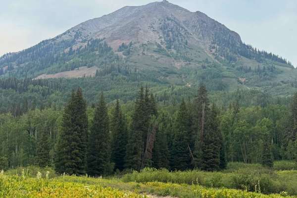
Sheep Mountain
Steep ascent through dense forest to the top of Sheep Mountain. Tight switchbacks and mild off-camber keeps this trail engaging, although not particularly difficult in general conditions. 270 degree view from the top features several of the peaks and valleys in the area. This in-and-out trail mak...
Learn more about Sheep Mountain
Paradise Divide
Paradise Divide is an iconic route in the Crested Butte area that is a dirt road connecting three of the main drainages of the area. This road offers incredible views of the surrounding mountains and takes you to some incredible campsites in Colorado. The terrain along this road varies quite a bit, ...
Learn more about Paradise Divide
Porter Mountain - FS 534
Porter Mountain is located on the east side of Grand Mesa, the largest mesa in the world. This ATV trail winds its way up the mountain and has a fantastic 270° view of the surrounding area. The southern edge of the peak is a cliff, which leads to great prominence and exposure. Access to the trail ca...
Learn more about Porter Mountain - FS 534
Emerald Lake Road
Emerald Lake Road is an offshoot of 317. This road dips down and takes you right to Emerald Lake, which is a beautiful and popular attraction in the area. The road has some ruts in it, but nothing too major, as it takes you to the main parking area for the lake. This parking area can fit many cars. ...
Learn more about Emerald Lake Road
Carbon Trail
Carbon Trail is a 10-mile single-track near the town of Crested Butte, Colorado, that starts off of Kebler Pass with a big creek crossing through Coal Creek. It's not super deep but still requires some technique to get across smoothly. Most of the trail is a wide rocky surface through a beautiful fo...
Learn more about Carbon Trail
Gunsight Pass
This is a great Jeep trail close to Crested Butte. The actual name of the trail is Gunsight Pass, but since access to the pass is no longer allowed I renamed it. The first thing you see after leaving Paradise Divide Road is piles of coal left behind from the Smith Hill Mine which operated from 1884...
Learn more about Gunsight Pass
Slide Rock Road
Slide Rock Road is a quick offshoot of Washington Gulch Road that offers several campsites along it. This road does get rough and rutted, and it is recommended to have clearance for this road. Beginning at the outhouses and open views of the valley, you quickly come into the aspen grove. This drive ...
Learn more about Slide Rock Road
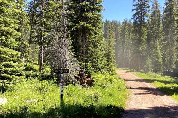
Hay Park (#729)
Hay Park is a fun 50-inch trail that connects Eureka and Hay Park Road. It offers nice views of several lakes. The trail does not change much in elevation and lacks many technical sections but is pretty heavily rutted in spots. The trail passes through many tall and sometimes thick pines rather than...
Learn more about Hay Park (#729)
Washington Gulch Road
This road starts with very easy and mild terrain, offering a ton of camping options along the way up. The campsites are designated only, and first come, first serve.
The road gradually gets more difficult as you move up it, but stays relatively easy till you reach the private property boundary of E...
Learn more about Washington Gulch Road
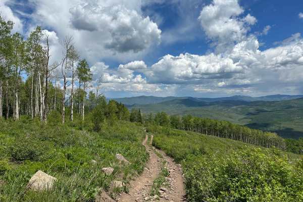
ATV trails near Somerset, Colorado
Explore ATV-friendly trails near you. These trails are accessible for vehicles up to 50 inches wide, perfect for ATVs and smaller off-road machines.
Overland Reservoir
This is a scenic graded road over Grand Mesa between Paonia and Collbran, easy enough to be done in a passenger car. Overland Reservoir is owned by Overland Ditch and Reservoir Company, founded in 1903 as a mutual ditch company to serve agricultural farmers primarily in the Redlands Mesa area of Del...
Learn more about Overland Reservoir
Holly Terror Road - FS 703
This road travels down through the pine forest, it is rocky and at times muddy, it is also very narrow in spots that a full-size vehicle might have a hard time squeezing through. With narrower vehicle mirrors had to be folded in to get through. About halfway down the trail you will have to cross thr...
Learn more about Holly Terror Road - FS 703
Buzzard Divide Road - FS#265
Buzzard Divide Road is a graded gravel road that provides easy access from CO-133 to the Grand Mesa and eventually to the town of Collbran. The road begins with a short easement through private land, and then winds through open meadows and aspen forests before reaching other accessible forest roads....
Learn more about Buzzard Divide Road - FS#265
Ellington Creek Road/ FR 128
Ellington Creek Road is also known by the locals as Cunningham Road. The road is rocky and narrow and would have to be tight in places in the trees for full-size trucks, and after wet weather, there are places with muddy holes to get through. The road travels up through forested areas of pines and a...
Learn more about Ellington Creek Road/ FR 128
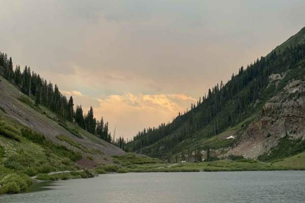
UTV/side-by-side trails near Somerset, Colorado
Find UTV and side-by-side trails near you. These trails accommodate vehicles up to 60 inches wide, ideal for UTVs, side-by-sides, and wider off-road rigs.
Overland Reservoir
This is a scenic graded road over Grand Mesa between Paonia and Collbran, easy enough to be done in a passenger car. Overland Reservoir is owned by Overland Ditch and Reservoir Company, founded in 1903 as a mutual ditch company to serve agricultural farmers primarily in the Redlands Mesa area of Del...
Learn more about Overland Reservoir
Holly Terror Road - FS 703
This road travels down through the pine forest, it is rocky and at times muddy, it is also very narrow in spots that a full-size vehicle might have a hard time squeezing through. With narrower vehicle mirrors had to be folded in to get through. About halfway down the trail you will have to cross thr...
Learn more about Holly Terror Road - FS 703
Buzzard Divide Road - FS#265
Buzzard Divide Road is a graded gravel road that provides easy access from CO-133 to the Grand Mesa and eventually to the town of Collbran. The road begins with a short easement through private land, and then winds through open meadows and aspen forests before reaching other accessible forest roads....
Learn more about Buzzard Divide Road - FS#265
Ellington Creek Road/ FR 128
Ellington Creek Road is also known by the locals as Cunningham Road. The road is rocky and narrow and would have to be tight in places in the trees for full-size trucks, and after wet weather, there are places with muddy holes to get through. The road travels up through forested areas of pines and a...
Learn more about Ellington Creek Road/ FR 128
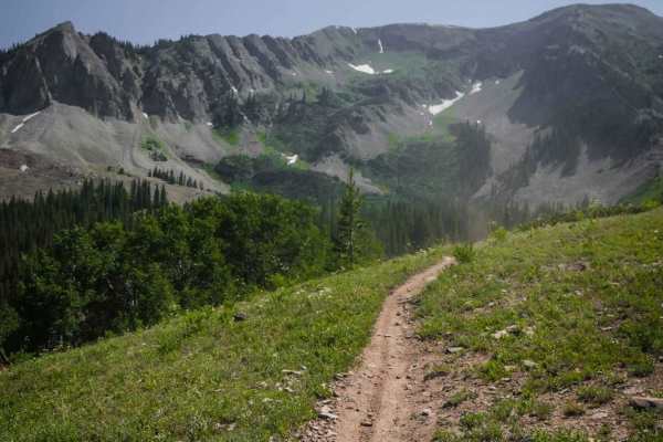
The onX Offroad Difference
onX Offroad combines trail photos, descriptions, difficulty ratings, width restrictions, seasonality, and more in a user-friendly interface. Available on all devices, with offline access and full compatibility with CarPlay and Android Auto. Discover what you're missing today!
Open Trail Map