
Dirt Bike Trails
Near San Manuel, Arizona
Explore All Dirt Bike Trails Near San Manuel, Arizona
Dirt Bike Trails Near San Manuel, Arizona
Discover the best dirt bike trails near you. Browse trail maps, check difficulty ratings, and find your next adventure — whether you're looking for a quick ride or an all-day expedition.
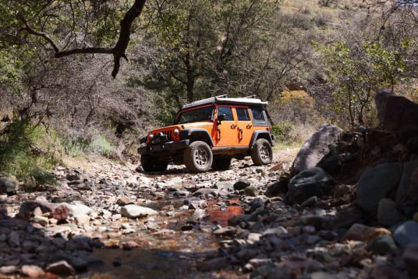
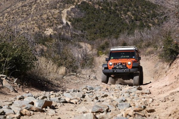
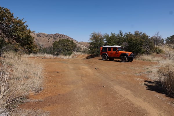
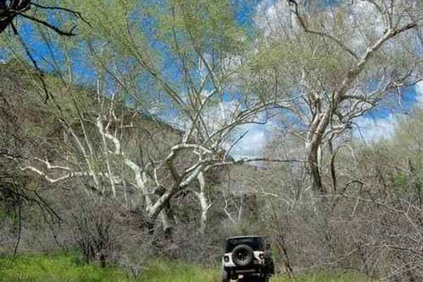
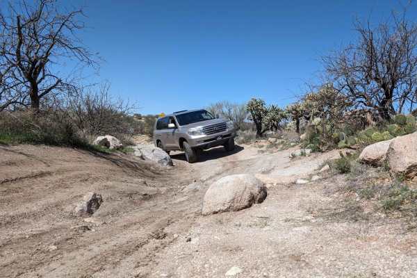
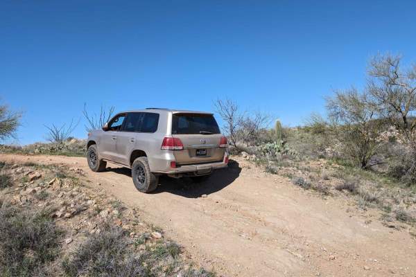
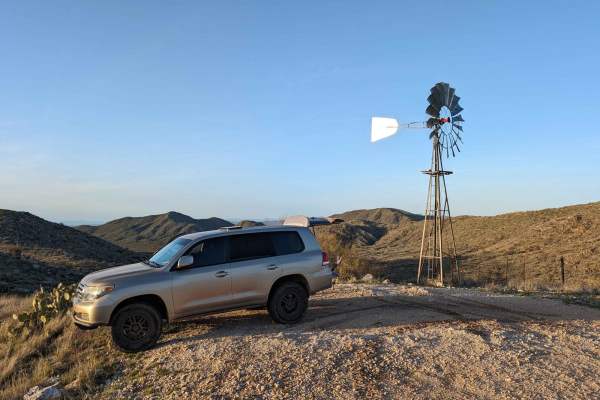
Ascent from Peppersauce Canyon
This route kicks off in the wooded, lower elevations of Peppersauce Canyon, northeast of Tucson, Arizona. It is a primitive, yet well-traveled two-track that runs parallel to a wash, westward into the Catalina Mountains. This forest road features shade and scenery, multiple small stream crossings, a...
Learn more about Ascent from Peppersauce Canyon
Backway to Mount Lemmon
This trail offers a simple, low-difficulty route north of Tucson, Arizona, with a six-mile stretch that climbs and winds up the mountain and provides some appealing views. Beyond this section, the road remains straightforward and easy to follow, making it a relaxed option for drivers seeking a calm,...
Learn more about Backway to Mount Lemmon
Copper Creek Mine Trail
This scenic trail takes you on a winding journey through the rugged desert landscapes of southern Arizona, offering stunning views of mountain peaks as it meanders along. Starting in State Trust land, the trail leads you toward the active mining areas near Mammoth, Arizona, before eventually reachin...
Learn more about Copper Creek Mine Trail
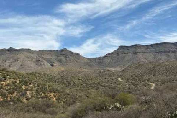
Road to the Summit of Rice Peak
This is a noteworthy forest road spur that culminates atop Rice Peak, in Coronado National Forest, northeast of Tucson, Arizona. Rice Peak Road is a very rugged two-track that runs south along a mountain ridge, significantly increasing in elevation for its duration. Enjoy breathtaking views to the w...
Learn more about Road to the Summit of Rice Peak
Nugget Road and Rolling Hills
This is a mid-mountain forest road segment in Catalina National Forest, northwest of Tucson, Arizona. It is accessible via Peppersauce Canyon and is an enjoyable, mildly challenging primitive route that culminates high on a mountain ridge, at the junction for Rice Peak Road. Enjoy exploring higher e...
Learn more about Nugget Road and Rolling Hills
Cowboy Miller Road
This dirt and rocky road will bypass the famous Carpet Hill on the Rug Road to Klondyke trail, placing you approximately one mile North of Carpet Hill. The entrance to Cowboy Miller Road is off South River Road. Please be respectful of the private land staging area and follow signage to keep the gat...
Learn more about Cowboy Miller Road
Continental Copper Access
If you love breathtaking scenery, driving through saguaro forests, and adventurous off-road experiences, the Continental Copper Access route is perfect for you! This road starts around two-thirds up the mountainside, beginning at the Mount Lemmon Control Road trail, and descends almost entirely to t...
Learn more about Continental Copper Access
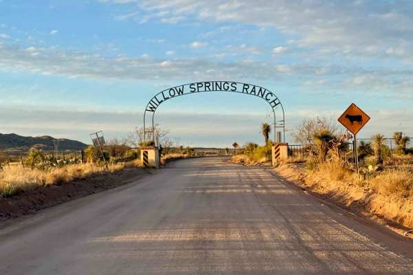
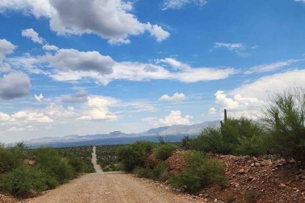
Willow Springs Road
Willow Springs Road stands out as one of the best-maintained main arteries in the area, providing a smooth and easily navigable route. This trail accommodates larger vehicles quite comfortably, including motorhomes and campers, especially in sections closest to the southern part of the route where y...
Learn more about Willow Springs Road
Rug Road to Klondyke
Rug Road is a 4x4 trail that begins in Mammoth, traverses the famous "Carpet Hill" and then climbs to Table Mountain Pass in the Zapata Mountains. It then drops down into the Aravaipa watershed, passes through Klondyke, and then either east to Fort Thomas on US 70 (this track) or south to Willcox o...
Learn more about Rug Road to Klondyke
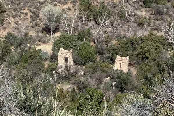
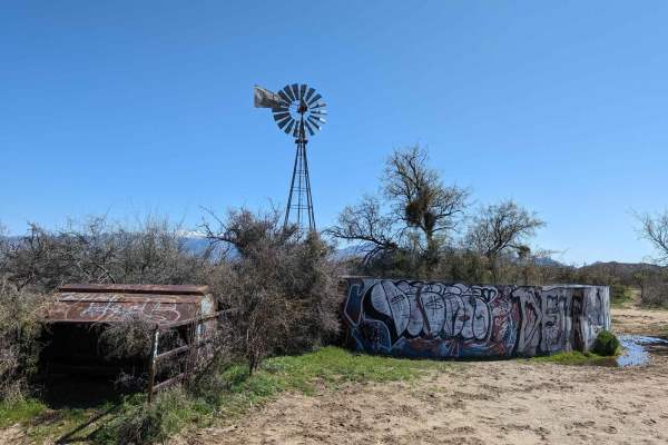
Sybley Mansion Spur
This trail consists of loose rocks, washed areas, and a couple of places that your high-clearance vehicle will have no problem going over. Once you get to the end of the trail, you will need to walk a short distance up to get a look at the mansion ruins. Also, this is a good place to have lunch or t...
Learn more about Sybley Mansion Spur
North San Perdo River Road
The San Pedro River Road extends for about 10 miles, with approximately 4.5 miles consisting of a dirt and gravel trail. The trail is generally well-maintained and easy to navigate. The only potentially challenging section is a wash crossing, which may have flowing water depending on recent weather ...
Learn more about North San Perdo River Road

Falcon Valley Ranch Access
Falcon Valley Ranch Trail offers a rugged off-road experience, with dips, erosion, and ruts that add mellow technical challenges along the way. The trail features some braiding, requiring attention to stay on the most passable route. It ends at a locked gate, marking the boundary where vehicle trave...
Learn more about Falcon Valley Ranch Access
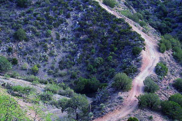
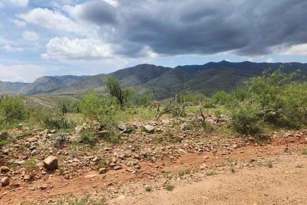
Charouleau Gap
Charouleau Gap trail is known to be one of the best in the state. Its most intimidating obstacle, "The Step," is optional, but you'll find many more impressive spots that aren't. When Canada Del Oro Wash is flowing, the experience is epic. The Tuscon Rough Riders maintain the trail.
Learn more about Charouleau Gap
50 Year Trail Loop
Start on East Golder Ranch Drive. Turn left through the cattle guard onto E Equestrian Trail. At a corral, you take the right at the Y and proceed onto a single-vehicle-width trail. The trail remains easy with the mountain bike trail called 50 Year Trail crisscrossing the 4x4 trail and campsites alo...
Learn more about 50 Year Trail Loop
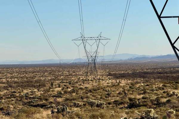
High Voltage Hijinks
If you find yourself longing for more excitement after the smooth ride on East Willow Springs Drive, High Voltage Hijinks is the trail that delivers! This route offers a refreshing challenge with its deep washouts and rugged terrain, all while providing breathtaking views of the north side of the Sa...
Learn more about High Voltage Hijinks
Badlands Trail
This cut-across from East Edwin Road to East Cochise Springs Road is a nice 4x4 track that leads you to many more remote campsites and to the "Badlands" loop trail system for mountain bikes. The trail takes you through some beautiful Sonoran desert vistas and past some side trails with their own fla...
Learn more about Badlands Trail
East Edwin Road
When accessing this trail, the turn to the west from Highway 77 (North Oracle Road) has its own stoplight, making the turn easier. The road has several cattle guards, some with missing bars, so be careful to not get a flat tire. Signs alert you that you're entering Arizona State Trust Land, which ne...
Learn more about East Edwin Road
East Cochie Spring Trail
The trail veers off of the East Edwin Road just after crossing the first wash. You turn north onto the trail. The trail weaves through some tight spots in trees and cacti. The mud holes can get big after a rain, but the bottoms are mostly sandy. The main trail is the most used, but there are several...
Learn more about East Cochie Spring Trail
Gasline Trail
The Gasline Trail mirrors the rugged nature of Lovetta, featuring steep hills with loose, off-camber erosion that requires careful attention. As you navigate, keep an eye out for hilltop campsites, offering scenic spots to stop along the way. The trail eventually mellows out, transforming into a smo...
Learn more about Gasline Trail
Chimney Rock
Chimney Rock is an engaging, moderately challenging desert route near Tucson ideal for seasoned offroaders, ATV riders, and SxS enthusiasts looking for a mix of technical obstacles and scenic terrain. Accessed via Redington Road, this trail features a split difficulty profile, offering an easier ent...
Learn more about Chimney Rock
ATV trails near San Manuel, Arizona
Explore ATV-friendly trails near you. These trails are accessible for vehicles up to 50 inches wide, perfect for ATVs and smaller off-road machines.
Ascent from Peppersauce Canyon
This route kicks off in the wooded, lower elevations of Peppersauce Canyon, northeast of Tucson, Arizona. It is a primitive, yet well-traveled two-track that runs parallel to a wash, westward into the Catalina Mountains. This forest road features shade and scenery, multiple small stream crossings, a...
Learn more about Ascent from Peppersauce Canyon
Backway to Mount Lemmon
This trail offers a simple, low-difficulty route north of Tucson, Arizona, with a six-mile stretch that climbs and winds up the mountain and provides some appealing views. Beyond this section, the road remains straightforward and easy to follow, making it a relaxed option for drivers seeking a calm,...
Learn more about Backway to Mount Lemmon
Copper Creek Mine Trail
This scenic trail takes you on a winding journey through the rugged desert landscapes of southern Arizona, offering stunning views of mountain peaks as it meanders along. Starting in State Trust land, the trail leads you toward the active mining areas near Mammoth, Arizona, before eventually reachin...
Learn more about Copper Creek Mine Trail
Road to the Summit of Rice Peak
This is a noteworthy forest road spur that culminates atop Rice Peak, in Coronado National Forest, northeast of Tucson, Arizona. Rice Peak Road is a very rugged two-track that runs south along a mountain ridge, significantly increasing in elevation for its duration. Enjoy breathtaking views to the w...
Learn more about Road to the Summit of Rice Peak
UTV/side-by-side trails near San Manuel, Arizona
Find UTV and side-by-side trails near you. These trails accommodate vehicles up to 60 inches wide, ideal for UTVs, side-by-sides, and wider off-road rigs.
Ascent from Peppersauce Canyon
This route kicks off in the wooded, lower elevations of Peppersauce Canyon, northeast of Tucson, Arizona. It is a primitive, yet well-traveled two-track that runs parallel to a wash, westward into the Catalina Mountains. This forest road features shade and scenery, multiple small stream crossings, a...
Learn more about Ascent from Peppersauce Canyon
Backway to Mount Lemmon
This trail offers a simple, low-difficulty route north of Tucson, Arizona, with a six-mile stretch that climbs and winds up the mountain and provides some appealing views. Beyond this section, the road remains straightforward and easy to follow, making it a relaxed option for drivers seeking a calm,...
Learn more about Backway to Mount Lemmon
Copper Creek Mine Trail
This scenic trail takes you on a winding journey through the rugged desert landscapes of southern Arizona, offering stunning views of mountain peaks as it meanders along. Starting in State Trust land, the trail leads you toward the active mining areas near Mammoth, Arizona, before eventually reachin...
Learn more about Copper Creek Mine Trail
Road to the Summit of Rice Peak
This is a noteworthy forest road spur that culminates atop Rice Peak, in Coronado National Forest, northeast of Tucson, Arizona. Rice Peak Road is a very rugged two-track that runs south along a mountain ridge, significantly increasing in elevation for its duration. Enjoy breathtaking views to the w...
Learn more about Road to the Summit of Rice Peak
The onX Offroad Difference
onX Offroad combines trail photos, descriptions, difficulty ratings, width restrictions, seasonality, and more in a user-friendly interface. Available on all devices, with offline access and full compatibility with CarPlay and Android Auto. Discover what you're missing today!
Open Trail Map