Joe Boxodonuts
Jul 10, 2026
2024 GMC Canyon AT4X
Open
DustyRough/Deteriorated
Disabled vehicle is only partially blocking the road - I was able to pass in my GMC Canyon. Pima sheriff sticker on the vehicle as of 11:45am July 10 so I assume it will be removed today or over the weekend. See photos.
Ian Halstead
Jul 08, 2026
Obstructed
Broken Down Vehicle
From the top of the Control Road it was reported today that there is a disabled vehicle not too far down that is blocking the road to everything but ATV type vehicles.
Edward K7ECW
Jun 20, 2026
2027 Toyota Land Cruiser
Open
Normal
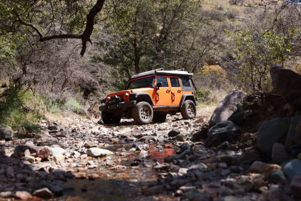
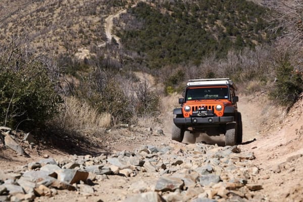
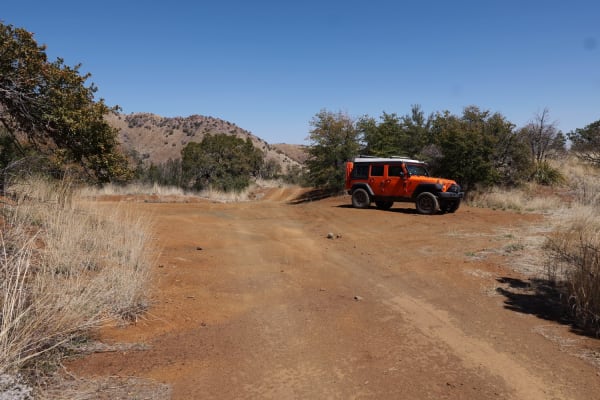
This was breaking in the new LC! No modifications yet. Only hickup is the OnX trail map took us onto American Flag Ranch road (which was closed) 2 miles in. Stay on the paved road. We put it in 4 low from the Continental Copper Access, and glad that we did. High clearance is recommended from here to the top. Crawled over some rough rocks in the road, and had no clearance issues, just took it slow. An enjoyable morning detour.
Jerry Allen
Jun 13, 2026
Open
Dusty
Made the mistake thinking “easy” meant RWD could make it all the way. Well, I did but it wasn’t easy! Didn’t break anything but will definitely be more careful. Trial is fairly accessible for RWD up to the last couple miles.
Jason H
May 23, 2026
Open
NormalDustyRough/Deteriorated
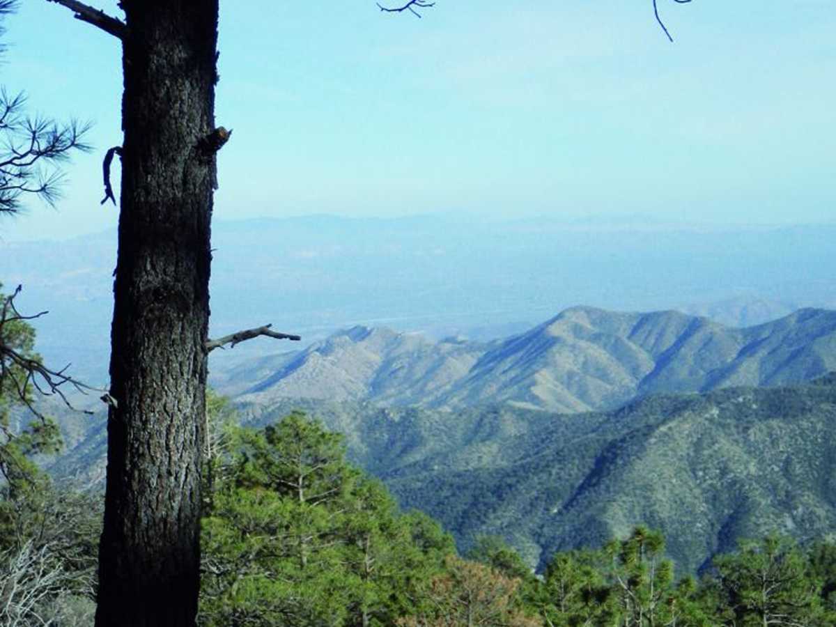
Beautiful scenery and fairly chill drive. As others have stated, it gets more technical (would say about a 4) towards the last part. I would not recommend this in a stock height vehicle unless you’re ok with some underbody scratches. I did this in my factory lifted Tacoma and had plenty of clearance the entire way. Do not recommend the final stretch for standard SUVs or cars as you will not have a good time.
Steven Hinkle
May 18, 2026
1993 Jeep Grand Cherokee
Open
NormalDustyWashboardRough/Deteriorated
The first half of the trail was unassuming. A bit rocky and bumpy, but fair for the level 2 rating. When the trail narrows at the fork towards the top, the rock gardens begin. Stock 4×4 vehicles can make it with careful line choice. Be mindful that the trail is in a burn area. There were two trees in the road and many off to the sides. If you're doing this trail in low visibility they can sneak up on you. I wouldn't say airing down is necessary because I didn't and I never searched for traction on my 235s. 4 low comes in handy for vehicle control. It really is a scenic route and a fun run. I was impressed my rig did it without clangs, scrapes, or bangs. The technical rating for the last part is a 4-5.
Rod Snyder
May 07, 2026
Open
Rough/DeterioratedWashboard
The trail isn’t hard on a motorcycle but it’s not really enjoyable due to the endless imbedded rocks and washboards. Probably won’t ride it again but it’s off my list now. Took me 1:17 on my dual sport at an easy pace.
Jadon Iverson
Apr 08, 2026
Open
Normal
Trail was great very doable in any midsize 4x4 truck. Gets a little technical towards the top. Took my buddy and I about 2.5 hours from the start of the dirt. A few fairly narrow sections, but nothing my truck couldn’t handle.
Ethan Williams
Mar 29, 2026
2000 Toyota Tundra
Open
DustyWashboard
Beautiful trail. I went in my stock 1st gen Tundra. Plan for about 4hrs. The top section closer to the peak (once you reach the gate) is definitely more difficult. I’d rate it 4/10 due to large rocks and some slightly technical lines required with the bottom half being a 1/10
Roy Fisher
Mar 24, 2026
Open
Very good easy ride no problems going up or down. Great scenery
Jordan Neese
Mar 21, 2026
2020 Jeep Gladiator
Open
Rough/Deteriorated
Headed down the trail, pretty rough for 80% of the trail. Air down the tires and I would say lift is mandatory if you don't want to get scraped.
Todd Campbell
Mar 20, 2026
2023 Toyota SR5
Open
NormalDustyRough/DeterioratedWashboard
Road was open. Last 8-9 miles to the top were very rough. I have a 3inch lift and 32’s and sure glad I did. I think a stock height would have scraped a few times.
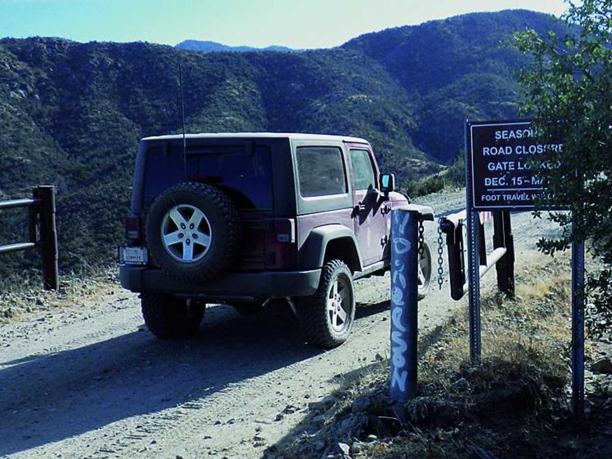
Weston Preecs
Jan 18, 2026
2025 Chevrolet Colorado
Temporarily Closed
Gates are left open but signs do state that even with open gates the trail is closed until March 1st
Shawn Doherty
Dec 22, 2025
2023 Ford Bronco
Temporarily Closed
Kellen Bogardus
Dec 07, 2025
2009 Volvo XC70
Open
Dusty
I’d say 2/10 is underrating this trail. It’s a 3-4 with the mile or two below Crystal Spring being the toughest, more than what I got in the pics. Rutted out rock sections would require a lift without taking lines around. Aired down and taking the entire width of the road this was a tough one for my Volvo and I got a couple new scrapes underneath. Also, although it didn’t present a problem there were icy sections in areas of shade even though it was in the 60s. Worth it though, amazing views the whole way and didn’t see anyone else the last 10 miles. Interesting bonus: earlier this year my grandfather tried to go down this in his stock Mercedes E300. 2 blown tires, cracked oil pan, and other damage totaling over $10k!