
Dirt Bike Trails
Near Robie Creek, Idaho
Explore All Dirt Bike Trails Near Robie Creek, Idaho
Dirt Bike Trails Near Robie Creek, Idaho
Discover the best dirt bike trails near you. Browse trail maps, check difficulty ratings, and find your next adventure — whether you're looking for a quick ride or an all-day expedition.
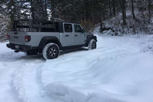
Rocky Canyon Road
Rocky Canyon Road is a scenic mountain pass suitable for beginner offroaders and high-clearance four-wheel-drive vehicles, offering a direct, unpaved alternative to Highway 21 that connects East Boise to Robie Creek. Spanning approximately 8.5 miles, this route climbs from an elevation of roughly 3,...
Learn more about Rocky Canyon Road
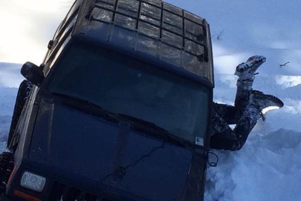
Boise Ridge Road
Boise Ridge Road is a scenic, moderate forest service route ideal for high-clearance 4x4s, side-by-sides, and dirt bikes looking for expansive ridgeline views overlooking Boise, Idaho. Stretching over 11 miles and reaching a peak elevation of 6,509 feet, this unpaved route connects the high-country ...
Learn more about Boise Ridge Road
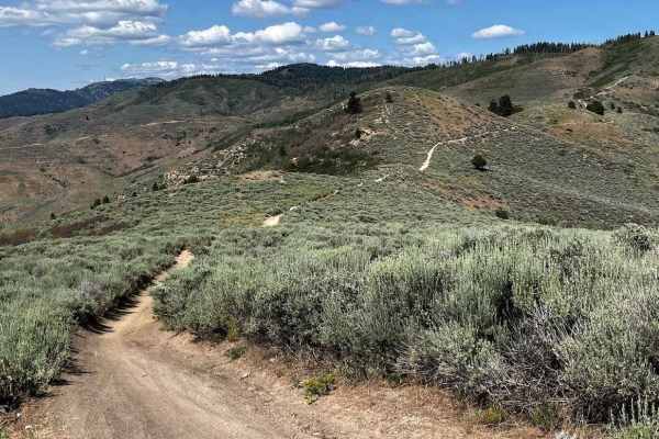
Femrite's Patrol Trail 6
Femrite's is a narrow, mostly single-track route cut into the side of the hill above Boise, Idaho. It is fairly sandy, with some steep rocky climb sections that take some momentum to get up. It's a side route of Trail 4, part of the 8th Street motorcycle motorized system. This trail has two fairly c...
Learn more about Femrite's Patrol Trail 6

North Fork River Road
Do you like long drives on a dirt road, river views, and hot springs? This road is for you! Enjoy a dirt road that follows along the Boise River. It is possible to do this in any vehicle as long as there is no snow or heavy rainstorms. During heavy rainstorms, this road could become dangerous with f...
Learn more about North Fork River Road
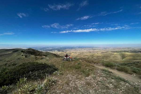
8th Street Motorcycle Trail
8th Street Motorcycle Trail is a multi-use trail for motorcycles, hikers, and mountain bikes. It's mainly a single track with a good mix of hard-pack, whoops, and two small sections that are steep with embedded rocks. It starts from the trailhead staging area on the 8th Street Extension and goes up ...
Learn more about 8th Street Motorcycle Trail
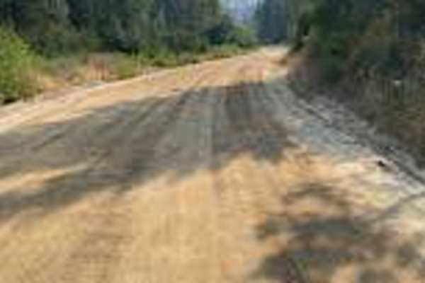
Thorn Creek Road
Thorn Creek Road is a wide, flat dirt road tracking alongside Thorn Creek up the canyon. Expect occasional washboards. You’ll find several large dispersed campsites suitable for 5th wheels along the route, plus a non-motorized/singletrack side trail for bikes, horses, and dirt bikes. The road links ...
Learn more about Thorn Creek Road
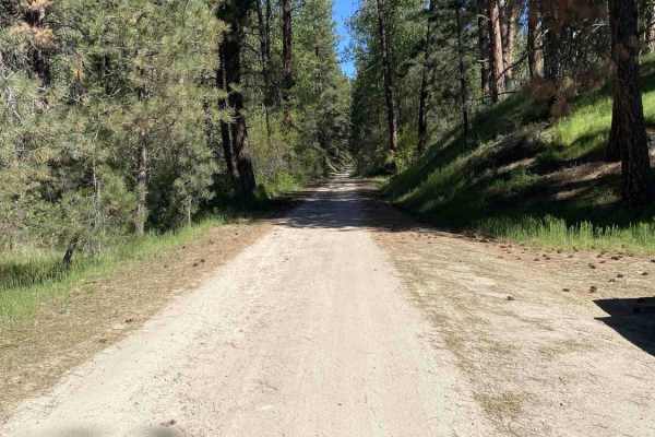
Cottonwood Creek Road - FS 377
Cottonwood Creek Road (FS #277) offers a steady, scenic climb starting from Arrowrock Dam and ascending through a dense, continuous canopy of pine trees. The journey begins near the small, three-site Cottonwood Creek Campground. The spur trail to the campground is particularly narrow and prone to ca...
Learn more about Cottonwood Creek Road - FS 377

Oregon Trail
This trail packs a lot into a short distance, blending various terrain challenges with deep Idaho history. As you parallel the original Oregon Trail, you’ll encounter 4-foot cement pillars around the one-mile mark that officially designate the historic route. The first mile features deep ruts that o...
Learn more about Oregon Trail
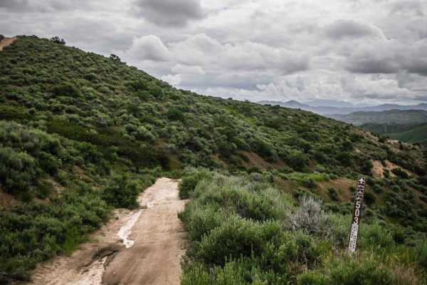
503
This short ATV trail is in the Danskin Trail System just southeast of Boise, Idaho. It's a wide and shelfy ATV trail that is two-track wide, with a steady decline and meanders by a creek. In the beginning, it looks like an old road, with a lot of overgrowth of shrubs lining the trail and grass on th...
Learn more about 503
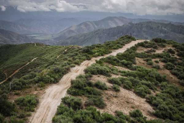
501
501 is an easy 50" trail for dirt bikes and ATVs but is slightly harder for ATVs due to steep climbs and lots of whoops. The trail is a wide ridge line path across a series of green rolling hills in the Boise National Forest. It's two-track width the whole way on a dirt surface, and the dirt is a li...
Learn more about 501
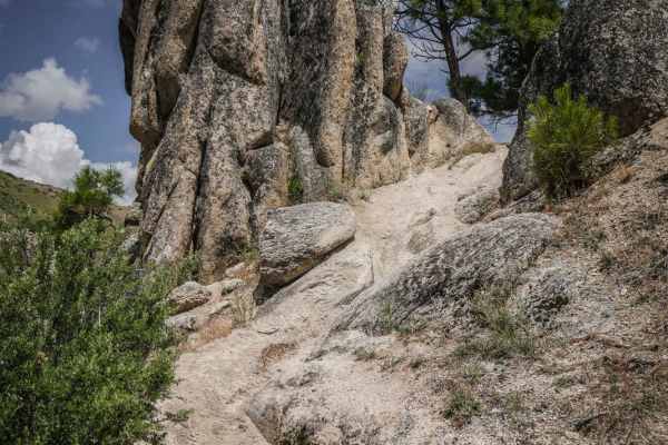
301
Danskin #301 is a challenging single track in the Boise National Forest full of creek crossings, rock obstacles, and narrow shelfy trail sections. Throughout the trail, it has about 6 creek crossings. The creek crossings themselves are smooth with some rocks, but sometimes there is a rocky section l...
Learn more about 301

510
This fun and challenging single track goes through a dry low alpine terrain with tall grass, lots of overgrown shrubs, and sparsely separated coniferous trees with lots of pine needles on the ground. It's a narrow dirt trail that side-hills along the bottom of a mostly wide open hillside above a rav...
Learn more about 510
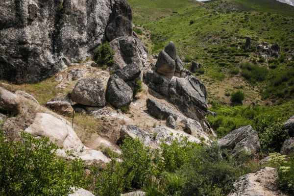
302
Danskin #302 is a short trail used to connect with #301 but has a tricky rock obstacle in a creek crossing. It drops down from ATV #300 on a grassy hillside towards the creek, with really neat granite rock towers on the sides of the trail. The creek crossing has a bunch of boulders in the trail that...
Learn more about 302
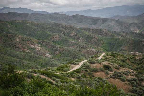
502
This short ATV trail connects ATV trails 500 and 501. It's mostly easy but has two sections where the trail is rutted out right down the center of the trail. On a dirt bike, it's easy to get troughed out here, but it may be easier on an ATV because you can straddle the rut. It also has several secti...
Learn more about 502
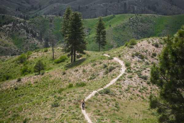
512
Danskin #512 is a ridge line single track in the Boise National Forest. It's on a wider ridge line atop a series of rolling green hills, and the trail itself is a decently wide single track, thus the exposure is not too bad. It goes along a fence line for much of it, with wide open views and not man...
Learn more about 512
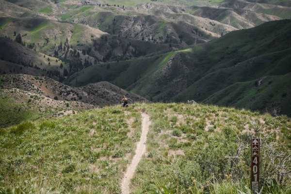
401
Single track #401 in the Danskin Mountains is a very steep downhill the entire way from #310 to #400, losing 1,300 feet in 1.5 miles. It's a bunch of steep descents, sometimes with a flatter section in between. Some sections of the trail are very steep with some loose dirt over a hard-packed, embedd...
Learn more about 401
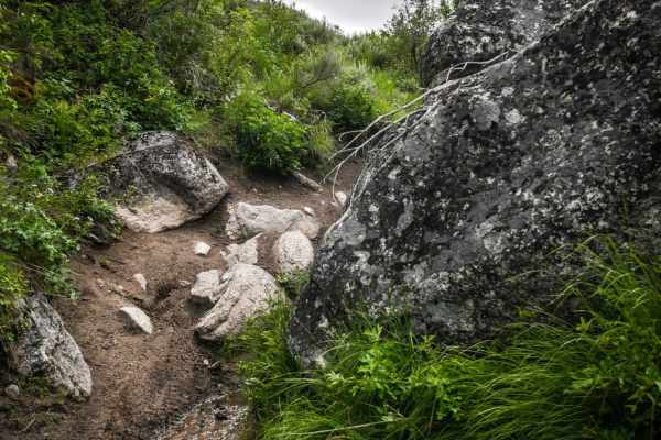
530
This narrow and shelfy single track is a fun ride in the Danskin Mountains that is different than the many ridge line trails in the trail system. This trail drops off from ATV trail #521 through a huge sweeping switchback down to a creek. The switchbacks are pretty wide and not that steep. It drops ...
Learn more about 530
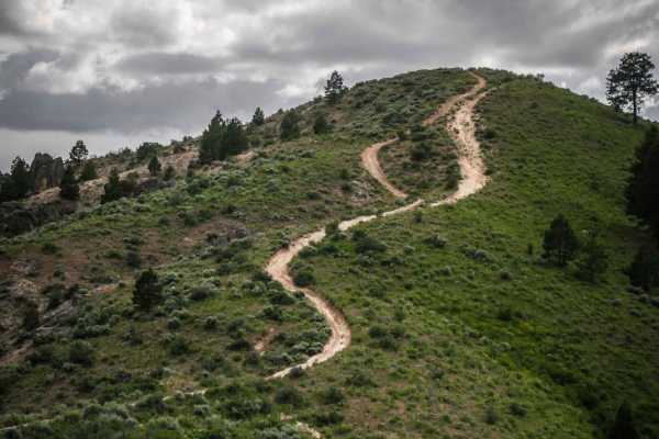
521
ATV #521 is a wide ridge line two-track with wide open views of the surrounding Danskin Mountains. It starts at a 5 way intersection with trails #531, #530, and #532 at the bottom of a valley under some pine trees, and climbs up about 900 feet over 2 miles up to ATV #520. It has several steep hill c...
Learn more about 521

532
This ridge line trail starts on the east end with a shallow creek crossing in an overgrown wooded section full of trees, brush, and low branches. After the creek, it climbs up to the intersection with #533 on a wide-open ridge line. The climb is steep with a rockier section at the bottom of the clim...
Learn more about 532
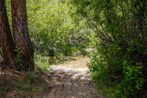
531
This is one of several easy ATV trails in the Danskin Trail System of the Boise National Forest. On the north end, this one starts in a pine tree forest with a big creek crossing that is deep in parts, as it leaves ATV trail #300. It climbs up to a ridge line with several steep hill climbs. The trai...
Learn more about 531
ATV trails near Robie Creek, Idaho
Explore ATV-friendly trails near you. These trails are accessible for vehicles up to 50 inches wide, perfect for ATVs and smaller off-road machines.
Rocky Canyon Road
Rocky Canyon Road is a scenic mountain pass suitable for beginner offroaders and high-clearance four-wheel-drive vehicles, offering a direct, unpaved alternative to Highway 21 that connects East Boise to Robie Creek. Spanning approximately 8.5 miles, this route climbs from an elevation of roughly 3,...
Learn more about Rocky Canyon Road
Boise Ridge Road
Boise Ridge Road is a scenic, moderate forest service route ideal for high-clearance 4x4s, side-by-sides, and dirt bikes looking for expansive ridgeline views overlooking Boise, Idaho. Stretching over 11 miles and reaching a peak elevation of 6,509 feet, this unpaved route connects the high-country ...
Learn more about Boise Ridge Road
North Fork River Road
Do you like long drives on a dirt road, river views, and hot springs? This road is for you! Enjoy a dirt road that follows along the Boise River. It is possible to do this in any vehicle as long as there is no snow or heavy rainstorms. During heavy rainstorms, this road could become dangerous with f...
Learn more about North Fork River Road
Thorn Creek Road
Thorn Creek Road is a wide, flat dirt road tracking alongside Thorn Creek up the canyon. Expect occasional washboards. You’ll find several large dispersed campsites suitable for 5th wheels along the route, plus a non-motorized/singletrack side trail for bikes, horses, and dirt bikes. The road links ...
Learn more about Thorn Creek Road
UTV/side-by-side trails near Robie Creek, Idaho
Find UTV and side-by-side trails near you. These trails accommodate vehicles up to 60 inches wide, ideal for UTVs, side-by-sides, and wider off-road rigs.
Boise Ridge Road
Boise Ridge Road is a scenic, moderate forest service route ideal for high-clearance 4x4s, side-by-sides, and dirt bikes looking for expansive ridgeline views overlooking Boise, Idaho. Stretching over 11 miles and reaching a peak elevation of 6,509 feet, this unpaved route connects the high-country ...
Learn more about Boise Ridge Road
North Fork River Road
Do you like long drives on a dirt road, river views, and hot springs? This road is for you! Enjoy a dirt road that follows along the Boise River. It is possible to do this in any vehicle as long as there is no snow or heavy rainstorms. During heavy rainstorms, this road could become dangerous with f...
Learn more about North Fork River Road
Thorn Creek Road
Thorn Creek Road is a wide, flat dirt road tracking alongside Thorn Creek up the canyon. Expect occasional washboards. You’ll find several large dispersed campsites suitable for 5th wheels along the route, plus a non-motorized/singletrack side trail for bikes, horses, and dirt bikes. The road links ...
Learn more about Thorn Creek Road
Cottonwood Creek Road - FS 377
Cottonwood Creek Road (FS #277) offers a steady, scenic climb starting from Arrowrock Dam and ascending through a dense, continuous canopy of pine trees. The journey begins near the small, three-site Cottonwood Creek Campground. The spur trail to the campground is particularly narrow and prone to ca...
Learn more about Cottonwood Creek Road - FS 377
The onX Offroad Difference
onX Offroad combines trail photos, descriptions, difficulty ratings, width restrictions, seasonality, and more in a user-friendly interface. Available on all devices, with offline access and full compatibility with CarPlay and Android Auto. Discover what you're missing today!
Open Trail Map