
Dirt Bike Trails
Near Redstone, Colorado
Explore All Dirt Bike Trails Near Redstone, Colorado
Dirt Bike Trails Near Redstone, Colorado
Discover the best dirt bike trails near you. Browse trail maps, check difficulty ratings, and find your next adventure — whether you're looking for a quick ride or an all-day expedition.
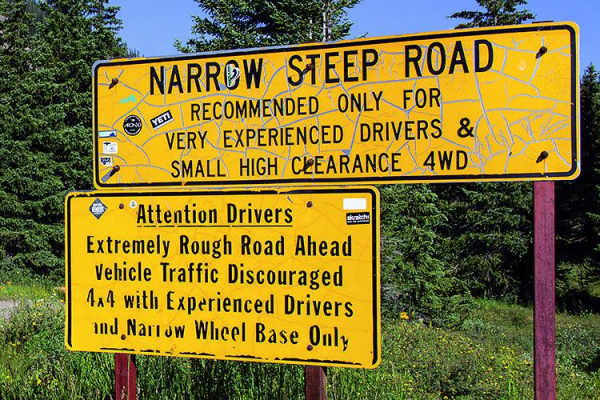
Schofield Pass
This route takes you over Schofield Pass. You're sure to run into some tourists around Crystal Mill, which is a very popular tourist destination. The run through Crystal Canyon will take you to Devil's Punchbowl, a swimming pool of water underneath a majestic waterfall.
Learn more about Schofield Pass
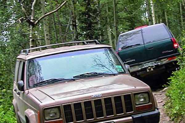
Lead King Basin
Lead King Basin is an exceptional high-country route for intermediate off-roaders looking to experience breathtaking wildflower displays, autumn colors, and stunning alpine vistas near Marble, Colorado. This 7.9-mile point-to-point trail climbs roughly 2,350 feet from Beaver Lake up into the spectac...
Learn more about Lead King Basin
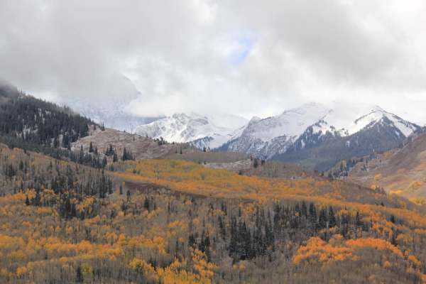
Capitol Creek Road
Capitol Creek Road is an ideal moderate route for offroaders seeking stunning high-country views and access to premier hiking in the Maroon Bells-Snowmass Wilderness. Spanning approximately 3.1 miles near Aspen, Colorado, this scenic trail climbs through vibrant aspen groves that deliver spectacular...
Learn more about Capitol Creek Road
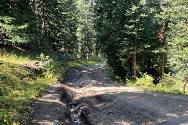
Sheep Mountain
Sheep Mountain is an engaging out-and-back climb designed for intermediate offroaders seeking stunning high-alpine views without extreme technical obstacles. Branching off from the Lead King Basin loop near Marble, Colorado, this 2.2-mile trail ascends rapidly through dense evergreen forests, gainin...
Learn more about Sheep Mountain
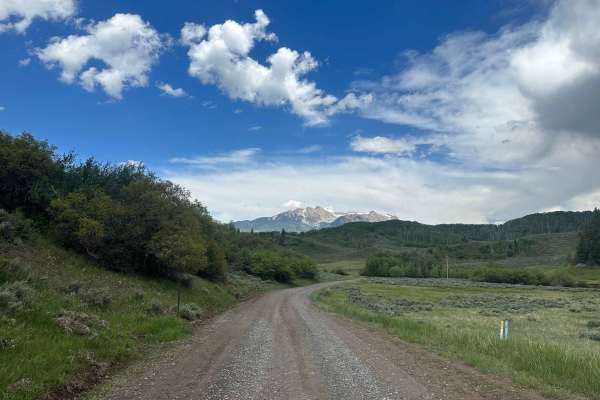
Buzzard Divide Road - FS#265
Buzzard Divide Road is a graded gravel road that provides easy access from CO-133 to the Grand Mesa and eventually to the town of Collbran. The road begins with a short easement through private land, and then winds through open meadows and aspen forests before reaching other accessible forest roads....
Learn more about Buzzard Divide Road - FS#265
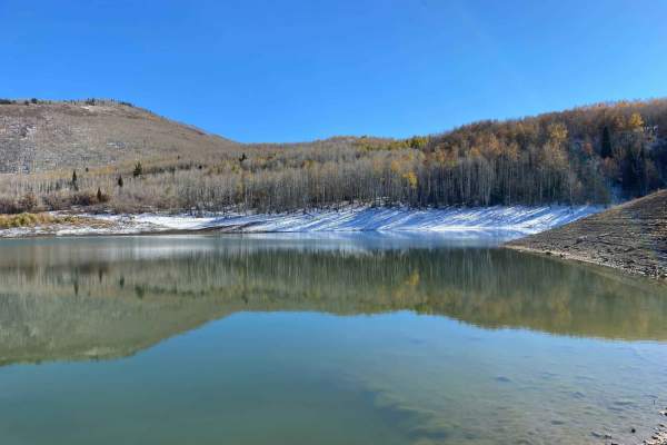
Dinkle Lake Road
Dinkle Lake Road is an easy dirt road that provides spectacular views of Mt. Sopris and access to Dinkle Lakes, Thomas Lakes Trailhead, and the Mt. Sopris Trailhead. This trail is mostly tame, with a couple of small rocks to get up and over. There are picnic areas located at Dinkle Lake for day use....
Learn more about Dinkle Lake Road
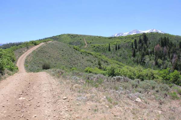
The Crown: BLM Road #8320
The Crown offers sweeping views of the Elk Range, Basalt, and Carbondale. See incredible views of Mount Sopris and Capitol Peak. This trail is generally one car length wide, and can get steep at times, but doesn't get very technical. Be on the lookout for mountain bikers, grazing cattle, horses, and...
Learn more about The Crown: BLM Road #8320
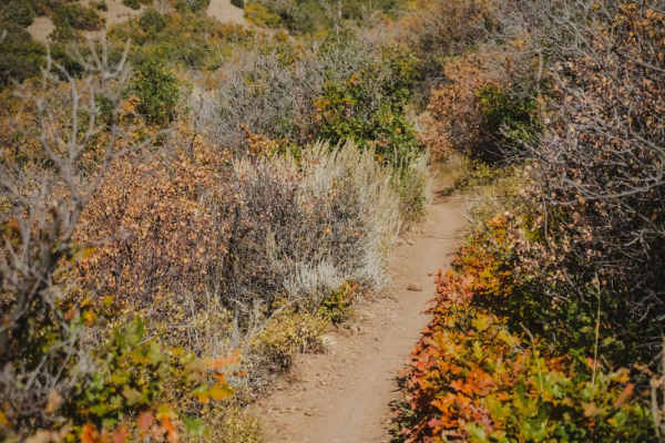
South Porcupine Trail
This is a 1.3-mile-long easy single track that goes along the rim of a mountain the whole way. It's really smooth, with rocks pushed to the side of the trail. There isn't much exposure because it's on a wide shelf but sometimes gets close to the edge. It goes through a low alpine terrain of rolling ...
Learn more about South Porcupine Trail
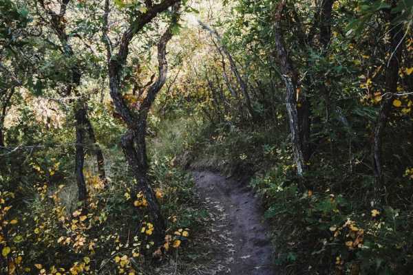
North Porcupine Trail
This is a 2.7-mile-long easy single track that is a fun and curvy trail through sagebrush and scrub oak. It's mostly flat, with only a couple of sections of small hills with loose rocks. It curves through trees and bushes and goes through a couple of sections where the trees are really tight like a ...
Learn more about North Porcupine Trail
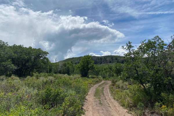
Over the Crown: BLM Road #8324
BLM Road #8324 provides a lengthy adventure around the crown and can act as an extension loop to BLM Road 8230. From this trail, you will see great views of Mt. Sopris, the Elk Range, Carbondale, and Basalt. This road is lightly used, and is overgrown at some points - so watch out for pin striping. ...
Learn more about Over the Crown: BLM Road #8324
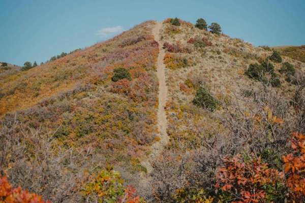
BLM Route 8322
BLM Route 8322 is a dirt bike trail in the Crown Trail System, and is slightly more difficult than the other 5 motorized trails in this trail system. From northeast to southwest, the trail is made up of several steep and loose descents all the way down to the bottom of the trail. It starts with a pr...
Learn more about BLM Route 8322
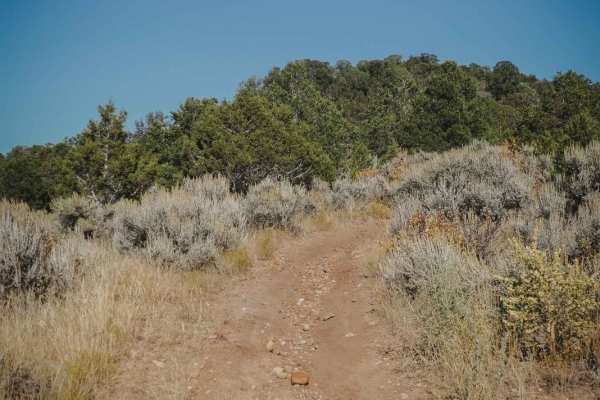
Outie
Outie is a short single-track trail in the Crown Motorized Trail System that goes through sagebrush and small trees in a low alpine/high desert terrain. It goes through a mix of small trees and grassy meadows. It's mostly smooth and flat, with one easy section of rocks, a couple of dips in and out o...
Learn more about Outie
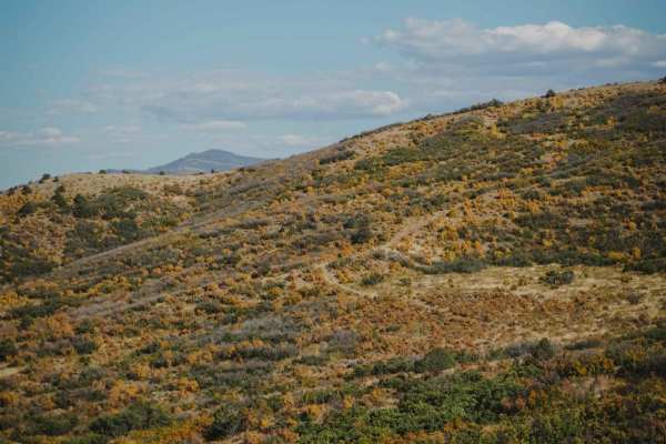
Buckhorn
Buckhorn is a fun and easy single track that goes through a mix of sagebrush and scrub oak and small trees near Carbondale, Colorado. It traverses across the sides of a bunch of rolling hills, with lots of big snaking curves that go down the hillsides. It has lots of big wide switchbacks that are gr...
Learn more about Buckhorn
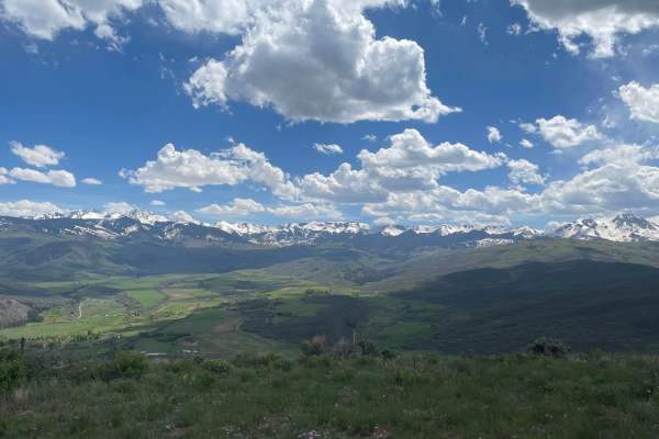
Light Hill Road
BLM Road #8334 is not challenging in itself, but presents great views. There are many spurs with plenty of space for camping. Each spur leads to a great view of the surrounding mountains, valleys, and towns. Wild flowers are in full bloom during the spring. The road that travels west along the ridge...
Learn more about Light Hill Road
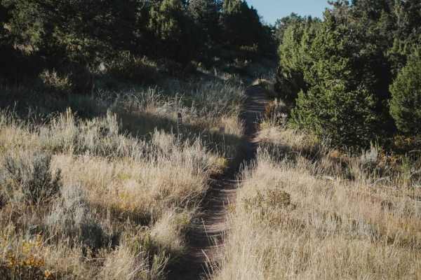
Buckhorn Traverse
Buckhorn Traverse starts at the east end of Buckhorn and is a similar trail with many wide switchbacks and fun curves on a series of rolling low alpine hills. There are more switchbacks than on the Buckhorn trail, which makes it slightly more difficult, but they are wide. A couple of them have loose...
Learn more about Buckhorn Traverse
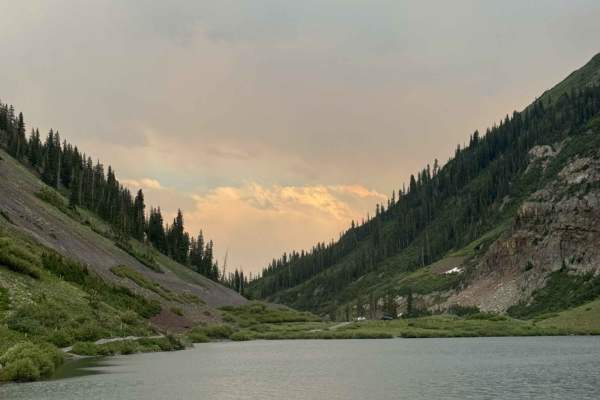
Emerald Lake Road
Emerald Lake Road is an offshoot of 317. This road dips down and takes you right to Emerald Lake, which is a beautiful and popular attraction in the area. The road has some ruts in it, but nothing too major, as it takes you to the main parking area for the lake. This parking area can fit many cars. ...
Learn more about Emerald Lake Road
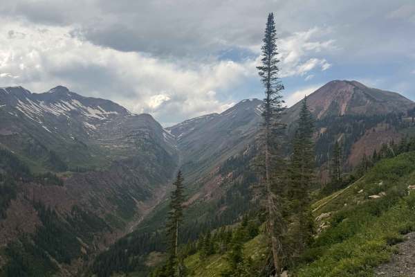
Paradise Divide
Paradise Divide is an iconic route in the Crested Butte area that is a dirt road connecting three of the main drainages of the area. This road offers incredible views of the surrounding mountains and takes you to some incredible campsites in Colorado. The terrain along this road varies quite a bit, ...
Learn more about Paradise Divide
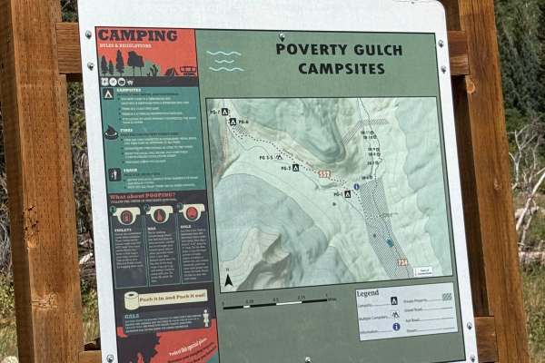
Poverty Gulch
Poverty Gulch is a fun, relatively easy trail that climbs close to treeline and offers some great scenery along the way. There is parking near the end of the trail where you can continue on foot and hike farther toward the top.
The trail is mostly straightforward, and I completed the entire route in...
Learn more about Poverty Gulch
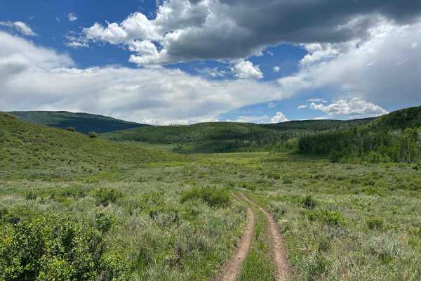
Porter Cutoff - FS 535
Porter Cutoff is an alternate route that makes its way up to Porter Mountain while following the rolling foothills and low sagebrush rather than aspen trees. It is a very easy trail, especially in the downhill direction. It is just a fun trail to cruise along, as it follows the contours of the land ...
Learn more about Porter Cutoff - FS 535
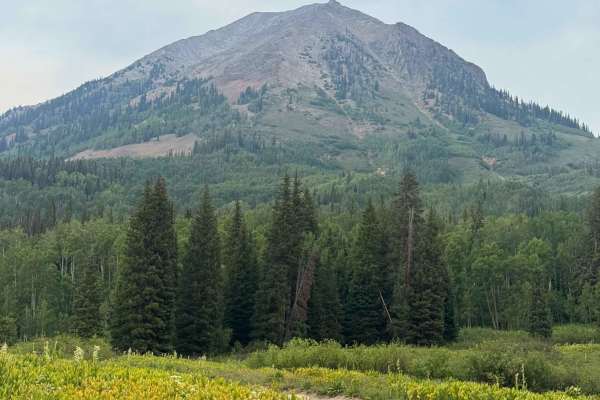
Slide Rock Road
Slide Rock Road is a quick offshoot of Washington Gulch Road that offers several campsites along it. This road does get rough and rutted, and it is recommended to have clearance for this road. Beginning at the outhouses and open views of the valley, you quickly come into the aspen grove. This drive ...
Learn more about Slide Rock Road
ATV trails near Redstone, Colorado
Explore ATV-friendly trails near you. These trails are accessible for vehicles up to 50 inches wide, perfect for ATVs and smaller off-road machines.
Schofield Pass
This route takes you over Schofield Pass. You're sure to run into some tourists around Crystal Mill, which is a very popular tourist destination. The run through Crystal Canyon will take you to Devil's Punchbowl, a swimming pool of water underneath a majestic waterfall.
Learn more about Schofield Pass
Lead King Basin
Lead King Basin is an exceptional high-country route for intermediate off-roaders looking to experience breathtaking wildflower displays, autumn colors, and stunning alpine vistas near Marble, Colorado. This 7.9-mile point-to-point trail climbs roughly 2,350 feet from Beaver Lake up into the spectac...
Learn more about Lead King Basin
Capitol Creek Road
Capitol Creek Road is an ideal moderate route for offroaders seeking stunning high-country views and access to premier hiking in the Maroon Bells-Snowmass Wilderness. Spanning approximately 3.1 miles near Aspen, Colorado, this scenic trail climbs through vibrant aspen groves that deliver spectacular...
Learn more about Capitol Creek Road
Sheep Mountain
Sheep Mountain is an engaging out-and-back climb designed for intermediate offroaders seeking stunning high-alpine views without extreme technical obstacles. Branching off from the Lead King Basin loop near Marble, Colorado, this 2.2-mile trail ascends rapidly through dense evergreen forests, gainin...
Learn more about Sheep Mountain
UTV/side-by-side trails near Redstone, Colorado
Find UTV and side-by-side trails near you. These trails accommodate vehicles up to 60 inches wide, ideal for UTVs, side-by-sides, and wider off-road rigs.
Schofield Pass
This route takes you over Schofield Pass. You're sure to run into some tourists around Crystal Mill, which is a very popular tourist destination. The run through Crystal Canyon will take you to Devil's Punchbowl, a swimming pool of water underneath a majestic waterfall.
Learn more about Schofield Pass
Lead King Basin
Lead King Basin is an exceptional high-country route for intermediate off-roaders looking to experience breathtaking wildflower displays, autumn colors, and stunning alpine vistas near Marble, Colorado. This 7.9-mile point-to-point trail climbs roughly 2,350 feet from Beaver Lake up into the spectac...
Learn more about Lead King Basin
Capitol Creek Road
Capitol Creek Road is an ideal moderate route for offroaders seeking stunning high-country views and access to premier hiking in the Maroon Bells-Snowmass Wilderness. Spanning approximately 3.1 miles near Aspen, Colorado, this scenic trail climbs through vibrant aspen groves that deliver spectacular...
Learn more about Capitol Creek Road
Sheep Mountain
Sheep Mountain is an engaging out-and-back climb designed for intermediate offroaders seeking stunning high-alpine views without extreme technical obstacles. Branching off from the Lead King Basin loop near Marble, Colorado, this 2.2-mile trail ascends rapidly through dense evergreen forests, gainin...
Learn more about Sheep Mountain
The onX Offroad Difference
onX Offroad combines trail photos, descriptions, difficulty ratings, width restrictions, seasonality, and more in a user-friendly interface. Available on all devices, with offline access and full compatibility with CarPlay and Android Auto. Discover what you're missing today!
Open Trail Map