
Dirt Bike Trails
Near Ponshewaing, Michigan
Explore All Dirt Bike Trails Near Ponshewaing, Michigan
Dirt Bike Trails Near Ponshewaing, Michigan
Discover the best dirt bike trails near you. Browse trail maps, check difficulty ratings, and find your next adventure — whether you're looking for a quick ride or an all-day expedition.
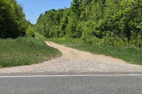
Pipeline Pass
This wide-open gas line corridor blends sand and grass with scattered loose rock, giving it a constantly changing surface depending on where you drop your tires. It runs fast in sections, but never really smooth—bumpy stretches and rolling hills keep you working the wheel the whole way through.
Alo...
Learn more about Pipeline Pass
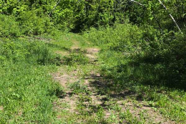
Loggers Lane
This old logging connector feels like a trail that time forgot—in the best way. Starting off near the quiet, overgrown intersection of Newson Loop and Newson Road, the route quickly drops you into a grass-covered two-track that barely looks like it gets used anymore. It connects through to Mitchell ...
Learn more about Loggers Lane
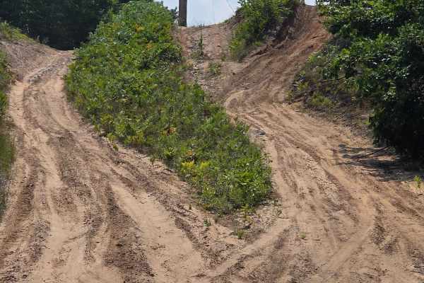
King Road Ride
This seasonal road and trail is located on the outskirts of Petoskey, Michigan. It is made up mostly of dirt and sand and can become muddy after rain. The route is wide enough for oncoming traffic to pass, though some stretches have high sandy banks and occasional fallen trees or branches. Several s...
Learn more about King Road Ride
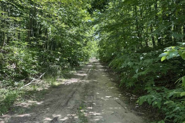
Berry Creek
Berry Creek is an ORV trail that's legal for all types and sizes of vehicles, from large 4x4s to dirt bikes. The trail is mostly made up of dirt and is surrounded by dense forest. Keep an eye out along the trail, and you'll see a large sinkhole.
Learn more about Berry Creek
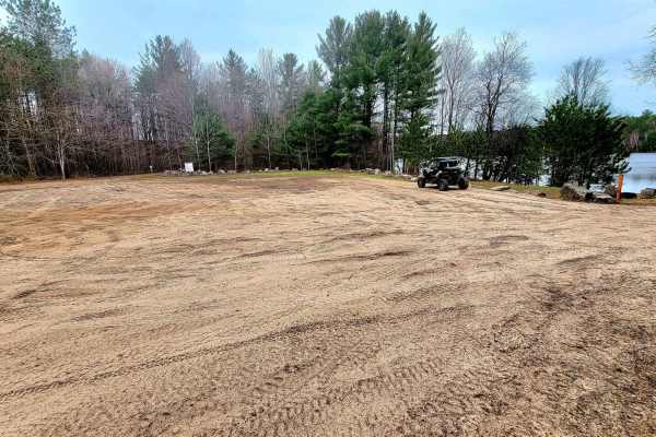
Weber Lake Area
This trail has a beautiful hidden lake and state campground on Weber Lake at one end of this trail. Plus a wildlife observation area adjacent to the lake. There are lots of deer and turkey at sundown, and the other end has a horse bed and breakfast. Its mainly a flat and firm trail and has 1 large s...
Learn more about Weber Lake Area
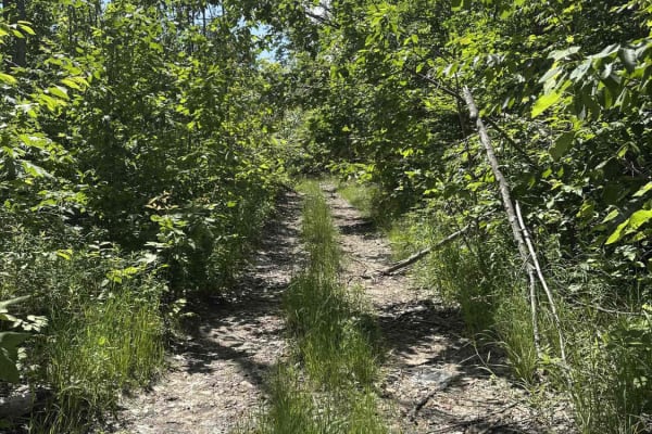
Mortan
Mortan is an ORV trail that's legal for all vehicle types and sizes, from large 4x4s to dirt bikes. It's a two-track made of dirt and surrounded by dense forest. While the trail is open to all vehicles, larger ones might encounter challenges due to the overhanging brush and branches.
Learn more about Mortan
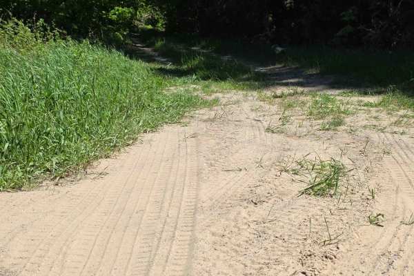
Newson Loop
This connector between Newson Road and Hopper Road feels like one of those quiet backcountry routes that only gets better the further you commit to it. At the Newson Road end, the entrance is heavily overgrown and easy to miss, with brush closing in and the track partially swallowed by grass. It’s c...
Learn more about Newson Loop
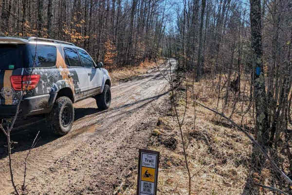
Harmon Road
This trail is mostly sandy with rolling hills and mature forests. Some areas are pretty rutted and muddy, but only because there has been logging at both the north and south ends of the trail. The trail is wide enough for a single vehicle and is well-trimmed, so none of that Michigan pinstriping.
Learn more about Harmon Road
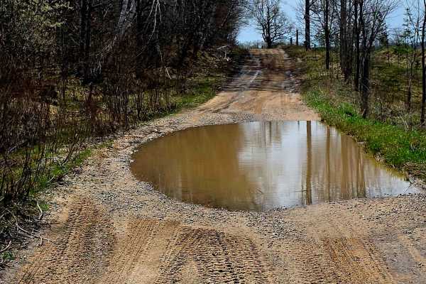
Welsh Road
This is a point-to-point trail between Wolverine and Petoskey, Michigan. About 15 miles west of exit 301 off of I-75, there is a Trailhead Parking area near Weber Lake on Springvale Road. Just west of Wolverine Road, past Weber Lake Campground. Parking is centrally located near lots of awesome trail...
Learn more about Welsh Road
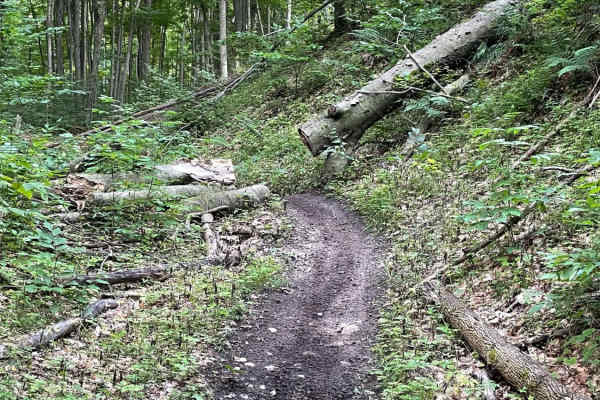
Tomahawk B Loop - Blackberry Ridge Section
Single track segment of Tomahawk B Loop Motorcycle only. This track travels through mostly wooded areas filled with tight and sometimes technical areas and then opens to a very overgrown area of Blackberry bushes. Riders beware! Proper protective riding gear is recommended as to avoid being cut by t...
Learn more about Tomahawk B Loop - Blackberry Ridge Section
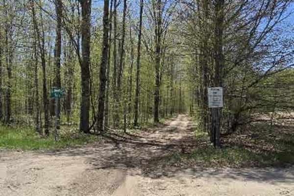
Taylor Road
This trail begins at Maxwell Road and eases you immediately into a hard-packed dirt and sand two-track, bordered by a quiet stretch of trees that set the tone for a scenic, relaxed drive. The surface starts firm and predictable, making it an easy roll for most vehicles.
As you move deeper in, the t...
Learn more about Taylor Road
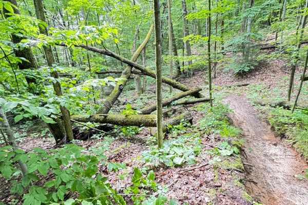
Southwest Leg Tomahawk B Loop
On the southwest end of Tomahawk B loop, you will find dense forest with sand, hard pack, loamy soil, and thick brush along the trail. Ferns and other small trees tend to grow quickly in toward the trail. This section is twisty with some elevation change. Some standing water may be present in a few ...
Learn more about Southwest Leg Tomahawk B Loop
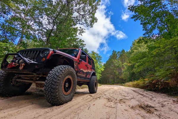
LP 76/7
LP 76/7 is an excellent, beginner-friendly sand route that offers a scenic tour through northern Michigan's forested terrain, making it perfect for stock four-wheel-drive vehicles, SxSs, and dirt bikes looking for a relaxed yet engaging ride. Stretching approximately 10 miles from the neighborhood a...
Learn more about LP 76/7
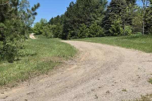
Heaton Road
This route begins as a firm mix of hard-packed dirt and sand, offering an easy roll-in before the terrain starts to shift. Seasonal mudholes appear along the way—ranging anywhere from 8 to 24 inches deep, depending on recent weather—adding a bit of unpredictability and requiring careful line choice....
Learn more about Heaton Road
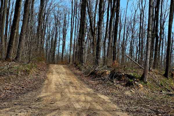
County Line Road
This a point-to-point seasonal road trail that is pretty much flat and firm dirt and gravel mix, some of the terrain has small rocks, it is mostly a straight trail with a few hills that is easily traversed but has a nice lake at the eastern end that offers a place to take a swim or fish, there is a ...
Learn more about County Line Road
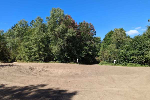
Marl Creek Road 765/760
Marl Creek Road 765/760 is an enjoyable, easy-going route ideal for scenic explorers and stock off-road vehicles looking to experience northern Michigan's marshy woodlands. Spanning approximately 5.9 miles with minimal elevation change, this continuous route begins as Trail 765 before transitioning ...
Learn more about Marl Creek Road 765/760
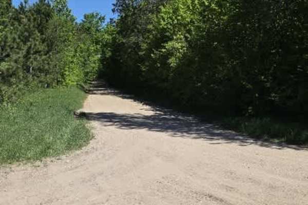
Hopper Road
A wide, 1.5-car trail that cuts off County Line Road, this route is made up of hard-packed sand and dirt and winds through a quiet, tree-lined stretch of forest. It’s an easy, relaxed drive that feels more remote than it is, with a naturally secluded feel once you’re in. One of the standout features...
Learn more about Hopper Road
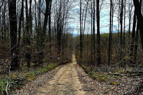
Gillette Road
Point-to-point trail south of Petoskey, Michigan, and west of the ORV parking trailhead located on Springvale Road. This trail/seasonal road. Can be a cut-through from Johnson Rd trail just north and take you to Cobb Road. and over to Springbrook Golf course, which has a bar and grill and welcomes O...
Learn more about Gillette Road
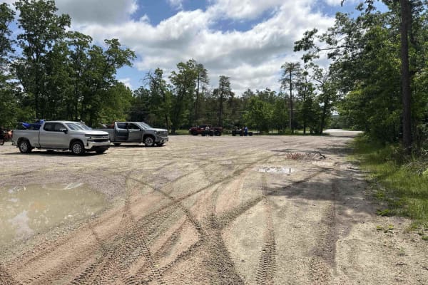
Indian River trailhead
Indian River trailhead is part of a designated off-road vehicle (ORV) trail that is legal for all vehicle types and sizes, from large 4x4s to dirt bikes. The trail is predominantly made up of sand and is surrounded by dense forests. This is a heavily traveled area, and there are a few blind corners....
Learn more about Indian River trailhead
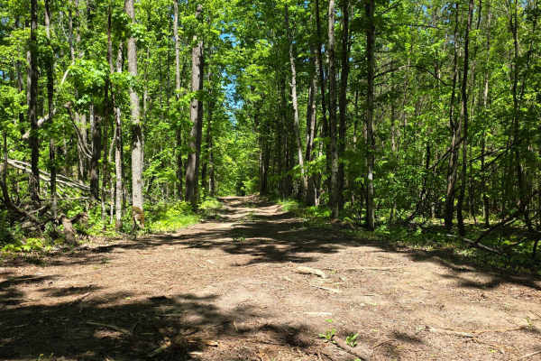
Wilber Hill
This route begins as a firm mix of hard-packed dirt and sand, offering an easy roll-in before the terrain starts to shift. Seasonal mudholes appear along the way—ranging anywhere from 8 to 24 inches deep, depending on recent weather—adding a bit of unpredictability and requiring careful line choice....
Learn more about Wilber Hill
ATV trails near Ponshewaing, Michigan
Explore ATV-friendly trails near you. These trails are accessible for vehicles up to 50 inches wide, perfect for ATVs and smaller off-road machines.
Pipeline Pass
This wide-open gas line corridor blends sand and grass with scattered loose rock, giving it a constantly changing surface depending on where you drop your tires. It runs fast in sections, but never really smooth—bumpy stretches and rolling hills keep you working the wheel the whole way through.
Alo...
Learn more about Pipeline Pass
Loggers Lane
This old logging connector feels like a trail that time forgot—in the best way. Starting off near the quiet, overgrown intersection of Newson Loop and Newson Road, the route quickly drops you into a grass-covered two-track that barely looks like it gets used anymore. It connects through to Mitchell ...
Learn more about Loggers Lane
King Road Ride
This seasonal road and trail is located on the outskirts of Petoskey, Michigan. It is made up mostly of dirt and sand and can become muddy after rain. The route is wide enough for oncoming traffic to pass, though some stretches have high sandy banks and occasional fallen trees or branches. Several s...
Learn more about King Road Ride
Berry Creek
Berry Creek is an ORV trail that's legal for all types and sizes of vehicles, from large 4x4s to dirt bikes. The trail is mostly made up of dirt and is surrounded by dense forest. Keep an eye out along the trail, and you'll see a large sinkhole.
Learn more about Berry Creek
UTV/side-by-side trails near Ponshewaing, Michigan
Find UTV and side-by-side trails near you. These trails accommodate vehicles up to 60 inches wide, ideal for UTVs, side-by-sides, and wider off-road rigs.
Pipeline Pass
This wide-open gas line corridor blends sand and grass with scattered loose rock, giving it a constantly changing surface depending on where you drop your tires. It runs fast in sections, but never really smooth—bumpy stretches and rolling hills keep you working the wheel the whole way through.
Alo...
Learn more about Pipeline Pass
Loggers Lane
This old logging connector feels like a trail that time forgot—in the best way. Starting off near the quiet, overgrown intersection of Newson Loop and Newson Road, the route quickly drops you into a grass-covered two-track that barely looks like it gets used anymore. It connects through to Mitchell ...
Learn more about Loggers Lane
King Road Ride
This seasonal road and trail is located on the outskirts of Petoskey, Michigan. It is made up mostly of dirt and sand and can become muddy after rain. The route is wide enough for oncoming traffic to pass, though some stretches have high sandy banks and occasional fallen trees or branches. Several s...
Learn more about King Road Ride
Berry Creek
Berry Creek is an ORV trail that's legal for all types and sizes of vehicles, from large 4x4s to dirt bikes. The trail is mostly made up of dirt and is surrounded by dense forest. Keep an eye out along the trail, and you'll see a large sinkhole.
Learn more about Berry Creek
The onX Offroad Difference
onX Offroad combines trail photos, descriptions, difficulty ratings, width restrictions, seasonality, and more in a user-friendly interface. Available on all devices, with offline access and full compatibility with CarPlay and Android Auto. Discover what you're missing today!
Open Trail Map