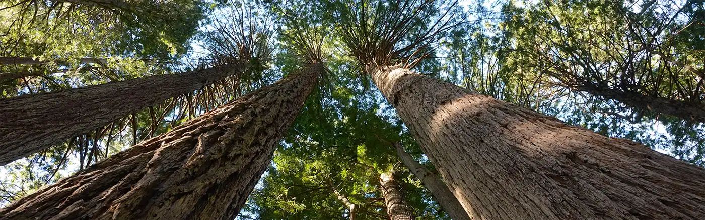
Dirt Bike Trails
Near Platina, California
Explore All Dirt Bike Trails Near Platina, California
Dirt Bike Trails Near Platina, California
Discover the best dirt bike trails near you. Browse trail maps, check difficulty ratings, and find your next adventure — whether you're looking for a quick ride or an all-day expedition.
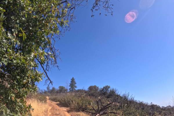
Pattymocus Lookout - FS 28N01
Branching east from the primary FS 29N45 transit corridor, Pattymocus Lookout (FS 28N01) serves as a brief, out-and-back mountain spur located within the Shasta-Trinity National Forest. The pathway carves through a diverse landscape, transitioning from sweeping grassy savannas and dense chaparral br...
Learn more about Pattymocus Lookout - FS 28N01
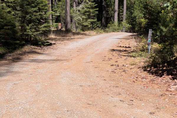
Hall City Creek Road - FS 29N07
This single-lane gravel road begins from the Browns Creek Road - FS 30N01 and connects through to the Potato Creek Road - FS 30N04. The road surface is mostly in good condition, with the exception of one spot with erosion ruts and damage a little over a foot deep. The road is wide enough to meet a...
Learn more about Hall City Creek Road - FS 29N07
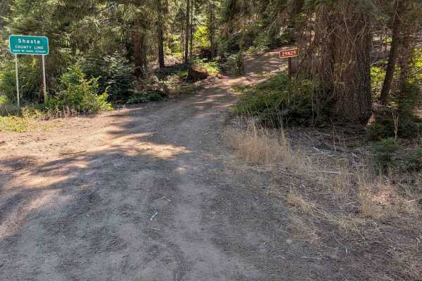
Micro Tower Road - FS 29N29
This single-lane dirt road starts from Highway 36 and connects through to the McFarland Ridge Road - FS 29N25. Near its high point, the road passes by a microwave tower. The grade of climb is fairly steep, and there are several abrupt 18-inch high water bars interrupting the available traction. The ...
Learn more about Micro Tower Road - FS 29N29
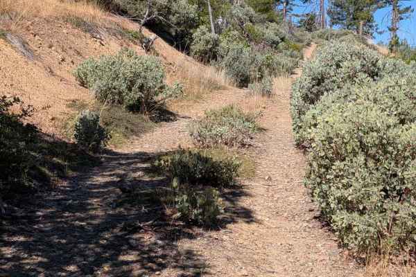
Wilson Point Road - FS 30N21
This single-lane dirt road starts from the Chanchelulla Gulch Road - FS 30N15 and connects to Potato Creek Road - FS 30N04, but was blocked by downed trees about 1.4 miles in when evaluated. By how overgrown it is, it has been this way for several years. Pinstriping is very likely for a full-size v...
Learn more about Wilson Point Road - FS 30N21
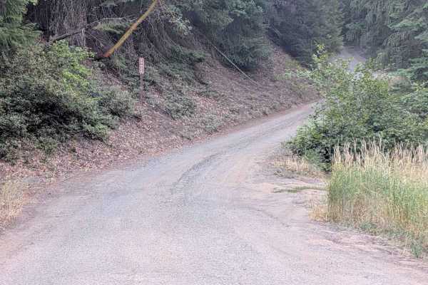
McFarland Ridge Road - FS 29N25
This single-lane dirt and gravel road begins from Hwy 36 and loops around to String Bean Creek Road - FS 29N28 near Hwy 36. It starts as a gravel road at Hwy 36, but transitions to dirt closer to the 29N28 side. There are plenty of places to meet another vehicle safely, but there are sections too n...
Learn more about McFarland Ridge Road - FS 29N25

Chanchelulla Gulch Road - FS 30N15
This single-lane gravel road begins from the Midas Saddle Road - FS 30N16 and connects through to the Browns Creek Road - FS 30N01. The road surface is mostly in good condition, with some areas of erosion damage up to a foot deep and a couple of sections of more natural surface. The road is a littl...
Learn more about Chanchelulla Gulch Road - FS 30N15
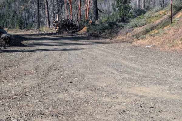
Baker Flat Road - FS 29N41
This single-lane gravel and dirt road starts at the South Fork Goods Creek Road - FS 29N27, crosses the McFarland Ridge Road - FS 29N25, and ends at Stuart Gap Road - FS 28N10. The road was a little overgrown in places and had some loose rocks up to a foot in diameter. There is minor erosion damage ...
Learn more about Baker Flat Road - FS 29N41
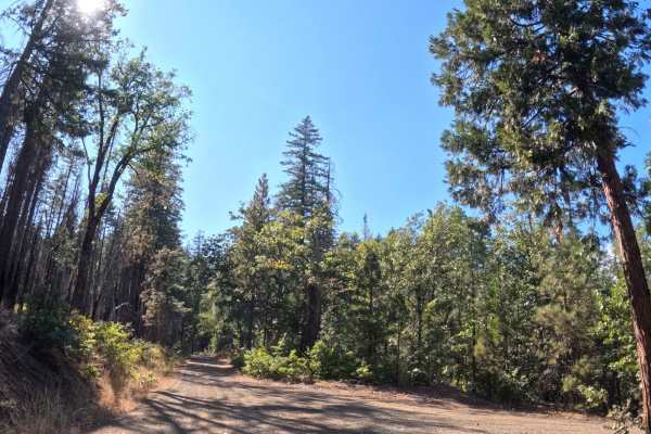
Snake Lake - FS 28N18
Forking north from the Stuart Gap transit corridor (FS 28N10), Snake Lake (FS 28N18) functions as a highly scenic, out-and-back gravel spur descending toward the water. The route wanders through a beautifully preserved section of the Trinity National Forest that largely escaped recent regional wildf...
Learn more about Snake Lake - FS 28N18
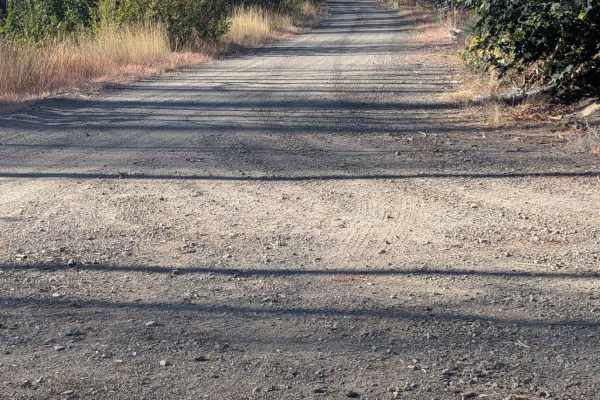
South Fork Goods Creek Road - FS 29N27
This single-lane gravel and dirt road starts at the String Bean Creek Road - 29N28 and ends at a turnaround about 4.6 miles later after looping around onto a ridge near but at a higher elevation than its starting point. The road is gravel at first, but becomes dirt shortly after its intersection wit...
Learn more about South Fork Goods Creek Road - FS 29N27
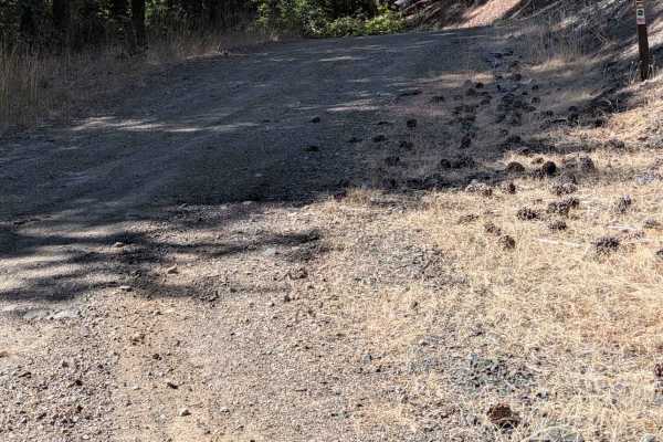
Reagan Meadow Road - FS 28N68
This single-lane dirt road starts from Stuart Gap Road - FS 28N10 and connects through to the String Bean Creek Road - 29N28. It has areas of ruts and erosion damage up to 18 inches deep, along with exposed embedded rocks and loose rocks around a foot high. All three of those show up on some climbs ...
Learn more about Reagan Meadow Road - FS 28N68
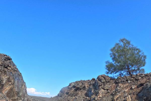
Wells Creek Peak North - FS 28N05
Branching eastward from the primary trail junction at Tedoc Gap (FS 29N45), Wells Creek Peak North (FS 28N05) functions as an incredibly scenic, point-to-point connector that traverses the elevated ridges of Tedoc Mountain. The lengthy corridor weaves through a dynamic landscape within the Trinity N...
Learn more about Wells Creek Peak North - FS 28N05
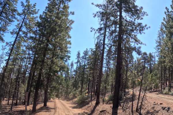
Wells Creek Peak - South - FS 28N05
Forking east from the FS 27N13 junction at Tedoc Gap, Wells Creek Peak - South (FS 28N05) functions as a narrow, point-to-point transit route driving deeper into the wilderness. The trail descends southeast through the Shasta-Trinity National Forest, navigating a rugged landscape heavily marked by t...
Learn more about Wells Creek Peak - South - FS 28N05
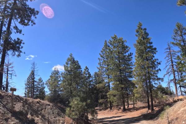
Post Creek - FS 28N36
Branching westward off Forest Road 29N45, Post Creek (FS 28N36) functions as a well-traveled point-to-point connector linking across the high-country landscape. The road traverses the rolling hillsides of the Trinity National Forest, winding through a striking transitional environment of healthy gre...
Learn more about Post Creek - FS 28N36
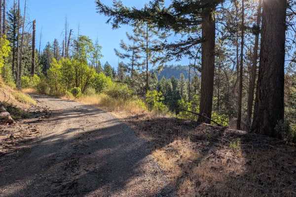
Midas Saddle Road - FS 30N16
This gravel road begins from the Potato Creek Road - FS 30N04 and connects through to the Browns Creek Road - FS 30N01, but when evaluated, it was blocked by downed trees about 8 miles in. From the condition of the road beyond the trees, they have been there for years. The road is initially good gr...
Learn more about Midas Saddle Road - FS 30N16
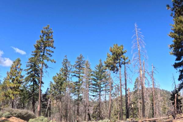
Round Mountain Creek - FS 28N14
Branching west from the FS 28N14C junction, Round Mountain Creek (FS 28N14) serves as an incredibly scenic, point-to-point gravel route that wraps northward around the contours of Round Mountain. The trail carves a path through the Trinity National Forest, offering a striking visual contrast between...
Learn more about Round Mountain Creek - FS 28N14
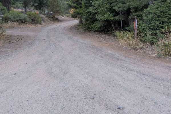
Potato Creek Road - FS 30N04
This gravel road starts at Wildwood Road and ends at a gate at a private property boundary about 4.6 miles later. Some base maps show it going through to connect back to Wildwood Road, but it doesn't. There's a Forest Service sign at the intersection with the FS 30N16 road indicating it will dead-en...
Learn more about Potato Creek Road - FS 30N04
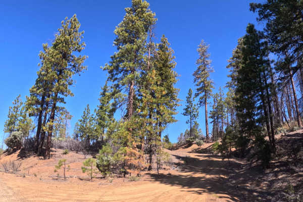
Tedoc Gap Spur A - FS 29N45A
Branching south from Forest Road 29N45 near Tedoc Gap, Tedoc Gap Spur A - 29N45A serves as a brief out-and-back spur leading directly into the recovering high country. The route traverses the hillsides of the Trinity National Forest, winding through a rugged landscape that intermixes surviving green...
Learn more about Tedoc Gap Spur A - FS 29N45A
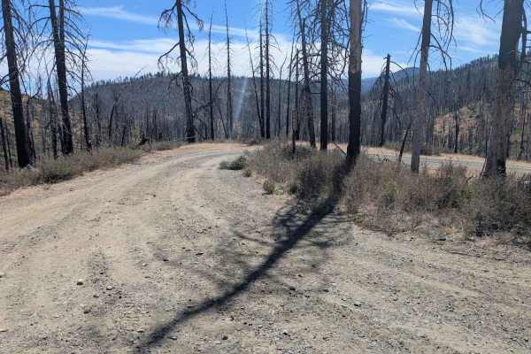
Strong Road - FS 29N39
This single-lane gravel road begins from String Bean Creek Road - FS 29N28 and connects through to Stuart Gap Road - FS 28N10. It has some areas of erosion damage up to a foot deep, and also one spot that has eroded away the side of the road a few feet. It has some random loose rocks up to a foot in...
Learn more about Strong Road - FS 29N39
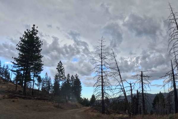
Paul’s Day - FS 28N09
Branching eastward off FS 35, Paul’s Day (FS 28N09) functions as a remote, out-and-back gravel spur descending deep into the wilderness. The trail carves along the mountainside through the Trinity National Forest, offering a striking visual contrast between patches of untouched, pine-heavy greenery ...
Learn more about Paul’s Day - FS 28N09
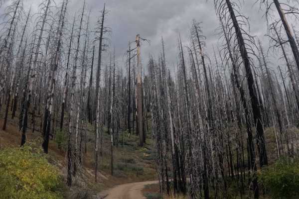
North Star Mountain - FS 28N13
Forking away from FS 35, North Star Mountain (FS 28N13) operates as a highly scenic, point-to-point gravel connector that travels east to west, roughly paralleling the main route before eventually looping back to reconnect with FS 35. The lengthy corridor weaves across the exposed, elevated hillside...
Learn more about North Star Mountain - FS 28N13
ATV trails near Platina, California
Explore ATV-friendly trails near you. These trails are accessible for vehicles up to 50 inches wide, perfect for ATVs and smaller off-road machines.
Pattymocus Lookout - FS 28N01
Branching east from the primary FS 29N45 transit corridor, Pattymocus Lookout (FS 28N01) serves as a brief, out-and-back mountain spur located within the Shasta-Trinity National Forest. The pathway carves through a diverse landscape, transitioning from sweeping grassy savannas and dense chaparral br...
Learn more about Pattymocus Lookout - FS 28N01
Hall City Creek Road - FS 29N07
This single-lane gravel road begins from the Browns Creek Road - FS 30N01 and connects through to the Potato Creek Road - FS 30N04. The road surface is mostly in good condition, with the exception of one spot with erosion ruts and damage a little over a foot deep. The road is wide enough to meet a...
Learn more about Hall City Creek Road - FS 29N07
Micro Tower Road - FS 29N29
This single-lane dirt road starts from Highway 36 and connects through to the McFarland Ridge Road - FS 29N25. Near its high point, the road passes by a microwave tower. The grade of climb is fairly steep, and there are several abrupt 18-inch high water bars interrupting the available traction. The ...
Learn more about Micro Tower Road - FS 29N29
Wilson Point Road - FS 30N21
This single-lane dirt road starts from the Chanchelulla Gulch Road - FS 30N15 and connects to Potato Creek Road - FS 30N04, but was blocked by downed trees about 1.4 miles in when evaluated. By how overgrown it is, it has been this way for several years. Pinstriping is very likely for a full-size v...
Learn more about Wilson Point Road - FS 30N21
UTV/side-by-side trails near Platina, California
Find UTV and side-by-side trails near you. These trails accommodate vehicles up to 60 inches wide, ideal for UTVs, side-by-sides, and wider off-road rigs.
Pattymocus Lookout - FS 28N01
Branching east from the primary FS 29N45 transit corridor, Pattymocus Lookout (FS 28N01) serves as a brief, out-and-back mountain spur located within the Shasta-Trinity National Forest. The pathway carves through a diverse landscape, transitioning from sweeping grassy savannas and dense chaparral br...
Learn more about Pattymocus Lookout - FS 28N01
Hall City Creek Road - FS 29N07
This single-lane gravel road begins from the Browns Creek Road - FS 30N01 and connects through to the Potato Creek Road - FS 30N04. The road surface is mostly in good condition, with the exception of one spot with erosion ruts and damage a little over a foot deep. The road is wide enough to meet a...
Learn more about Hall City Creek Road - FS 29N07
Micro Tower Road - FS 29N29
This single-lane dirt road starts from Highway 36 and connects through to the McFarland Ridge Road - FS 29N25. Near its high point, the road passes by a microwave tower. The grade of climb is fairly steep, and there are several abrupt 18-inch high water bars interrupting the available traction. The ...
Learn more about Micro Tower Road - FS 29N29
Wilson Point Road - FS 30N21
This single-lane dirt road starts from the Chanchelulla Gulch Road - FS 30N15 and connects to Potato Creek Road - FS 30N04, but was blocked by downed trees about 1.4 miles in when evaluated. By how overgrown it is, it has been this way for several years. Pinstriping is very likely for a full-size v...
Learn more about Wilson Point Road - FS 30N21
The onX Offroad Difference
onX Offroad combines trail photos, descriptions, difficulty ratings, width restrictions, seasonality, and more in a user-friendly interface. Available on all devices, with offline access and full compatibility with CarPlay and Android Auto. Discover what you're missing today!
Open Trail Map