
Dirt Bike Trails
Near Pittsburg, Oklahoma
Explore All Dirt Bike Trails Near Pittsburg, Oklahoma
Dirt Bike Trails Near Pittsburg, Oklahoma
Discover the best dirt bike trails near you. Browse trail maps, check difficulty ratings, and find your next adventure — whether you're looking for a quick ride or an all-day expedition.
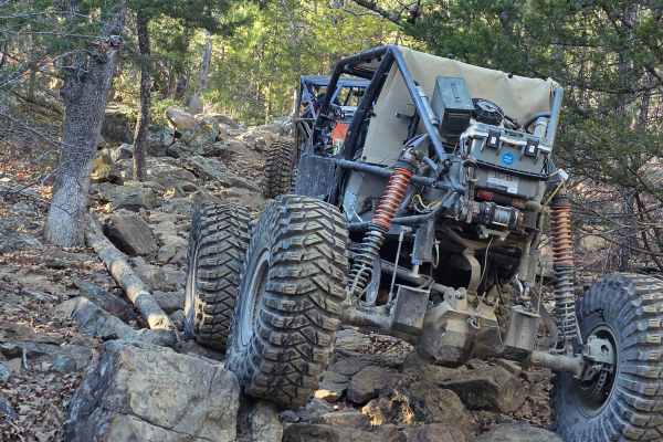
Coon Hunter
The Coon Hunter Trail presents a rugged and engaging climb through the diverse landscape of Oklahoma. This path uniquely uses a century-old washout as its primary route, guiding hikers up a challenging 300-foot elevation gain over rocky terrain. The ascent is demanding, winding through the trees and...
Learn more about Coon Hunter
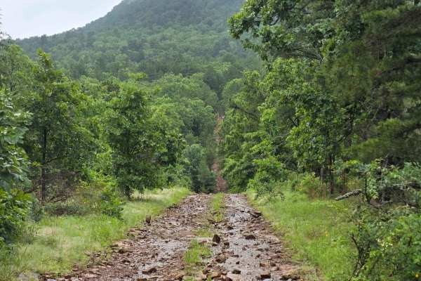
West Boundry Trail
The dirt trail runs parallel to the boundary fence of a private land parcel in rural Oklahoma, cutting through a mix of open prairie and lightly wooded areas. The trail itself is about 8 to 10 feet wide, composed of compacted red clay and loose gravel, with patches of grass and sand depending on rec...
Learn more about West Boundry Trail

Working Man Race Track
This was a great track set up for the working man races on Labor Day weekend. Sections that had boulders placed throughout to navigate or jump if you were daring enough. Other areas went through the trees with jumps, curves, and straightaway areas to pull your Days Of Thunder maneuvers and overcome ...
Learn more about Working Man Race Track

Flip Flop
This is a rugged offroad trail that snakes through a rocky Oklahoma mountain creek, where massive boulders demand precise tire placement and low-range crawling. Water rushes past tires as rigs climb slick, off-camber ledges, threatening to tip at every turn. Twisting through dense forest and steep i...
Learn more about Flip Flop
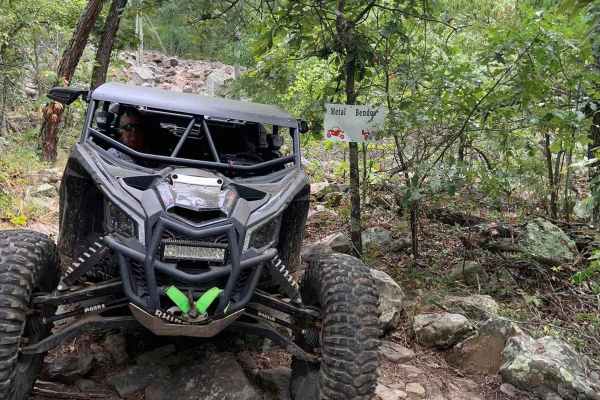
Metal Bender
The offroad buggy roars as it tackles the steep, loose rocky hillside. Tires spin, flinging gravel in every direction while the suspension groans under the strain. The 100-foot elevation gain looms ahead, challenging every bit of traction and torque. Sharp rocks rattle beneath, threatening control. ...
Learn more about Metal Bender
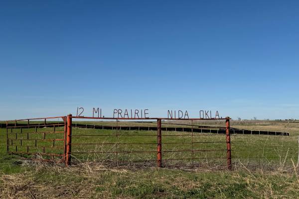
Twelve Mile Prairie Trail #1
The 12-mile Prairie Trail begins at Horse Creek Road and ends at Dunn Road or vice versa, and rolls out across open country that mixes prairie stretches, scattered timber, and gentle elevation changes. The route follows a series of old rural paths that feel untouched and authentic, giving the ride a...
Learn more about Twelve Mile Prairie Trail #1
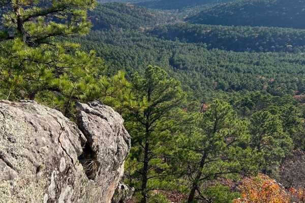
White Rock
This is a challenging trail with tight turns, narrow straits, steep climbs, and not many places to pass or turn around. If pinstripes are a deal breaker then you may want to reconsider. With that being said this trail will take you to one of the coolest rock formations and one of the best views in t...
Learn more about White Rock
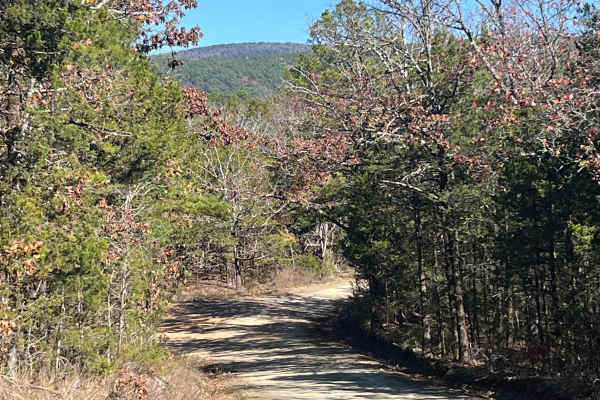
Muse
This is an easy and well maintained gravel road that cuts through the Quachita Wildlife Management Area near Muse, Oklahoma. Can be traveled in either direction, and you can access other activities along this route, like hunting, camping, and other off-road routes. Erosion can be an issue in some sp...
Learn more about Muse
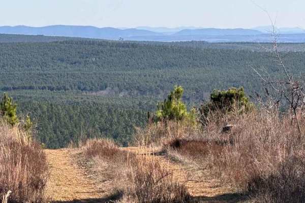
East Signal Mountain
This is a beautiful area of North Western McCurtain County; it is highly isolated, and the terrain for most of the trail is just hilltop roads and small creek valleys. There are some pine farms in the area, but the land near the top, which is over 1400 feet high, is probably a Rating 3 to 5, too muc...
Learn more about East Signal Mountain
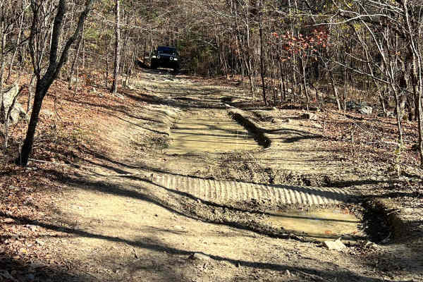
Sycamore Creek
Sycamore Creek can be run as an in-and-out trail or you can connect with many other trails in the area and travel right on through these trails get narrow and challenging, so beware. There are a few low spots that seem to always have a little mud and when it rains, they will become impossible, espec...
Learn more about Sycamore Creek
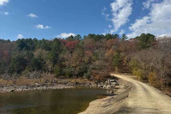
Jones Ranch Trail
Easy route that crossed the Glover River. This could be washed out with heavy rain and become muddy. Otherwise, this is a nice connection to other trails, or even a back way to bypass Broken Bow on your way home. No camping options available on this trail.
Learn more about Jones Ranch Trail
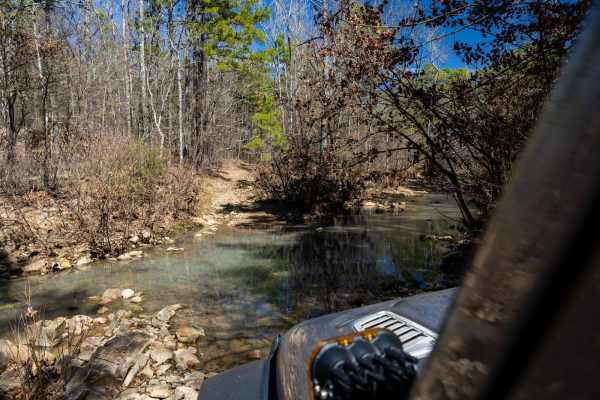
Billy Creek Spur Trail
We stumbled upon this little trail while exploring. It was rocky, tight, and super fun! There were a few small water crossings and breathtaking views. But, there are a few technical areas where proper lines are needed. I imagine it could get very interesting during rain or after heavy rain.
Learn more about Billy Creek Spur Trail

Morgan
The north portion of this trail is easy;the southern half is a bit more challenging. The trail can be traveled in either direction and has a variety of surfaces, such as mud bogs, creek crossings, and narrow sections. This is a gravel road, and it gets tight in the trees, especially for 4x4. The sou...
Learn more about Morgan
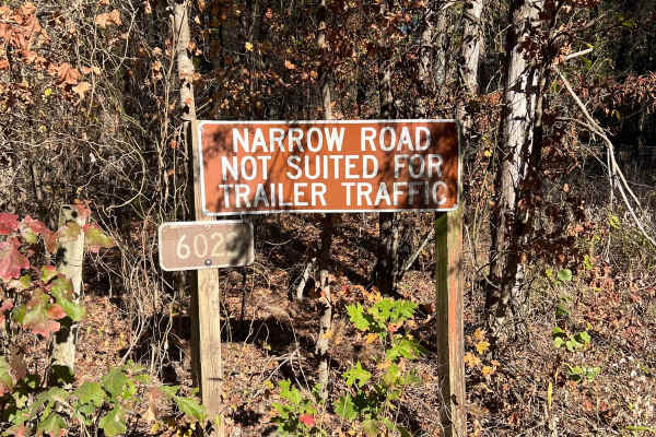
Lenox Ridge Road
Lenox Ridge Road is a mountain road that runs through the Quachita National Forest from Billy Creek campground to Oklahoma scenic Highway 1. The road is maintained with dirt and gravel, and signs are posted at each end advising against traveling it with trailers. There are a couple of nice campsites...
Learn more about Lenox Ridge Road
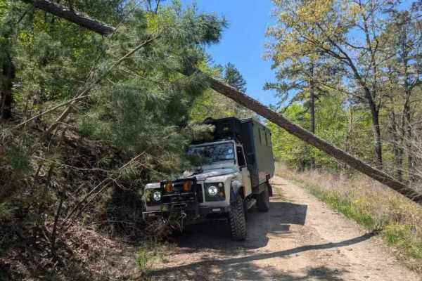
53250
This off-road trail winds through a dense forest, revealing a narrow track that shows signs of limited upkeep, particularly through overgrowth and numerous muddy, rock-bottomed holes often present during April. Several off-camber stretches and areas of water damage add challenges, alongside a few mo...
Learn more about 53250
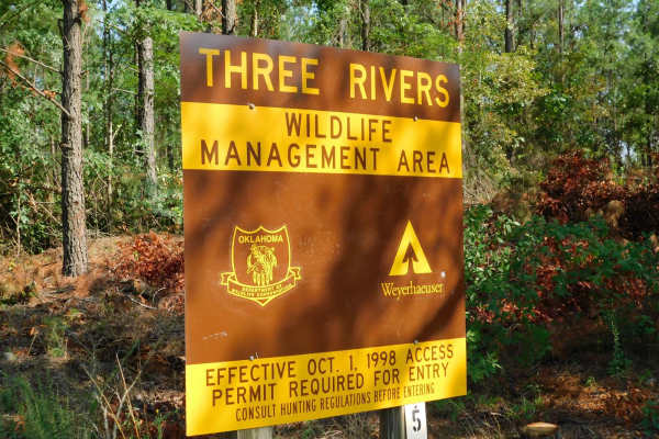
Arkansas Crossing NFS SEOK
This is a trail located in Northern McCurtain County in Oklahoma. This trail is mostly a level 1-2 Trail, except for the water crossing on the Glover River which will require a high clearance vehicle and may be uncrossable if there is high water. There are no markings to gauge water level. The trail...
Learn more about Arkansas Crossing NFS SEOK
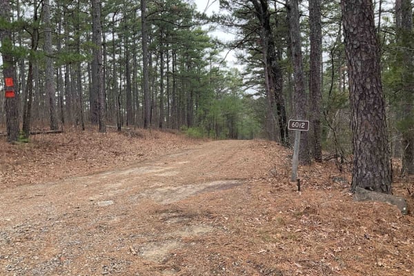
Goldville Trail
The Goldville Trail, also known as Forest Service Road 6012, is nestled in the picturesque Ouachita National Forest, just north of the Winding Stair Mountains. This challenging trail begins with an easy stretch, offering a gentle introduction before quickly transitioning into a more demanding rocky ...
Learn more about Goldville Trail
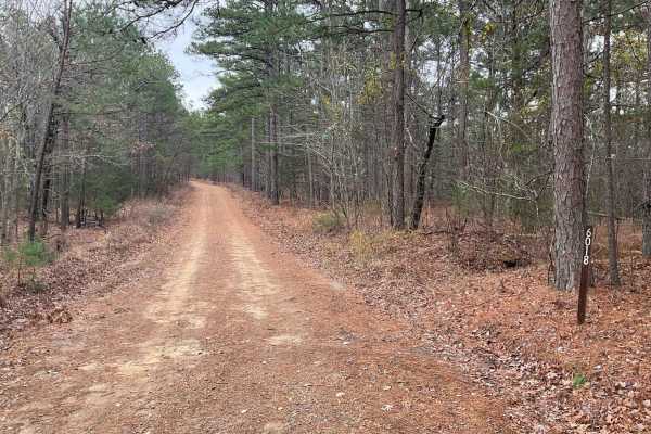
Tram Ridge Trail
Tram Ridge, also known as Forest Service Road 6018, is a scenic trail nestled in the Ouachita National Forest. Historically, the area is rich in natural beauty and has been a site for outdoor enthusiasts for generations. The trail is relatively easy, accessible to most vehicles, and is known for its...
Learn more about Tram Ridge Trail
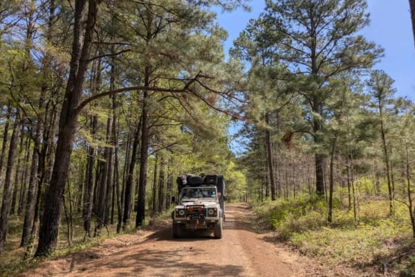
53140
This off-road route presents a scenic journey along a mostly flat, well-maintained gravel surface, although it is quite narrow with trees lining the edges. The trail features a deceptively steep ascent that may require some vehicles to shift into a lower gear for optimal performance. Once past the c...
Learn more about 53140
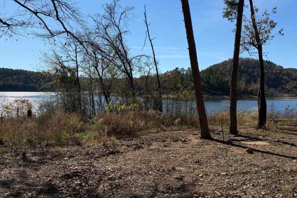
Johnny Beavers Trail to Holly Creek Landing
This wonderful trailt is very scenic and runs through some locally owned areas and some with pine plantations. It eventually ends in a national forest area and on Oklahoma Wildlife Department land when you get near the Mountain Fork River--well-maintained roads in places. Beware of the open yellow g...
Learn more about Johnny Beavers Trail to Holly Creek Landing
ATV trails near Pittsburg, Oklahoma
Explore ATV-friendly trails near you. These trails are accessible for vehicles up to 50 inches wide, perfect for ATVs and smaller off-road machines.
Coon Hunter
The Coon Hunter Trail presents a rugged and engaging climb through the diverse landscape of Oklahoma. This path uniquely uses a century-old washout as its primary route, guiding hikers up a challenging 300-foot elevation gain over rocky terrain. The ascent is demanding, winding through the trees and...
Learn more about Coon Hunter
West Boundry Trail
The dirt trail runs parallel to the boundary fence of a private land parcel in rural Oklahoma, cutting through a mix of open prairie and lightly wooded areas. The trail itself is about 8 to 10 feet wide, composed of compacted red clay and loose gravel, with patches of grass and sand depending on rec...
Learn more about West Boundry Trail
Working Man Race Track
This was a great track set up for the working man races on Labor Day weekend. Sections that had boulders placed throughout to navigate or jump if you were daring enough. Other areas went through the trees with jumps, curves, and straightaway areas to pull your Days Of Thunder maneuvers and overcome ...
Learn more about Working Man Race Track
Flip Flop
This is a rugged offroad trail that snakes through a rocky Oklahoma mountain creek, where massive boulders demand precise tire placement and low-range crawling. Water rushes past tires as rigs climb slick, off-camber ledges, threatening to tip at every turn. Twisting through dense forest and steep i...
Learn more about Flip Flop
UTV/side-by-side trails near Pittsburg, Oklahoma
Find UTV and side-by-side trails near you. These trails accommodate vehicles up to 60 inches wide, ideal for UTVs, side-by-sides, and wider off-road rigs.
Coon Hunter
The Coon Hunter Trail presents a rugged and engaging climb through the diverse landscape of Oklahoma. This path uniquely uses a century-old washout as its primary route, guiding hikers up a challenging 300-foot elevation gain over rocky terrain. The ascent is demanding, winding through the trees and...
Learn more about Coon Hunter
West Boundry Trail
The dirt trail runs parallel to the boundary fence of a private land parcel in rural Oklahoma, cutting through a mix of open prairie and lightly wooded areas. The trail itself is about 8 to 10 feet wide, composed of compacted red clay and loose gravel, with patches of grass and sand depending on rec...
Learn more about West Boundry Trail
Working Man Race Track
This was a great track set up for the working man races on Labor Day weekend. Sections that had boulders placed throughout to navigate or jump if you were daring enough. Other areas went through the trees with jumps, curves, and straightaway areas to pull your Days Of Thunder maneuvers and overcome ...
Learn more about Working Man Race Track
Flip Flop
This is a rugged offroad trail that snakes through a rocky Oklahoma mountain creek, where massive boulders demand precise tire placement and low-range crawling. Water rushes past tires as rigs climb slick, off-camber ledges, threatening to tip at every turn. Twisting through dense forest and steep i...
Learn more about Flip Flop
The onX Offroad Difference
onX Offroad combines trail photos, descriptions, difficulty ratings, width restrictions, seasonality, and more in a user-friendly interface. Available on all devices, with offline access and full compatibility with CarPlay and Android Auto. Discover what you're missing today!
Open Trail Map