Arkansas Crossing NFS SEOK

Total Miles 11
Technical Rating
4 Moderate
Best Time Spring, Summer, Fall, Winter
Trail Type Full-Width Road
Accessible By
Open Trail Map

Trail Overview

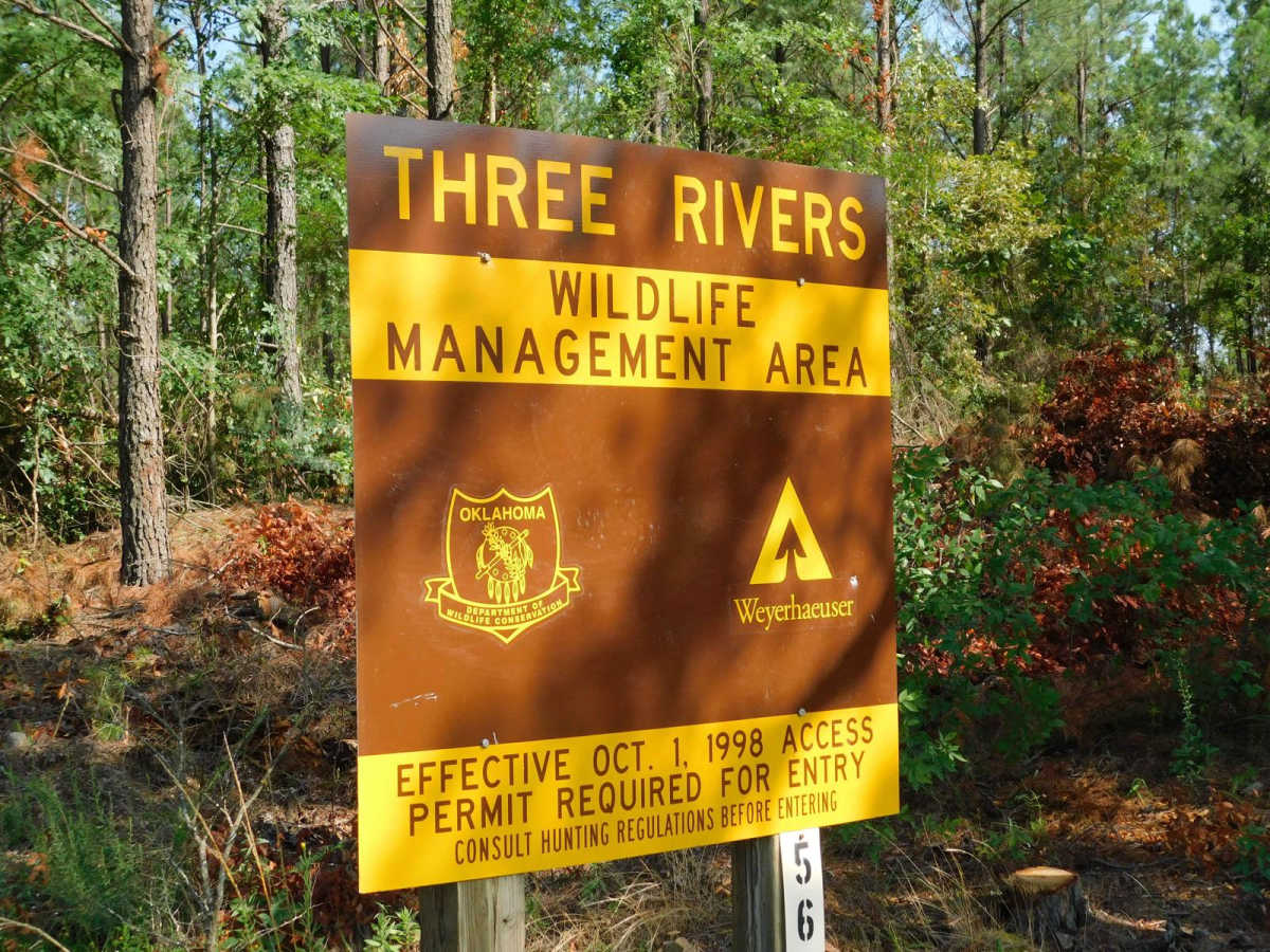
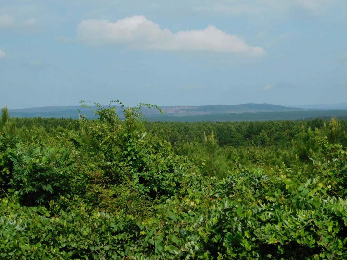
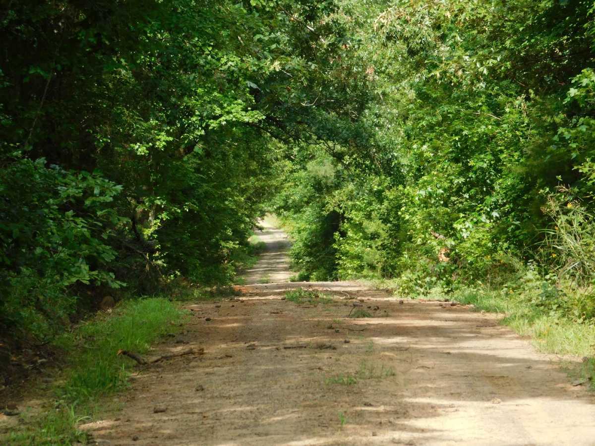
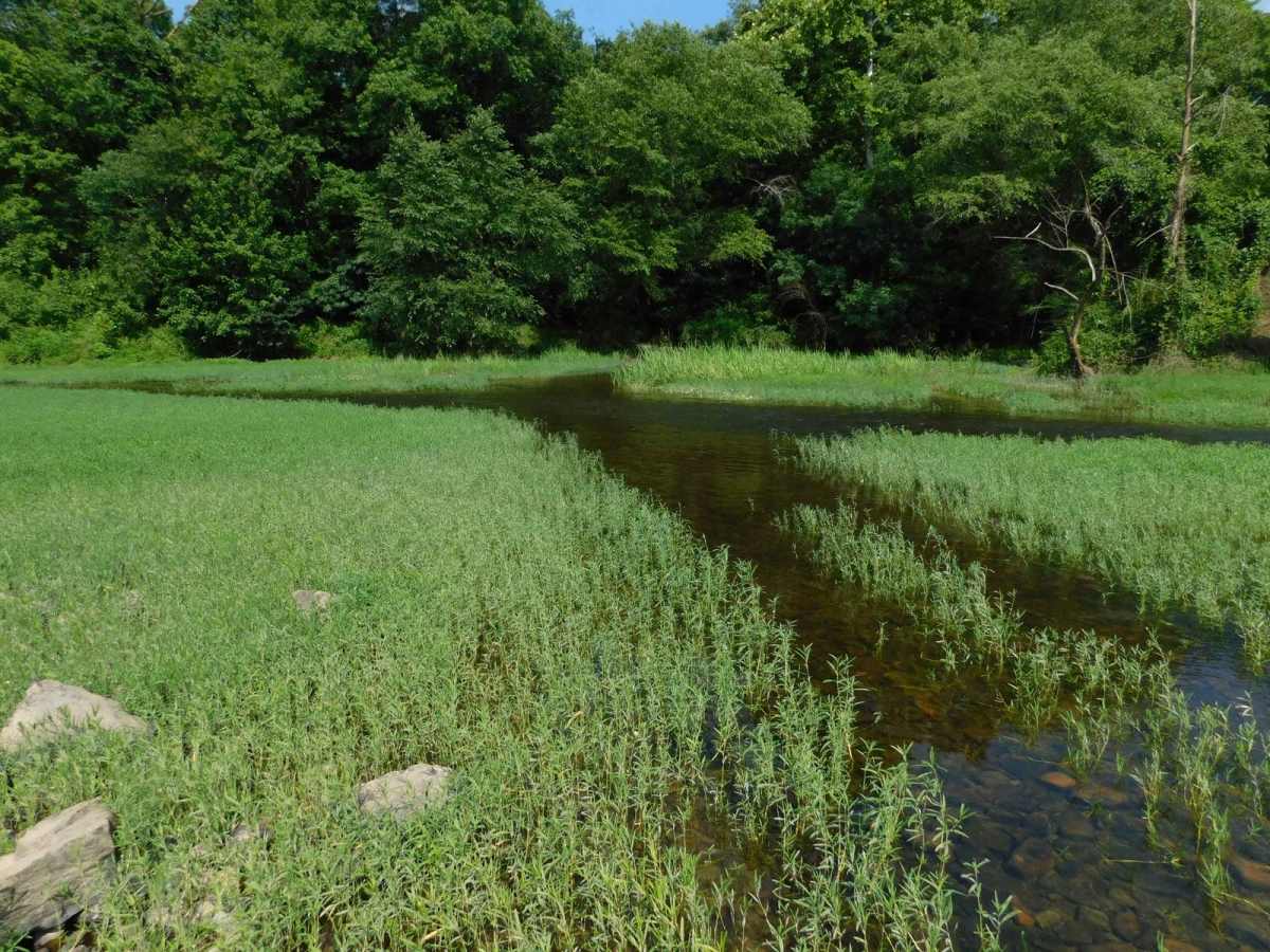
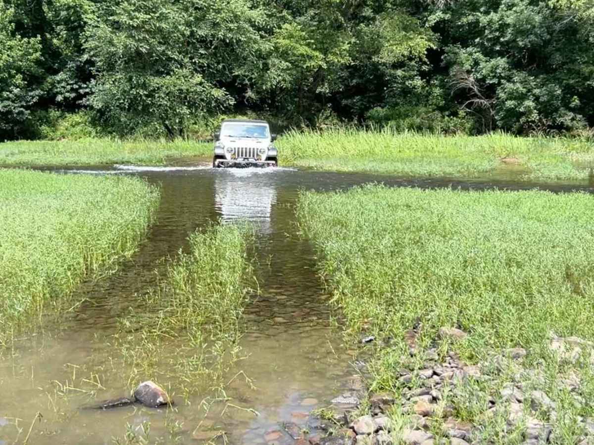
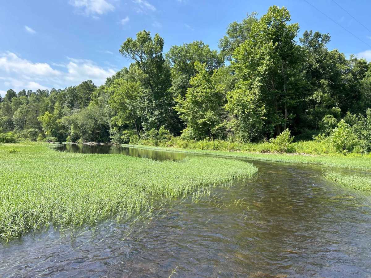
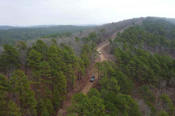
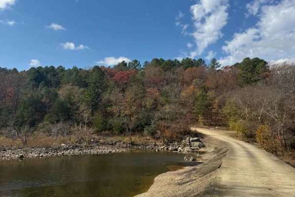
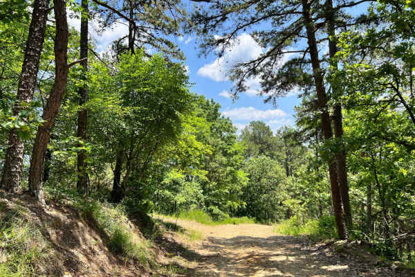
This is a trail located in Northern McCurtain County in Oklahoma. This trail is mostly a level 1-2 Trail, except for the water crossing on the Glover River which will require a high clearance vehicle and may be uncrossable if there is high water. There are no markings to gauge water level. The trail has beautiful vistas from hilltop that show the surrounding terrain, rolling hills and scenic Hilltops. The river crossing is on the Glover River which is the only river in southeast Oklahoma to not have a dam and lake. It is a beautiful river complex gathering several small creeks as it flows south becoming a larger flowing river in this part of the National Forest Service land. The trail starts out on Highway 259 with a dirt road, it passed through some private, but passable land and lots of pine plantations only to end in the Quachita NFS land as you near the Glover River. This road begins in a gravel, well kept road, eventually gets intermittent with wash outs and rocks, the river crossing is mostly river rocks of various sizes. There are clearings for camping but they are in no way developed, just small sites used by locals for fishing and swimming access as well.

Photos of Arkansas Crossing NFS SEOK

Difficulty

The trail itself is not that difficult, but the water crossing should be considered a four during the low rain part of the year. If water level is up, this would be a treacherous crossing.

History

This crossing is historically significant and was used as far back with wagons and early logging crossings for the River, connecting two areas of Northern McCurtain County.

Technical Rating

4

Status Reports

Add Status Report
Erick Magana
May 16, 2026
Open
Fairly easy trail. The water crossing was not very deep when I went through.
Mitchell Davis
Feb 21, 2026
Open
Trail was nice. There is a cool campsite beside the river which is sweet. The river was flowing rapidly with about 3’ of water so sadly couldn’t finish. I will definitely be back to try.
Hunter Simmons
Sep 17, 2025
Open
Pretty calm trail. Only technical part was when leaving the river on one side, but even that wasn’t bad. Trail was a dirt road for the majority of the time and the water was roughly 6in deep and very calm.
Greg Gable
Jun 27, 2025
Open
Kaelyn Guillen
Jun 01, 2025
Open
Water was too high to cross by ourselves.
David Braman
Apr 06, 2025
Open
Darius Mahboubi
Feb 08, 2025
Open
A little muddy closer to the river but navigable. River was very high so had stop there.
Lori Armstrong
Sep 06, 2024
Open
Easy trail until you get to the area that goes down to the river. Beware that the owner of some property just before the river stopped us and asked if we were lost. She was pleasant but warned us that there was no bridge and Google maps was wrong. I kindly let her know I was not looking for the bridge, just the river. Took a few times to convince her I was not lost. She was concerned about people getting stuck in the river. However, today the water was very low and almost no water to cross. The river has been low for some time and the rocky river bottom was dry and bumpy.
JC Diaz
Jul 21, 2024
Open
Sign at entrance says it's only open in the fall. We saw other trucks go in so we followed. Trail is 1 95% of the way. It gets more rough towards the end. The water crossing was great. So signs for how deep. Risky. Trees are available for winch.

Arkansas Crossing NFS SEOK Trail can be accessed by the following ride types:

  • Single Track
  • 50 Inch
  • 60 Inch
  • High Clearance
  • Full Width

Arkansas Crossing NFS SEOK Map

The onX Offroad Difference

onX Offroad combines trail photos, descriptions, difficulty ratings, width restrictions, seasonality, and more in a user-friendly interface. Available on all devices, with offline access and full compatibility with CarPlay and Android Auto. Discover what you're missing today!

Open Trail Map