
Dirt Bike Trails
Near Nooksack, Washington
Explore All Dirt Bike Trails Near Nooksack, Washington
Dirt Bike Trails Near Nooksack, Washington
Discover the best dirt bike trails near you. Browse trail maps, check difficulty ratings, and find your next adventure — whether you're looking for a quick ride or an all-day expedition.

Middle Fork Nooksack - FS 38
Middle Fork Nooksack is a 12.6-mile out-and-back gravel road located east of Deming and ending at Ridley Creek Trailhead. The road surface gets procedurally rougher, starting as a wide gravel road with some potholes and ending as a tight trail with some ruts and large deep potholes. The first 4.8 mi...
Learn more about Middle Fork Nooksack - FS 38
Canyon Creek Road
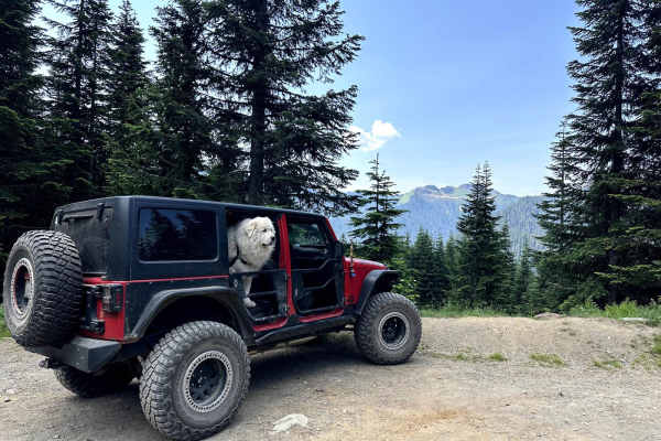
This 15.2 miles out and back trail heads up to the Damfino Lakes Hiking Trailhead, which becomes a multi-use trail from 1 AUG to 30 SEP for horses and motorcycles. This road gives excellent views of Church, Bearpaw, and Excelsior Mountains with Mount Baker in the background. This road is passable by...
Learn more about Canyon Creek Road
Canyon Ridge Road
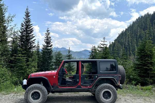
This 14-mile out-and-back trail climbs up to the canyon Ridgeline and ends at the canyon ridge trailhead (motorcycle trail). This trail gives great views of Bald Mountain and the Canyon valley area. There is a dispersed camping area along this road. The trail starts paved and then is a gravel forest...
Learn more about Canyon Ridge Road
Glacier Creek Road
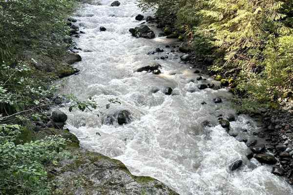
This 5.4 mile out and back trail once accessed several backcountry hiking trails and views of the glaciers on Mt. Baker. This road has been washed out by the creek in multiple areas and has been closed to motorized vehicles at 2.9 miles but still open for hiking. This trail is passable by 2WD, AWD, ...
Learn more about Glacier Creek Road
Nooksack River Trail
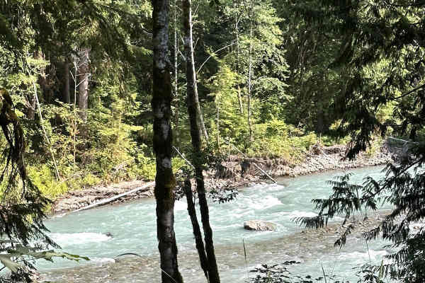
This 6.2 mile out and back trail used to run along the Nooksack River and then up the Wells Creek Valley, but a washout on the road around 3.4 miles in has closed the upper portion to vehicles. This area has several dispersed camping areas along the Nooksack River. This road is passable by 2WD, AWD,...
Learn more about Nooksack River Trail
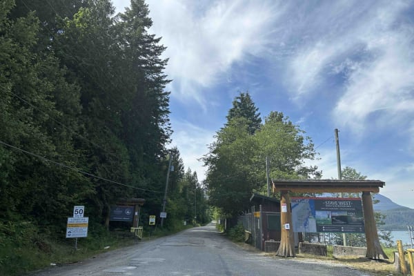
Florence Lake FSR
Florence FSR runs along the west side of Stave Lake. There is a Dam and Generating Station on Stave Lake that you can cross if you want to explore the east side of the lake. The road to Rock Creek is well maintained and most vehicles should be able to make the trek. However, the washboarding is pret...
Learn more about Florence Lake FSR
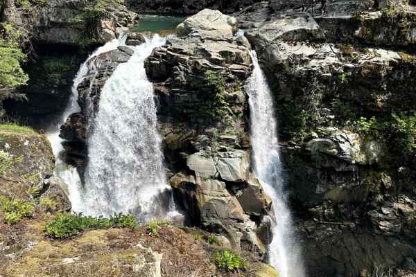
Well's Creek Road
This 24.4-mile out-and-back trail runs along Wells Creek and ends at the Cougar Divide Trailhead. This trail has many beautiful views of Mt. Baker and the surrounding canyons. Nooksack Falls is the most popular waterfall along this trail, but there are several other waterfalls to see. The trail is a...
Learn more about Well's Creek Road
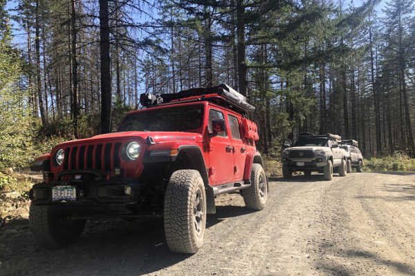
West Harrison to 20 Mile Bay
West Harrison to 20 Mile Bay is an ideal route for scenic explorers and beginner offroaders looking to experience the rugged beauty of Harrison Lake along a forest service road in British Columbia. Spanning approximately 30.5 miles, this point-to-point trail begins near the Sasquatch Inn and follows...
Learn more about West Harrison to 20 Mile Bay
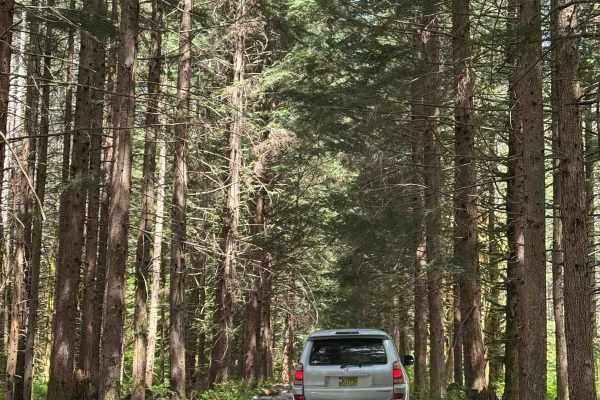
Salsbury Lake Trail
This short trail will take you along the Lost Creek Forest Service Road terminating at Salsbury Lake Recreation Site. The trail is well maintained for the majority of the trip, with some sections prone to large potholes. Expect loose rocks and steep sections throughout the trail with multiple water ...
Learn more about Salsbury Lake Trail
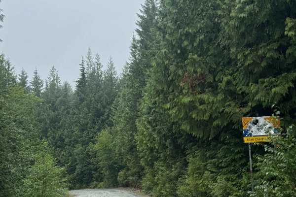
Fire Creek Swimming Hole
This is a narrow, one-vehicle-wide gravel forest road with room to pass that travels past the Fire Creek Swimming Hole. There are a couple of spots for camping near the swimming hole, and the road ends at a bright yellow gate about a mile from Stave Lake that is posted as private with no public acce...
Learn more about Fire Creek Swimming Hole
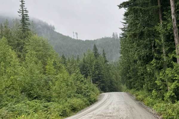
Lost Creek
This is a gravel forest road that leads you into a network of trails. The route is wide enough for two vehicles most of the way, with several one-lane bridges. There are turnouts should you encounter other vehicles. There are minor washboards and potholes, but overall this is an easy route that is s...
Learn more about Lost Creek
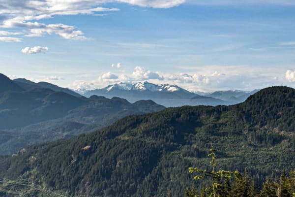
Mount Woodside
This trail starts out as two car widths wide and has a few steep sections along the way. You'll find yourself going through beautifully forested areas, as well as cut blocks, with periodic spots to stop and take photos of the view below. At 4.2 km, it's worth taking the spur to the left to the hang ...
Learn more about Mount Woodside
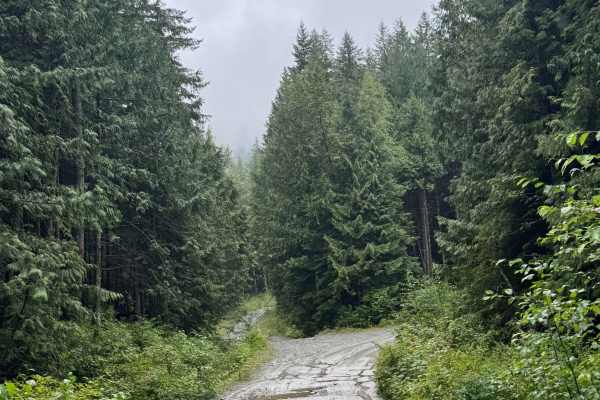
Lost Twin
This is a gravel forest road with some rock in the trail. The trail gradually climbs nearly 500 feet over 1.7 miles to a dead-end campsite at Twin Lakes. The trail is narrow and one vehicle wide, with overgrown vegetation and tight trees the last quarter mile. There are many humps/whoops and one ver...
Learn more about Lost Twin
Marten Lake
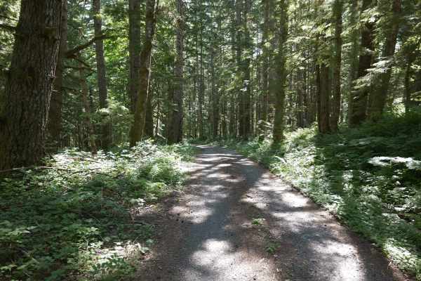
An enjoyable forest service road that has a little of everything you can expect from a drive deep into the Pacific Northwest woods. Beautiful scenery is found throughout, including two bridges crossing over the beautiful Park & Morovitz creeks. If you stick with it all the way to the top, at around ...
Learn more about Marten Lake
Bridal Falls FSR
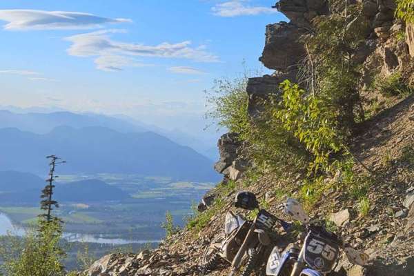
Bridal Falls FSR is a fairly steep and rough route. 4x4 is a definite requirement as the road is unmaintained and with lots of loose rock and deep cross ditches. Vehicles can only go 3/4 of the way due to a landslide that happened in the 80's. After the landslide, the trail is open to hiking or dirt...
Learn more about Bridal Falls FSR
NF Road 1131
This National Forest Road leads up to the Boulder Ridge Trailhead. This trail is full of twists and turns and is unmaintained and quite overgrown--guaranteed to leave pinstripes. It is dirt and gravel with some off-camber obstacles, deep ruts, and small water runoffs. The trailhead itself is quite b...
Learn more about NF Road 1131
Baker River Road
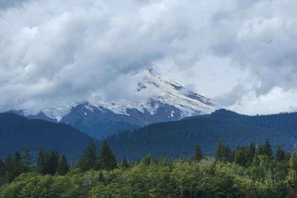
Baker River Road is a combination of paved, dirt and gravel roads at varying points. This is an easy and not rutted out and back trail that drives around multiple locations of Baker Lake, including the swimming and boat launch areas. There are multiple dispersed camping locations directly on the sid...
Learn more about Baker River Road
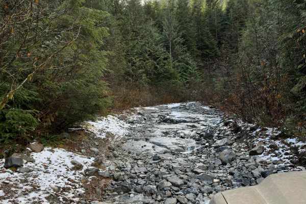
Kenyon Lake Trail
This is a short but technical trail to a beautiful hidden lake. You will find various obstacles such as washouts with logs, loose rock hill climbs, root sections, and optional rock faces with two routes. A spotter is recommended if you're new to the trail, and 33" tires minimum with 2"+ lift is reco...
Learn more about Kenyon Lake Trail
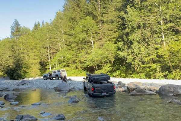
Grotto Falls
Grotto Falls Trail winds through and up the coastal mountains of British Columbia, ending at a lovely waterfall swimming hole. The majority of the trail follows a forest service road, with the final few kilometers being the roughest part of the journey. The forest service road winds through the beau...
Learn more about Grotto Falls
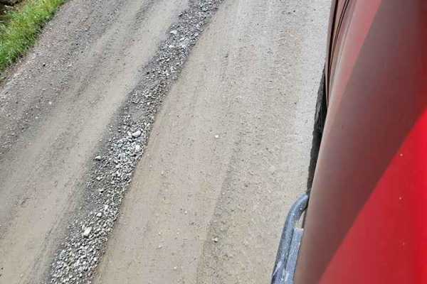
Trail Ridge Road
Trail Ridge Road is an easy, windy, single-width Forest Service gravel and dirt road that takes you up and around the Baker Lake area. It is a mostly well-maintained dirt road with minimal potholes, a few small water run-offs, and gorgeous views. You do need to cross the dam to get to this section o...
Learn more about Trail Ridge Road
ATV trails near Nooksack, Washington
Explore ATV-friendly trails near you. These trails are accessible for vehicles up to 50 inches wide, perfect for ATVs and smaller off-road machines.
Middle Fork Nooksack - FS 38
Middle Fork Nooksack is a 12.6-mile out-and-back gravel road located east of Deming and ending at Ridley Creek Trailhead. The road surface gets procedurally rougher, starting as a wide gravel road with some potholes and ending as a tight trail with some ruts and large deep potholes. The first 4.8 mi...
Learn more about Middle Fork Nooksack - FS 38
Canyon Creek Road
This 15.2 miles out and back trail heads up to the Damfino Lakes Hiking Trailhead, which becomes a multi-use trail from 1 AUG to 30 SEP for horses and motorcycles. This road gives excellent views of Church, Bearpaw, and Excelsior Mountains with Mount Baker in the background. This road is passable by...
Learn more about Canyon Creek Road
Canyon Ridge Road
This 14-mile out-and-back trail climbs up to the canyon Ridgeline and ends at the canyon ridge trailhead (motorcycle trail). This trail gives great views of Bald Mountain and the Canyon valley area. There is a dispersed camping area along this road. The trail starts paved and then is a gravel forest...
Learn more about Canyon Ridge Road
Glacier Creek Road
This 5.4 mile out and back trail once accessed several backcountry hiking trails and views of the glaciers on Mt. Baker. This road has been washed out by the creek in multiple areas and has been closed to motorized vehicles at 2.9 miles but still open for hiking. This trail is passable by 2WD, AWD, ...
Learn more about Glacier Creek Road
UTV/side-by-side trails near Nooksack, Washington
Find UTV and side-by-side trails near you. These trails accommodate vehicles up to 60 inches wide, ideal for UTVs, side-by-sides, and wider off-road rigs.
Middle Fork Nooksack - FS 38
Middle Fork Nooksack is a 12.6-mile out-and-back gravel road located east of Deming and ending at Ridley Creek Trailhead. The road surface gets procedurally rougher, starting as a wide gravel road with some potholes and ending as a tight trail with some ruts and large deep potholes. The first 4.8 mi...
Learn more about Middle Fork Nooksack - FS 38
Canyon Creek Road
This 15.2 miles out and back trail heads up to the Damfino Lakes Hiking Trailhead, which becomes a multi-use trail from 1 AUG to 30 SEP for horses and motorcycles. This road gives excellent views of Church, Bearpaw, and Excelsior Mountains with Mount Baker in the background. This road is passable by...
Learn more about Canyon Creek Road
Canyon Ridge Road
This 14-mile out-and-back trail climbs up to the canyon Ridgeline and ends at the canyon ridge trailhead (motorcycle trail). This trail gives great views of Bald Mountain and the Canyon valley area. There is a dispersed camping area along this road. The trail starts paved and then is a gravel forest...
Learn more about Canyon Ridge Road
Glacier Creek Road
This 5.4 mile out and back trail once accessed several backcountry hiking trails and views of the glaciers on Mt. Baker. This road has been washed out by the creek in multiple areas and has been closed to motorized vehicles at 2.9 miles but still open for hiking. This trail is passable by 2WD, AWD, ...
Learn more about Glacier Creek Road
The onX Offroad Difference
onX Offroad combines trail photos, descriptions, difficulty ratings, width restrictions, seasonality, and more in a user-friendly interface. Available on all devices, with offline access and full compatibility with CarPlay and Android Auto. Discover what you're missing today!
Open Trail Map