
Dirt Bike Trails
Near Murphys, California
Explore All Dirt Bike Trails Near Murphys, California
Dirt Bike Trails Near Murphys, California
Discover the best dirt bike trails near you. Browse trail maps, check difficulty ratings, and find your next adventure — whether you're looking for a quick ride or an all-day expedition.

Stanislaus Forebay
This a very easy trail and is mostly forest roads that zig-zag up the hill to the Forebay. This can be accessed from many ways whether it be from Columbia, Twain Harte, or Camp 9. The Camp 9 entrance is the fastest way in and is a pretty drive looking over the Stanislaus River. Fishing? Try the Fore...
Learn more about Stanislaus Forebay
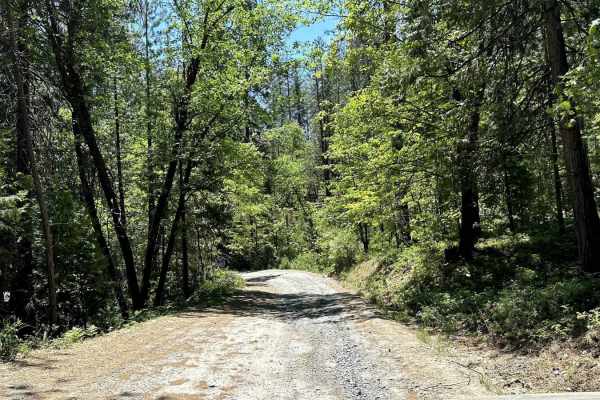
Candy Rock Road
As of May 26, 2023. This road is accessible by vehicles of higher clearance than sedans. This is due to the fire road are not as flat and maintained as Google Maps makes it out to be. When driving on the road, there will be moderately size ruts, and bumps running across the width of the road due to ...
Learn more about Candy Rock Road

Forebay to American Camp
This trail is a connector between the American Camp Lookout and the Forebay trail. Connect all these 3 trails for a fun weekend or day trip full of adventure and fishing/exploring! There is a creek crossing as well as a bridge crossing with some swimming holes. Be prepared for some mud and ruts, es...
Learn more about Forebay to American Camp
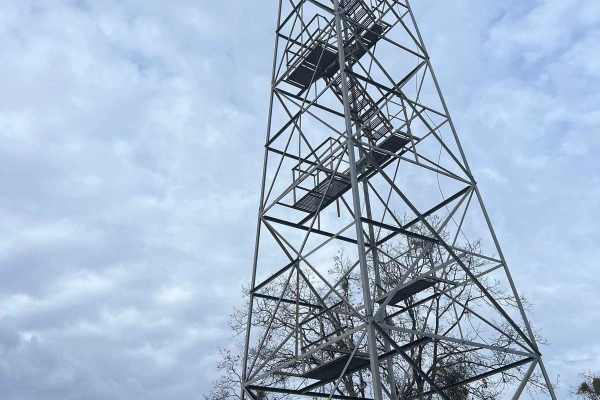
American Camp Lookout
This is a super pretty drive as it descends into the canyons and back up to the mountaintops. On your way to the lookout, you will drive through the Italian Bar/Lost Dutchman Mining Camp, which is a cool place to either pay to camp or you can pay and go gold panning in the river. After leaving there...
Learn more about American Camp Lookout

Candy Rock Road P.2
As of May 26, 2023. This road is accessible by vehicles of higher clearance than sedans. This is because the fire roads are not as flat and maintained as Google Maps makes them out to be. When driving on the road, there will be moderately size ruts, and bumps running across the width of the road due...
Learn more about Candy Rock Road P.2
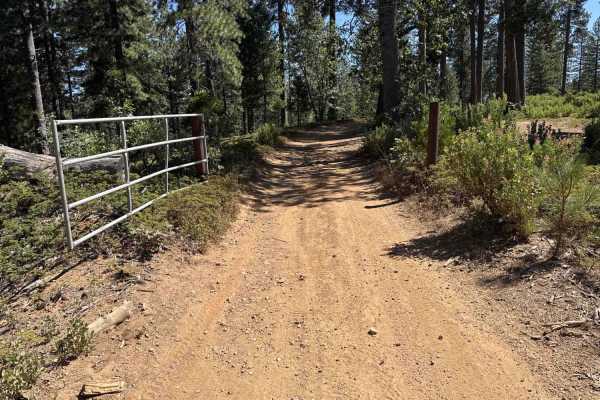
FS 5N56
Connecting the White Pines Lake recreational area with neighboring backcountry routes, Forest Service Road 5N56 serves as an accessible forest thoroughfare within the Stanislaus National Forest. The route winds through a shaded mixed-conifer environment dominated by tall ponderosa pines, incense ced...
Learn more about FS 5N56
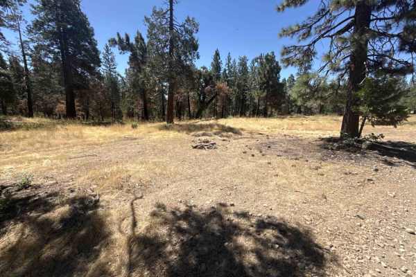
FS 5N52
Forest Service Road 5N52 serves as an essential backcountry connector linking recreational staging areas, camping clearings, and branching motorized routes within the Stanislaus National Forest. The route winds through a mixed-conifer woodland characterized by towering ponderosa pines, mature incens...
Learn more about FS 5N52
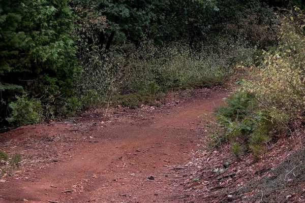
15EV111
This is a wide and easy ATV trail that goes through the southwest corner of the Interface OHV trail system for 1.7 miles. This one is mostly just a wide access corridor that accesses several other trails, and then you can take this to return to the beginning or staging area instead of having to take...
Learn more about 15EV111
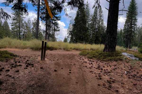
15EV65
This is a very easy ATV trail that is less than half a mile long, and has no technical elements. It is very wide, smooth, straight and fast, making it ideal for riders of all skill levels. It doesn’t have any rocks or obstacles. It gently curves through the forest of tall oak, cedars and pines, lin...
Learn more about 15EV65
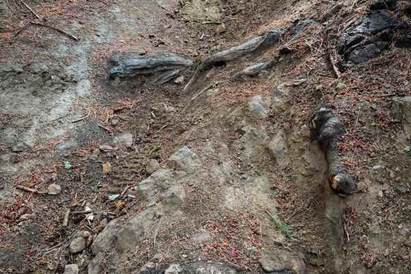
15EV59
This is a 0.6 mile long dirt bike trail that has some deeper rutted sections making it slightly more technical. The east end starts out pretty rutted, dropping off of the ATV trail 15EV111, and going down a couple small and uneven rut and root ledges. It descends pretty steeply through the forest fo...
Learn more about 15EV59
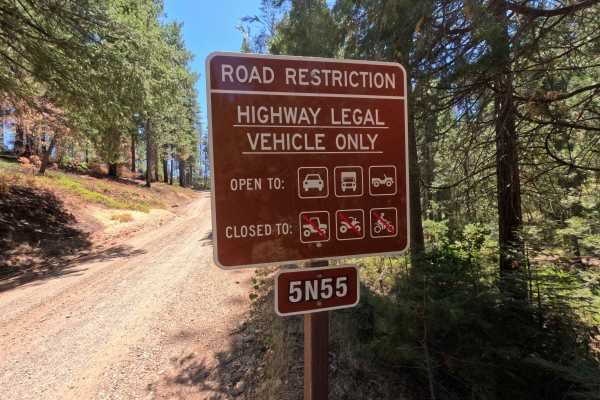
Mandel Rd - FS 5N55
Mandel Road - FS Road 5N55 serves as a smooth connector link bridging Forest Road 5N56 and Forest Road 7N08 near the White Lake area. Set within the Stanislaus National Forest, the corridor travels through a shaded, verdant mixed-conifer woodland framed by towering pines, incense cedars, and lush gr...
Learn more about Mandel Rd - FS 5N55
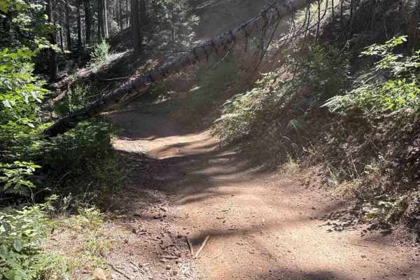
FS 5N41Y
Branching off Forest Service Road 5N52 at the staging area, FS 5N41Y serves as a backcountry connector linking into the surrounding motorized trail network within the Stanislaus National Forest. The route winds through a shaded mixed-conifer woodland characterized by towering pines, fragrant cedars,...
Learn more about FS 5N41Y
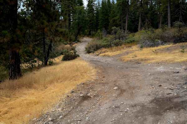
15EV73
This is a wide and easy ATV trail that starts out on the south end lined with small manzanita shrubs and under towering pine trees. It has small loose rocks and shallow ruts, gradually ascending up a hillside, but is mostly a smooth dirt path. It gets a bit narrow in a couple spots between the shrub...
Learn more about 15EV73

15EV61
The south end of this trail starts at an intersection with 15EV60, and it steeply climbs up for less than half a mile until it connects with the ATV trail 15EV73. The entire route is a narrow and shelfy trail cut into the hillside, lined with pines and manzanitas. It hugs the hillside, with small lo...
Learn more about 15EV61
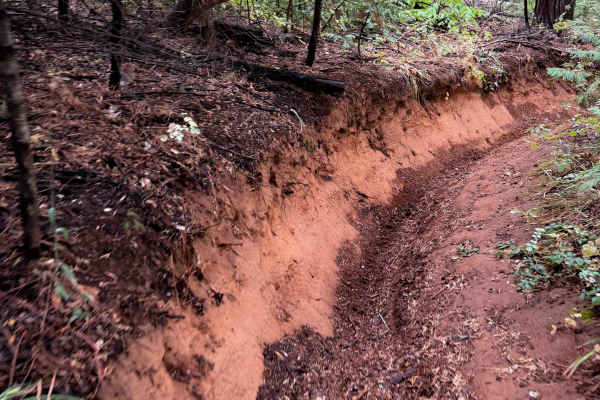
15EV63
This is a short and easy trail in the Interface Trail System that winds through the forest. Its east entrance starts on FS 5N41Y and it zig zags west for 1.2 miles. The beginning has some deeper ruts and troughed out sections, sometimes dug out a foot below the forest floor. There are a few embedded...
Learn more about 15EV63
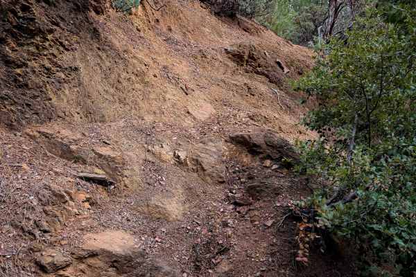
15EV60
This is one of the longer and more difficult trails within the Interface Trail System. The east entrance spurs off of 15EV62, and it starts steeply descending down a deeply rutted path with small loose rocks. Some of the ruts are at least a foot deep, and it side-hills down an exposed hillside lined...
Learn more about 15EV60
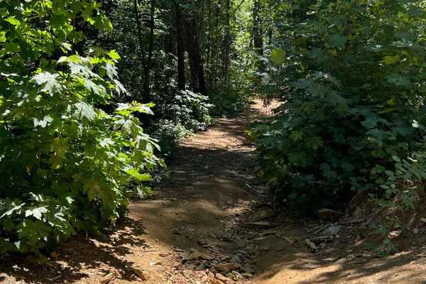
Keltz Mine
This trail is steep, overgrown, and narrow. Typically home to lots of poison oak and fallen trees but the reward at the end is totally worth it! Keltz Mine road takes you down to the South Fork Stanislaus River and ends at a camping area. There are fish and swimming holes and slippery rocks so bewar...
Learn more about Keltz Mine

15EV105
This is a wide and easy ATV trail that cuts through the middle of the Interface OHV trail system, acting as an easy access route to access several other trails. It has minor loose rock and shallow ruts, but mostly is smooth dirt. It’s lined with bear clover, and goes through a sparse forest of tower...
Learn more about 15EV105
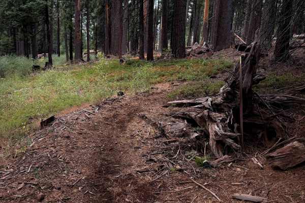
15EV68
15EV68 is a short and easy dirt bike trail that mostly just curves through the forest on a narrow single track on smooth dirt for .7 miles. The trail goes through several previously cut logs, and looks like it gets maintained for any downfall. It goes up and down small hills and meanders through the...
Learn more about 15EV68
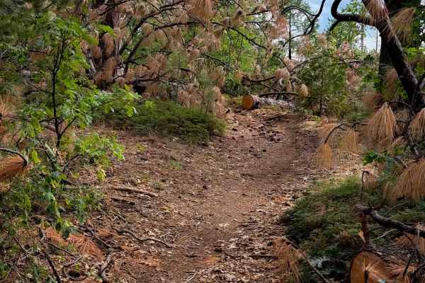
15EV58
This short dirt bike trail weaves between a tight corridor of oaks and shrubs, with towering pine trees. It meanders along the hillside through the tight bushes, often overgrown and whacking you in the face and blocking visibility. Several downed logs have been cut, keeping the trail clear, but ther...
Learn more about 15EV58
ATV trails near Murphys, California
Explore ATV-friendly trails near you. These trails are accessible for vehicles up to 50 inches wide, perfect for ATVs and smaller off-road machines.
Stanislaus Forebay
This a very easy trail and is mostly forest roads that zig-zag up the hill to the Forebay. This can be accessed from many ways whether it be from Columbia, Twain Harte, or Camp 9. The Camp 9 entrance is the fastest way in and is a pretty drive looking over the Stanislaus River. Fishing? Try the Fore...
Learn more about Stanislaus Forebay
Candy Rock Road
As of May 26, 2023. This road is accessible by vehicles of higher clearance than sedans. This is due to the fire road are not as flat and maintained as Google Maps makes it out to be. When driving on the road, there will be moderately size ruts, and bumps running across the width of the road due to ...
Learn more about Candy Rock Road
Forebay to American Camp
This trail is a connector between the American Camp Lookout and the Forebay trail. Connect all these 3 trails for a fun weekend or day trip full of adventure and fishing/exploring! There is a creek crossing as well as a bridge crossing with some swimming holes. Be prepared for some mud and ruts, es...
Learn more about Forebay to American Camp
American Camp Lookout
This is a super pretty drive as it descends into the canyons and back up to the mountaintops. On your way to the lookout, you will drive through the Italian Bar/Lost Dutchman Mining Camp, which is a cool place to either pay to camp or you can pay and go gold panning in the river. After leaving there...
Learn more about American Camp Lookout
UTV/side-by-side trails near Murphys, California
Find UTV and side-by-side trails near you. These trails accommodate vehicles up to 60 inches wide, ideal for UTVs, side-by-sides, and wider off-road rigs.
Stanislaus Forebay
This a very easy trail and is mostly forest roads that zig-zag up the hill to the Forebay. This can be accessed from many ways whether it be from Columbia, Twain Harte, or Camp 9. The Camp 9 entrance is the fastest way in and is a pretty drive looking over the Stanislaus River. Fishing? Try the Fore...
Learn more about Stanislaus Forebay
Candy Rock Road
As of May 26, 2023. This road is accessible by vehicles of higher clearance than sedans. This is due to the fire road are not as flat and maintained as Google Maps makes it out to be. When driving on the road, there will be moderately size ruts, and bumps running across the width of the road due to ...
Learn more about Candy Rock Road
Forebay to American Camp
This trail is a connector between the American Camp Lookout and the Forebay trail. Connect all these 3 trails for a fun weekend or day trip full of adventure and fishing/exploring! There is a creek crossing as well as a bridge crossing with some swimming holes. Be prepared for some mud and ruts, es...
Learn more about Forebay to American Camp
American Camp Lookout
This is a super pretty drive as it descends into the canyons and back up to the mountaintops. On your way to the lookout, you will drive through the Italian Bar/Lost Dutchman Mining Camp, which is a cool place to either pay to camp or you can pay and go gold panning in the river. After leaving there...
Learn more about American Camp Lookout
The onX Offroad Difference
onX Offroad combines trail photos, descriptions, difficulty ratings, width restrictions, seasonality, and more in a user-friendly interface. Available on all devices, with offline access and full compatibility with CarPlay and Android Auto. Discover what you're missing today!
Open Trail Map