
Dirt Bike Trails
Near Mount Charleston, Nevada
Explore All Dirt Bike Trails Near Mount Charleston, Nevada
Dirt Bike Trails Near Mount Charleston, Nevada
Discover the best dirt bike trails near you. Browse trail maps, check difficulty ratings, and find your next adventure — whether you're looking for a quick ride or an all-day expedition.
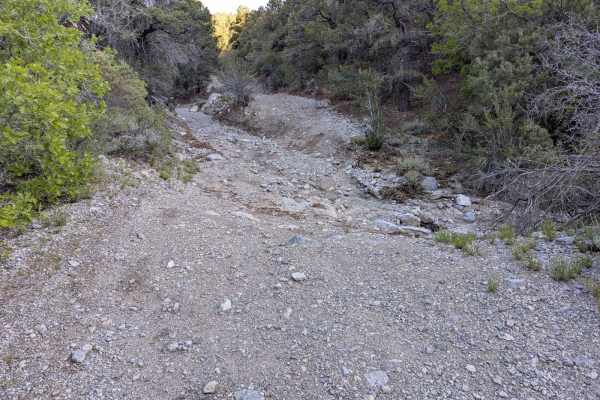
Telephone Canyon Road (530)
Telephone Canyon Road connects highway 157 (Kyle Canyon) to 158 (Deer Creek Road). It is a 2-track trail that runs up a canyon wash in the forest and can shift with heavy rains. The trail surface is mostly loose gravel and rock. In the winter, it can have deep snow. There are some wash crossings wit...
Learn more about Telephone Canyon Road (530)
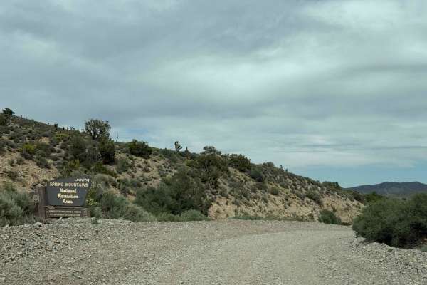
Harris Springs Cutoff Road
This trail starts in the Spring Mountains Recreational Area and ends in the Red Rock National Conservation Area managed by the BLM. The area within the BLM boundaries is known as the Harris Springs Recreation Area. The main purpose of this trail is to provide access to the Prospect Springs Road as w...
Learn more about Harris Springs Cutoff Road

Champion Road
This trail is a short forest service road that provides access from Deer Creek Road to State Route 156. In the trail, you can find small offshoots that provide opportunities for dispersed camping or day use recreation. This trail is a graded dirt road accessible by RVs and trailers; please note that...
Learn more about Champion Road
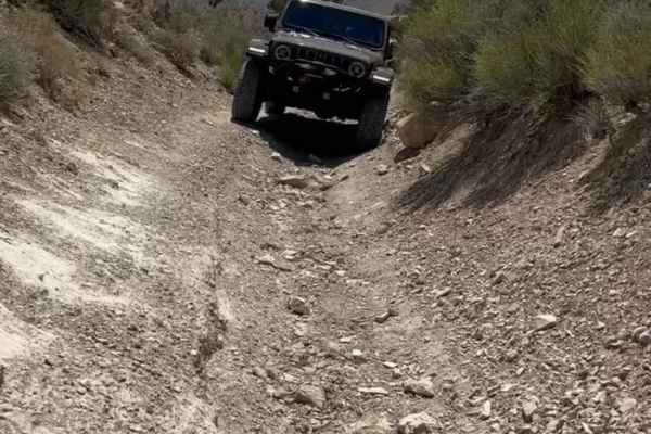
Lucky Strike Road
The trail starts off of Kyle Canyon Rd (Highway 157) and takes you into Grapevine Canyon in Mount Charleston. 4WD is recommended. The first part of the trail is pretty easy with some sandy areas that lead to Grapevine Springs. This is a beautiful canyon with a lot of greenery, as you continue past t...
Learn more about Lucky Strike Road

Spring Mountain Recreation Area - Side Trail 01
This side trail starts off of Lovell Road, about 17 miles from Nevada Highway 160. The road starts out from NV 160 as Trout Canyon Road and at mile 7, you take the right fork which is Lovell Road. Both these are wide, level dirt and gravel roads. When you turn right off of Lovell Road, you will be o...
Learn more about Spring Mountain Recreation Area - Side Trail 01

Loop Boundary Road
Loop Boundary Road is a scenic 3.2-mile trail in the Spring Mountains near Las Vegas, perfect for stock four-wheel-drive vehicles and SxSs looking for a quick, rewarding escape with stunning panoramic vistas. Starting at an elevation of roughly 5,575 feet, the trail begins as a mostly level single-t...
Learn more about Loop Boundary Road
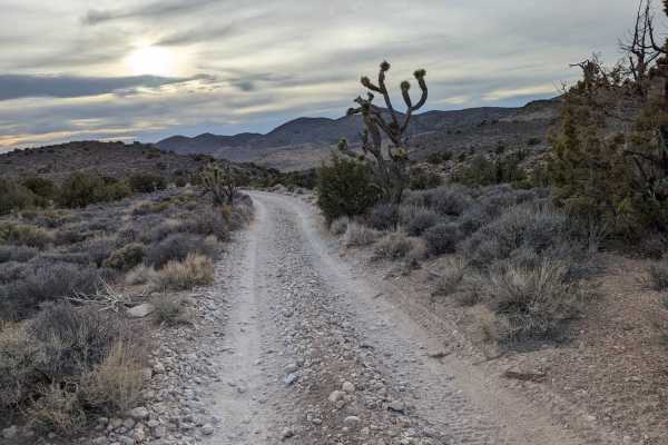
Johnswort Road
Relatively open, single-track road with a mostly dirt and loose rock surface. This road has some rough patches with rutting in parts and uneven, narrow sections. The trail passes Juniper, Joshua Trees, grass, and Sage vegetation. Good chance of spotting wild horses in this area, as evidenced by the ...
Learn more about Johnswort Road

Carpenter Canyon Trail
This is one of many fast and flowy single-track trails in the Pahrump BLM desert. Lots of short and easy trails make up this trail system that can all be ridden in a day or two. This one is a mix of narrow dirt trails and gravel washes. It flows over a couple of ridge lines on small rolling desert h...
Learn more about Carpenter Canyon Trail

Elk Meadow
This is one of the longer trails in the Pahrump BLM riding area and is a fast and fun winding trail through a beautiful Joshua Tree Forest. The trail is a steady decline/incline the entire way and is mostly road width. It's mostly dirt with loose rocks, sections of gravel, some easy rock slab sectio...
Learn more about Elk Meadow

Middle Elk Meadow Part 2
This section of the Middle Elk Meadow Trail is slightly more difficult than Part 1 due to a rockier surface, some small washouts, and lots of really low branches to watch out for sticking out over the trail. It winds in and out of a gravel wash with some loose rocks, and climbs out of the wash onto ...
Learn more about Middle Elk Meadow Part 2
Joshua Tree Wash
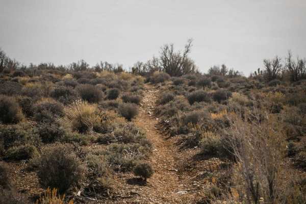
This is a short trail on BLM in Pahrump with epic views of Joshua trees and the Spring Mountains. The trail starts on a wider dirt path beneath Joshua trees and pine trees, and winds in and out of gravel washes and over several small hills. The washes are mostly smooth, easy trails with no obstacles...
Learn more about Joshua Tree Wash

Deer Creek - FS 45560
3Deer Creek has 2 sections: Deer Creek Road (FS 45560) and Deer Creek Spur Road (FS 45560A). This route begins on Lee Canyon Road (State Route 156) and heads South along Deer Creek. There is a parking area at Lee Canyon and Deer Creek Road, as well as a few other parking/camping spots in the first m...
Learn more about Deer Creek - FS 45560

Trout Canyon to Highway 160
Starting out from Trout Canyon, the trail is pleasant and easy with gravel/dirt washes, and then it gets tougher. There are portions of the trail that run through washes, and that area floods terribly so the washes are different each time the area gets rain. Several hills and sections required 4WD, ...
Learn more about Trout Canyon to Highway 160

Middle Elk Meadow Part 1
This is an easy wash trail on Pahrump BLM land. It's a mix of a wide gravel wash and a wide dirt trail. It's consistently easy the whole way with no obstacles except for a couple of small washouts. On the west end, it dumps onto a road, or you can turn southeast before hitting the road and continue ...
Learn more about Middle Elk Meadow Part 1
Carpenter Wash Bypass
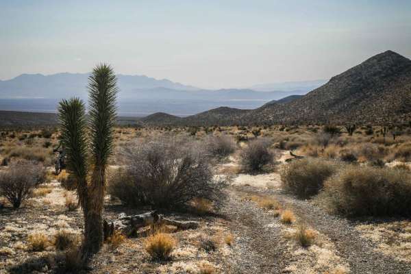
Carpenter Wash Bypass can be ridden in connection with several other single-track trails in the Pahrump BLM for a fun day ride in the desert. Stage off of Carpenter Canyon Road, or connect to this trail from Wheeler Pass by some of the jeep roads in this area. The north end of the trail peels off of...
Learn more about Carpenter Wash Bypass
Middle Elk Meadow Connector Trail
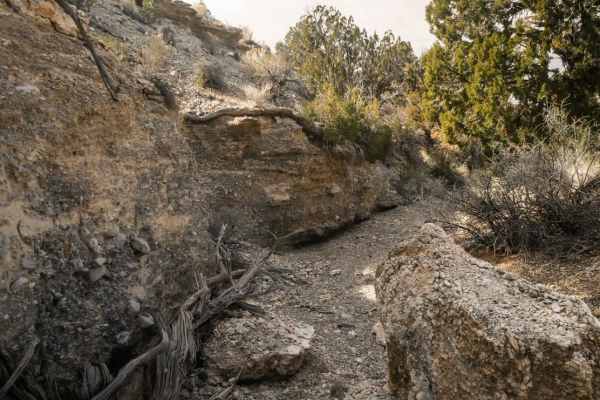
This is a short connector trail to connect Wheeler Wash to the Middle Elk Meadow single-track trail. It is mostly an easy and smooth gravel wash, with no difficult obstacles. It is a scenic trail with neat canyon rock wall features and beautiful Joshua trees. It's a shared-use trail with horseback r...
Learn more about Middle Elk Meadow Connector Trail
081 Bypass Trail
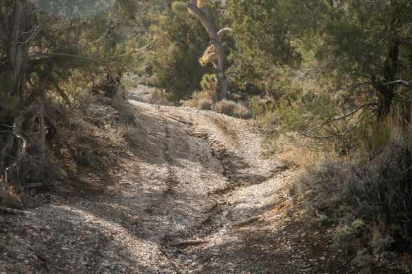
This is a short connector trail to connect Wheeler Pass Road to several other designated single-track trails in the Pahrump Riding Area. This trail starts as road width but narrows as it enters a wash, and is shared use with horseback riders. It's mostly a gravel surface on top of dirt and winds thr...
Learn more about 081 Bypass Trail
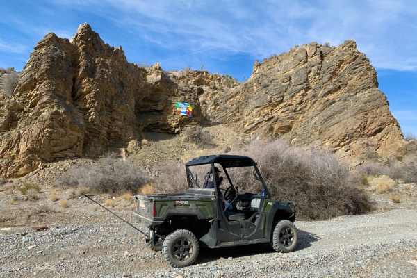
Upper Wheeler Wash
Upper Wheeler Wash offers an easy, highly scenic descent through a wide, meandering dry wash basin, making it ideal for beginners and scenic cruisers in four-wheel-drive vehicles, SxSs, and dirt bikes. This 4.1-mile route drops approximately 1,060 feet from its starting elevation of 5,365 feet down ...
Learn more about Upper Wheeler Wash
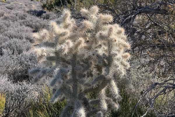
Wallace Canyon Road
Wallace Canyon Road is a scenic mountain climb on the west side of the Spring Mountains that offers four-wheel-drive enthusiasts and SxS riders a gradual but rewarding ascent with stunning desert vistas. Starting on Bureau of Land Management (BLM) land east of Pahrump, Nevada, this 6.6-mile route cl...
Learn more about Wallace Canyon Road
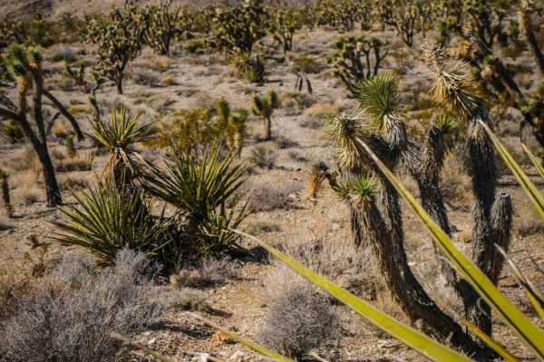
Carpenter Bypass
This trail is a short connector trail very similar to the other trails in the area, made up of a mix of dirt with loose rock and gravel washes. There are some bigger loose rocks in the middle of the trail to watch out for, and the trail is surrounded by Joshua Trees and Yucca. It's a slight decline ...
Learn more about Carpenter Bypass
ATV trails near Mount Charleston, Nevada
Explore ATV-friendly trails near you. These trails are accessible for vehicles up to 50 inches wide, perfect for ATVs and smaller off-road machines.
Telephone Canyon Road (530)
Telephone Canyon Road connects highway 157 (Kyle Canyon) to 158 (Deer Creek Road). It is a 2-track trail that runs up a canyon wash in the forest and can shift with heavy rains. The trail surface is mostly loose gravel and rock. In the winter, it can have deep snow. There are some wash crossings wit...
Learn more about Telephone Canyon Road (530)
Harris Springs Cutoff Road
This trail starts in the Spring Mountains Recreational Area and ends in the Red Rock National Conservation Area managed by the BLM. The area within the BLM boundaries is known as the Harris Springs Recreation Area. The main purpose of this trail is to provide access to the Prospect Springs Road as w...
Learn more about Harris Springs Cutoff Road
Lucky Strike Road
The trail starts off of Kyle Canyon Rd (Highway 157) and takes you into Grapevine Canyon in Mount Charleston. 4WD is recommended. The first part of the trail is pretty easy with some sandy areas that lead to Grapevine Springs. This is a beautiful canyon with a lot of greenery, as you continue past t...
Learn more about Lucky Strike Road
Spring Mountain Recreation Area - Side Trail 01
This side trail starts off of Lovell Road, about 17 miles from Nevada Highway 160. The road starts out from NV 160 as Trout Canyon Road and at mile 7, you take the right fork which is Lovell Road. Both these are wide, level dirt and gravel roads. When you turn right off of Lovell Road, you will be o...
Learn more about Spring Mountain Recreation Area - Side Trail 01
UTV/side-by-side trails near Mount Charleston, Nevada
Find UTV and side-by-side trails near you. These trails accommodate vehicles up to 60 inches wide, ideal for UTVs, side-by-sides, and wider off-road rigs.
Telephone Canyon Road (530)
Telephone Canyon Road connects highway 157 (Kyle Canyon) to 158 (Deer Creek Road). It is a 2-track trail that runs up a canyon wash in the forest and can shift with heavy rains. The trail surface is mostly loose gravel and rock. In the winter, it can have deep snow. There are some wash crossings wit...
Learn more about Telephone Canyon Road (530)
Harris Springs Cutoff Road
This trail starts in the Spring Mountains Recreational Area and ends in the Red Rock National Conservation Area managed by the BLM. The area within the BLM boundaries is known as the Harris Springs Recreation Area. The main purpose of this trail is to provide access to the Prospect Springs Road as w...
Learn more about Harris Springs Cutoff Road
Lucky Strike Road
The trail starts off of Kyle Canyon Rd (Highway 157) and takes you into Grapevine Canyon in Mount Charleston. 4WD is recommended. The first part of the trail is pretty easy with some sandy areas that lead to Grapevine Springs. This is a beautiful canyon with a lot of greenery, as you continue past t...
Learn more about Lucky Strike Road
Spring Mountain Recreation Area - Side Trail 01
This side trail starts off of Lovell Road, about 17 miles from Nevada Highway 160. The road starts out from NV 160 as Trout Canyon Road and at mile 7, you take the right fork which is Lovell Road. Both these are wide, level dirt and gravel roads. When you turn right off of Lovell Road, you will be o...
Learn more about Spring Mountain Recreation Area - Side Trail 01
The onX Offroad Difference
onX Offroad combines trail photos, descriptions, difficulty ratings, width restrictions, seasonality, and more in a user-friendly interface. Available on all devices, with offline access and full compatibility with CarPlay and Android Auto. Discover what you're missing today!
Open Trail Map