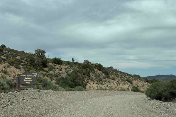
Spring Mountain Recreation Area - Side Trail 01

Total Miles 12.9
Technical Rating
5 Moderate
Best Time Summer, Fall, Spring
Trail Type Full-Width Road
Accessible By
Open Trail Map

Trail Overview

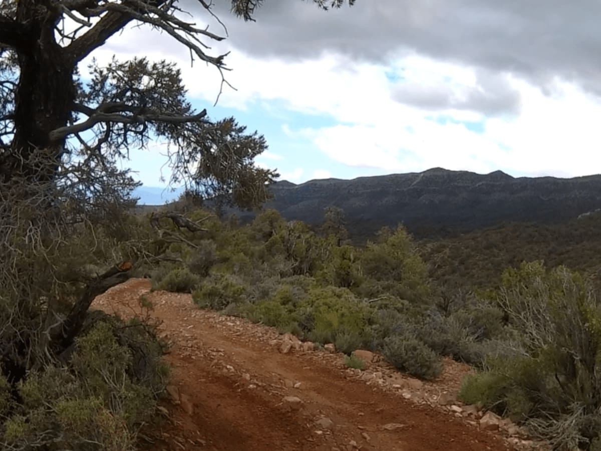
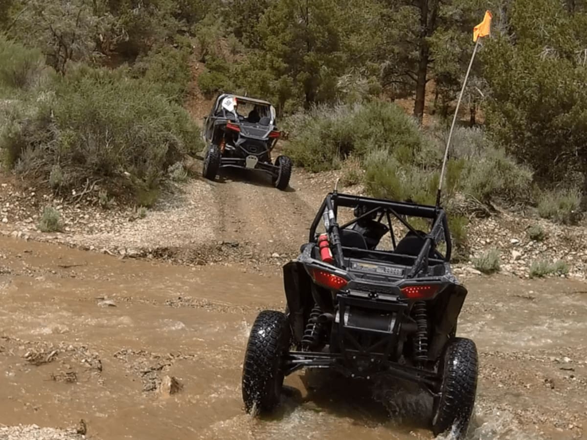
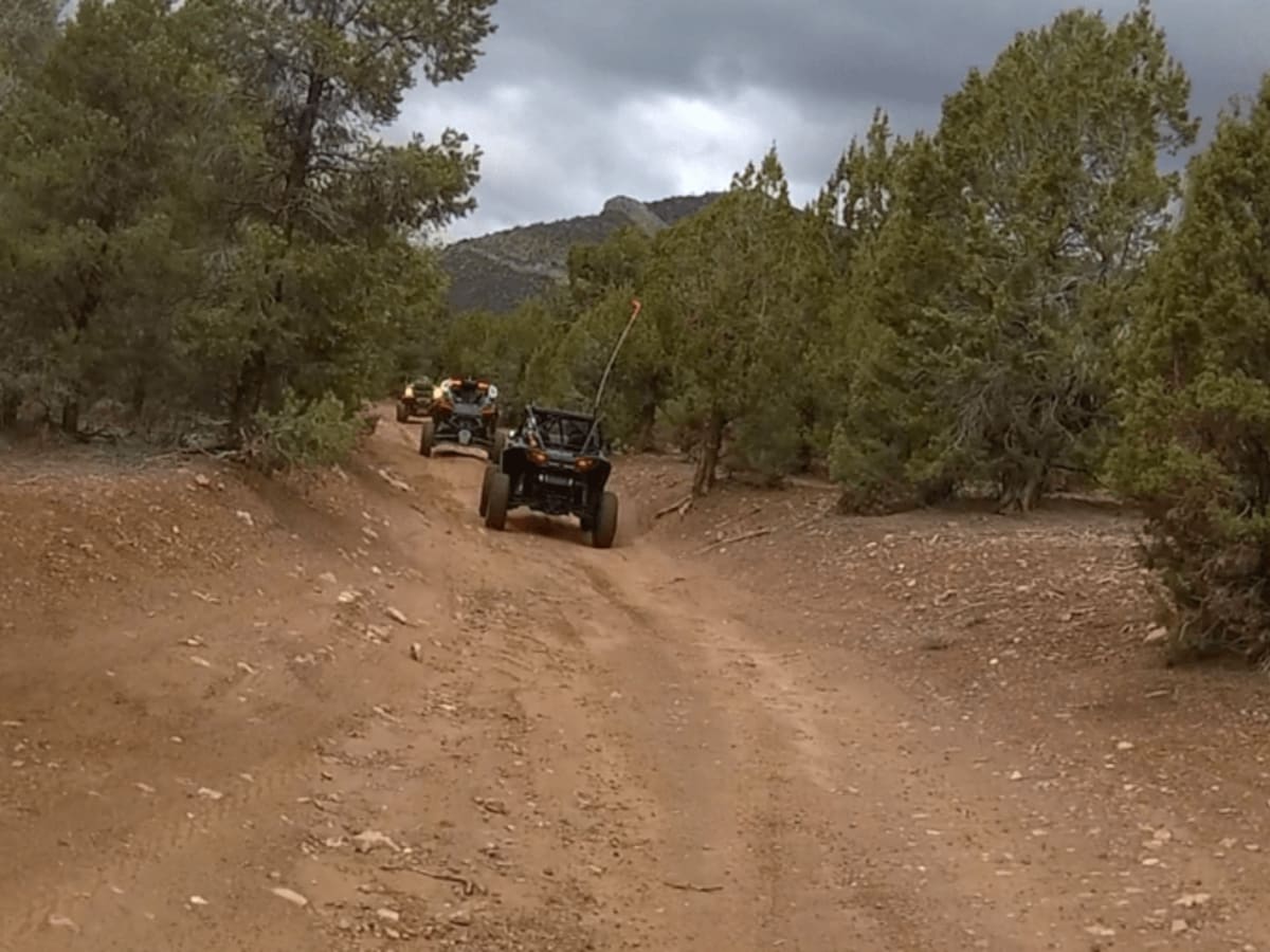
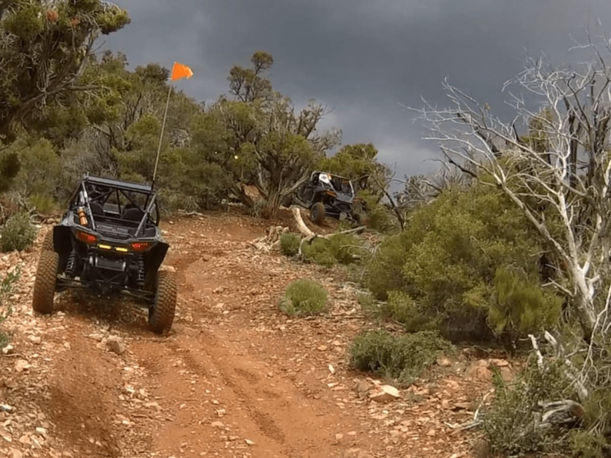
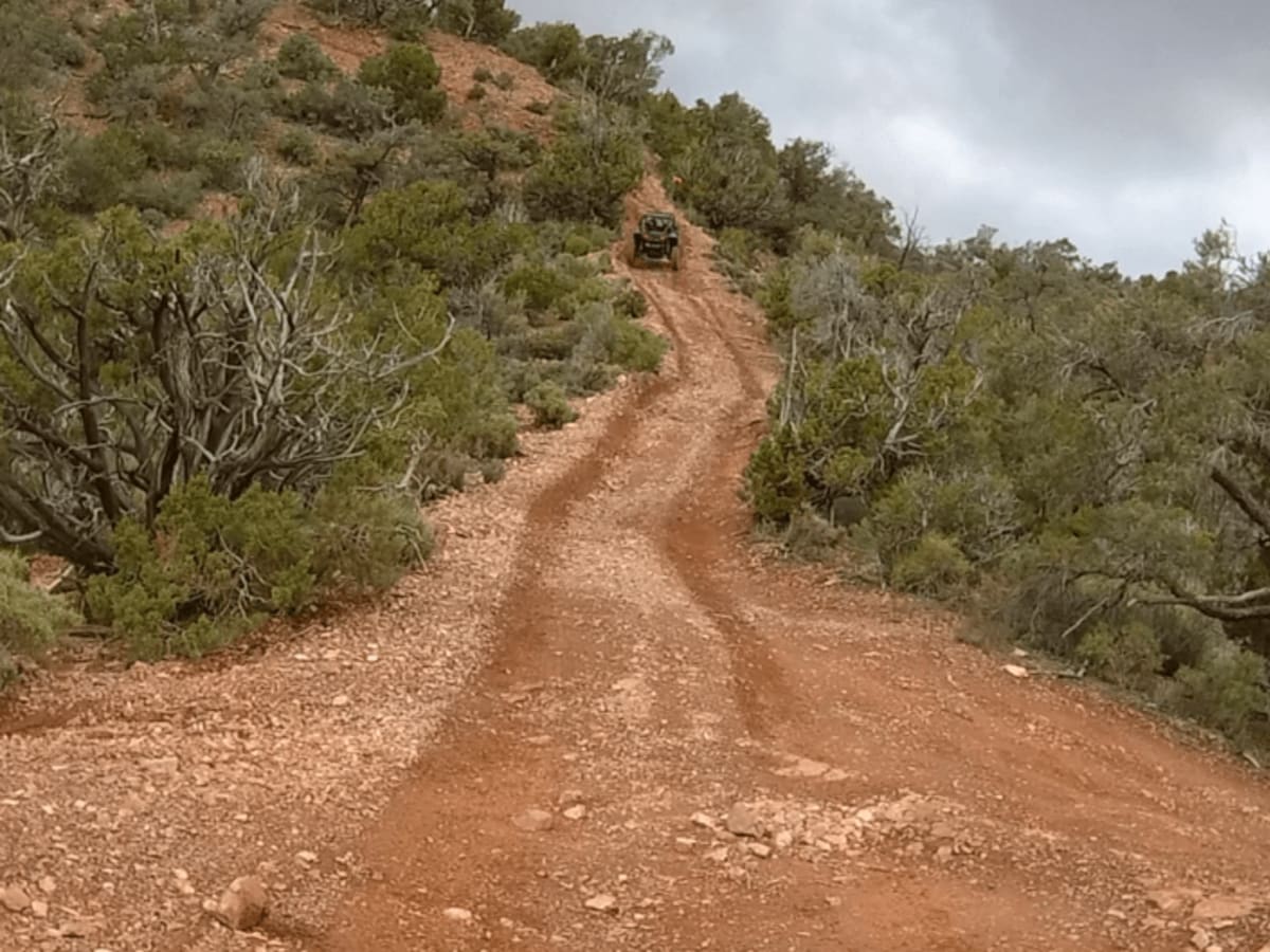
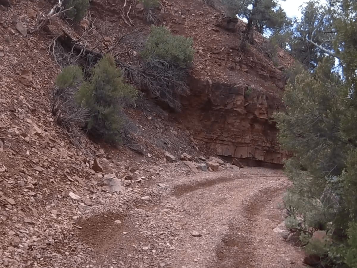
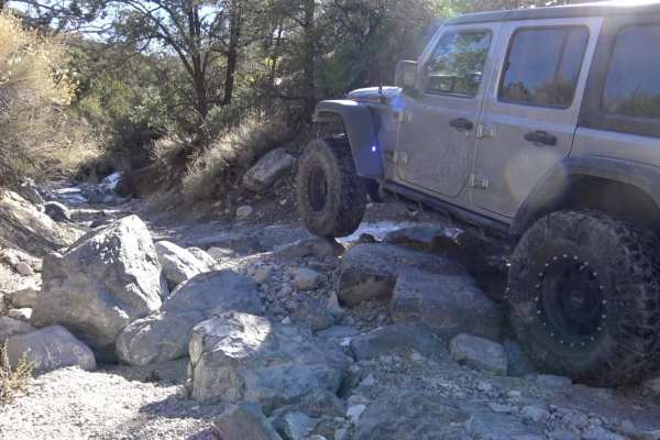
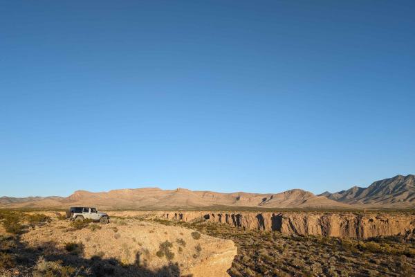
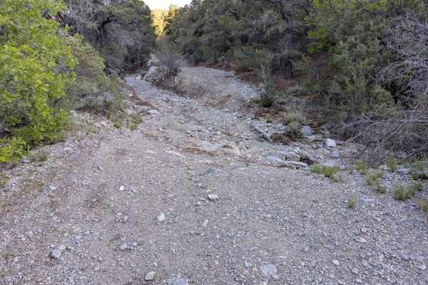
This side trail starts off of Lovell Road, about 17 miles from Nevada Highway 160. The road starts out from NV 160 as Trout Canyon Road and at mile 7, you take the right fork which is Lovell Road. Both these are wide, level dirt and gravel roads. When you turn right off of Lovell Road, you will be on Forest Service Road 45538. This double-wide trail turns into Forest Service Road 259334. After about 2.8 miles, you will stay left at the fork and the trail becomes 45539. The trail climbs into the mountains but is wide, flat, and easy. At 7.75 miles from Lovell Road, you will make a hard left turn onto Lost Cabin Spring Road 45545. The trail becomes narrower with rocky sections as it continues to climb into the mountains. After 1.75 miles from where you turned onto Lost Cabin Spring Road, you will make another left turn onto an unmarked trail. There is a soft steep uphill section that is rated intermediate and should be no problem if you are in 4-wheel drive and in low gear. At the top of the hill climb, the trail makes a sharp left turn and follows the ridgeline. The trail is again narrow but wide enough for full-size SxSs and Jeeps. There are a few slight off-camber sections but nothing too challenging. You will now begin a long slow downhill until you enter Lovell Wash after 2.75 miles. This section is very scenic with rock walls to the left and trees to the right.

Photos of Spring Mountain Recreation Area - Side Trail 01

Difficulty

There's a steep soft hill climb that requires 4-low, a few off-camber sections, and some tight rocky areas.

Technical Rating

5

Status Reports

Add Status Report
JEEP GOBIATOR
Nov 23, 2025
Open
Love this trail with amazing view made it all the way to the top, one part is very steep and narrow made it in 4 Lo in my jeep gladiator like nothing, other than that is super easy.
Nolan Acree
Jul 18, 2025
Open
Great ride. Extremely narrow trail but was easily done by a stock Ford Bronco. The incline was pretty difficult but managed. Loose dirt and rock made traction hard to find but deflating and 4L made it possible. Nice a cool in the 70’s so a great place to stop and eat lunch.
Jason W
Jun 30, 2025
Open
Very narrow. You WILL get pin strip no matter what. There are tree stumps and large boulders throughout the trail that will challenge your wheel placement. Depending on which route you take you either will be climbing or descending on the 28 degree peak. My 2 door rubicon did great even with the tight 90 degree turns. The map is not 100% accurate so you will have to get creative to find your way back to the trail. Overall I feel like this is a level 3-4 trail depending on your experience. Long based vehicles might find it more difficult. Very fun, very scenic and in the 80’s on a 110 degree day at the end of June.
TJ Vogelsang
Jan 19, 2025
Open
Slow and steady is key. This trail is NARROW. I had a stock height Silverado and I was rubbing some branches. There are a few steep inclines around 15°. The views were amazing and it was a nice challenge.
Jim Roal
May 18, 2024
Open
Steep climbs and drops with loose rocks and ruts as well as some loamy wash sections. Challenging on a bike. The North section is beautiful with evergreen cover.
Patrick Lim
Apr 21, 2024
Open
It's a very windy trail and slow, careful speed is the way to go. The trail got progressively narrower and I made it to a point where it was a liiiiitle too narrow for my comfort. The moment it started to look like a mountain bike trail I backed off and turned back. More of a side-by-side trail I would say. If you're afraid of pin-striping, def not the trail for you ;). It does have a very nice campsite at the beginning to the right though.

Spring Mountain Recreation Area - Side Trail 01 Trail can be accessed by the following ride types:

  • Single Track
  • 50 Inch
  • 60 Inch
  • High Clearance
  • Full Width

Spring Mountain Recreation Area - Side Trail 01 Map

The onX Offroad Difference

onX Offroad combines trail photos, descriptions, difficulty ratings, width restrictions, seasonality, and more in a user-friendly interface. Available on all devices, with offline access and full compatibility with CarPlay and Android Auto. Discover what you're missing today!

Open Trail Map