
Dirt Bike Trails
Near Mount Airy, Georgia
Explore All Dirt Bike Trails Near Mount Airy, Georgia
Dirt Bike Trails Near Mount Airy, Georgia
Discover the best dirt bike trails near you. Browse trail maps, check difficulty ratings, and find your next adventure — whether you're looking for a quick ride or an all-day expedition.
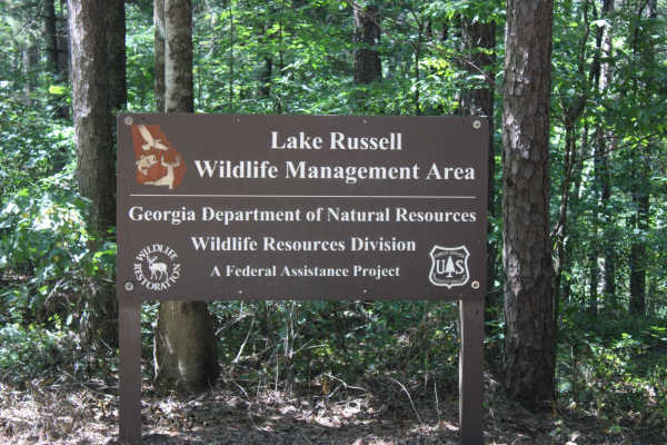
Georgia Mountain Orchard
Georgia Mountain Orchard Road is an easy route into the Lake Russel WMA. This route begins just outside of Cornelia, Georgia. This road can be driven in 2WD and is a relaxing trek overall. Driving south, you will encounter Austin Cemetery on the left. It is easy to pass if you are not looking for it...
Learn more about Georgia Mountain Orchard
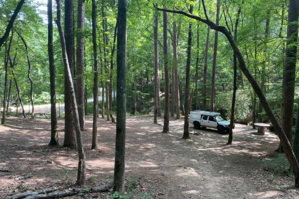
Brown Bottom Road
Brown Bottom Road is located in the center of a section of the Chattahoochee National Forest outside of Cornelia, GA. This road is wide, covered in large gravel and wide enough for two vehicles to pass in most sections. However, it's important to remember safe driving practices due to some steep cu...
Learn more about Brown Bottom Road
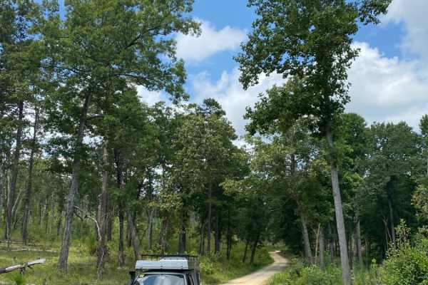
Guard Camp Road
Guard Camp Road is located in the Chattahoochee National Forest near Cornelia, GA. Nearby, you can visit Tallulah Gorge, view the waterfalls, explore downtown Clayton and fish in the numerous waterways. While camping is available throughout the region, this section of national forest seems less trav...
Learn more about Guard Camp Road
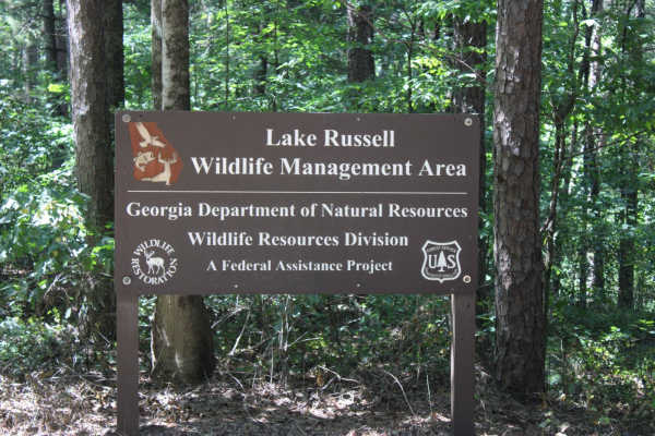
Red Root Road- FS 92
Red Root Road, also known as FSR 92, is a route that traverses the Lake Russel WMA from just outside Toccoa, GA to Mt. Airy, GA. This route can be used to access seasonal routes within the WMA area. Multiple areas can be found for camping, especially along the Middle Fork Broad River. If camping, p...
Learn more about Red Root Road- FS 92
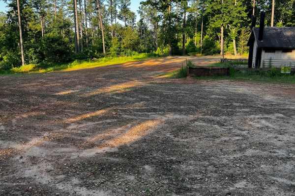
Locust Stake Moon Walk - 148F
Part of the Locust Stake OHV Trail system. This trail begins on the left side of the parking lot as you enter the trailhead. It loops around and back to itself, or near the end, you can turn and continue to the other trails here. This trail has a few moderately difficult rocky hills and one large ro...
Learn more about Locust Stake Moon Walk - 148F
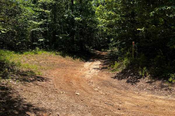
Locust Stake Ranger Run - 148
Part of the Locust Stake OHV system. The trail is for ATVs and Dirt Bikes. The trail is moderate to easy, clay hard base. The trail is 2-way, so be cautious and stay to the right. First trail to the right, leaving the trailhead staging area.
Learn more about Locust Stake Ranger Run - 148
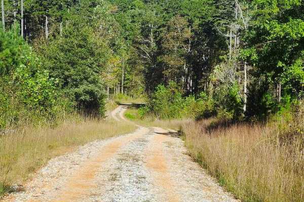
Beaver Swamp Trail
This scenic 2.6-mile, single-lane out-and-back trail winds through steep slopes, winding turns, and rolling dips, offering occasional passing areas, dispersed campsites, and short exploratory spurs. The route passes through private property boundaries and ends near a gated private property boundary ...
Learn more about Beaver Swamp Trail
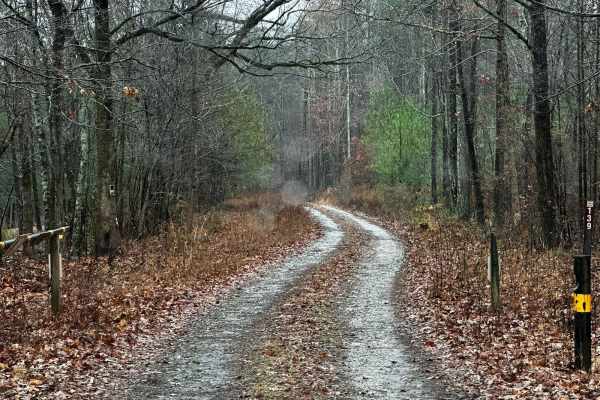
Black Mountain Road - FSR 139
Black Mountain Road is an out-and-back trail that gets you near the top of Black Mountain (1509ft). This route has a special designation and is only open from 8/30-1/9. This area is used for hunting, so be sure to be aware of your surroundings, and if you get out to hike to the top of the mountain, ...
Learn more about Black Mountain Road - FSR 139
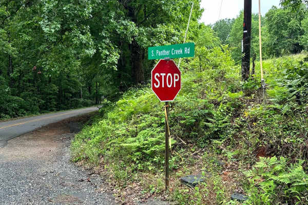
South Panther Creek Road (FSR 220)
FSR 220 is an out-and-back ride that starts at the junction of Black Mountain Road and South Panther Creek Road. You will turn left onto South Panther Creek Road. The end of the road is also accessible for a few houses, so pay close attention to the trail to avoid entering private property. The over...
Learn more about South Panther Creek Road (FSR 220)
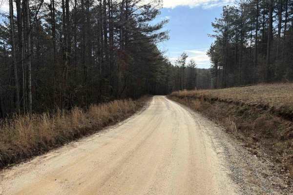
COL Hough Road
COL Hough Road connects US Route 23 at the east end and the Bear Gap Road at the west end of the trail. It is a gravel forestry road with some soft sand spots that can turn into 2-foot deep mud holes after heavy rain. The road is not always wide enough for two vehicles to pass. 4WD and High-Clearanc...
Learn more about COL Hough Road
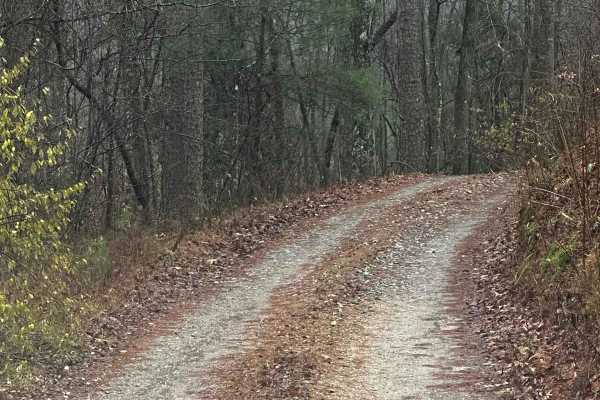
Honey Stand Road - FSR 184
Honey Stand Road is a short out-and-back trail that can be used to get closer access to the Panther Creek walking trail that leads to Panther Creek Falls. The road is graveled with little to no issues traversing. Most vehicles should be able to make it to the end with no issues. At the end, you will...
Learn more about Honey Stand Road - FSR 184
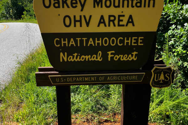
Oakey Mountain OHV
Oakey Mountain is the most difficult/extreme public OHV in Georgia. There are quite a few hills and rocky climbs. This is not a trail for beginners or even intermediates. There is a bike loading ramp in both the north and south parking lots and in the North Day Use Area. Here is a Vault with x6 park...
Learn more about Oakey Mountain OHV
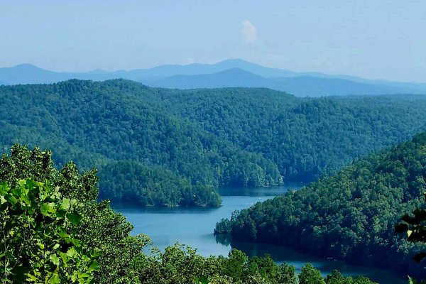
Tugalo Lake Trail
A very scenic 1.8-mile winding descent of gravel with a sand base that leads to historic Tugalo Dam and Yonah Campground on Tugalo Lake. Minor washouts occur within switchbacks, with viewing mirrors provided for safe travel for oncoming traffic. The campground offers a boat ramp, tent campsites with...
Learn more about Tugalo Lake Trail
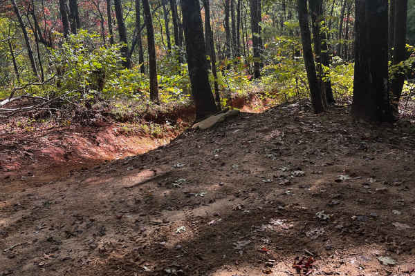
Ann's Gap - Oakley Mountain OHV
Extreme hill climb at Oakey Mountain. This is part of the original trail that has had a bypass installed to folks can at least get past. The USFS left this in rather than close it off since it's all rock and can't get much worse with time and erosion. It's already about as bad as it can get.
Learn more about Ann's Gap - Oakley Mountain OHV
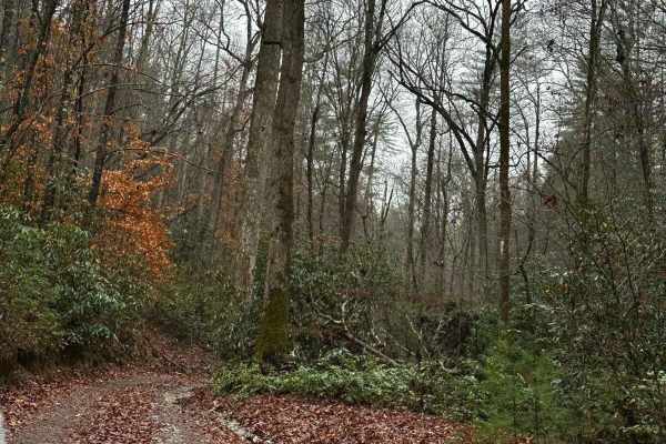
Falls Branch Road - FSR 2
Falls Branch Road is an out-and-back trail that takes roughly 1 Hour to complete. The trail is mostly single-vehicle wide with a few spots to pass if needed. The trail has a few ruts and rocks that could be tricky when wet. Overall, 4WD should not be needed unless wet. The trail ends in an area that...
Learn more about Falls Branch Road - FSR 2
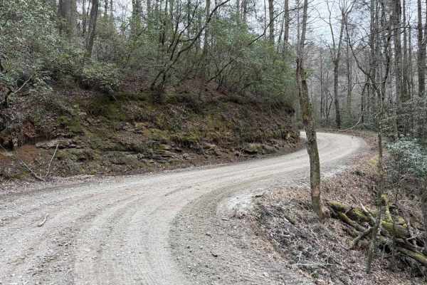
Bear Gap Road
The Bear Gap Road connects the Orchard Road at the east end and the Low Gap Road at the west end of the trail. The road takes you along the Tallulah River and gives you access to some hiking trails to local waterfalls. It is a gravel forestry road with some soft sand spots that can turn into mud hol...
Learn more about Bear Gap Road
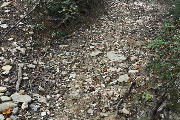
Moates Knob - Oakey Mountain OHV
Top loop at Oakey Mountain OHV. Most of Oakey Mountain is for expert riders only. This loop can give a preview of what's to come for intermediate riders. It connects as a loop to the main trail, so you can ride some of the nearby trails and not get stuck in the back after all the hill climbs.
Learn more about Moates Knob - Oakey Mountain OHV
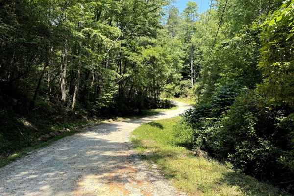
West Seed Lake Road
A beautiful gravel road along the west side of Seed Lake. The road is well-maintained and usually wide enough for two cars to pass. The Lake Seed Recreation Area offers a swimming area for kids and adults and several picnic sites with tables and fire pits. Restrooms with changing rooms are available...
Learn more about West Seed Lake Road
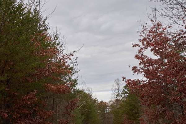
Lake Tugaloo (Bull Sluice Road)
Lake Tugaloo is a gravel road that descends through the scenic Chattahoochee National Forest to the shores of Lake Tugaloo on the Georgia-South Carolina border. Perfect for stock SUVs, overland rigs, and vehicles towing trailers, this roughly 3.9-mile trail offers a smooth but winding drive. The pat...
Learn more about Lake Tugaloo (Bull Sluice Road)
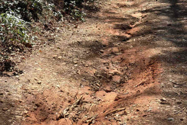
Crow Creek - FS 27
The Crow Creek trail, also known as FS 27, takes you from the West Seed Lake Road along the Crow Creek to a hiking trail to the Crow Creek Falls and primitive campsites along the creek. It is a gravel forestry road with some soft sand spots that can turn into 2-foot deep mud holes after heavy rain. ...
Learn more about Crow Creek - FS 27
ATV trails near Mount Airy, Georgia
Explore ATV-friendly trails near you. These trails are accessible for vehicles up to 50 inches wide, perfect for ATVs and smaller off-road machines.
Georgia Mountain Orchard
Georgia Mountain Orchard Road is an easy route into the Lake Russel WMA. This route begins just outside of Cornelia, Georgia. This road can be driven in 2WD and is a relaxing trek overall. Driving south, you will encounter Austin Cemetery on the left. It is easy to pass if you are not looking for it...
Learn more about Georgia Mountain Orchard
Brown Bottom Road
Brown Bottom Road is located in the center of a section of the Chattahoochee National Forest outside of Cornelia, GA. This road is wide, covered in large gravel and wide enough for two vehicles to pass in most sections. However, it's important to remember safe driving practices due to some steep cu...
Learn more about Brown Bottom Road
Guard Camp Road
Guard Camp Road is located in the Chattahoochee National Forest near Cornelia, GA. Nearby, you can visit Tallulah Gorge, view the waterfalls, explore downtown Clayton and fish in the numerous waterways. While camping is available throughout the region, this section of national forest seems less trav...
Learn more about Guard Camp Road
Red Root Road- FS 92
Red Root Road, also known as FSR 92, is a route that traverses the Lake Russel WMA from just outside Toccoa, GA to Mt. Airy, GA. This route can be used to access seasonal routes within the WMA area. Multiple areas can be found for camping, especially along the Middle Fork Broad River. If camping, p...
Learn more about Red Root Road- FS 92
UTV/side-by-side trails near Mount Airy, Georgia
Find UTV and side-by-side trails near you. These trails accommodate vehicles up to 60 inches wide, ideal for UTVs, side-by-sides, and wider off-road rigs.
Georgia Mountain Orchard
Georgia Mountain Orchard Road is an easy route into the Lake Russel WMA. This route begins just outside of Cornelia, Georgia. This road can be driven in 2WD and is a relaxing trek overall. Driving south, you will encounter Austin Cemetery on the left. It is easy to pass if you are not looking for it...
Learn more about Georgia Mountain Orchard
Brown Bottom Road
Brown Bottom Road is located in the center of a section of the Chattahoochee National Forest outside of Cornelia, GA. This road is wide, covered in large gravel and wide enough for two vehicles to pass in most sections. However, it's important to remember safe driving practices due to some steep cu...
Learn more about Brown Bottom Road
Guard Camp Road
Guard Camp Road is located in the Chattahoochee National Forest near Cornelia, GA. Nearby, you can visit Tallulah Gorge, view the waterfalls, explore downtown Clayton and fish in the numerous waterways. While camping is available throughout the region, this section of national forest seems less trav...
Learn more about Guard Camp Road
Red Root Road- FS 92
Red Root Road, also known as FSR 92, is a route that traverses the Lake Russel WMA from just outside Toccoa, GA to Mt. Airy, GA. This route can be used to access seasonal routes within the WMA area. Multiple areas can be found for camping, especially along the Middle Fork Broad River. If camping, p...
Learn more about Red Root Road- FS 92
The onX Offroad Difference
onX Offroad combines trail photos, descriptions, difficulty ratings, width restrictions, seasonality, and more in a user-friendly interface. Available on all devices, with offline access and full compatibility with CarPlay and Android Auto. Discover what you're missing today!
Open Trail Map