
Dirt Bike Trails
Near Maverick Mountain, Montana
Explore All Dirt Bike Trails Near Maverick Mountain, Montana
Dirt Bike Trails Near Maverick Mountain, Montana
Discover the best dirt bike trails near you. Browse trail maps, check difficulty ratings, and find your next adventure — whether you're looking for a quick ride or an all-day expedition.
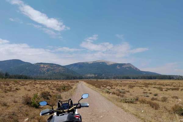
Canyon Creek - Quartz Hill
Canyon Creek - Quartz Hill is an incredibly scenic twenty-three-mile point-to-point offroad trail through the Pioneer Mountains, perfect for beginners and intermediate drivers seeking historic ruins and vast subalpine meadows. Starting near Highway 43 in the north or Interstate 15 to the southeast, ...
Learn more about Canyon Creek - Quartz Hill
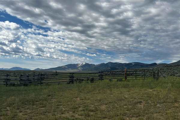
Mellow Milo
This is a mellow but scenic loop that definitely shows you why it's the "Big Sky" state. Keep your eyes out for antelope, rabbits, and wildflowers. There are lots of good campfire/picnic spots and campsites. It's not technical at all and could easily be done in a sedan. About halfway through, there ...
Learn more about Mellow Milo
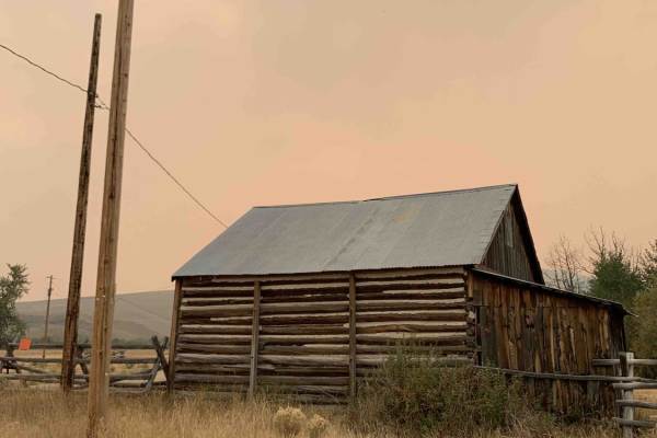
Big Hole - Road 181
Big Hole - Road 181 is an easy-going 41.8-mile dirt route that serves as an excellent scenic drive for families, beginners, and history enthusiasts looking to explore the beautiful Beaverhead-Bitterroot region. Bookended by Highway 278 near Jackson, Montana, to the north and the Shoshone Ridge Inter...
Learn more about Big Hole - Road 181
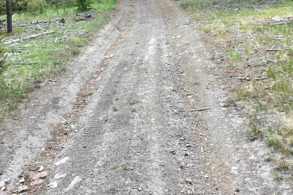
Everson Creek Road
This 12-mile single-lane road connects the Black Canyon Ridge Road to the Lemhi Pass Road. It is signed as BLM Road #1882. Beginning from the intersection of the Black Canyon Road (FS 5932), the first two miles of this road traverse wooded and rugged terrain. This segment of the road treats the t...
Learn more about Everson Creek Road
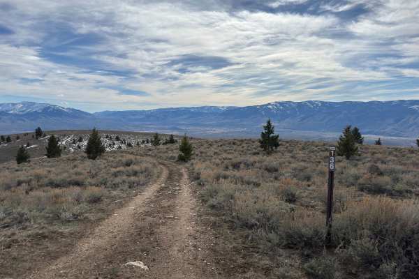
BLM Trail 136
BLM Trail 136 is a narrow, one-vehicle-wide trail that offers a great mix of scenery and a slight challenge. It connects BLM Trail 138 to BLM Trail 137 and BLM Trail 135. The surface is fairly rocky, with most rocks coming in around 8 inches or less. It’s not overly technical, but you’ll want to tak...
Learn more about BLM Trail 136

BLM Trail 139
BLM Trail 139 continues off the east end of Sagehen Flat Road and works its way back west, offering a scenic alternative route—though at the time of running it, it doesn’t fully reconnect due to a closed gate near the west end. If you start from the east side, you’ll begin with a short but moderatel...
Learn more about BLM Trail 139
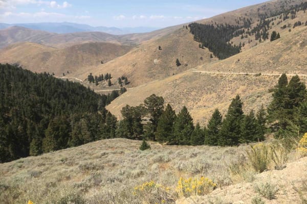
Lemhi Pass Road
This is a well-maintained gravel road that connects Lemhi Pass to the little village of Lemhi in the valley. It is a two-lane road and a little steep with several hairpin turns. Vehicles with trailers and large RVs are not recommended. This road is sometimes referred to as the Agency Creek Road.
Learn more about Lemhi Pass Road
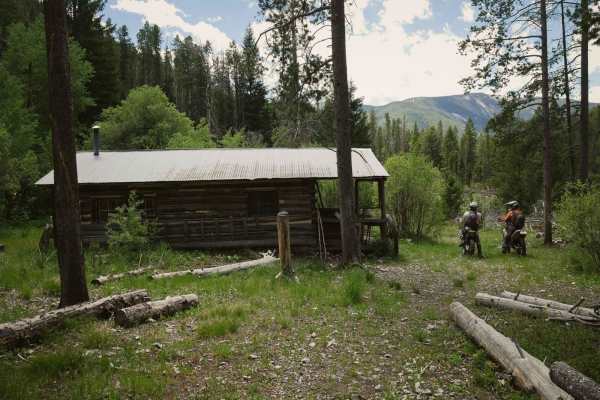
Sheep Creek
Sheep Creek is a fun and easier alpine single track in the Salmon National Forest that starts on the east end at the Idaho/Montana border, parallels the Continental Divide, and goes past an old cabin. It's shelfy and exposed in a lot of spots as it cuts across the hillsides, with a bit of loose rock...
Learn more about Sheep Creek
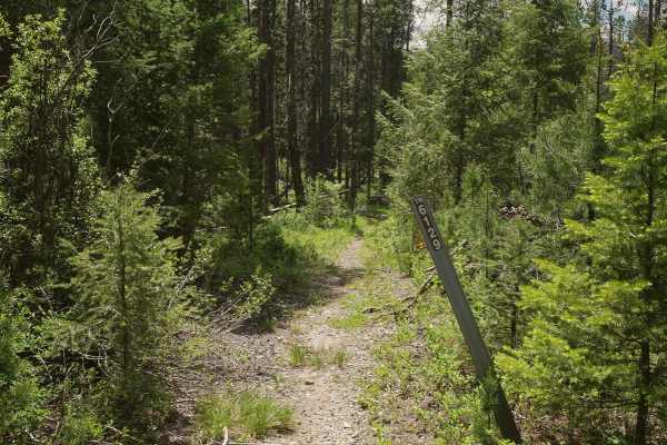
South Fork Sheep Creek
South Fork Sheep Creek is a 5.5-mile-long single track that departs from the Sheep Creek Trail, and heads south until it ends on South Fork Sheep Creek Road. The north end starts as a fast and flowy alpine single track, through pine trees, overgrown bushes, and shelfy exposed side-hills. There's lot...
Learn more about South Fork Sheep Creek
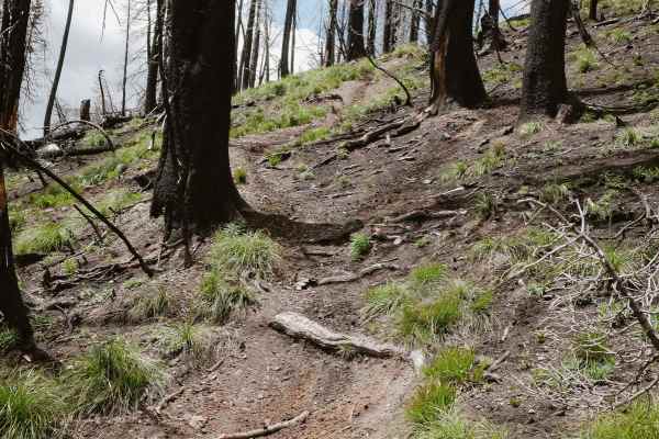
Continental Divide NST
This is a 6-mile segment of the Continental Divide NST single track that borders the Salmon National Forest and the Beaverhead National Forest on the border of Montana and Idaho. The south entrance starts at a pinch point and continues as a fun alpine single track tightly between the pine trees. Wat...
Learn more about Continental Divide NST

BLM Trail 137
BLM Trail 137 is a short connector trail between Sagehen Flat Road and BLM 136, offering a slightly different feel compared to others in the area. It’s a one-vehicle-wide trail that winds through sagebrush and small meadows, with sections of soft dirt, grass, and occasional small rocks (nothing larg...
Learn more about BLM Trail 137
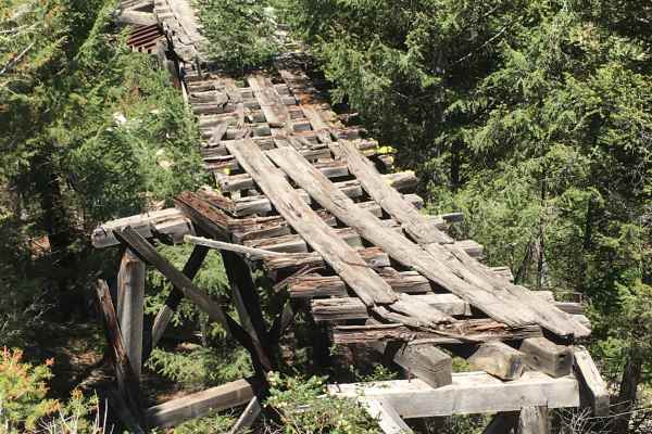
Copper Queen Mine Road
This road, signed as FS 60068 on the ground, connects the Agency Creek Road, also known as the Lemhi Pass Road, eventually to the Continental Divide (CD). But of course, it's not known as the Copper Queen Mine road because it accesses the CD; it got its name because the first segment of the road is...
Learn more about Copper Queen Mine Road
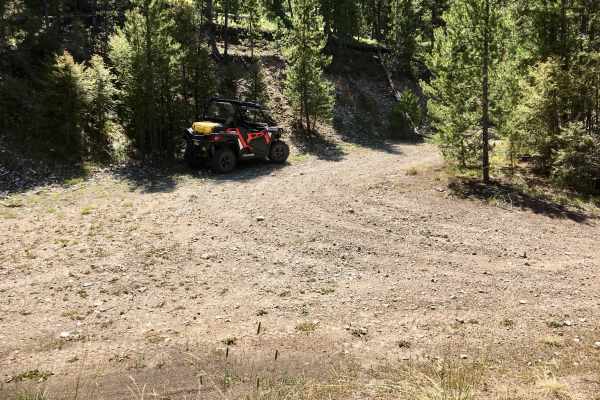
Queen - Agency ATV Route
This ATV trail intersects with the Copper Queen Road near the Continental Divide and works its way down to the Agency Creek Road (also sometimes referred to as the Lemhi Pass Road), a drop in elevation of about 2000 feet over 5 miles. At higher elevations, the trail passes through heavy stands of p...
Learn more about Queen - Agency ATV Route
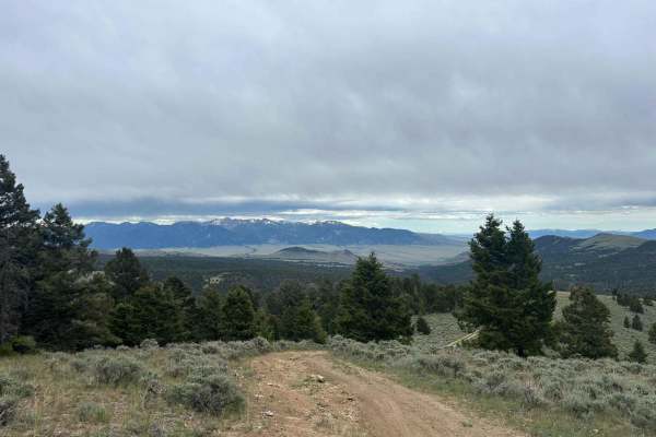
Brazil Ridge
This is a very steep climb through the trees that's very cramped in some areas. It has great views at the top, and when the cattle have been moved into that lot, there will be quite a few roaming. Cow patties are everywhere and the views are gorgeous at the top. The entire valley is in sight when at...
Learn more about Brazil Ridge
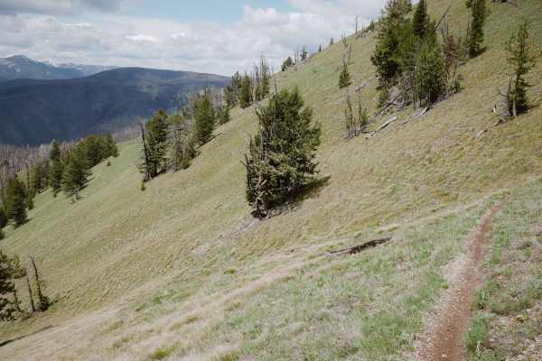
Three Mile Ridge
Three Mile Ridge is a 5-mile-long single track in the Salmon National Forest that departs from the Continental Divide Trail on the north end and loses 3,200 feet as it goes south towards Forest Service Road 60079. The trail rides along on top of a mountain, winding through a burn area on a narrow si...
Learn more about Three Mile Ridge
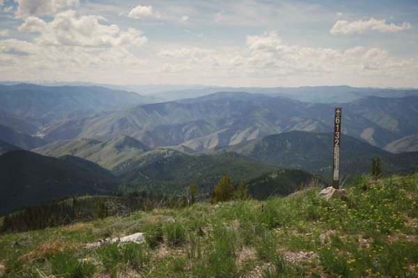
Stein Mountain
Stein Mountain is a 2.8-mile-long singletrack in the Salmon National Forest that is open from 5/22 to 9/7. The east end starts at the summit of Stein Mountain, above 8,500 feet elevation, where there is a radio tower. As you go west, it loses more than 2,000 feet of elevation over less than 3 miles,...
Learn more about Stein Mountain
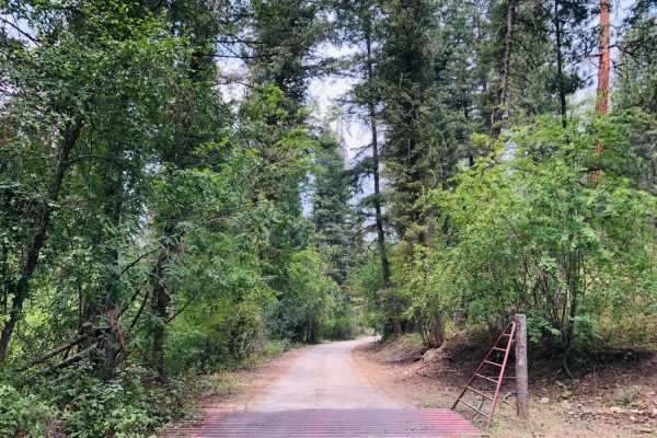
4th of July Trail
This is a 2 lane, maintained forest service road that leads to the long-standing fire tower for the Northfork, ID area with a 360-degree view of the surrounding mountain ranges. The knowledgeable and friendly watchman we spoke to has been standing watch over this area for 20 summers. There is a shor...
Learn more about 4th of July Trail
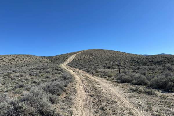
BLM 124
BLM 124 is the natural continuation of Trail 122 and serves as a short connector back to Sagehen Flat Road. Starting from the west end, you’ll immediately hit a moderately steep but short climb with some light ruts. Near the top of that climb, the trail gets a bit rockier, which can make traction sl...
Learn more about BLM 124
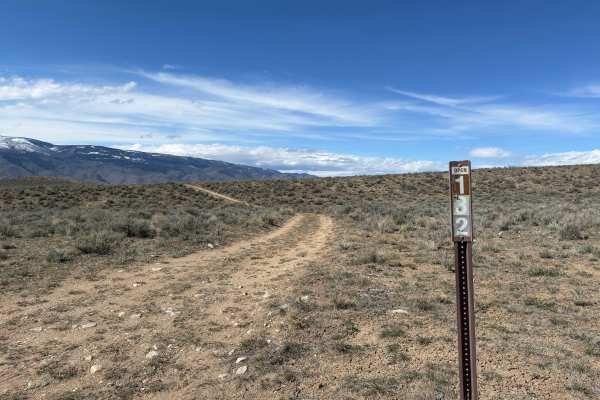
BLM Trail 132
BLM Trail 132 is a short, easy connector that links Sagehen Flat Road over to BLM 131. It’s a one-vehicle-wide trail but has enough room in spots to pass oncoming traffic. The surface is mostly dirt with a few patches of small rocks (nothing over about 6 inches), and the trail runs along a gradual c...
Learn more about BLM Trail 132
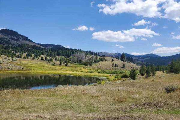
German Gulch
German Gulch is a moderately challenging 14-mile double-track trail designed specifically for 50-inch ATVs and motorcycles, offering riders an exciting mix of rocky climbs and fast, flowing sections near the Continental Divide. Starting at an elevation of approximately 5,500 feet, the route winds it...
Learn more about German Gulch
ATV trails near Maverick Mountain, Montana
Explore ATV-friendly trails near you. These trails are accessible for vehicles up to 50 inches wide, perfect for ATVs and smaller off-road machines.
Canyon Creek - Quartz Hill
Canyon Creek - Quartz Hill is an incredibly scenic twenty-three-mile point-to-point offroad trail through the Pioneer Mountains, perfect for beginners and intermediate drivers seeking historic ruins and vast subalpine meadows. Starting near Highway 43 in the north or Interstate 15 to the southeast, ...
Learn more about Canyon Creek - Quartz Hill
Mellow Milo
This is a mellow but scenic loop that definitely shows you why it's the "Big Sky" state. Keep your eyes out for antelope, rabbits, and wildflowers. There are lots of good campfire/picnic spots and campsites. It's not technical at all and could easily be done in a sedan. About halfway through, there ...
Learn more about Mellow Milo
Big Hole - Road 181
Big Hole - Road 181 is an easy-going 41.8-mile dirt route that serves as an excellent scenic drive for families, beginners, and history enthusiasts looking to explore the beautiful Beaverhead-Bitterroot region. Bookended by Highway 278 near Jackson, Montana, to the north and the Shoshone Ridge Inter...
Learn more about Big Hole - Road 181
Everson Creek Road
This 12-mile single-lane road connects the Black Canyon Ridge Road to the Lemhi Pass Road. It is signed as BLM Road #1882. Beginning from the intersection of the Black Canyon Road (FS 5932), the first two miles of this road traverse wooded and rugged terrain. This segment of the road treats the t...
Learn more about Everson Creek Road
UTV/side-by-side trails near Maverick Mountain, Montana
Find UTV and side-by-side trails near you. These trails accommodate vehicles up to 60 inches wide, ideal for UTVs, side-by-sides, and wider off-road rigs.
Canyon Creek - Quartz Hill
Canyon Creek - Quartz Hill is an incredibly scenic twenty-three-mile point-to-point offroad trail through the Pioneer Mountains, perfect for beginners and intermediate drivers seeking historic ruins and vast subalpine meadows. Starting near Highway 43 in the north or Interstate 15 to the southeast, ...
Learn more about Canyon Creek - Quartz Hill
Mellow Milo
This is a mellow but scenic loop that definitely shows you why it's the "Big Sky" state. Keep your eyes out for antelope, rabbits, and wildflowers. There are lots of good campfire/picnic spots and campsites. It's not technical at all and could easily be done in a sedan. About halfway through, there ...
Learn more about Mellow Milo
Big Hole - Road 181
Big Hole - Road 181 is an easy-going 41.8-mile dirt route that serves as an excellent scenic drive for families, beginners, and history enthusiasts looking to explore the beautiful Beaverhead-Bitterroot region. Bookended by Highway 278 near Jackson, Montana, to the north and the Shoshone Ridge Inter...
Learn more about Big Hole - Road 181
Everson Creek Road
This 12-mile single-lane road connects the Black Canyon Ridge Road to the Lemhi Pass Road. It is signed as BLM Road #1882. Beginning from the intersection of the Black Canyon Road (FS 5932), the first two miles of this road traverse wooded and rugged terrain. This segment of the road treats the t...
Learn more about Everson Creek Road
The onX Offroad Difference
onX Offroad combines trail photos, descriptions, difficulty ratings, width restrictions, seasonality, and more in a user-friendly interface. Available on all devices, with offline access and full compatibility with CarPlay and Android Auto. Discover what you're missing today!
Open Trail Map