
Dirt Bike Trails
Near Little Grass Valley, California
Explore All Dirt Bike Trails Near Little Grass Valley, California
Dirt Bike Trails Near Little Grass Valley, California
Discover the best dirt bike trails near you. Browse trail maps, check difficulty ratings, and find your next adventure — whether you're looking for a quick ride or an all-day expedition.
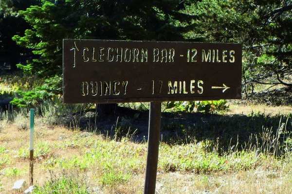
Cleghorn Bar
This is a fun drive with varying terrain. Green-sticker vehicles allowed and staging is available toward the beginning of the ride. Look for the sign that starts the 4WD riding. This routes takes you through beautiful valleys and up and over ridges. Hang on for a steep descent to the Feather River's...
Learn more about Cleghorn Bar
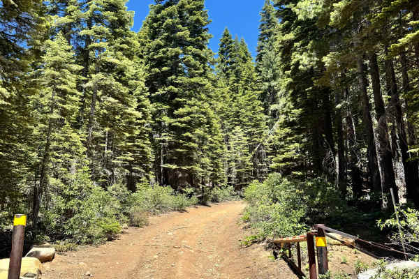
Saddleback Lookout - FS 25
This is a mostly dirt and rocky trail that takes you up to Saddleback Lookout. The trail is kind of steep, and some sections are a shelf road. The trail does start to have quite a bit of rock and is a little more like shale rock the closer you get to the lookout. You can go up to the lookout, it is ...
Learn more about Saddleback Lookout - FS 25
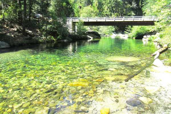
Sly Creek Trail
This trail is rated as a Level 1 difficulty. It offers a relatively easy experience, characterized by a flat, well-maintained road predominantly composed of gravel and dirt. However, it should be noted that during winter, the trail may become muddy, slippery, and snow-covered. Accessible from Laport...
Learn more about Sly Creek Trail
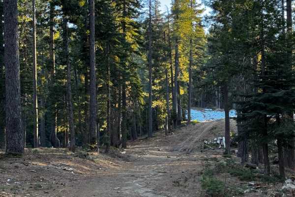
Red Ant
This trail is more like a fire road and features a few climbs and tight turns. It has a couple of areas designated for dispersed camping and offers some views of the canyon. The trail has been recently recut and cleared in certain sections. Additionally, there are some areas that are single-wide wit...
Learn more about Red Ant
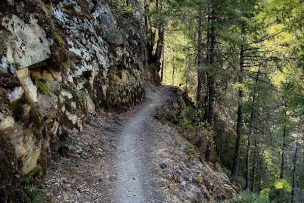
First Divide
First Divide is a fun moto route near Downieville that is also popular with downhill mountain bikers, and is part of the 15-mile-long “Downieville Downhill” that goes from Packer Lake Saddle to Downieville. It drops over 1,200 feet in 3.3 miles from north to south. This trail is very exposed and she...
Learn more about First Divide
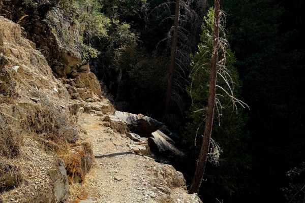
Second Divide
Second Divide is a fun, but extremely exposed, moto route near Downieville with several technical sections. This area is popular with mountain bikers, but this trail specifically may have fewer mountain bikers on the trail because it’s not part of the main “Downieville Downhill” route from Packer La...
Learn more about Second Divide
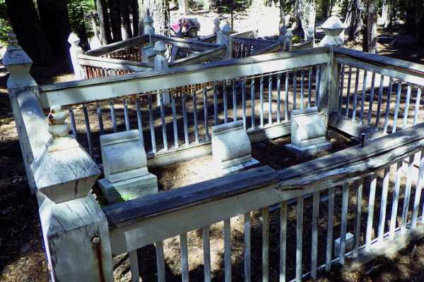
Poker Flat
A challenging drive that passes through two historic gold mining towns: Poker Flat and Howland Flat. The trail can be used as a shortcut between Downieville and La Porte. Trip to Saddleback Mountain Lookout Tower has rewarding views. Green-sticker vehicles can stage on the La Porte side at the large...
Learn more about Poker Flat
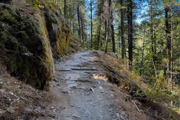
Third Divide
Third Divide is a fun 2 mile long moto route near Downieville that is also popular with downhill mountain bikers, and is part of the 15 mile long “Downieville Downhill” that goes from Packer Lake Saddle to the town of Downieville. The majority of Third Divide is pretty easy, as it is smooth and flow...
Learn more about Third Divide
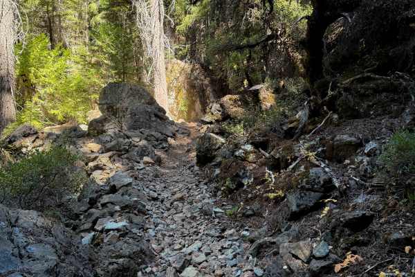
Big Boulder
Big Boulder is a fun and moderately easy singletrack near Downieville that is also popular for downhill mountain bikers. It drops over 1,500 feet in 3 miles from north to south. The trail has several wide and smooth switchbacks, including right away on the north end, and later on in the middle of th...
Learn more about Big Boulder
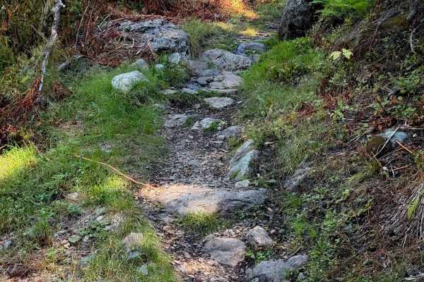
Pauley Creek
Pauley Creek starts at a three-way intersection with Butcher Ranch at a wide intersection that is a good place to take a break. It crosses a wide bridge over the creek, then enters a forested path full of embedded rock features. It has tight turns winding through the trees, with a few bigger hairpin...
Learn more about Pauley Creek
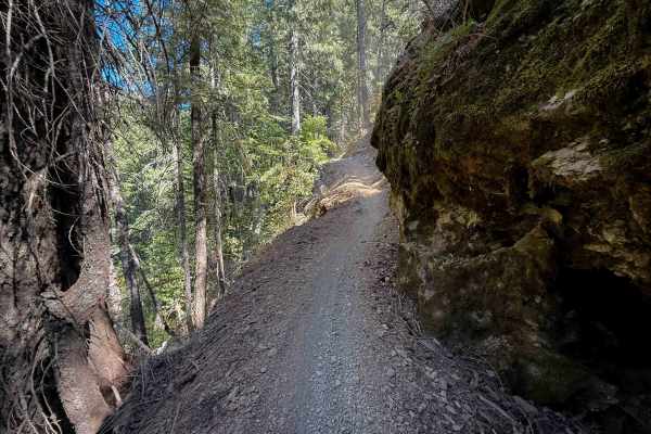
Butcher Ranch
Butcher Ranch is a long trail near Downieville – 6.6 miles long, and is part of the “Downieville Downhill” route from Packer Lake Saddle to Downieville – very popular with mountain bikers. There is a big bridge crossing early on over Pauley Creek. The west half of the trail is shelfy and narrow, wit...
Learn more about Butcher Ranch
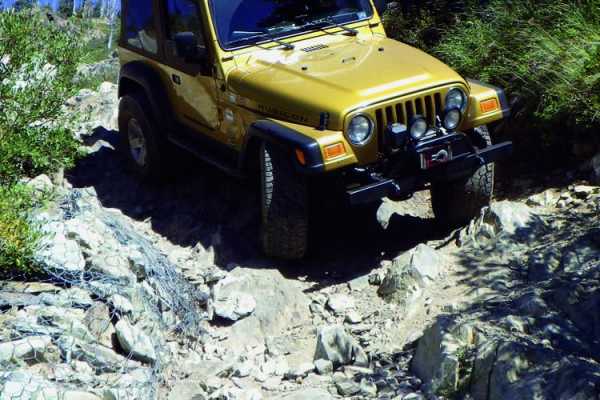
Snake Lake
Short but beautiful hard-core trail. Great views looking down on Gold Lake and Snake Lake. Route open to green-sticker vehicles on posted routes only. Overnight camping in designated sites only. Watch for hikers and mountain bikers on Pacific Crest Hiking Trail.
Learn more about Snake Lake
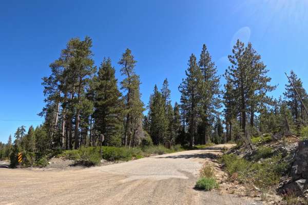
Church meadow road - FS 721
Starting near Gold Lake, Church Meadow Road is a pretty easy, manageable trail suitable for all vehicles. The route features a dirt and gravel surface with occasional loose granite rocks that are easy for all skill levels to navigate. The difficulty remains consistently low throughout the entire dri...
Learn more about Church meadow road - FS 721
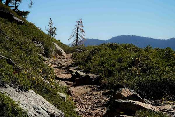
Gold Valley Rim
This is a 5.2 mile long singletrack in the Tahoe National Forest with incredible views and tons of technical rock features. The south end starts at the Packer Lake Saddle, with space for a few vehicles to park. From the south end, it curves around the edge of the open hillside with an incredible vie...
Learn more about Gold Valley Rim
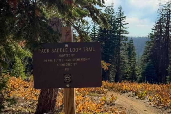
Pack Saddle Loop
This is a short 0.6 mile segment of trail near the Packer Lake Saddle that is easy and beginner-friendly. It starts and ends off of the Sunrise trail, which is similar in easy difficulty. It cuts across the hillsides on a gradual and smooth path, winding through pine trees with open views out over t...
Learn more about Pack Saddle Loop
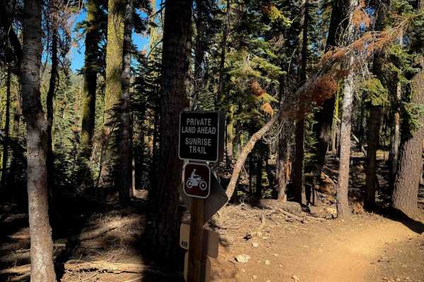
Sunrise
Sunrise is a 1.4-mile-long connecting route between Butcher Ranch Trail and the Sierra Buttes Trailhead. This trail is generally easy, being smooth and flowy, with big banked corners, wide gradual switchbacks, and minor embedded rock. One of the switchbacks has a big root on the inside of the turn, ...
Learn more about Sunrise
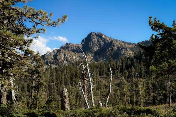
Gold Valley Connector
This is a short connector trail from the Sierra Buttes parking area to the Packer Lake Saddle. It weaves along the hilltop with open views, including a fantastic view towards the Sierra Butte and fire tower and surrounding mountains. The trail is generally pretty easy, just gradually cutting across ...
Learn more about Gold Valley Connector
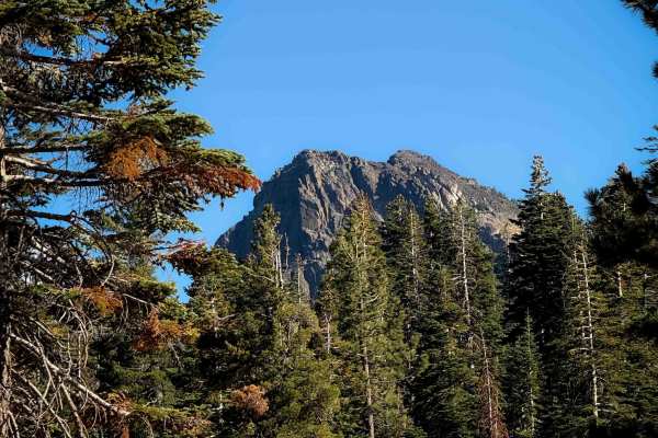
Pack Saddle Drop
This is a short singletrack, half a mile long, that drops down from the road (FS 93-002) near the Sierra Buttes Trailhead. It curves down the hillside through a series of easy and wide switchbacks as it weaves through tall mossy pine trees. The trail is clear of any logs and didn’t have much rock. I...
Learn more about Pack Saddle Drop
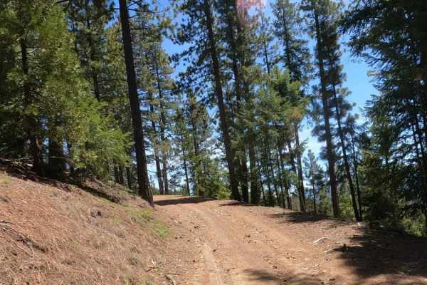
Bonta Ridge - NF23N05Y
Bonta Ridge is an occasionally maintained gravel Forest Service road that climbs from Bonta Creek Road above the CA-70 highway up to Penman Saddle and points beyond in this section of the Plumas National Forest. This is a seasonal road that climbs up above 7,000 feet, and one should be prepared to b...
Learn more about Bonta Ridge - NF23N05Y
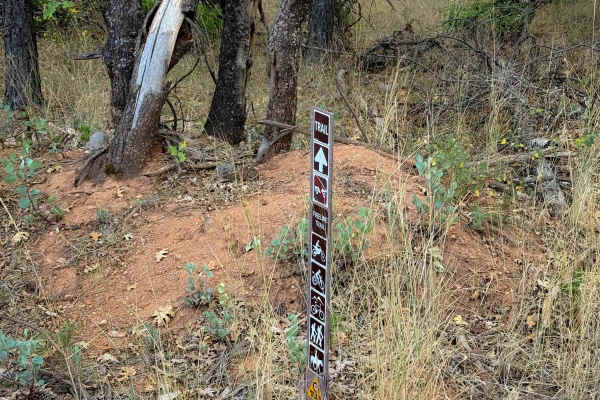
Fireline
The west end of Fireline starts across the road from the Berry Creek Tie, and it makes a .7 mile long loop to the main road (403) just south of the 4 Corners staging area. It’s a very easy and approachable trail, being a wide single track through a dry and sparse pine forest. The trail meanders alon...
Learn more about Fireline
ATV trails near Little Grass Valley, California
Explore ATV-friendly trails near you. These trails are accessible for vehicles up to 50 inches wide, perfect for ATVs and smaller off-road machines.
Cleghorn Bar
This is a fun drive with varying terrain. Green-sticker vehicles allowed and staging is available toward the beginning of the ride. Look for the sign that starts the 4WD riding. This routes takes you through beautiful valleys and up and over ridges. Hang on for a steep descent to the Feather River's...
Learn more about Cleghorn Bar
Saddleback Lookout - FS 25
This is a mostly dirt and rocky trail that takes you up to Saddleback Lookout. The trail is kind of steep, and some sections are a shelf road. The trail does start to have quite a bit of rock and is a little more like shale rock the closer you get to the lookout. You can go up to the lookout, it is ...
Learn more about Saddleback Lookout - FS 25
Sly Creek Trail
This trail is rated as a Level 1 difficulty. It offers a relatively easy experience, characterized by a flat, well-maintained road predominantly composed of gravel and dirt. However, it should be noted that during winter, the trail may become muddy, slippery, and snow-covered. Accessible from Laport...
Learn more about Sly Creek Trail
Red Ant
This trail is more like a fire road and features a few climbs and tight turns. It has a couple of areas designated for dispersed camping and offers some views of the canyon. The trail has been recently recut and cleared in certain sections. Additionally, there are some areas that are single-wide wit...
Learn more about Red Ant
UTV/side-by-side trails near Little Grass Valley, California
Find UTV and side-by-side trails near you. These trails accommodate vehicles up to 60 inches wide, ideal for UTVs, side-by-sides, and wider off-road rigs.
Cleghorn Bar
This is a fun drive with varying terrain. Green-sticker vehicles allowed and staging is available toward the beginning of the ride. Look for the sign that starts the 4WD riding. This routes takes you through beautiful valleys and up and over ridges. Hang on for a steep descent to the Feather River's...
Learn more about Cleghorn Bar
Saddleback Lookout - FS 25
This is a mostly dirt and rocky trail that takes you up to Saddleback Lookout. The trail is kind of steep, and some sections are a shelf road. The trail does start to have quite a bit of rock and is a little more like shale rock the closer you get to the lookout. You can go up to the lookout, it is ...
Learn more about Saddleback Lookout - FS 25
Sly Creek Trail
This trail is rated as a Level 1 difficulty. It offers a relatively easy experience, characterized by a flat, well-maintained road predominantly composed of gravel and dirt. However, it should be noted that during winter, the trail may become muddy, slippery, and snow-covered. Accessible from Laport...
Learn more about Sly Creek Trail
Red Ant
This trail is more like a fire road and features a few climbs and tight turns. It has a couple of areas designated for dispersed camping and offers some views of the canyon. The trail has been recently recut and cleared in certain sections. Additionally, there are some areas that are single-wide wit...
Learn more about Red Ant
The onX Offroad Difference
onX Offroad combines trail photos, descriptions, difficulty ratings, width restrictions, seasonality, and more in a user-friendly interface. Available on all devices, with offline access and full compatibility with CarPlay and Android Auto. Discover what you're missing today!
Open Trail Map