
Dirt Bike Trails
Near Lents, Oregon
Explore All Dirt Bike Trails Near Lents, Oregon
Dirt Bike Trails Near Lents, Oregon
Discover the best dirt bike trails near you. Browse trail maps, check difficulty ratings, and find your next adventure — whether you're looking for a quick ride or an all-day expedition.
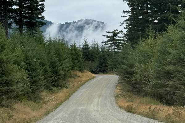
L-1000
This is a point-to-point trail that will connect you between 2 other trails in the area. It will also lead you to the Yacoult Burn Trailhead where you can access the area's hiking trail. There is also access to Cold Creek Campground. The trail is mainly a wide gravel road that is comprised of loose ...
Learn more about L-1000

Jones Creek ORV
Jones Creek Trail is limited to vehicles less than 50" wide. It is approximately 11 miles long and has an elevation gain of almost 2500 feet. It is one way to travel with trail markers. It traverses forested areas and logged areas.
Learn more about Jones Creek ORV

Larch Mountain L-1500
Larch Mountain L-1500 is located in the Yacolt Burn State Forest which encompasses 90,000 acres of forest in Southwest Washington. During the winter and spring, this area isn't advised for vehicle traffic as it is covered in snow. Late spring, summer and fall are the best times to enjoy this area. A...
Learn more about Larch Mountain L-1500
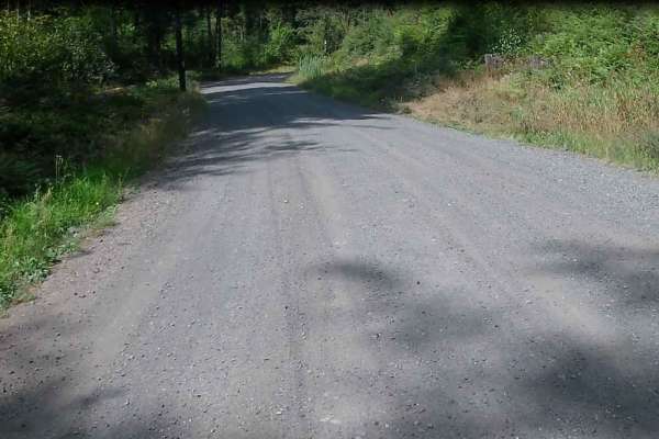
Skamania Mines
This well-maintained gravel road is easily accessible by ADV, high-clearance 4WD, or 2WD vehicles. The road surface is generally smooth and well-packed with little to no large ruts, divots, or rough sections. The gravel is in good shape and makes for a comfortable ride. The road travels through priv...
Learn more about Skamania Mines
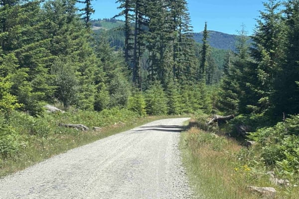
Cold Creek Camp
On this trail, expect a peaceful atmosphere with a well-maintained gravel road. Most vehicles can handle it in dry conditions with no 4WD needed. You'll cruise at 15 to 25 mph, kicking up a bit of dust when there are dry conditions. The campground is open Thursday through Monday and has 9 spots. Ver...
Learn more about Cold Creek Camp
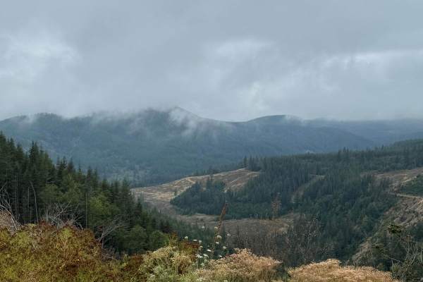
CG 1400 Connecting Trail
This is mainly a loose grave trail but there are short sections where the trail becomes hard pack gravel. The trail has some minor ruts and washouts along the way. The trail is wide enough to allow for passing in most areas there are however a few areas where the trail narrows and passing is not pos...
Learn more about CG 1400 Connecting Trail

L-1200
L-1200 is located in the Yacolt Burn State Forest. It's an easy gravel road that is well maintained by the state. Once on the trail, you will first cross the West Fork Washougal River where you can stop and enjoy the scenery and the small waterfall and even camp if you'd like. From there you continu...
Learn more about L-1200
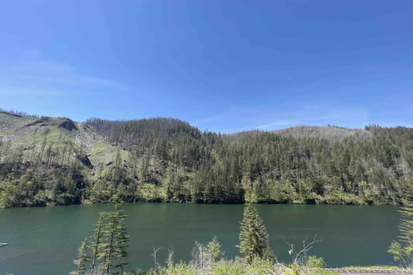
National Forest Development Road 4610
National Forest Development Rd 4610 has changed a lot over the last couple of years as the Riverside forest fire ripped through this area. Be advised that landslides, falling trees, and debris can occur in this area at any time. This road is not at all advised for a car. Road 4610 starts as a paved ...
Learn more about National Forest Development Road 4610

L-1100
L-1100 is located in the Yacolt Burn State Forest which is nestled at the base of the Cascade Mountain Range in Southwest Washington. These roads are well maintained and are gravel with very few potholes. There are houses and private property along this route for the first section of this trail. The...
Learn more about L-1100
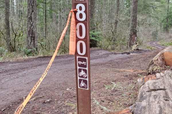
Trail 800
Trail 800 is an exciting, moderately challenging 1.2-mile trek tailored for intermediate offroaders seeking a mix of technical rock crawling and muddy play areas. Located just off Abbott Road near the Clackamas Highway, this short but action-packed route climbs roughly 187 feet from a starting eleva...
Learn more about Trail 800
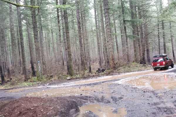
Thoughtful Lunch Trail
The Thoughtful Lunch Trail is an easy, highly accessible route in the Ladee Flats OHV area, making it perfect for beginners, families, or anyone looking for a quick, scenic spot to pause and take in the view. Spanning approximately one mile, this short dirt-and-mud path gently climbs about 148 feet ...
Learn more about Thoughtful Lunch Trail

Green Mountain Gravel Pits
This route takes you off the main Green Mountain Road, up Green Mountain Middle Road, and to a few gravel pit areas. The route provides a few views of the city of Colton and other cities farther out. The pits are locations with some four-wheeling obstacles and is where a lot of people go to shoot th...
Learn more about Green Mountain Gravel Pits
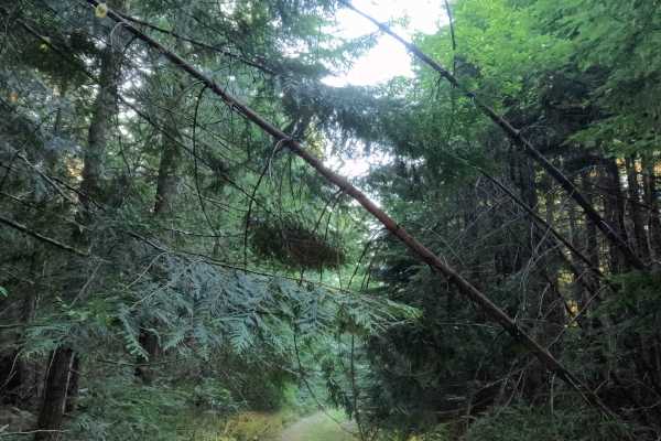
FS 4615140
Set within the dense evergreen forest canopy of the Mt. Hood National Forest, FS 4615140 is a quiet and secluded out-and-back single-track spur. Accessed directly off of FS 4615000, this 1.2-mile gravel route branches west into lush woodland shade. Outdoor enthusiasts and campers travel this seclude...
Learn more about FS 4615140
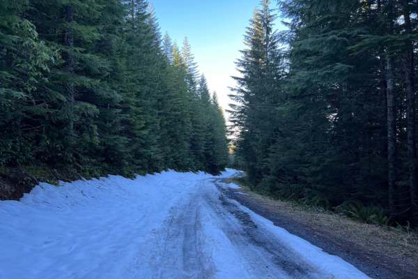
Green Mountain Road
This is one of the main roads heading up to Goat Mountain. There are many spur roads you can take off of Green Mountain Road; just make sure to check the status of gate closures. The area is full of 4x4 and ATV trails. There is snow covering a majority of the road during the winter months.
Learn more about Green Mountain Road
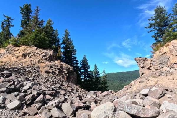
South Eagle Pit / Quarry - FS 4615130
Set along the edge of a lush, flourishing evergreen forest within Mt. Hood National Forest, South Eagle Pit / Quarry (FS 4615130) provides a scenic and technical backcountry excursion. Accessed directly off of Forest Service Road 4615000, this 1.2-mile out-and-back spur travels through dense conifer...
Learn more about South Eagle Pit / Quarry - FS 4615130
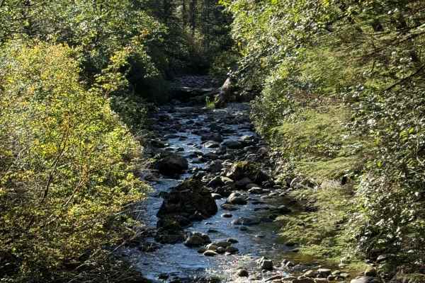
Poison Gulch Run
This is a deep forest trail that constantly changes its terrain type. It alternates from loose gravel to hard-packed gravel and hard-packed dirt with some rocky area mixed in. There are deep ruts and washouts along this trail that will put the driver in slight off-camber positions. Some of these rut...
Learn more about Poison Gulch Run
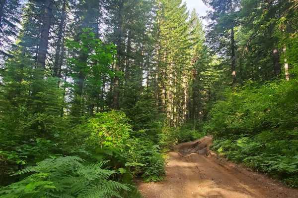
Deep Woods Brap Adventure
This road is not for the faint of heart or those without a plan. Follow this off-camber, mud-filled, axle-grabbing trail to the end only to unload a smaller off-road vehicle. Overgrown and with no good way to turn around, this trail may force you to back down. Be prepared. This is a connector trail ...
Learn more about Deep Woods Brap Adventure
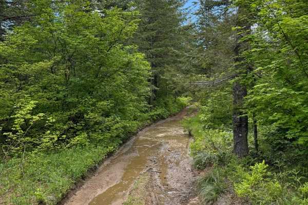
4104504 - Deep Woods Adventure
This is a deep forest route. The trail changes its surface several times and goes from a somewhat wide trail at times, to being very narrow and overgrown. The trail has very deep ruts and very deep washouts, a few of which will put you at extreme camber angles. Some of the ruts are very large with d...
Learn more about 4104504 - Deep Woods Adventure
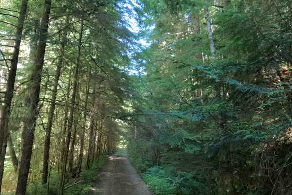
FS 4613130
Tucked within a lush, canopy-covered second-growth forest of hemlock, Douglas fir, and vibrant fern understory in Mt. Hood National Forest, FS 4613130 offers a secluded woodland bypass. Accessed off of FS 4613000 at its southern junction, this 2.1-mile single-lane connector branches off to climb thr...
Learn more about FS 4613130
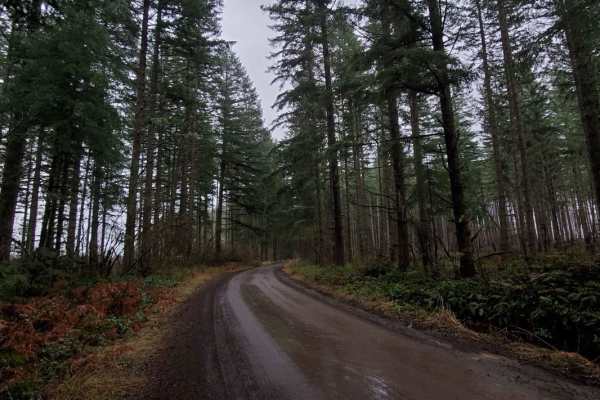
Abbott Road 4610
This road takes you up the mountain past the La Dee Flats staging area out towards the quarries. The staging area has raised loading docks for loading and unloading trailers. It goes past the La Dee Flats OHV play area. Fires have created weak limbs. Avoid when windy. There are tons of spin-off trai...
Learn more about Abbott Road 4610
ATV trails near Lents, Oregon
Explore ATV-friendly trails near you. These trails are accessible for vehicles up to 50 inches wide, perfect for ATVs and smaller off-road machines.
L-1000
This is a point-to-point trail that will connect you between 2 other trails in the area. It will also lead you to the Yacoult Burn Trailhead where you can access the area's hiking trail. There is also access to Cold Creek Campground. The trail is mainly a wide gravel road that is comprised of loose ...
Learn more about L-1000
Jones Creek ORV
Jones Creek Trail is limited to vehicles less than 50" wide. It is approximately 11 miles long and has an elevation gain of almost 2500 feet. It is one way to travel with trail markers. It traverses forested areas and logged areas.
Learn more about Jones Creek ORV
Larch Mountain L-1500
Larch Mountain L-1500 is located in the Yacolt Burn State Forest which encompasses 90,000 acres of forest in Southwest Washington. During the winter and spring, this area isn't advised for vehicle traffic as it is covered in snow. Late spring, summer and fall are the best times to enjoy this area. A...
Learn more about Larch Mountain L-1500
Cold Creek Camp
On this trail, expect a peaceful atmosphere with a well-maintained gravel road. Most vehicles can handle it in dry conditions with no 4WD needed. You'll cruise at 15 to 25 mph, kicking up a bit of dust when there are dry conditions. The campground is open Thursday through Monday and has 9 spots. Ver...
Learn more about Cold Creek Camp
UTV/side-by-side trails near Lents, Oregon
Find UTV and side-by-side trails near you. These trails accommodate vehicles up to 60 inches wide, ideal for UTVs, side-by-sides, and wider off-road rigs.
L-1000
This is a point-to-point trail that will connect you between 2 other trails in the area. It will also lead you to the Yacoult Burn Trailhead where you can access the area's hiking trail. There is also access to Cold Creek Campground. The trail is mainly a wide gravel road that is comprised of loose ...
Learn more about L-1000
Larch Mountain L-1500
Larch Mountain L-1500 is located in the Yacolt Burn State Forest which encompasses 90,000 acres of forest in Southwest Washington. During the winter and spring, this area isn't advised for vehicle traffic as it is covered in snow. Late spring, summer and fall are the best times to enjoy this area. A...
Learn more about Larch Mountain L-1500
Cold Creek Camp
On this trail, expect a peaceful atmosphere with a well-maintained gravel road. Most vehicles can handle it in dry conditions with no 4WD needed. You'll cruise at 15 to 25 mph, kicking up a bit of dust when there are dry conditions. The campground is open Thursday through Monday and has 9 spots. Ver...
Learn more about Cold Creek Camp
CG 1400 Connecting Trail
This is mainly a loose grave trail but there are short sections where the trail becomes hard pack gravel. The trail has some minor ruts and washouts along the way. The trail is wide enough to allow for passing in most areas there are however a few areas where the trail narrows and passing is not pos...
Learn more about CG 1400 Connecting Trail
The onX Offroad Difference
onX Offroad combines trail photos, descriptions, difficulty ratings, width restrictions, seasonality, and more in a user-friendly interface. Available on all devices, with offline access and full compatibility with CarPlay and Android Auto. Discover what you're missing today!
Open Trail Map