
Dirt Bike Trails
Near Edgar Springs, Missouri
Explore All Dirt Bike Trails Near Edgar Springs, Missouri
Dirt Bike Trails Near Edgar Springs, Missouri
Discover the best dirt bike trails near you. Browse trail maps, check difficulty ratings, and find your next adventure — whether you're looking for a quick ride or an all-day expedition.

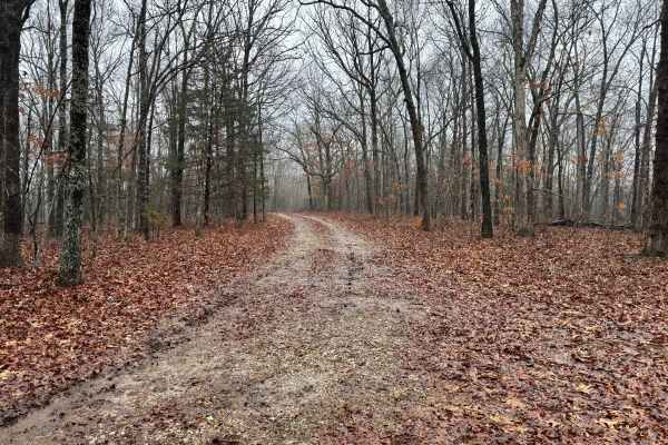
FS 1708
This is a scenic and easy route lined with tall, mature trees that create a peaceful, shaded drive. The surface is a well-maintained gravel road with no significant obstacles, steep climbs, or technical challenges, making it suitable for most vehicles. The route is straightforward and comfortable fr...
Learn more about FS 1708
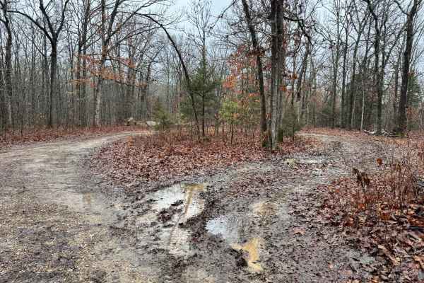
FSR 1708A
This is a fairly wide route with enough space for two vehicles to pass comfortably in most sections. However, drivers should remain alert, as active logging operations may take place along this route. It’s possible to encounter logging trucks, heavy equipment, or debris related to timber activity. S...
Learn more about FSR 1708A
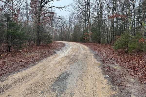
FS 1763
This is an out-and-back route with a generally straightforward layout and no major technical obstacles along the way. For most of the drive, the trail remains single vehicle width, requiring drivers to be mindful of oncoming traffic and limited passing space. During or after rainfall, there is a low...
Learn more about FS 1763
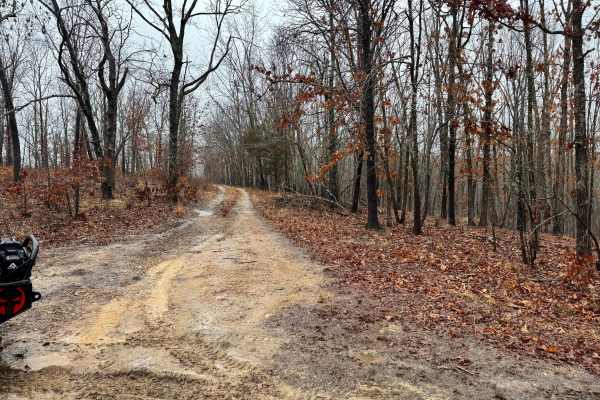
FS 1736
This route is fairly well-maintained and generally easy to travel, though it does feature several mud holes scattered along the route. While some of the puddles can appear deep, they typically have a firm, solid bottom that provides a stable footing for most vehicles. There are a few areas where tre...
Learn more about FS 1736
FS 1534
This route is generally well-maintained and offers a smooth, consistent driving surface for most of its length. Along the way, you’ll encounter several puddles, some deeper than others, though they typically have a firm, hard-packed bottom. The route is technically single-vehicle width, but there ar...
Learn more about FS 1534
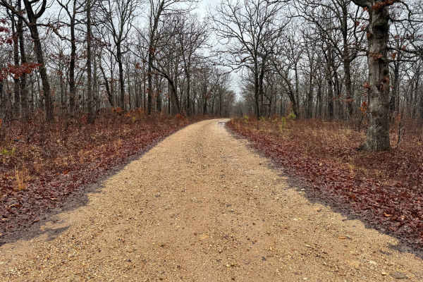
FS 1530
This route is very well maintained and nearly wide enough in many sections for two vehicles to pass comfortably. The surface is smooth and consistent, making for an easy and relaxed drive. Along the route, there are several designated pull-off areas suitable for dispersed camping. You’ll encounter a...
Learn more about FS 1530
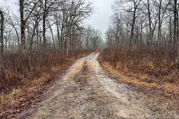
FS 1530C
This trail features numerous mud puddles scattered along the route, some of which can be fairly deep depending on recent weather. While the water-filled sections may look intimidating, most of them typically have a firm, solid bottom underneath. Vegetation has begun to grow along portions of the tra...
Learn more about FS 1530C
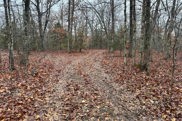
FS 1530B
This route is narrow for most of its length, making it strictly single-vehicle width with little room for error. Because of the tight tree coverage on both sides, there is a real possibility of sliding toward trees if traction breaks loose, especially in the rutted sections. After recent rainfall, c...
Learn more about FS 1530B
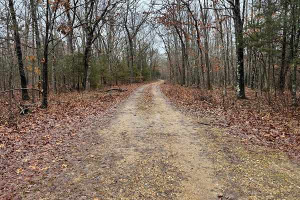
FS 1710
This is a single vehicle wide route that remains fairly pleasant to travel. While there are a few rougher or uneven sections along the route, the surface is generally manageable and does not present significant difficulty. Trees line both sides of the route, creating a more enclosed feel, and it’s p...
Learn more about FS 1710
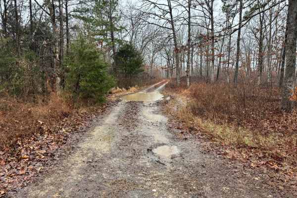
FS 1733
A well-maintained gravel road that is generally easy to navigate, though there are a few narrower sections where trees and brush close in slightly. Along the route, you’ll encounter several puddles that can become surprisingly deep, especially after periods of rain, so it’s wise to approach them cau...
Learn more about FS 1733

FS 1730A
This is an out-and-back route that sees limited maintenance but is still traveled enough to follow without much difficulty. Early on, there is a single dispersed campsite located not far from the trailhead. The route quickly narrows as it moves into thicker timber, with dense tree cover creating tig...
Learn more about FS 1730A

FS 1702
This route starts out fairly wide and is in very good condition, making the first stretch easy to navigate. The surface is well-maintained and generally smooth. Around 1 mile in, you may encounter a small seasonal waterfall and a shallow water crossing that flows across the trail, depending on recen...
Learn more about FS 1702
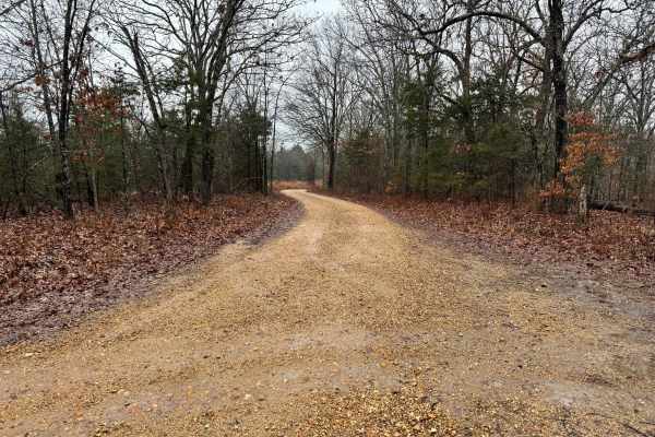
FS 1727
This route follows a wide, well-maintained gravel road that is easy to navigate and comfortable for most vehicles. The surface is generally smooth, with no significant obstacles or technical challenges along the way. Several side roads and offshoots branch off from the main route, offering opportuni...
Learn more about FS 1727
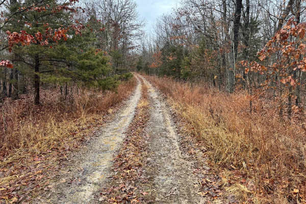
FS 1705
This route begins as a wide county road with enough room for two vehicles to pass comfortably. As you continue, it narrows significantly near a barn and transitions into more of a single vehicle wide route. Use caution in this area, as the property on the same side as the barn is clearly marked as p...
Learn more about FS 1705

Thomas Lane
This is a maintained gravel road with generally smooth conditions, though you will encounter a few rougher or washboarded sections along the way. There are a couple of larger dispersed camping areas that offer plenty of space for multiple vehicles or small groups. The route eventually leads to Mayfi...
Learn more about Thomas Lane
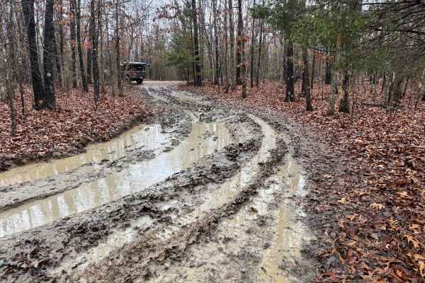
FS 1727C
This is an unmaintained trail that sees limited upkeep and can become challenging depending on recent weather. Expect several deep, muddy ruts filled with thick mud, especially in low-lying areas. There are also a few tight squeezes between trees where light pinstriping is likely, particularly for w...
Learn more about FS 1727C
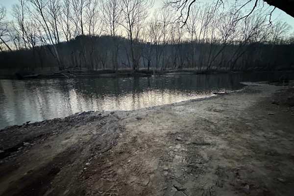
Booker Bend
This route drops you down toward the Big Piney River and offers a straightforward way to reach the water without heavy traffic or crowds. A few sections are noticeably steep, but they’re built on a solid gravel base that provides decent traction in dry conditions. After rain, those same climbs can b...
Learn more about Booker Bend
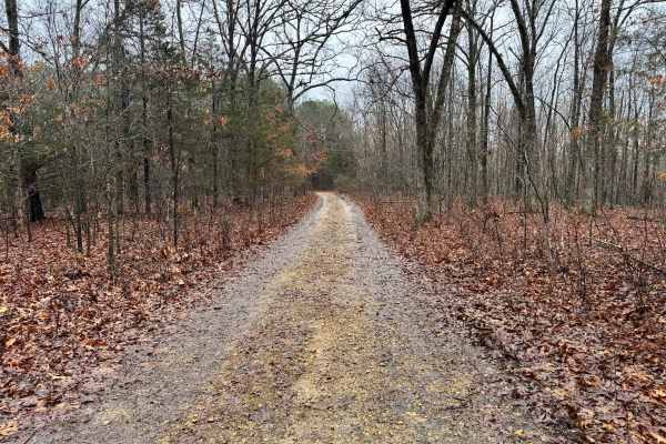
FS 1727A
This route is primarily gravel and generally easy to travel, with a consistent surface throughout most of the route. In several sections, you’ll encounter areas where water tends to pool, sometimes creating larger standing puddles. While these spots can look intimidating at first glance, they typica...
Learn more about FS 1727A
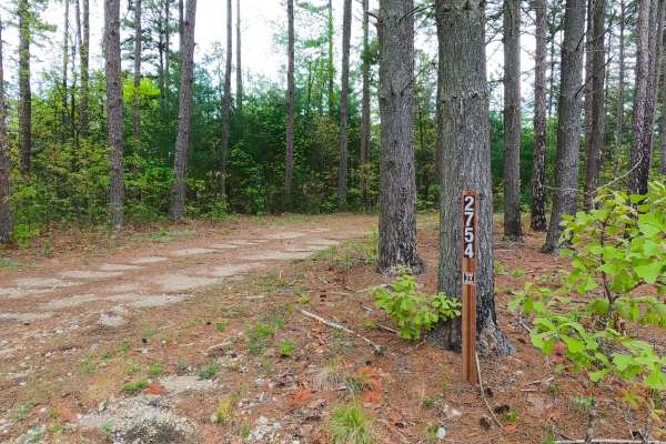
James Ridge - FS 2754
James Ridge FS 2754, is a semi-maintained gravel forest road within the Salem Unit of Mark Twain National Forest. The road features a ridge-top ride on the hill with James Branch Creek to the south and Chandler Hollow/Lost Lake to the east. Along the way, there are small water collection spots, surf...
Learn more about James Ridge - FS 2754
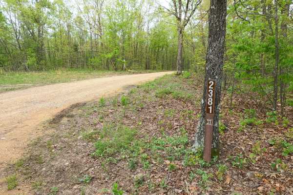
Old Mill - FS 2381
Old Mill FS 2381, is a semi-maintained gravel forest road within the Salem Unit of Mark Twain National Forest. The road features a ridge-top ride on the hill separating James Branch Creek/Chandler Hollow to the North and Indian Creek/Todd Hollow to the South. Along the way, there are small water col...
Learn more about Old Mill - FS 2381
ATV trails near Edgar Springs, Missouri
Explore ATV-friendly trails near you. These trails are accessible for vehicles up to 50 inches wide, perfect for ATVs and smaller off-road machines.
FS 1708
This is a scenic and easy route lined with tall, mature trees that create a peaceful, shaded drive. The surface is a well-maintained gravel road with no significant obstacles, steep climbs, or technical challenges, making it suitable for most vehicles. The route is straightforward and comfortable fr...
Learn more about FS 1708
FSR 1708A
This is a fairly wide route with enough space for two vehicles to pass comfortably in most sections. However, drivers should remain alert, as active logging operations may take place along this route. It’s possible to encounter logging trucks, heavy equipment, or debris related to timber activity. S...
Learn more about FSR 1708A
FS 1763
This is an out-and-back route with a generally straightforward layout and no major technical obstacles along the way. For most of the drive, the trail remains single vehicle width, requiring drivers to be mindful of oncoming traffic and limited passing space. During or after rainfall, there is a low...
Learn more about FS 1763
FS 1736
This route is fairly well-maintained and generally easy to travel, though it does feature several mud holes scattered along the route. While some of the puddles can appear deep, they typically have a firm, solid bottom that provides a stable footing for most vehicles. There are a few areas where tre...
Learn more about FS 1736
UTV/side-by-side trails near Edgar Springs, Missouri
Find UTV and side-by-side trails near you. These trails accommodate vehicles up to 60 inches wide, ideal for UTVs, side-by-sides, and wider off-road rigs.
FS 1708
This is a scenic and easy route lined with tall, mature trees that create a peaceful, shaded drive. The surface is a well-maintained gravel road with no significant obstacles, steep climbs, or technical challenges, making it suitable for most vehicles. The route is straightforward and comfortable fr...
Learn more about FS 1708
FSR 1708A
This is a fairly wide route with enough space for two vehicles to pass comfortably in most sections. However, drivers should remain alert, as active logging operations may take place along this route. It’s possible to encounter logging trucks, heavy equipment, or debris related to timber activity. S...
Learn more about FSR 1708A
FS 1763
This is an out-and-back route with a generally straightforward layout and no major technical obstacles along the way. For most of the drive, the trail remains single vehicle width, requiring drivers to be mindful of oncoming traffic and limited passing space. During or after rainfall, there is a low...
Learn more about FS 1763
FS 1736
This route is fairly well-maintained and generally easy to travel, though it does feature several mud holes scattered along the route. While some of the puddles can appear deep, they typically have a firm, solid bottom that provides a stable footing for most vehicles. There are a few areas where tre...
Learn more about FS 1736
The onX Offroad Difference
onX Offroad combines trail photos, descriptions, difficulty ratings, width restrictions, seasonality, and more in a user-friendly interface. Available on all devices, with offline access and full compatibility with CarPlay and Android Auto. Discover what you're missing today!
Open Trail Map