
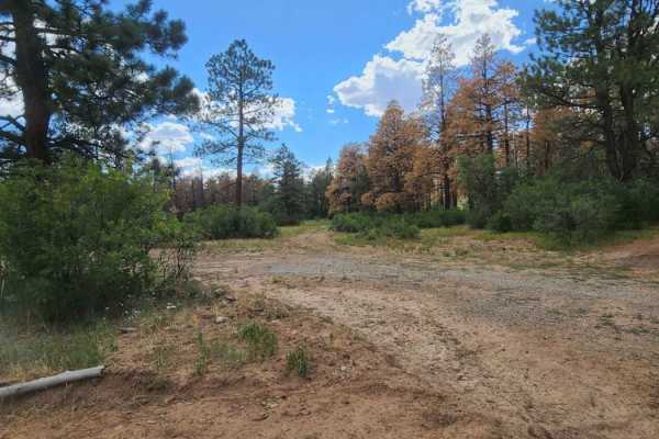
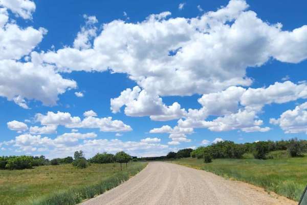
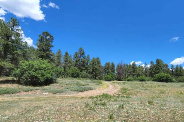
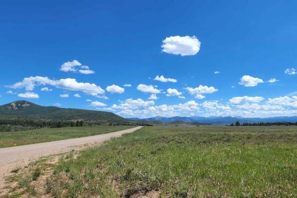
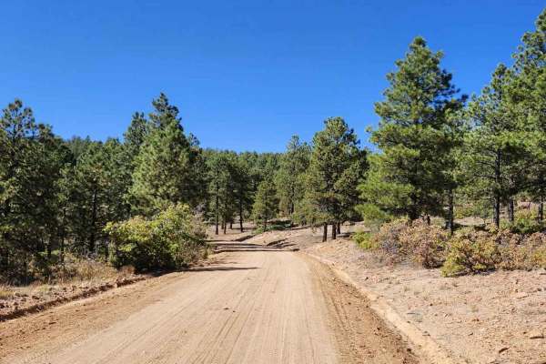
Dirt Bike Trails
Near Dove Creek, Colorado
Explore All Dirt Bike Trails Near Dove Creek, Colorado
Dirt Bike Trails Near Dove Creek, Colorado
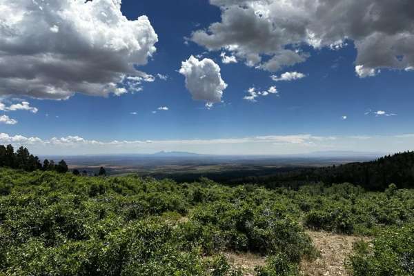
Discover the best dirt bike trails near you. Browse trail maps, check difficulty ratings, and find your next adventure — whether you're looking for a quick ride or an all-day expedition.
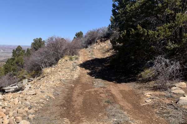
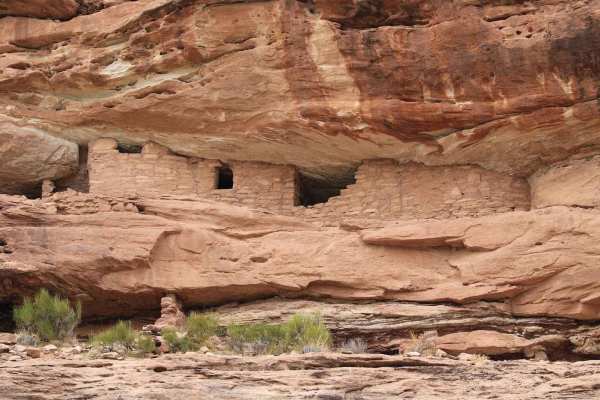
Uranium
This trail starts out easy and gets more difficult as you go. You will run across a few old uranium mines that still have mining equipment and old structures. It gives you access to many spurs and side trails that give you amazing views. It's short but many many more options open up as you go.
Learn more about Uranium
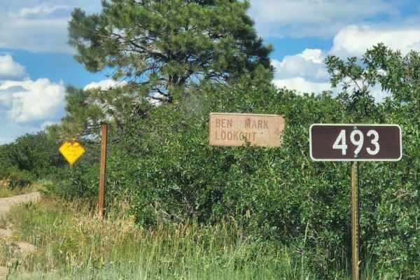
Bench Mark Lookout
This drive takes you up to a lookout with beautiful scenery and big tall trees. The road can be muddy when wet and dusty when dry. There is access to other roads. Easy road for any vehicle and is typically two vehicles wide. In this area, you might see cows and there is no camping. Dirt or rocky roa...
Learn more about Bench Mark Lookout
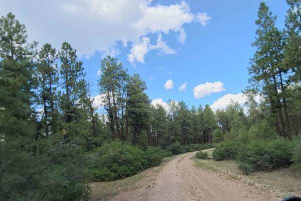
Cabin Rim Road
Quick short road with beautiful scenery and big tall trees. The road can be muddy when wet, and dusty when dry. Typically two vehicles wide and provides access to other roads. An easy road for any vehicle, safe for most 4WD and high-clearance 2WD vehicles. You might see cows. Dirt or rocky road with...
Learn more about Cabin Rim Road
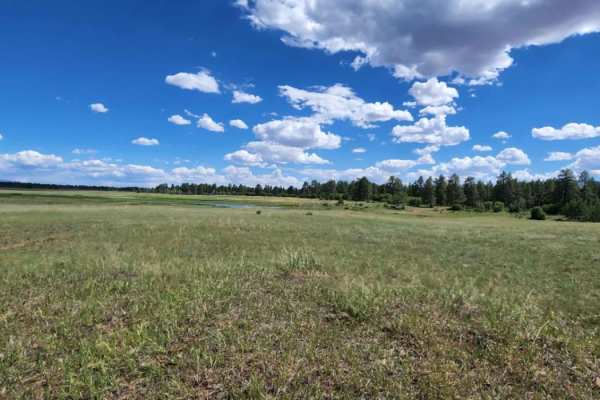
Ferris Road
There is burned area at end of the road, so be mindful of debris, and muddy spots. There are some camp spots and access to other roads. Pretty open pastures.Dirt or rocky road with gentle grades. Safe for most 4WD and high-clearance 2WD vehicles. Roads are typically two vehicles wide.
Learn more about Ferris Road
Flat Iron Road
This is a quick, short road with beautiful scenery and tall trees. It can be muddy when wet, dusty when dry, and provides access to other roads. An easy road for any vehicle and is safe for most 4WD and high-clearance 2WD vehicles. In this area, you might see cows, and there is some camping. Dirt or...
Learn more about Flat Iron Road
Ormiston Point Road
This road offers some camping, good access to many other roads, and lots of views. There is cell service at spots, but it can be very spotty with the weather. Can be muddy when wet. Dirt or rocky road with gentle grades. Safe for most 4WD and high-clearance 2WD vehicles. Roads are typically two vehi...
Learn more about Ormiston Point Road
Dry Canyon A Road
There are some low trees on this road, so it is not recommended for tall vehicles. Along this route is a big open meadow and some camping areas. Can be muddy when wet. There are some small rocky areas. You may encounter shallow water crossings and obstacles under 12" on the trail, including small le...
Learn more about Dry Canyon A Road
Trimble Road
This is a short quick access road to get to others. There are some pretty views and big open pastures. There are lots and lots of cows, so watch out for cow pies! Dirt or rocky road, typically unmaintained after rain or snow. Can be muddy when wet. You may encounter shallow water crossings and obsta...
Learn more about Trimble Road
Montezuma Canyon Road
Montezuma Canyon Road is a 34.5-mile point-to-point trail rated 1 of 10 located in San Juan County. Montezuma Canyon Road follows a high desert canyon with a well-maintained graded or gravel road. This road is suitable for both 2WD and 4WD vehicles. Although this is a point-to-point trail, it is a d...
Learn more about Montezuma Canyon Road
Beaver Rim F Road
This road can be very dusty when dry and muddy when wet. Beautiful view at the end with a small camp spot for one or two people. Dirt or rocky road, typically unmaintained after rain or snow. You may encounter shallow water crossings and obstacles under 12" on the trail, including small ledges. Road...
Learn more about Beaver Rim F Road
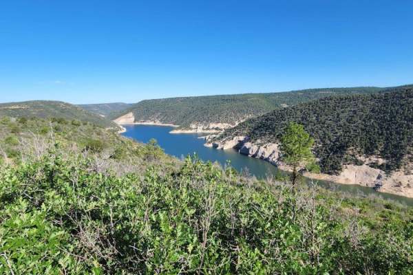
Beaver Rim Road
Beaver Rim Road is an inviting 5.7-mile off-road route near McPhee Reservoir, ideal for beginners and scenic drivers seeking a rewarding destination with a stunning overlook at the trail's end. Navigating through the picturesque landscape of southwestern Colorado, the trail begins near the Boggy Dra...
Learn more about Beaver Rim Road
Abajo Peak Trail
Welcome to the Abajo Peak Off-Road Trail! Nestled within the breathtaking wilderness of Monticello Utah, this mountain dirt off-road trail offers a delightful adventure for beginners and seasoned explorers alike. The trail is renowned for its accessibility, making it an excellent choice for those lo...
Learn more about Abajo Peak Trail

Plateau Road
Short quick access road to get to others. There are big open pastures with lots of cows, so watch out for cow pies! Dirt or rocky road with gentle grades. Safe for most 4WD and high-clearance 2WD vehicles. Roads are typically two vehicles wide. Can be muddy when wet.
Learn more about Plateau Road
Beaver Point Road
There are big open pastures with lots of cows, so watch out for cow pies! Dirt or rocky road with gentle grades. Safe for most 4WD and high-clearance 2WD vehicles. Roads are typically two vehicles wide. Can be muddy when wet. There are multiple areas to camp with amazing views.
Learn more about Beaver Point Road
Trail 55255 to 55258
This trail is a fun, short little detour from the main road up the mountain. There are a few small rocks and holes on the trail but nothing too serious. Any 4x4 should make it up this trail. The start of the trail is a little bit narrow but doable by any side-by-side or full-sized truck. It takes yo...
Learn more about Trail 55255 to 55258
Dude Ranch to Stone Henge
Starts off as a paved road, then turns into a maintained dirt road, then bare right into a forested OHV trail. This is a great beginner trail. Be on the look-out for a large grassy opening that's great for camping, complete with stone henge rock fire pit, and wigham. This road is shared by horses, h...
Learn more about Dude Ranch to Stone Henge
FR50084/Recapture Road
Recapture Canyon in the Blanding/Monticello, Utah area is a scenic rocky canyon that borders the Abajo Mountains to the north, Recapture Reservoir and Blanding, Utah to the south. Abajo Mountain is a twin peak that dominates the landscape at over 11k feet on both peaks and frequently has snow until ...
Learn more about FR50084/Recapture Road
Devils Canyon Road
This is an easy mountain road that is well-maintained. Use this route to access other trails and camping sites in the area. Camp Jackson Trailhead, Wagon Wheel Trailhead, and Bulldog Trailhead are accessed from this road. This is not a good Winter destination but Summer, Spring, and Fall are great t...
Learn more about Devils Canyon Road
Lower Stock Pond Trail
This is an access trail to two stock ponds that are always full. The trail is rough and rugged since the weather has washed it out in a few places. This trail starts in the pine trees, travels through some scrub oak then back into the pines. This trail ends back up on the paved blue mountain road. T...
Learn more about Lower Stock Pond Trail
Trail - 55249
This is a great little trail that eventually takes you to a lookout point. The trail has some rocky sections and tight areas on the trail. It is recommended for a UTV, ATV, or dirt bikes. Depending on the time of the year you might run into some runoff coming down the trail. Watch out for cattle nea...
Learn more about Trail - 55249
ATV trails near Dove Creek, Colorado
Explore ATV-friendly trails near you. These trails are accessible for vehicles up to 50 inches wide, perfect for ATVs and smaller off-road machines.
Uranium
This trail starts out easy and gets more difficult as you go. You will run across a few old uranium mines that still have mining equipment and old structures. It gives you access to many spurs and side trails that give you amazing views. It's short but many many more options open up as you go.
Learn more about Uranium
Bench Mark Lookout
This drive takes you up to a lookout with beautiful scenery and big tall trees. The road can be muddy when wet and dusty when dry. There is access to other roads. Easy road for any vehicle and is typically two vehicles wide. In this area, you might see cows and there is no camping. Dirt or rocky roa...
Learn more about Bench Mark Lookout
Cabin Rim Road
Quick short road with beautiful scenery and big tall trees. The road can be muddy when wet, and dusty when dry. Typically two vehicles wide and provides access to other roads. An easy road for any vehicle, safe for most 4WD and high-clearance 2WD vehicles. You might see cows. Dirt or rocky road with...
Learn more about Cabin Rim Road
Ferris Road
There is burned area at end of the road, so be mindful of debris, and muddy spots. There are some camp spots and access to other roads. Pretty open pastures.Dirt or rocky road with gentle grades. Safe for most 4WD and high-clearance 2WD vehicles. Roads are typically two vehicles wide.
Learn more about Ferris Road
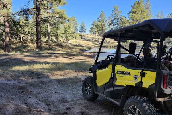
UTV/side-by-side trails near Dove Creek, Colorado
Find UTV and side-by-side trails near you. These trails accommodate vehicles up to 60 inches wide, ideal for UTVs, side-by-sides, and wider off-road rigs.
Bench Mark Lookout
This drive takes you up to a lookout with beautiful scenery and big tall trees. The road can be muddy when wet and dusty when dry. There is access to other roads. Easy road for any vehicle and is typically two vehicles wide. In this area, you might see cows and there is no camping. Dirt or rocky roa...
Learn more about Bench Mark Lookout
Cabin Rim Road
Quick short road with beautiful scenery and big tall trees. The road can be muddy when wet, and dusty when dry. Typically two vehicles wide and provides access to other roads. An easy road for any vehicle, safe for most 4WD and high-clearance 2WD vehicles. You might see cows. Dirt or rocky road with...
Learn more about Cabin Rim Road
Ferris Road
There is burned area at end of the road, so be mindful of debris, and muddy spots. There are some camp spots and access to other roads. Pretty open pastures.Dirt or rocky road with gentle grades. Safe for most 4WD and high-clearance 2WD vehicles. Roads are typically two vehicles wide.
Learn more about Ferris Road
Flat Iron Road
This is a quick, short road with beautiful scenery and tall trees. It can be muddy when wet, dusty when dry, and provides access to other roads. An easy road for any vehicle and is safe for most 4WD and high-clearance 2WD vehicles. In this area, you might see cows, and there is some camping. Dirt or...
Learn more about Flat Iron Road
The onX Offroad Difference
onX Offroad combines trail photos, descriptions, difficulty ratings, width restrictions, seasonality, and more in a user-friendly interface. Available on all devices, with offline access and full compatibility with CarPlay and Android Auto. Discover what you're missing today!
Open Trail Map