
Dirt Bike Trails
Near Bingham Canyon, Utah
Explore All Dirt Bike Trails Near Bingham Canyon, Utah
Dirt Bike Trails Near Bingham Canyon, Utah
Discover the best dirt bike trails near you. Browse trail maps, check difficulty ratings, and find your next adventure — whether you're looking for a quick ride or an all-day expedition.
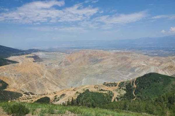
Kennecott Copper Mine Overlook
This trail is a quick 5-mile total out-and-back. It is well-maintained dirt leading to a large parking area that overlooks the main pit of the mine. One can also see the Salt Lake Valley to the east and Tooele Valley to the west and the views of the mountains, valleys, and mine are incredible. The r...
Learn more about Kennecott Copper Mine Overlook
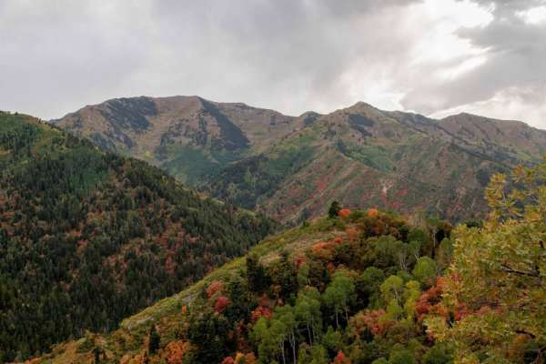
Butterfield Canyon
Closed from October to June. This is a great drive that takes you up and over the Oquirrh Mountains between Herriman and Tooele, Utah. This is a perfect place for an evening with great views. This area is particularly beautiful in the fall with many colors in the trees. You will also get a great bir...
Learn more about Butterfield Canyon
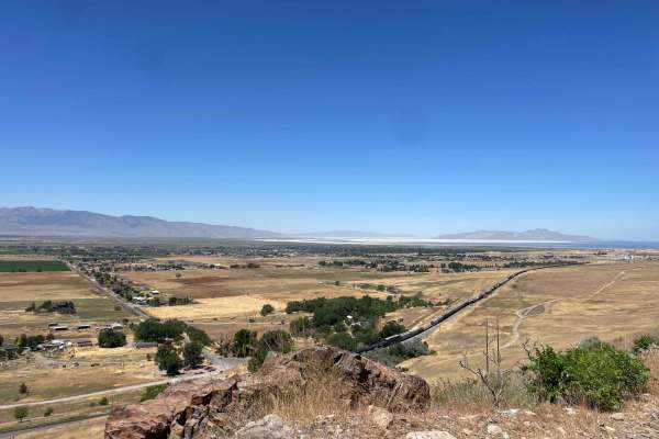
The Bunker Trail
There are a few gates on this trail, make sure you leave the gates the way you found them. This trail rides along the ridgeline and has lots of loose rocks (baby heads mostly with some sharp rocks). This can be challenging on a bigger motorcycle due to the grades and loose material. 4x4s might find ...
Learn more about The Bunker Trail
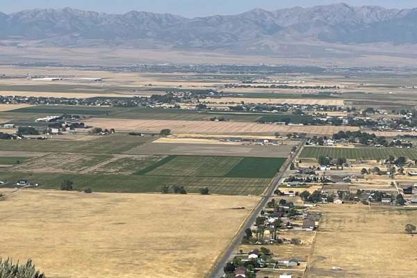
Bates Canyon Trail Access To Erda Lookout
This trail is a short 2-track hill. It starts off with a hardpack OHV trail and about a 1/3 of a mile in, you will get to a steep sand hill. This feature alone makes this a 4 or 5/10. You will need some speed and skill to make it up the deep sand slope. Other than this section, the trail is a 2 or 3...
Learn more about Bates Canyon Trail Access To Erda Lookout
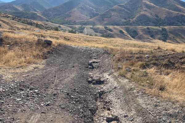
Bates Canyon Trail
This is a well-traveled two-track with all types of 4x4 and off-road machines. This trail is a great way to overlook the Tooele Valley above Stansbury Park and Erda. You will encounter some large rocks and rutted roads along the way to the top. There is a gate at the end where motorized travel is pr...
Learn more about Bates Canyon Trail
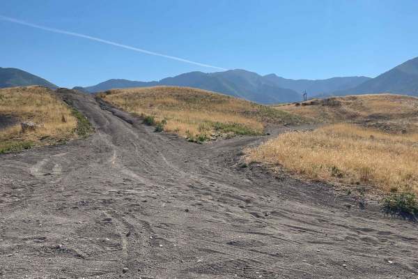
Pole Canyon Trail
This is one of the easiest ways to the top of the plateau. There are some large boulders and sand that could present a challenge depending on your vehicle type. There are mostly rocks on the lower half of the trail and then once climbing on the upper section, you will find a good hard pack and some ...
Learn more about Pole Canyon Trail
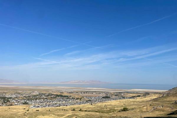
Radio Tower - Tramway Slide Trail
This route starts at the Radio Towers on Droubay Road and rides along the Rail Road tracks heading north, and about 3 miles up, you veer off to the east up the mountain toward the landslide on the hill. Once you are next to the fence line, you will go through a bit of a rock garden and then see a sm...
Learn more about Radio Tower - Tramway Slide Trail
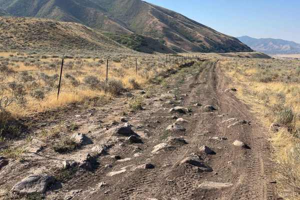
Springs Road Fence Line Trail
This trail starts off the dirt road called Foothill Drive. It starts heading east up the hill on the section line road and then connects to TC03617 back to the southeast all the way to the fence line. There is a gate that has been broken down in the past. There is NO Motorized access past this gate,...
Learn more about Springs Road Fence Line Trail
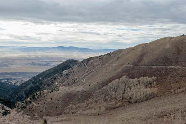
Jacob City Soldier Canyon Loop
Jacob City is a scenic loop with classic Great Basin scenery. The trail passes the historic Jacob City ghost town and then climbs to nearly 10,000 feet before climbing down to Soldier Canyon on a rough and narrow trail. Mine history is scattered throughout.
Learn more about Jacob City Soldier Canyon Loop
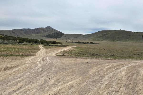
Hidden Hollow Loop
This is a fun family loop behind Hidden Hollow Elementary in Eagle Mountain. This is a multi-use area, so there are a lot of mountain bikers. This loop takes you to two lookouts. The first one overlooks Utah Lake and the Saratoga Springs Temple, the second overlook is at the Prayer Flags, and this o...
Learn more about Hidden Hollow Loop
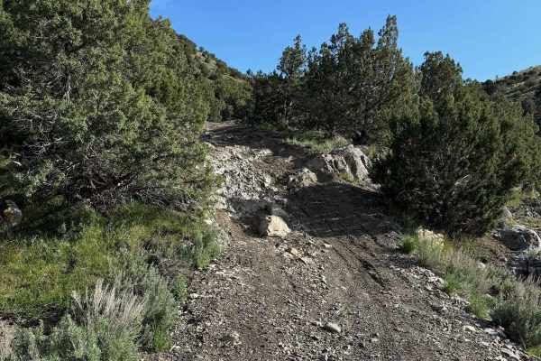
Lake Mountain Trail
This trail runs along Lake Mountain with a view looking down onto Eagle Mountain. It starts in Reformation Canyon. The trail is pretty mellow for the first 5.5 miles and consists mainly of hard-packed trails. 2 miles in is a gate that is to remain closed as you pass through. As this trail comes into...
Learn more about Lake Mountain Trail
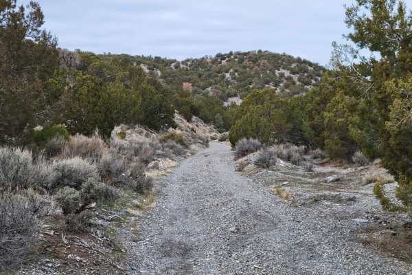
Dip Gulch Road
This trail starts out as easy and unassuming but quickly offers some challenges. Water erosion has created some deep gouges on the trail, making for off-camber sections. The further up trail you travel, the more narrow and less tracked it becomes. If you take a vehicle up there, expect to have veget...
Learn more about Dip Gulch Road
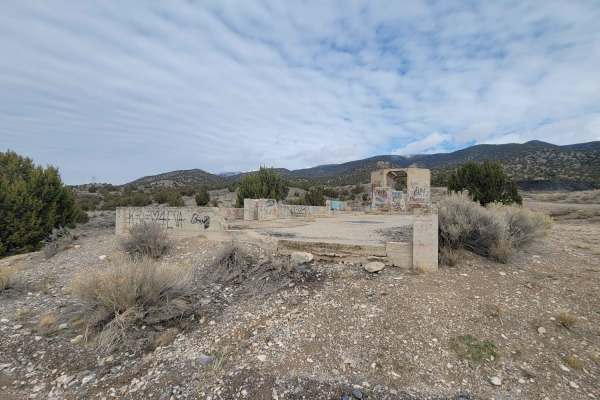
West Mercur Trail
West Mercur Trail is an easy, 2.3-mile dirt route perfect for beginners, scenic cruisers, and those looking to access the historic mining region of Tooele County. Connecting State Route 73 to the Mercur Canyon Road, this trail offers sweeping desert views overlooking the scenic Tooele Valley. Driver...
Learn more about West Mercur Trail
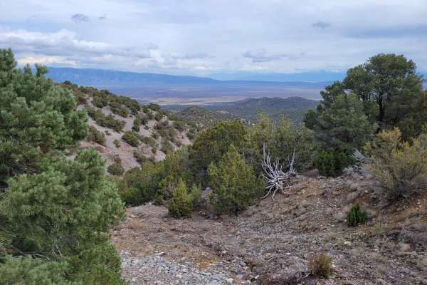
Here Back To There
A very short route that connects two different trails in the area. Towards the top of the trail, there is a small challenging section to navigate. Some of the rocks/ledges are notable in size, as well as the water erosion rut that's off to the one side. The valley views from up top are spectacular o...
Learn more about Here Back To There
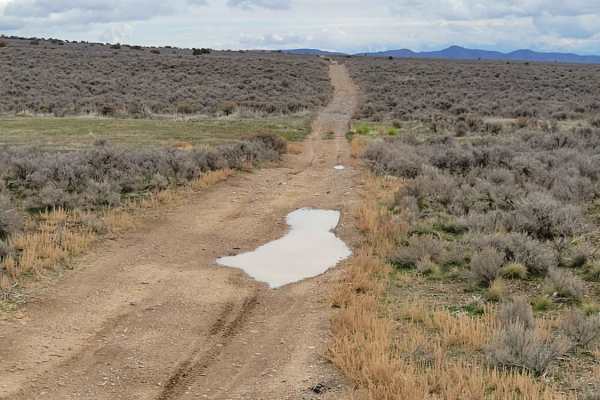
Pack Trail 1
Pack Trail 1 is an easy, 2.7-mile dirt route in the Fivemile Pass recreation area, perfect for beginners and connecting to nearby trails. Winding across the hillside with sweeping valley views, the trail maintains a gentle grade between 5,459 and 5,594 feet of elevation, gaining just 150 feet. It is...
Learn more about Pack Trail 1
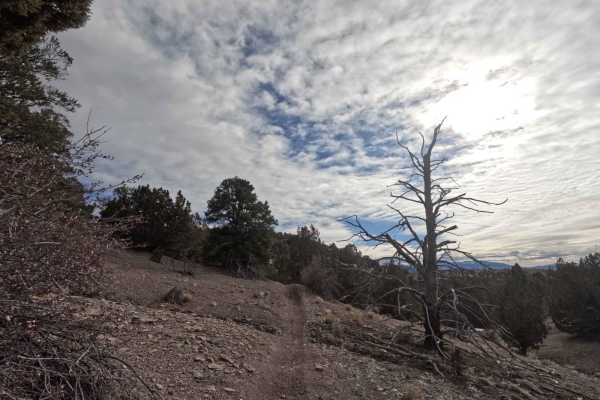
512
Trail 512 breaks off from the middle of 511 and heads West, before turning South and running into 509. This track is 1.4 miles in length and travels along small rolling hills in a spaced-out pine tree forest. You'll climb and then lose ~200 feet of elevation along this trail. The ground surface is p...
Learn more about 512
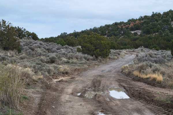
Bit of Both
This is a very short route that connects from one set of trails to another. Water/mud holes may be present on the trail in wet conditions. A section has been rutted due to water erosion and may cause the vehicle to be off-camber at times. There is a grated mine shaft about halfway, off to the west s...
Learn more about Bit of Both
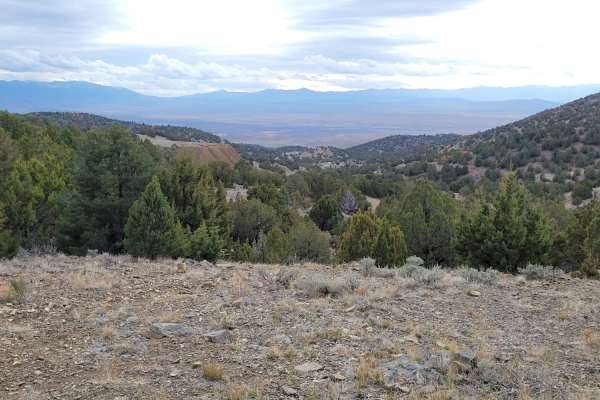
Wayne's Neighbor
This short route connects to several other trails in the area, including the infamous Wayne's World - notorious for advanced rock crawling and broken rigs. The turn-off for this area is just East of the towering mine tailings the trail passes by. It seemed a tractor had grated down the bottom portio...
Learn more about Wayne's Neighbor
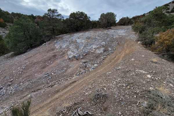
Rocky Road Trail
Predominantly this trail is fairly mild. However, there is one particular section of this trail that bumps up the difficult rating. It's a combination of rocky ledges on a steep grade with severely uneven terrain just beneath it; pictures don't do it justice. If you don't want to attempt the rock ga...
Learn more about Rocky Road Trail
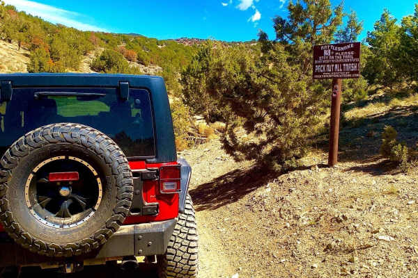
Rattlesnake Trail Technical
This short 1.4-mile point-to-point trail is excellent for the beginner-intermediate off-road driver. There are several obstacles to traverse with many different lines providing ledges from 10" to 24". Recommend 33" tires for this trail. Enjoy driving through the tailing piles at the end of the trail...
Learn more about Rattlesnake Trail Technical
ATV trails near Bingham Canyon, Utah
Explore ATV-friendly trails near you. These trails are accessible for vehicles up to 50 inches wide, perfect for ATVs and smaller off-road machines.
Kennecott Copper Mine Overlook
This trail is a quick 5-mile total out-and-back. It is well-maintained dirt leading to a large parking area that overlooks the main pit of the mine. One can also see the Salt Lake Valley to the east and Tooele Valley to the west and the views of the mountains, valleys, and mine are incredible. The r...
Learn more about Kennecott Copper Mine Overlook
Butterfield Canyon
Closed from October to June. This is a great drive that takes you up and over the Oquirrh Mountains between Herriman and Tooele, Utah. This is a perfect place for an evening with great views. This area is particularly beautiful in the fall with many colors in the trees. You will also get a great bir...
Learn more about Butterfield Canyon
The Bunker Trail
There are a few gates on this trail, make sure you leave the gates the way you found them. This trail rides along the ridgeline and has lots of loose rocks (baby heads mostly with some sharp rocks). This can be challenging on a bigger motorcycle due to the grades and loose material. 4x4s might find ...
Learn more about The Bunker Trail
Bates Canyon Trail Access To Erda Lookout
This trail is a short 2-track hill. It starts off with a hardpack OHV trail and about a 1/3 of a mile in, you will get to a steep sand hill. This feature alone makes this a 4 or 5/10. You will need some speed and skill to make it up the deep sand slope. Other than this section, the trail is a 2 or 3...
Learn more about Bates Canyon Trail Access To Erda Lookout
UTV/side-by-side trails near Bingham Canyon, Utah
Find UTV and side-by-side trails near you. These trails accommodate vehicles up to 60 inches wide, ideal for UTVs, side-by-sides, and wider off-road rigs.
Kennecott Copper Mine Overlook
This trail is a quick 5-mile total out-and-back. It is well-maintained dirt leading to a large parking area that overlooks the main pit of the mine. One can also see the Salt Lake Valley to the east and Tooele Valley to the west and the views of the mountains, valleys, and mine are incredible. The r...
Learn more about Kennecott Copper Mine Overlook
Butterfield Canyon
Closed from October to June. This is a great drive that takes you up and over the Oquirrh Mountains between Herriman and Tooele, Utah. This is a perfect place for an evening with great views. This area is particularly beautiful in the fall with many colors in the trees. You will also get a great bir...
Learn more about Butterfield Canyon
The Bunker Trail
There are a few gates on this trail, make sure you leave the gates the way you found them. This trail rides along the ridgeline and has lots of loose rocks (baby heads mostly with some sharp rocks). This can be challenging on a bigger motorcycle due to the grades and loose material. 4x4s might find ...
Learn more about The Bunker Trail
Bates Canyon Trail Access To Erda Lookout
This trail is a short 2-track hill. It starts off with a hardpack OHV trail and about a 1/3 of a mile in, you will get to a steep sand hill. This feature alone makes this a 4 or 5/10. You will need some speed and skill to make it up the deep sand slope. Other than this section, the trail is a 2 or 3...
Learn more about Bates Canyon Trail Access To Erda Lookout
The onX Offroad Difference
onX Offroad combines trail photos, descriptions, difficulty ratings, width restrictions, seasonality, and more in a user-friendly interface. Available on all devices, with offline access and full compatibility with CarPlay and Android Auto. Discover what you're missing today!
Open Trail Map