
Dirt Bike Trails
Near Arroyo Hondo, New Mexico
Explore All Dirt Bike Trails Near Arroyo Hondo, New Mexico
Dirt Bike Trails Near Arroyo Hondo, New Mexico
Discover the best dirt bike trails near you. Browse trail maps, check difficulty ratings, and find your next adventure — whether you're looking for a quick ride or an all-day expedition.
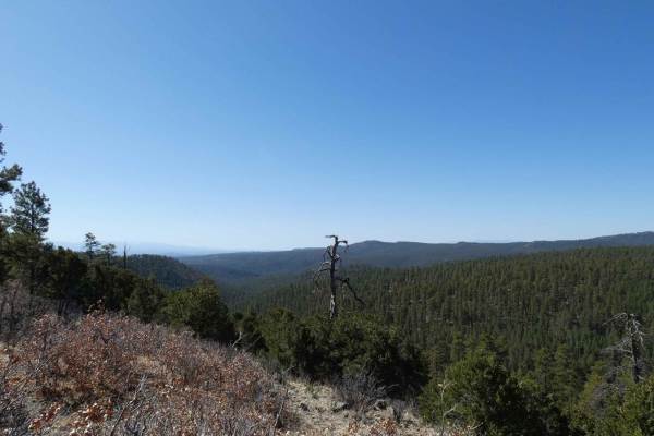
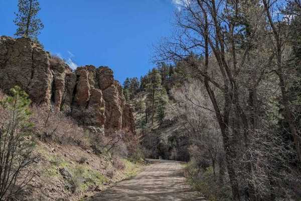
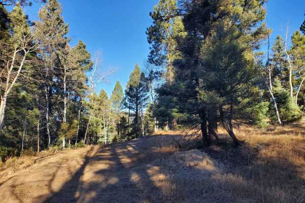
West Rim Trail
Difficulty: 2 (Easy) The West Rim trail offers 3.2 miles of scenic desert driving with spectacular canyon overlooks along the western edge of Rio Grande del Norte National Monument. Accessible from Taos Valley Road, this BLM route typically requires 45 minutes to complete, making it perfect for thos...
Learn more about West Rim Trail
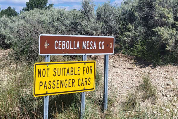
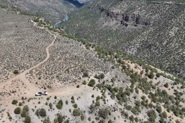
Cebolla Mesa
When the sign at the trail entrance states, "Not suitable for passenger cars", they aren't joking. This is a heavily unmaintained trail and is not recommended for anything with low clearance. Deep mud ruts are present throughout, both dry and wet. This trail may be even more challenging during/after...
Learn more about Cebolla Mesa
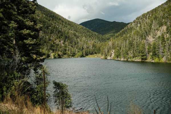
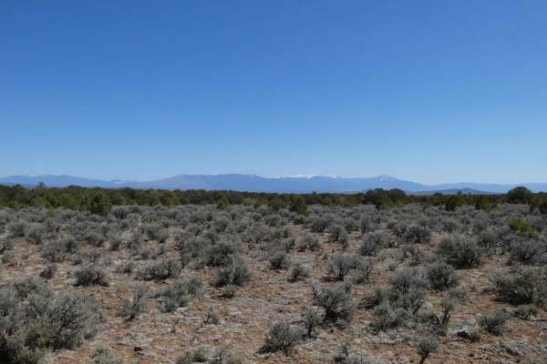
Goose Lake Trail
Goose Lake Trail ascends a tight, two-track road almost 3000 feet in 7.3 miles from the Red River Valley to one of New Mexico's most scenic high altitude lakes. Along the way, stop and explore the historic mining cabins from the late 1800s. To begin the trail, you'll have to navigate crossing the Re...
Learn more about Goose Lake Trail
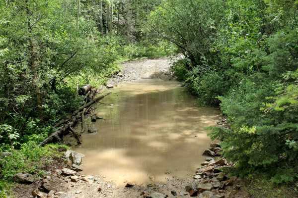
Cabresto Canyon - FS 134
Forest Service Road 134 is a rocky, relatively flat road that traverses down the Cabresto Canyon in Carson National Forest. This mostly gravel and dirt trail doesn't have any difficult obstacles and can be driven by any AWD vehicle. The 15-mile valley road is full of wildflowers, water-flowing creek...
Learn more about Cabresto Canyon - FS 134
Cabresto Lake - FS 134A
Forest Service Road 134A is a steep, rocky road that leads to Cabresto Lake; it's a beautiful mountain lake surrounded by the high peaks of Carson National Forest. The trail is narrow and consists of sharp rocks no larger than 12 inches in height. High-clearance 4x4 is recommended but high-clearance...
Learn more about Cabresto Lake - FS 134A
Pioneer Creek
Pioneer Creek Trail leaves from Red River behind the ski resort and then follows the canyon up. There are some large loose rocks towards the end and four water crossings where the trail crosses the creek. Although the map shows the trail goes further, it has been closed where the track ends, and a l...
Learn more about Pioneer Creek
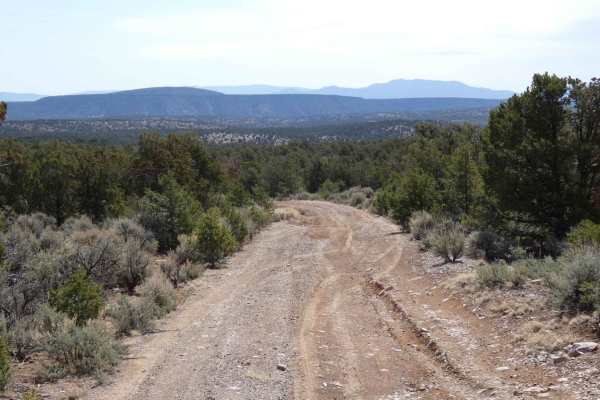
FS 45 Vallecitos to Petaca
FS 45 is a scenic, well-maintained dirt road that connects two small mountain towns, Vallecitos and Petaca. This can be considered part three of a fun and relaxing set of trails starting in Abiquiu, and ending up northeast in Tres Piedras. This route features dense pines and the occasional valley ov...
Learn more about FS 45 Vallecitos to Petaca
La Jara Canyon
This trail is a well-maintained forest road that leads from US 64 to some logging trails along the border of the Taos Pueblo. The road is closed near the logging trails as its condition deteriorates and has many dispersed camping sites along the length of it. Use caution for wetlands near the creek,...
Learn more about La Jara Canyon
Tusas Ridge
Tusas Ridge runs north from FSR-222 and dead-ends shy 10 miles to the west after a few substantial elevation changes. The primarily dirt two-track trail can be extremely muddy after wet weather, with smaller loose rocks up to 10 inches in size being the only other obstacle. Some minor rutting and mi...
Learn more about Tusas Ridge
Red Mesa FSR-578
Red Mesa FSR-578 is a point-to-point trail that connects from FS-222/CR-263 at its north entrance and leads back to SH-285 at its south entrance. This trail can be traversed from either end and is suitable for most high-clearance 2WD vehicles during dry weather. The surface is a decently balanced co...
Learn more about Red Mesa FSR-578
La Madera Loop FSR-222E
La Madera Loop is a highly diverse trail that offers many obstacles, terrain changes, and scenic views. The trail starts on softer dirt and is surrounded by trees before becoming a very lightly used and ungroomed or maintained trail that is beginning to show some signs of overgrowth. While the trail...
Learn more about La Madera Loop FSR-222E
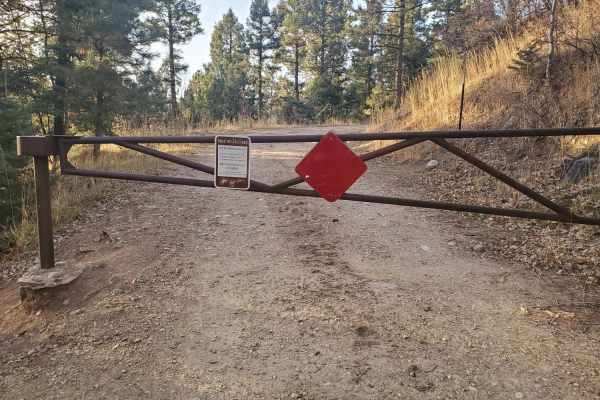
La Junta Canyon
A well-maintained forest road that is gated as it approaches the Taos Pueblo. It provides access to a woodcutting area as well as logging operations in the national forest. There are appx 4-5 dispersed camping areas along the road with no facilities but fire circles. Cell reception in the area is ad...
Learn more about La Junta Canyon
FS 222 Las Tablas to Tres Piedras
This is a short, straightforward trail in Carson National Forest that is well maintained, allowing any stock SUV to get from beginning to end with little stress. There are beautiful views, stands of cottonwoods amongst the pines, and unique rock formations along FS 222. Enjoy lunch by a pond in the ...
Learn more about FS 222 Las Tablas to Tres Piedras
Greenie East
This trail starts up Marlette Canyon before splitting off from Sawmill Trail. It then splits again from the most direct and well marked route to the peak, dropping back down into a drainage, before climbing back up and around to follow the crest of the ridge. It rejoins the direct route just before ...
Learn more about Greenie East
Sawmill
This is a rough and rocky mountain road that climbs high into the mountains of Carson National Forest. The route is generally easy with no technical obstacles and can be traveled in either direction. It offers excellent scenery and connects with several other notable off-road trails in the Red River...
Learn more about Sawmill
Osha Pass/70b
This route is the main forest road that provides access to the 70 Moto Trail, which is a width-restricted motorized trail that climbs to Osha Pass. This trail also provides access to the Elliot Barker Trail 1, a hike, bike, horse trail that runs 12 miles along the east edge of the National Forest. F...
Learn more about Osha Pass/70b
Apache Trail
This trail is an offshoot of Forest Road 70/Osha Pass trail. It leaves the main trail and tracks along the boundary of public and private land for a short while before climbing the mountainside and tracking further north into the National Forest. It provides access to a network of logging roads in t...
Learn more about Apache Trail
Vistas Overlook
Vistas Overlook is a primarily rocky trail and best run from its northern entrance, which is located approximately 2 miles from the south entrance of La Madera Loop, located off of CR519. Most high clearance AWD can complete the narrow two-track, and it will be an easy track for most 4WD and 4X4 veh...
Learn more about Vistas Overlook
Sawmill Greenie
This is a roundabout way of getting from Red River, NM to Greenie Peak. It departs town as a wide, two-lane gravel road, and passes several dispersed camping areas before starting to climb. There are other routes to Greenie Peak that are more direct that split off from this route. About halfway up, ...
Learn more about Sawmill Greenie
Devils Ridge
Devils Ridge when run from its east entrance starts as a very unsuspecting sandy wash with very few features aside from some loose rocks up to 12" in size. However, it quickly changes to an extremely narrow shelf road that follows the side of the canyon wall above the dry river bed below. It is advi...
Learn more about Devils Ridge
ATV trails near Arroyo Hondo, New Mexico
Explore ATV-friendly trails near you. These trails are accessible for vehicles up to 50 inches wide, perfect for ATVs and smaller off-road machines.
West Rim Trail
Difficulty: 2 (Easy) The West Rim trail offers 3.2 miles of scenic desert driving with spectacular canyon overlooks along the western edge of Rio Grande del Norte National Monument. Accessible from Taos Valley Road, this BLM route typically requires 45 minutes to complete, making it perfect for thos...
Learn more about West Rim Trail
Cebolla Mesa
When the sign at the trail entrance states, "Not suitable for passenger cars", they aren't joking. This is a heavily unmaintained trail and is not recommended for anything with low clearance. Deep mud ruts are present throughout, both dry and wet. This trail may be even more challenging during/after...
Learn more about Cebolla Mesa
Goose Lake Trail
Goose Lake Trail ascends a tight, two-track road almost 3000 feet in 7.3 miles from the Red River Valley to one of New Mexico's most scenic high altitude lakes. Along the way, stop and explore the historic mining cabins from the late 1800s. To begin the trail, you'll have to navigate crossing the Re...
Learn more about Goose Lake Trail
Cabresto Canyon - FS 134
Forest Service Road 134 is a rocky, relatively flat road that traverses down the Cabresto Canyon in Carson National Forest. This mostly gravel and dirt trail doesn't have any difficult obstacles and can be driven by any AWD vehicle. The 15-mile valley road is full of wildflowers, water-flowing creek...
Learn more about Cabresto Canyon - FS 134
UTV/side-by-side trails near Arroyo Hondo, New Mexico
Find UTV and side-by-side trails near you. These trails accommodate vehicles up to 60 inches wide, ideal for UTVs, side-by-sides, and wider off-road rigs.
West Rim Trail
Difficulty: 2 (Easy) The West Rim trail offers 3.2 miles of scenic desert driving with spectacular canyon overlooks along the western edge of Rio Grande del Norte National Monument. Accessible from Taos Valley Road, this BLM route typically requires 45 minutes to complete, making it perfect for thos...
Learn more about West Rim Trail
Cebolla Mesa
When the sign at the trail entrance states, "Not suitable for passenger cars", they aren't joking. This is a heavily unmaintained trail and is not recommended for anything with low clearance. Deep mud ruts are present throughout, both dry and wet. This trail may be even more challenging during/after...
Learn more about Cebolla Mesa
Goose Lake Trail
Goose Lake Trail ascends a tight, two-track road almost 3000 feet in 7.3 miles from the Red River Valley to one of New Mexico's most scenic high altitude lakes. Along the way, stop and explore the historic mining cabins from the late 1800s. To begin the trail, you'll have to navigate crossing the Re...
Learn more about Goose Lake Trail
Cabresto Canyon - FS 134
Forest Service Road 134 is a rocky, relatively flat road that traverses down the Cabresto Canyon in Carson National Forest. This mostly gravel and dirt trail doesn't have any difficult obstacles and can be driven by any AWD vehicle. The 15-mile valley road is full of wildflowers, water-flowing creek...
Learn more about Cabresto Canyon - FS 134
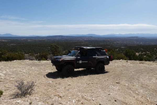
The onX Offroad Difference
onX Offroad combines trail photos, descriptions, difficulty ratings, width restrictions, seasonality, and more in a user-friendly interface. Available on all devices, with offline access and full compatibility with CarPlay and Android Auto. Discover what you're missing today!
Open Trail Map