
Dirt Bike Trails
Near Aneth, Utah
Explore All Dirt Bike Trails Near Aneth, Utah
Dirt Bike Trails Near Aneth, Utah
Discover the best dirt bike trails near you. Browse trail maps, check difficulty ratings, and find your next adventure — whether you're looking for a quick ride or an all-day expedition.
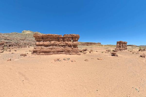
Recapture Pocket
This trail leads to Recapture Pocket, a scenic collection of hoodoos and cliffs. The trail north of Recapture Pocket is a very lightly used oil field access network, with rocky and sandy sections. Some of the more remote sections include rock ledges, sand dunes, and other challenges. A stock 4x4 or ...
Learn more about Recapture Pocket
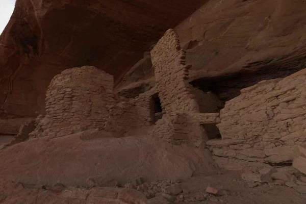
Comb Ridge
Comb Ridge is a 5.6-mile (11.2-mile round trip) out-and-back trail rated 3 of 10 located on the southern end of the Bear Ears National Monument. This trail is also known as the road to River House. This trail is rich in history both in Pre-Puebloan as well as the early Mormon settlers. This mostly h...
Learn more about Comb Ridge
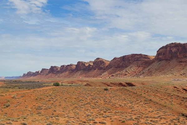
Comb Wash Road
Comb Wash Road follows the iconic Comb Ridge. The road itself is on BLM land and is suitable for most all-terrain vehicles. There are some water crossings in the Spring or when storms are nearby, so be careful to pay attention to weather reports. There are many side trails that lead to petroglyphs a...
Learn more about Comb Wash Road
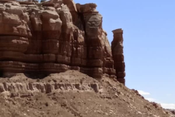
Butler Wash Road
Butler Wash Road is a beautiful drive between Highway 95 and Highway 163. This road is not recommended during or the day after heavy rain. With sandy and rocky wash roads, high-clearance 4x4 is recommended. There are flat sagebrush bottom areas interspersed by rocky canyons and cliffs with numerous ...
Learn more about Butler Wash Road
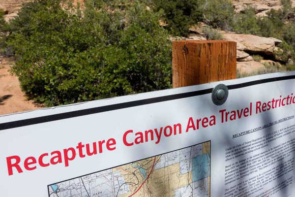
Recapture Rim Trail
Recapture Rim Trail is a 5.9-mile ATV/UTV/Motorcycle -only point-to-point trail rated 3 of 10 located in San Juan County. This trail is the closest trail to the now-closed Recapture Canyon. The trail starts on the eastern side of Blanding and after passing multiple farm fields arrives at the western...
Learn more about Recapture Rim Trail
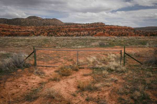
Fence Trail
This trail starts at Highway 95 through a fence. It's a faint trail in the beginning, going through pinyon pines and sagebrush. It's elevated above Butler Wash as it parallels the wash after leaving the highway, and steadily climbs up to the top of the mesa. It continues along the top of the mesa wi...
Learn more about Fence Trail
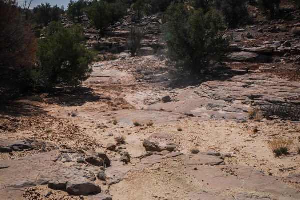
Trail 1
Trail 1 is a 1.3-mile loop off of South Elks Road. It's a narrower Jeep trail on hardpack dirt, between small bushes and pinyon pine on a gravelly surface. It joins up with a wider Jeep road as it makes a loop. The surface of the trail is mostly dirt, but it has some embedded slab rock, one section ...
Learn more about Trail 1
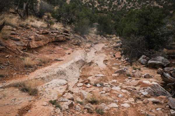
Rocky
This is a 3-mile Jeep trail that goes around the edge of a mesa on soft dirt, with lots of cattle tracks. It goes through lots of unmarked intersections between pinyon pine trees. It's a wider trail in the beginning, with dips across ravines and washes. It gets more technical with loose rock and sla...
Learn more about Rocky
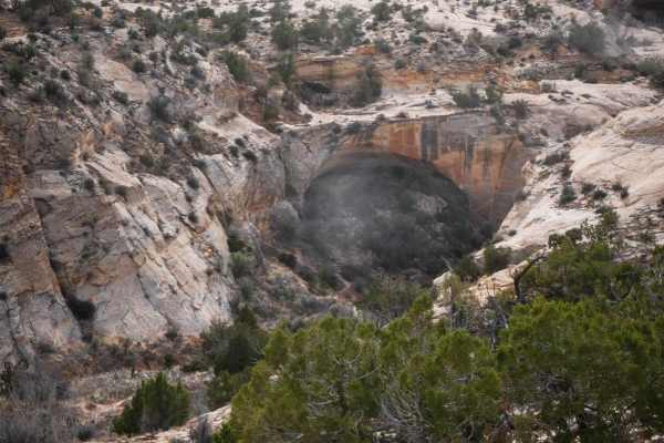
Butler Wash
This 3.4-mile 4x4 route starts on County Road 240 and goes south until it dead-ends at a cliff over Butler Wash. The cliff comes up suddenly, so don't go too fast at the end of the trail. This trail is less trafficked and more faint through soft dirt. It has lots of dips into ravines and washes with...
Learn more about Butler Wash
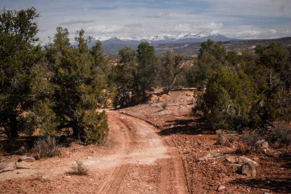
Trail 2
Trail 2 is a rutted, narrow Jeep trail near Blanding, Utah, that goes between pinyon pines and sagebrush with views toward the Abajo Mountains. It's a fun trail to explore in the fall and spring when it's not too hot or cold while connecting to many of the other trails in the area. This is a good pl...
Learn more about Trail 2
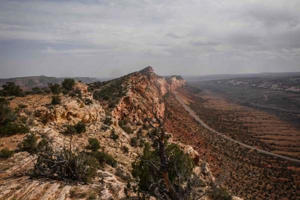
240
County Road 240 is a 9-mile-long full-width graded dirt road. It's smooth, hard-packed dirt, with nice views of all the surrounding green hills and mesas and pink sandstone layers. It's really scenic in a landscape with contrasting pink and green colors. The east end starts off of South Elks Road. I...
Learn more about 240
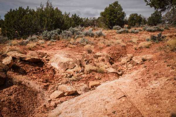
Cheese and Raisins
This is a narrower Jeep trail on dirt, through sagebrush and pinyon pine in the Cheese and Raisins Hills. The trail is less trafficked, with ruts and washouts on the side of the trail to watch out for. It has some slab rock and a couple of steeper loose downhills that are full of loose rocks, making...
Learn more about Cheese and Raisins
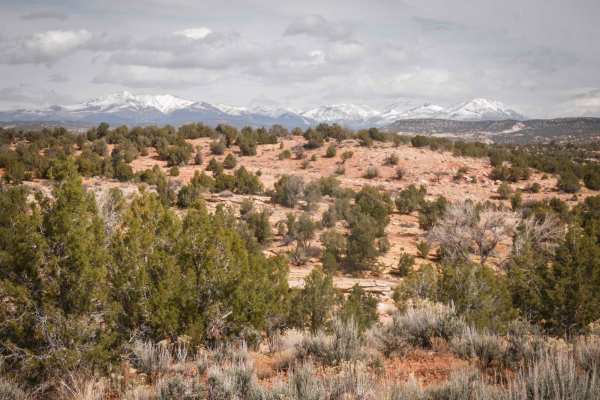
274 Shumway Mines Road
This is a wide graded dirt road that starts off of South Elks Road, which is also wide and easy. It goes for 1.3 miles, making a sharp left turn when it comes to a T in the road. It accesses several other 4x4 high-clearance roads that you can explore, most of which are unmarked. This road is overall...
Learn more about 274 Shumway Mines Road
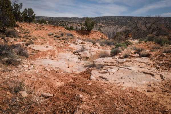
Cottonwood Creek
This is a 2-mile-long 4x4 road in the Brushy Basin area near Blanding, Utah. It goes through a high desert terrain full of sagebrush and pinyon pine, and the area is full of similar Jeep trails to explore. The southern entrance is a bit hard to find because it is faint and overgrown with hardly any ...
Learn more about Cottonwood Creek
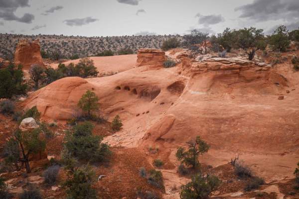
Chimney
This 4-mile scenic track starts from County Road 240 as a wider dirt trail on top of a desert mesa. As it goes south, it has lots of unmarked intersections for spurs you can explore. The trail is overall really easy but has features such as dips across ravines, wash crossings, tight turns, and ruts....
Learn more about Chimney
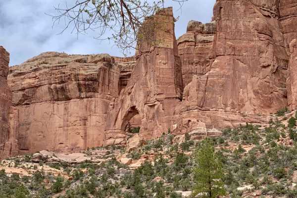
Arch Canyon
This 17.3 mile out and back box canyon trail features amazing Utah bluffs and rock formations and numerous water crossings. You will turn left before crossing the water that leads to Hotel Rock. There is a sign that shows Arch Canyon entrance. Depending on how much rainfall the area has received,...
Learn more about Arch Canyon
205
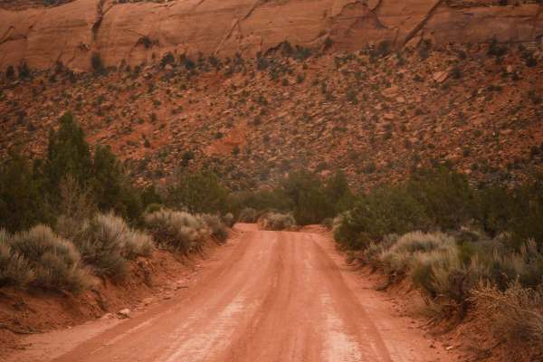
Road 205 starts off of Comb Ridge Descent and goes north for 2.2 miles on a full-width graded dirt road. As you drive north, you'll have views looking towards Comb Ridge and the tall red sandstone canyon walls. The road is flat and wide between sagebrush, with scenic views in every direction under t...
Learn more about 205
Shumway Mines
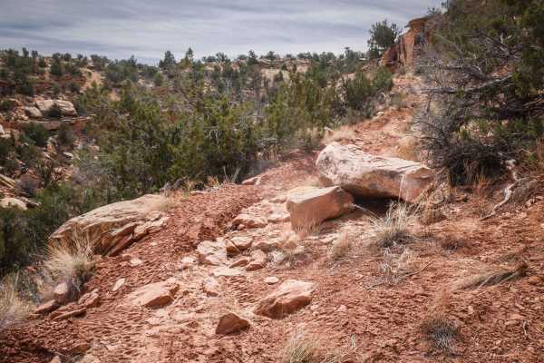
This is a narrow trail that departs from Road 274, heads west on a windy track, and dead-ends after 2 miles. It has shallow ruts and loose rocks and a short steeper section in the beginning. It turns into a shelfy road on a hillside. The harder parts of the trail are when it goes through narrow sect...
Learn more about Shumway Mines
Dead End Spur
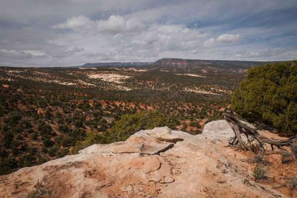
This is a 3-mile spur off of Shumway Mines that heads west into the Cheese and Raisins Hills and dead-ends at nowhere in particular. This trail is most likely used for hunting access or just exploring on OHVs. Although it dead-ends and has to be ridden as an out-and-back, it does have some nice view...
Learn more about Dead End Spur
Whiskers Draw
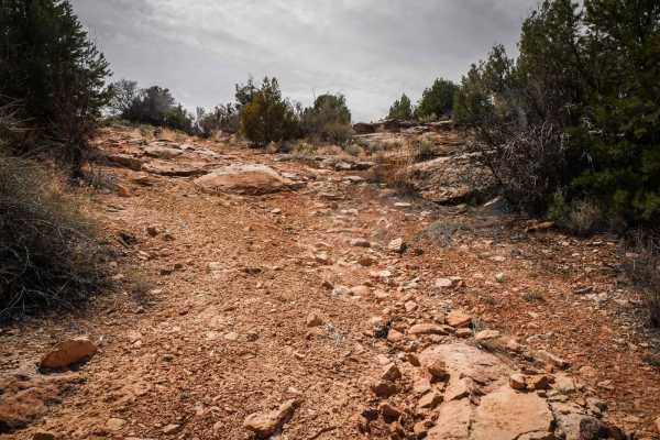
This 3.3-mile trail goes west from South Elks Road, connecting to another Jeep trail that makes a loop back to South Elks Road. It goes between pinyon pine and sagebrush with big ruts running alongside the trail. It has lots of big dips and G-outs as it crosses ravines running perpendicular through ...
Learn more about Whiskers Draw
ATV trails near Aneth, Utah
Explore ATV-friendly trails near you. These trails are accessible for vehicles up to 50 inches wide, perfect for ATVs and smaller off-road machines.
Recapture Pocket
This trail leads to Recapture Pocket, a scenic collection of hoodoos and cliffs. The trail north of Recapture Pocket is a very lightly used oil field access network, with rocky and sandy sections. Some of the more remote sections include rock ledges, sand dunes, and other challenges. A stock 4x4 or ...
Learn more about Recapture Pocket
Comb Ridge
Comb Ridge is a 5.6-mile (11.2-mile round trip) out-and-back trail rated 3 of 10 located on the southern end of the Bear Ears National Monument. This trail is also known as the road to River House. This trail is rich in history both in Pre-Puebloan as well as the early Mormon settlers. This mostly h...
Learn more about Comb Ridge
Comb Wash Road
Comb Wash Road follows the iconic Comb Ridge. The road itself is on BLM land and is suitable for most all-terrain vehicles. There are some water crossings in the Spring or when storms are nearby, so be careful to pay attention to weather reports. There are many side trails that lead to petroglyphs a...
Learn more about Comb Wash Road
Butler Wash Road
Butler Wash Road is a beautiful drive between Highway 95 and Highway 163. This road is not recommended during or the day after heavy rain. With sandy and rocky wash roads, high-clearance 4x4 is recommended. There are flat sagebrush bottom areas interspersed by rocky canyons and cliffs with numerous ...
Learn more about Butler Wash Road
UTV/side-by-side trails near Aneth, Utah
Find UTV and side-by-side trails near you. These trails accommodate vehicles up to 60 inches wide, ideal for UTVs, side-by-sides, and wider off-road rigs.
Recapture Pocket
This trail leads to Recapture Pocket, a scenic collection of hoodoos and cliffs. The trail north of Recapture Pocket is a very lightly used oil field access network, with rocky and sandy sections. Some of the more remote sections include rock ledges, sand dunes, and other challenges. A stock 4x4 or ...
Learn more about Recapture Pocket
Comb Ridge
Comb Ridge is a 5.6-mile (11.2-mile round trip) out-and-back trail rated 3 of 10 located on the southern end of the Bear Ears National Monument. This trail is also known as the road to River House. This trail is rich in history both in Pre-Puebloan as well as the early Mormon settlers. This mostly h...
Learn more about Comb Ridge
Comb Wash Road
Comb Wash Road follows the iconic Comb Ridge. The road itself is on BLM land and is suitable for most all-terrain vehicles. There are some water crossings in the Spring or when storms are nearby, so be careful to pay attention to weather reports. There are many side trails that lead to petroglyphs a...
Learn more about Comb Wash Road
Butler Wash Road
Butler Wash Road is a beautiful drive between Highway 95 and Highway 163. This road is not recommended during or the day after heavy rain. With sandy and rocky wash roads, high-clearance 4x4 is recommended. There are flat sagebrush bottom areas interspersed by rocky canyons and cliffs with numerous ...
Learn more about Butler Wash Road
The onX Offroad Difference
onX Offroad combines trail photos, descriptions, difficulty ratings, width restrictions, seasonality, and more in a user-friendly interface. Available on all devices, with offline access and full compatibility with CarPlay and Android Auto. Discover what you're missing today!
Open Trail Map