
Beginner Off-Road Trails
Near Wilson, Arkansas
Explore All Beginner Trails Near Wilson, Arkansas
Beginner Off-Road Trails Near Wilson, Arkansas
Discover the best beginner-friendly off-road trails near you. These easier, lower-rated trails are a great place to start — browse trail maps, check difficulty ratings, and find your next adventure.
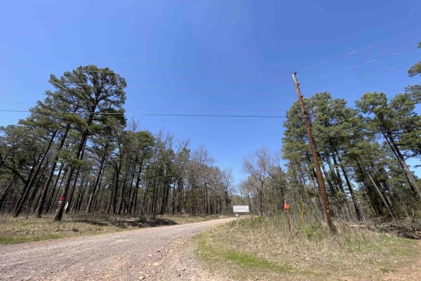
Rock Creek 1319
Rock Creek is an easy gravel road with creeks, campsites, and views for miles. It has eight spur trails for SxSs, ATVs, and 4x4 rigs. Griffin Mountain peaks at an elevation of 1004 feet giving you a taste of what the Ozarks has to offer. There are water crossings and lots of little creeks to play in...
Learn more about Rock Creek 1319
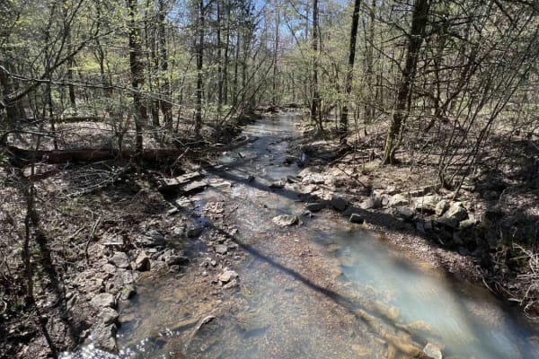
Cheyenne Road
One of the great features of the Ozarks is the endless dedicated ATV, SxS, dirt bike, and off-roading areas. Cheyenne Road is one of those gateway trails that will lead you to the Mountain Man Trailhead riding area. It's an easy gravel however there are washed-out sections and creek crossings with b...
Learn more about Cheyenne Road
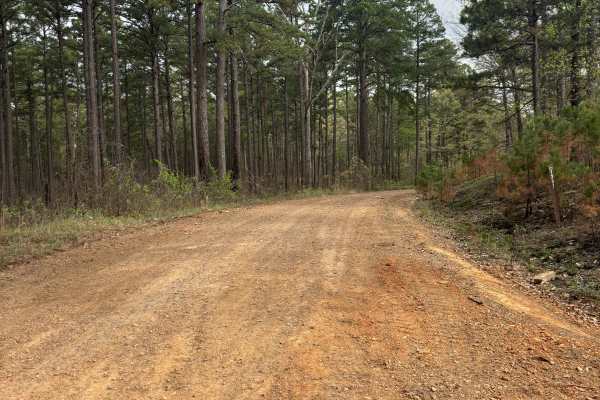
Tackett Mountain 1337
Tackett Mountain Road is an easy, scenic gravel route that loops around Tackett Mountain and serves as a great connector between Rock Creek 1319 and Rock Creek Road. This is a relaxing drive with seasonal beauty, especially in the spring. The road is primarily well-maintained gravel, making for a sm...
Learn more about Tackett Mountain 1337
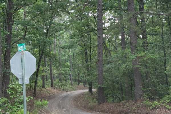
Wallace Bridge Road
Wallace Bridge Road is a beautiful gravel road that is woven through the Ouachita National Forest. This is a very well-maintained gravel road that passes through farmland in Deberrie, Arkansas, and runs along the Fourche LaFave River. This road is suitable for most vehicles as there are limited obst...
Learn more about Wallace Bridge Road
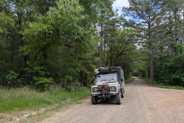
Slo Fork Road
Slo Fork is a well-maintained gravel road characterized by frequent corrugations and bumps, making cautious driving at lower speeds advisable. The route passes through picturesque landscapes dotted with private properties and rural farmsteads, offering scenic views of agricultural land before transi...
Learn more about Slo Fork Road
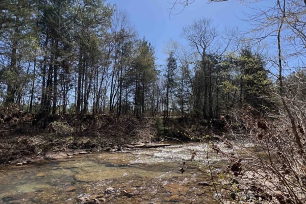
Liberty Springs 1334
Liberty Springs is the south entrance to the Brock Creek ATV Trail system, Brock Creek Campground, and Brock Creek Lake. This road is an easy dirt road with some gravel mixed in. There are beautiful spots to stop to have lunch before hitting the ATV trails. Brock Creek has a huge staging area big en...
Learn more about Liberty Springs 1334

Long Caney 849 to South Fourche LaFave River
The Northern entrance into the Ouachita National Forest leads to a beautiful large quiet campsite on the South Fourche LaFave River. The road leading to this location is gravel when coming from the north. Once you turn right on Long Caney, it turns into a mud hole road all the way to camp. Lots of t...
Learn more about Long Caney 849 to South Fourche LaFave River

Brock 40
This 4.5-mile ATV route starts at the Schoolhouse Hollow off of Brock 42. It's a windy ATV path through the trees, and after half a mile, it connects to Charleston Road for a moment at the Zing Trailhead. Continuing from there, the trail has been rerouted to loop around west before heading south. Th...
Learn more about Brock 40
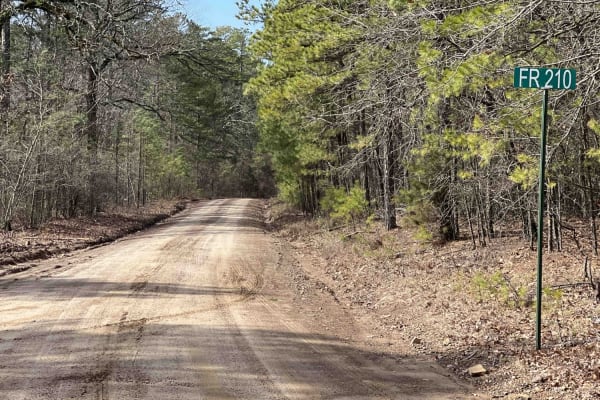
Link Mountain Road 210
Starting the trail to the east, it's an easy gravel road for the first 5 miles or so. Then it turns into a muddy mess with high ruts in the middle which make it hard for a low clearance vehicle to make it through certain sections. You can see this in the photo at mile 5.9. There are some really grea...
Learn more about Link Mountain Road 210
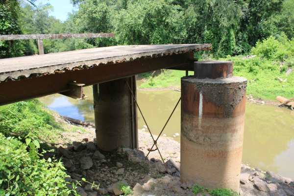
Petit Jean River Wildlife Mgmt Area
This gravel road leads to an old bridge, that has only a section left, on the Petit Jean River. This area is Petit Jean River Wildlife Management Area. This gravel road has several views of the Petit Jean River. A section of the bridge is still present on this side of the Petit Jean River. Standing ...
Learn more about Petit Jean River Wildlife Mgmt Area
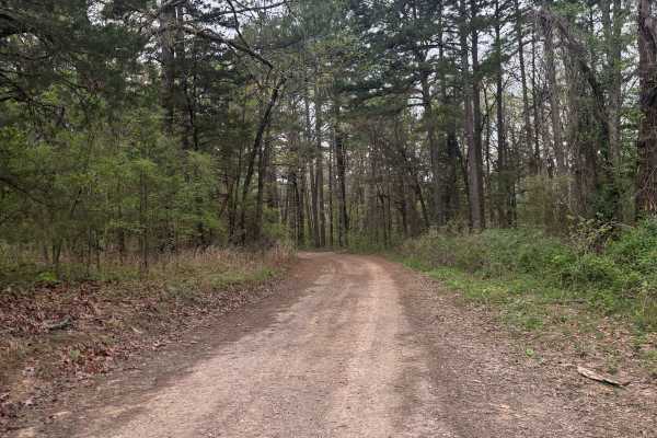
West Fork Point Remove Creek
West Fork Point Remove Creek is an easygoing, scenic trail that runs through a quiet pine forest in the southeastern Ozarks. This route is ideal for beginners or anyone looking for a relaxed ride with strong wildlife viewing potential. This trail connects Driver Creek Dam / Cedar Mountain to Lower ...
Learn more about West Fork Point Remove Creek
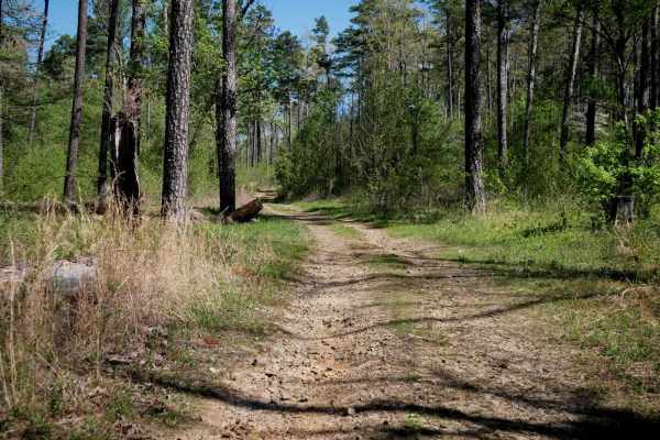
Brock 52
This half-mile connector trail linking Trail 51 to Road 1334 offers an easy ride through a wide, open forest of tall southern red oaks. The two-track path is generally smooth with intermittent rocky patches, and riders should be prepared for occasional downed logs and loose sticks along the way. Des...
Learn more about Brock 52
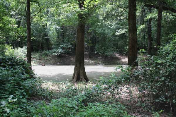
Cane Island
This gravel road enters The Petit Jean Wildlife Management Area from Highway 10. The WMA encompasses 15,502 acres approximately 12 miles south of Dardanelle. Petit Jean River Wildlife Management area is located about 8 miles north of Ola on Highway 7 North. The designated area can be accessed from s...
Learn more about Cane Island

Driver Creek Dam/Cedar Mountain
Driver Creek Dam starts out as an easy gravel road that winds through the forest, with steep grades and large gravel. You start at Cedar Mountain where you will find some amazing views and a huge dispersed campsite with a fire ring. This would be a perfect spot for someone traveling out of town and...
Learn more about Driver Creek Dam/Cedar Mountain
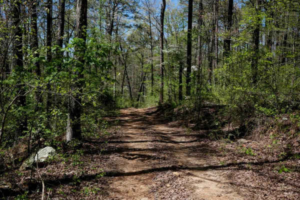
Brock 47
This short ATV connector runs north to south between trails 46 and 48, cutting across a hillside with a relatively smooth surface composed of small gravel and occasional larger rocks. Unlike many trails in the area, it features minimal turns, offering a straight and easy ride ideal for linking secti...
Learn more about Brock 47
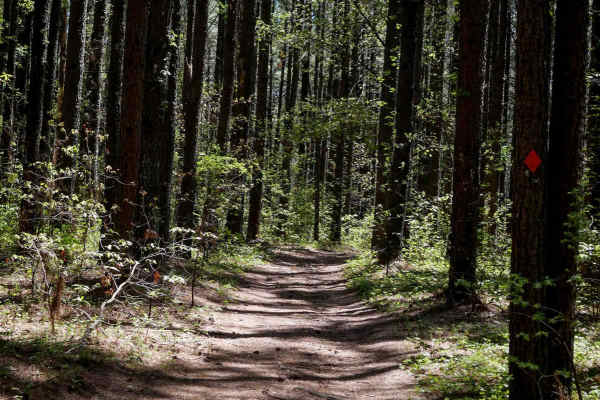
Brock 48
This trail descends gradually from north to south through a distinctive mix of tall loblolly pines and dense oak-maple forest. The surface is uneven and rutted in places, especially following spring storms, with occasional steep sections and downed logs across the path. The trail typically serves as...
Learn more about Brock 48
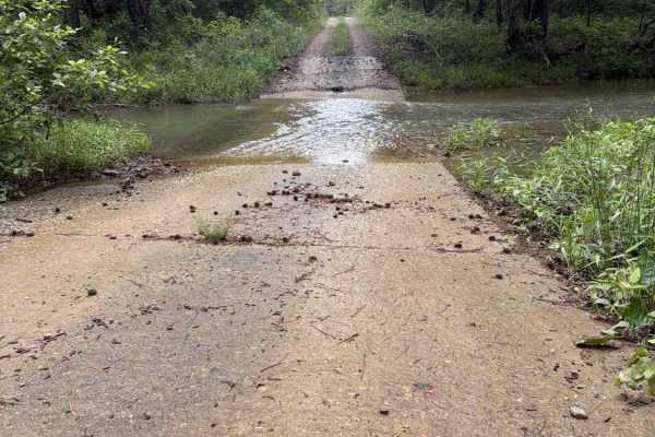
FS 29340
FS 29340 is a maintained gravel/dirt road that connects Long Caney Bypass to CR 182. Along the Ridgeline, you will get some fantastic views of the Ouachita National Forest and will often see Deer and other wildlife. There are a couple of low water bridges that are 6-12 inches deep, depending on the ...
Learn more about FS 29340
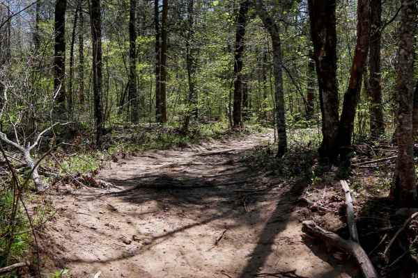
Brock 44
Brock 44 is a wide ATV trail in the Ozark National Forest featuring a mix of smooth and rocky surfaces with a shallow stream crossing at the west entrance in the Schoolhouse Hollow. The route is mostly flat with a gradual ascent of a few hundred feet over a mile, with the most difficult section bein...
Learn more about Brock 44
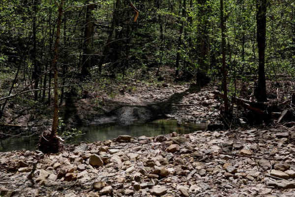
Brock 43
This 2-mile ATV trail in the Ozark National Forest gradually climbs 500 feet over 2 miles, connecting ATV trail 42 to Road 1318. It features a wide path with typical terrain for the area--rollers, dips, sharp curves, shallow stream crossings, and short steep climbs. Loose cobbly rock is common, with...
Learn more about Brock 43
Brock 51
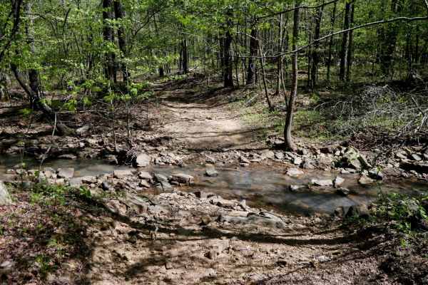
This wide two-track trail winds northeast through a scenic forest of dogwoods, offering a mix of dirt and loose rocky terrain. While generally accessible, riders should be aware that the southern entrance can flood after heavy rain, and some sections may be troughed out with mud puddles--though bypa...
Learn more about Brock 51
Beginner ATV trails near Wilson, Arkansas
Explore ATV-friendly trails near you. These trails are accessible for vehicles up to 50 inches wide, perfect for ATVs and smaller off-road machines.
Rock Creek 1319
Rock Creek is an easy gravel road with creeks, campsites, and views for miles. It has eight spur trails for SxSs, ATVs, and 4x4 rigs. Griffin Mountain peaks at an elevation of 1004 feet giving you a taste of what the Ozarks has to offer. There are water crossings and lots of little creeks to play in...
Learn more about Rock Creek 1319
Cheyenne Road
One of the great features of the Ozarks is the endless dedicated ATV, SxS, dirt bike, and off-roading areas. Cheyenne Road is one of those gateway trails that will lead you to the Mountain Man Trailhead riding area. It's an easy gravel however there are washed-out sections and creek crossings with b...
Learn more about Cheyenne Road
Tackett Mountain 1337
Tackett Mountain Road is an easy, scenic gravel route that loops around Tackett Mountain and serves as a great connector between Rock Creek 1319 and Rock Creek Road. This is a relaxing drive with seasonal beauty, especially in the spring. The road is primarily well-maintained gravel, making for a sm...
Learn more about Tackett Mountain 1337
Wallace Bridge Road
Wallace Bridge Road is a beautiful gravel road that is woven through the Ouachita National Forest. This is a very well-maintained gravel road that passes through farmland in Deberrie, Arkansas, and runs along the Fourche LaFave River. This road is suitable for most vehicles as there are limited obst...
Learn more about Wallace Bridge Road
Beginner UTV/side-by-side trails near Wilson, Arkansas
Find UTV and side-by-side trails near you. These trails accommodate vehicles up to 60 inches wide, ideal for UTVs, side-by-sides, and wider off-road rigs.
Rock Creek 1319
Rock Creek is an easy gravel road with creeks, campsites, and views for miles. It has eight spur trails for SxSs, ATVs, and 4x4 rigs. Griffin Mountain peaks at an elevation of 1004 feet giving you a taste of what the Ozarks has to offer. There are water crossings and lots of little creeks to play in...
Learn more about Rock Creek 1319
Cheyenne Road
One of the great features of the Ozarks is the endless dedicated ATV, SxS, dirt bike, and off-roading areas. Cheyenne Road is one of those gateway trails that will lead you to the Mountain Man Trailhead riding area. It's an easy gravel however there are washed-out sections and creek crossings with b...
Learn more about Cheyenne Road
Tackett Mountain 1337
Tackett Mountain Road is an easy, scenic gravel route that loops around Tackett Mountain and serves as a great connector between Rock Creek 1319 and Rock Creek Road. This is a relaxing drive with seasonal beauty, especially in the spring. The road is primarily well-maintained gravel, making for a sm...
Learn more about Tackett Mountain 1337
Wallace Bridge Road
Wallace Bridge Road is a beautiful gravel road that is woven through the Ouachita National Forest. This is a very well-maintained gravel road that passes through farmland in Deberrie, Arkansas, and runs along the Fourche LaFave River. This road is suitable for most vehicles as there are limited obst...
Learn more about Wallace Bridge Road
The onX Offroad Difference
onX Offroad combines trail photos, descriptions, difficulty ratings, width restrictions, seasonality, and more in a user-friendly interface. Available on all devices, with offline access and full compatibility with CarPlay and Android Auto. Discover what you're missing today!
Open Trail Map