
Beginner Off-Road Trails
Near Tehachapi, California
Explore All Beginner Trails Near Tehachapi, California
Beginner Off-Road Trails Near Tehachapi, California
Discover the best beginner-friendly off-road trails near you. These easier, lower-rated trails are a great place to start — browse trail maps, check difficulty ratings, and find your next adventure.
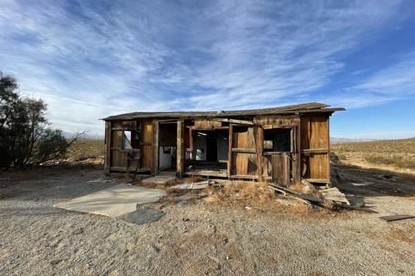
Whitmore Gold Mines
Whitmore Gold Mines is a short, scenic desert loop perfect for beginners, history buffs, and offroaders looking for a quick excursion into the western Mojave Desert's rich mining past. Located just west of Sierra Highway near Rosamond, this trail provides an accessible detour with low-intensity driv...
Learn more about Whitmore Gold Mines

Jawbone to Lake Isabella
Jawbone to Lake Isabella is a scenic, long-distance dirt route perfect for high-clearance SUV and truck owners looking to transition from the sprawling high desert of the Mojave up into the cool, pine-covered heights of the Piute Mountains. Covering approximately 48.7 miles, this point-to-point jour...
Learn more about Jawbone to Lake Isabella
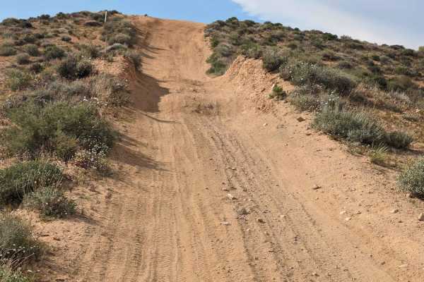
SC176 Gold Canyon Road
This 6-mile sandy road starts at Jawbone Canyon Road. It travels north through sandy washes. Off-camber, deep sand, and ruts are the main obstacles. Then it is a steep climb on an uneven and winding trail to the top. At that point, SC176 continues to the northeast. There is also a split-off to the ...
Learn more about SC176 Gold Canyon Road
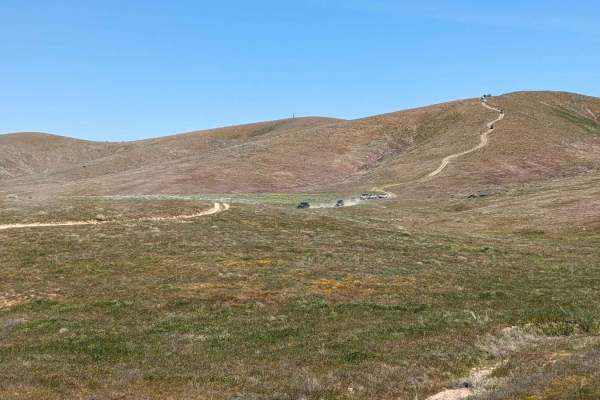
Fairmont Peak Summit
This trail climbs over 500 feet to the top of Fairmont Peak Tower. The route is rocky and uneven. Although a shorter route, airing down is highly recommended. Slow speeds are also recommended. Many rocks are sharp. Flats have been known to happen. There are views of solar arrays, adjacent valleys, a...
Learn more about Fairmont Peak Summit
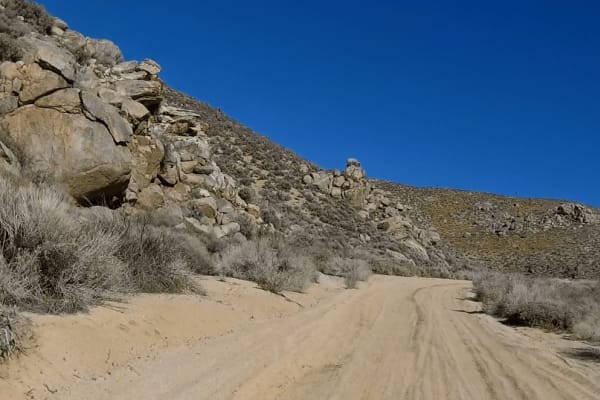
Alphie Springs Wash
This is a fun winding trail that starts right off of SC173 and quickly drops down into a soft wide sand wash. The trail narrows with a tight s-turn between large boulders then opens up into a double-wide trail that winds past the Yucca trees. After a few miles it dead ends into SC103, a left turn he...
Learn more about Alphie Springs Wash
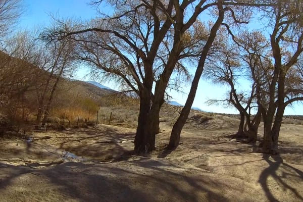
Dove Springs Access Trail
This route consists of two main trails, SC47 and SC328. The trail can be accessed on the West from Kelso Valley Road and from the East at the actual Dove Springs. My route includes the section between SC69 on the West and ends at the Actual Dove Springs. Most of this trail is a semi-soft double-wide...
Learn more about Dove Springs Access Trail
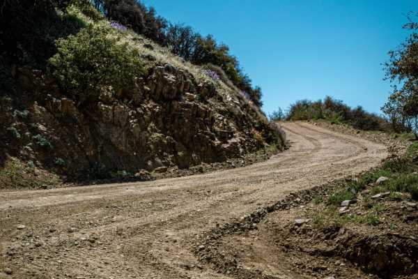
The Highest Peak of the Sierra Pelona
Take a quick, but pretty drive up to Burnt Peak. At 5,791' above sea level, this is the highest peak of the Sierra Pelona, which is one of the lower elevation ranges within California's Transverse Ranges. The ride to the top is relatively easy and can be done entirely in 2WD if the trail is dry. Mak...
Learn more about The Highest Peak of the Sierra Pelona
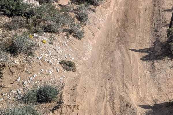
BLM SC186
This trail runs along the western border of the Dove Springs OHV Open Riding Area, high above the canyon with sweeping views down into the main riding area. It serves as a primary feeder road to many of the popular hill climbs, ramps, and wall trails below, so expect frequent traffic and vehicles cl...
Learn more about BLM SC186
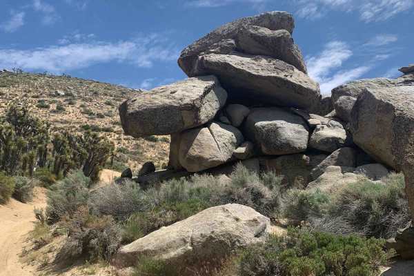
Hanging Rock Loop
This is a fun loop that starts off with SC39 and SC47. It begins with long downhill sections of s-turns and the trail is several feet below the main desert floor with Yuccas on both sides. After a few miles, you will make a right turn onto SC50 and start a climb up into the mountains. This section p...
Learn more about Hanging Rock Loop
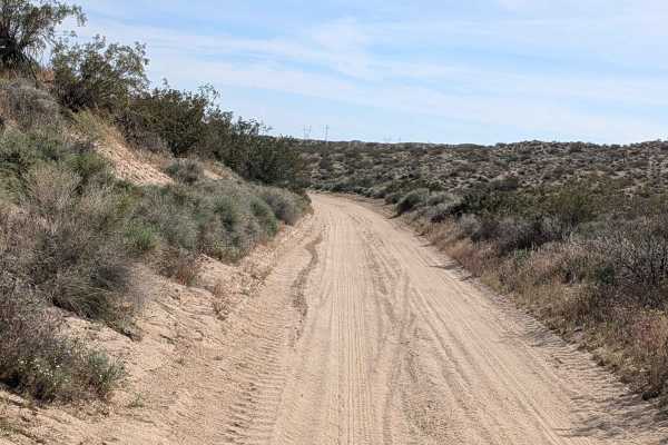
BLM SC94
This sandy route alternating between packed and loose sand winds through the Dove Springs OHV area as one of the main trails accessing other unnamed trails in the region. High traffic area demands watching for other vehicles constantly given the heavy use. The trail serves as an arterial connector t...
Learn more about BLM SC94
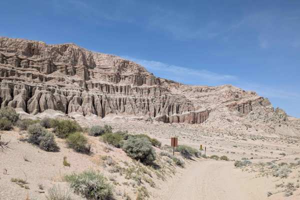
Tuft Point Road
Starting off Highway 14 within Red Rock Canyon State Park's restricted area, requiring staying on established trails, this sand and pumice route immediately starts climbing a sandy hill from the start. Surrounded by hills, desert brush, and Joshua trees throughout the journey. Part of the trail pass...
Learn more about Tuft Point Road
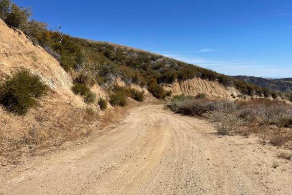
Maxwell Road
Maxwell Road is a 9.9-mile dirt route in the Angeles National Forest, connecting Lake Hughes Road to Liebre Mountain and the Sawmill Motor Way (USFS Route 7N23). Climbing from 3,211 feet near Lake Hughes to 5,425 feet near Sawmill Mountain, the trail offers expansive views of the western Sierra Pelo...
Learn more about Maxwell Road
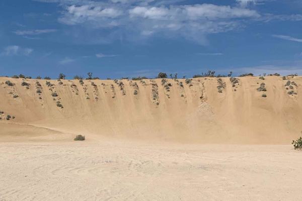
LA Aqueduct Road to Alphie Springs Road
This trail allows you to bypass the steep hill climbs leaving the main Dove Springs OHV staging area and climbing up above the valley floor. The trail is a hard pack road with some minor ruts and parallels the LA Aqueduct pipeline on the left. In a short distance, the trail starts a slow descent wi...
Learn more about LA Aqueduct Road to Alphie Springs Road
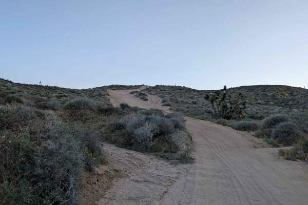
Dove Springs Canyon Rd BLM SC103
One of the main trails through Dove Springs OHV open riding area, this fine dusty sand route features lots of whoops and washboards, creating constant suspension action. High bank turns offer fun features for those wanting to add excitement to the traverse. The trail slowly makes its way to the edge...
Learn more about Dove Springs Canyon Rd BLM SC103
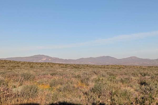
BLM SC94 North
This one vehicle-wide loose fine sand route threads through terrain populated with many desert bushes and occasional Joshua trees. Great views showcase the El Paso Mountains and Eastern Sierra Mountains throughout. The trail runs fairly straight overall but winds up and down small hills, creating an...
Learn more about BLM SC94 North

BLM SC44
This very sandy one vehicle wide route cuts through a small, shallow canyon surrounded by very small desert brush and a few Joshua trees. Interesting boulder rock formations appear throughout the canyon. Although mostly sandy, a few small rock sections, all under 12 inches tall, add variety. Great v...
Learn more about BLM SC44
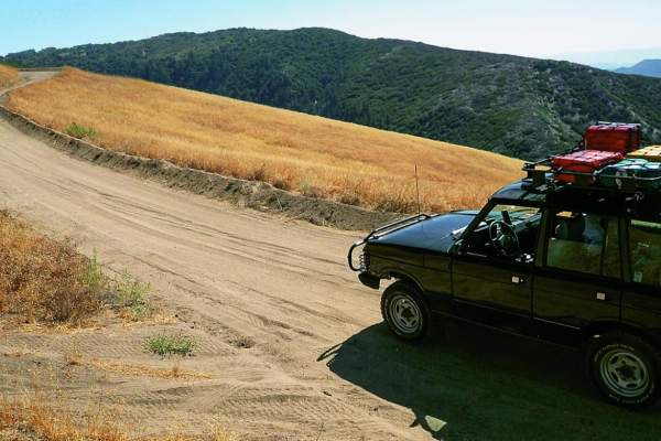
Liebre Mountain
Liebre Mountain is a scenic, introductory-level off-road route traversing the high ridges of the Angeles National Forest, offering stunning vistas of the Antelope Valley and Mojave Desert to the north. Stretching roughly 18 miles along Forest Road 7N23, this trail is ideal for beginner off-roaders a...
Learn more about Liebre Mountain
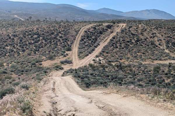
BLM SC129
This hard-pack sandy trail winds through Dove Springs OHV open riding area, perched high above, where you can look down into the main riding area below. Running along the north and east border of Dove Springs OHV, this elevated route passes near where wall trails climb and descend from below. Off-ca...
Learn more about BLM SC129
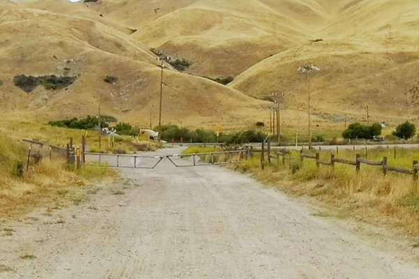
Salt Lick Trail
The Salt Lick Trail starts at the intersection with the Power Line Road - East Trail at GPS coordinates N34.77486° W118.84505° and is 1.4 miles long. This is an out-and-back trail that ends at a locked gate. There is an option to take the Wheatfield Trail at 1 mile down the trail. This is a hard-p...
Learn more about Salt Lick Trail
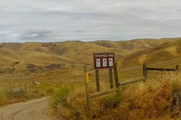
Wheatfield Trail
This is a short (.08 of a mile) trail that begins at the end of the Power Line Road - East Trail (GPS coordinates N34.77486° W118.84505°) and ends at the intersection with the Salt Lick Trail (GPS coordinates N34.78439° W118.83435°). It is a hard pack trail with just a few small whoops and some twis...
Learn more about Wheatfield Trail
Beginner ATV trails near Tehachapi, California
Explore ATV-friendly trails near you. These trails are accessible for vehicles up to 50 inches wide, perfect for ATVs and smaller off-road machines.
Fairmont Peak Summit
This trail climbs over 500 feet to the top of Fairmont Peak Tower. The route is rocky and uneven. Although a shorter route, airing down is highly recommended. Slow speeds are also recommended. Many rocks are sharp. Flats have been known to happen. There are views of solar arrays, adjacent valleys, a...
Learn more about Fairmont Peak Summit
Alphie Springs Wash
This is a fun winding trail that starts right off of SC173 and quickly drops down into a soft wide sand wash. The trail narrows with a tight s-turn between large boulders then opens up into a double-wide trail that winds past the Yucca trees. After a few miles it dead ends into SC103, a left turn he...
Learn more about Alphie Springs Wash
Dove Springs Access Trail
This route consists of two main trails, SC47 and SC328. The trail can be accessed on the West from Kelso Valley Road and from the East at the actual Dove Springs. My route includes the section between SC69 on the West and ends at the Actual Dove Springs. Most of this trail is a semi-soft double-wide...
Learn more about Dove Springs Access Trail
BLM SC186
This trail runs along the western border of the Dove Springs OHV Open Riding Area, high above the canyon with sweeping views down into the main riding area. It serves as a primary feeder road to many of the popular hill climbs, ramps, and wall trails below, so expect frequent traffic and vehicles cl...
Learn more about BLM SC186
Beginner UTV/side-by-side trails near Tehachapi, California
Find UTV and side-by-side trails near you. These trails accommodate vehicles up to 60 inches wide, ideal for UTVs, side-by-sides, and wider off-road rigs.
Fairmont Peak Summit
This trail climbs over 500 feet to the top of Fairmont Peak Tower. The route is rocky and uneven. Although a shorter route, airing down is highly recommended. Slow speeds are also recommended. Many rocks are sharp. Flats have been known to happen. There are views of solar arrays, adjacent valleys, a...
Learn more about Fairmont Peak Summit
Alphie Springs Wash
This is a fun winding trail that starts right off of SC173 and quickly drops down into a soft wide sand wash. The trail narrows with a tight s-turn between large boulders then opens up into a double-wide trail that winds past the Yucca trees. After a few miles it dead ends into SC103, a left turn he...
Learn more about Alphie Springs Wash
Dove Springs Access Trail
This route consists of two main trails, SC47 and SC328. The trail can be accessed on the West from Kelso Valley Road and from the East at the actual Dove Springs. My route includes the section between SC69 on the West and ends at the Actual Dove Springs. Most of this trail is a semi-soft double-wide...
Learn more about Dove Springs Access Trail
BLM SC186
This trail runs along the western border of the Dove Springs OHV Open Riding Area, high above the canyon with sweeping views down into the main riding area. It serves as a primary feeder road to many of the popular hill climbs, ramps, and wall trails below, so expect frequent traffic and vehicles cl...
Learn more about BLM SC186
The onX Offroad Difference
onX Offroad combines trail photos, descriptions, difficulty ratings, width restrictions, seasonality, and more in a user-friendly interface. Available on all devices, with offline access and full compatibility with CarPlay and Android Auto. Discover what you're missing today!
Open Trail Map