
Beginner Off-Road Trails
Near South Prairie, Washington
Explore All Beginner Trails Near South Prairie, Washington
Beginner Off-Road Trails Near South Prairie, Washington
Discover the best beginner-friendly off-road trails near you. These easier, lower-rated trails are a great place to start — browse trail maps, check difficulty ratings, and find your next adventure.
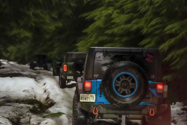
NF 7720000
This is a forest road leading from Wilkeson up into the mountains. The trail starts off nice and wide (approx 3 car widths) and continues up varying paths that wiggle down to a single lane. There is a variety of terrain in this section from dirt, gravel, loose rock, and mud. At this point in the sea...
Learn more about NF 7720000
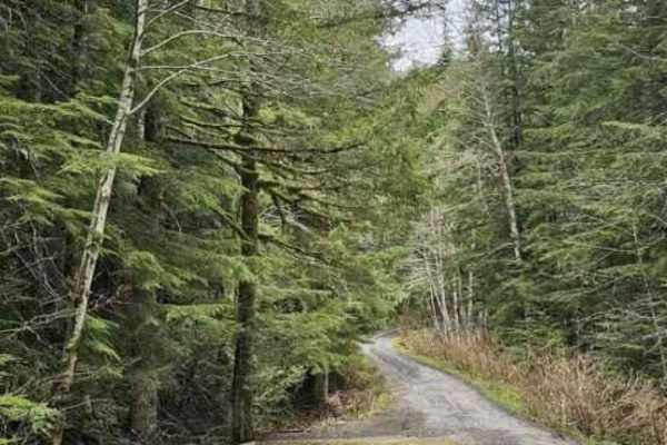
NF7720000 Overlook
The forks off of NF 7720000 are much narrower and might require high-clearance 4x4 in some cases. There are a few spots open for day camping, but nothing worth staying overnight. This particular spur leads to a nice overlook. Beware that there is a lot of trash at the trailhead--please pack out what...
Learn more about NF7720000 Overlook
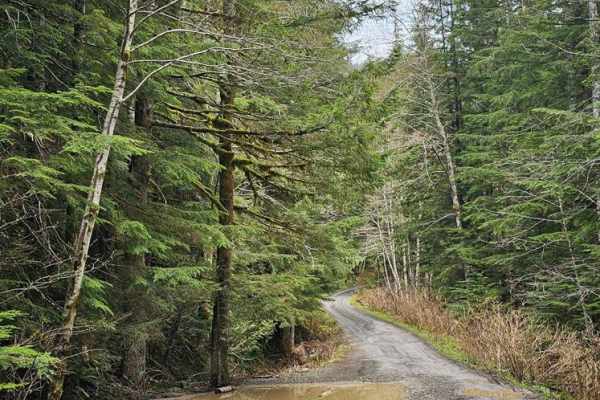
NF 7720000 Spur
This is a well-maintained new branch of 7720000 that was opened in Spring of 2024. Every fork off this road is valid. These forks are much narrower and might require high-clearance 4x4 in some cases. There are a few spots open for day camping, but nothing worth staying overnight.
Learn more about NF 7720000 Spur
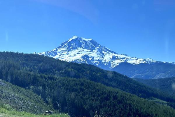
Evans Creek Campground/Trailhead
This 8.2-mile point-to-point trail begins as the pavement ends and continues to Evans Creek Campground and Trailhead. This is a well-maintained service road that is 2 vehicles wide. When open, the trail continues to Mowich Lake in Mount Rainier National Park. The campground has multiple primitive ca...
Learn more about Evans Creek Campground/Trailhead
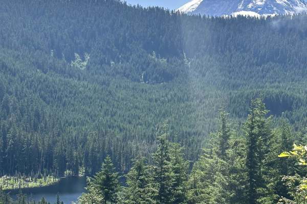
Summit Lake Trailhead
This 26-mile out-and-back trail takes you from the Carbon River Valley up to the Summit Lake Trailhead. There will be a left turn onto an expansive paved bridge that will take you across the Carbon River. This road is known as FS 7810, Summit Lake Trailhead Road, and Cayada Creek. After crossing th...
Learn more about Summit Lake Trailhead
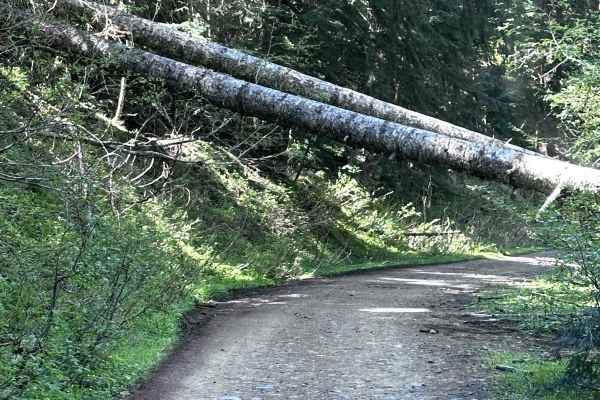
Poch Peak Trail
This 4.2-mile point-to-point trail starts at the Evans Creek Trailhead and goes up the west side of the ORV area. This trail is an easy drive with only shallow mud holes along the way. There is one washout that has short steep grades on each side. Several different trails are accessible from this tr...
Learn more about Poch Peak Trail
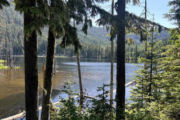
Coplay & East Lake Trail
This 3.2-mile out-and-back trail forks off of the Summit Lake trailhead road and gives access to both Coplay and East Lake. There is a campground with pit toilets at Coplay Lake. A portion of this trail takes you into the surrounding forest with dispersed camping spots. There is a small rock outcrop...
Learn more about Coplay & East Lake Trail
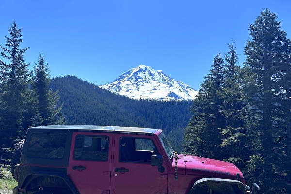
Poch Ridge Trail
This 3.2-mile point-to-point trail begins at the Evans Creek Trailhead and connects to two more challenging trails. This trail is an easy trail with shallow mud holes and ruts along it. There is one optional obstacle which is a short steep hill climb. There are several great views of Mount Rainier a...
Learn more about Poch Ridge Trail
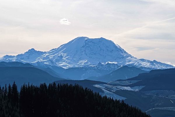
Slippery Creek Road
This is a primitive dead-end logging road. There are a few pull-offs for day camping and quite a few spectacular views of Mount Rainier. Where the road dead-ends, it is dug out, so could be accessible by vehicles that have clearance or by ATVs/dirt bikes. The Grass Mountain hiking trail also crosses...
Learn more about Slippery Creek Road
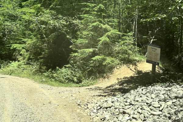
9 Road
This 4.5-mile point-to-point trail gives access to most of the 4WD trails (Mainline, Sunrise, Alder Loop, and Swamp trail) within the Elbe Hills ORV Area. It also gives access to the campground and dispersed camping area. At the end of the trail, there is a little obstacle area. This trail is a main...
Learn more about 9 Road
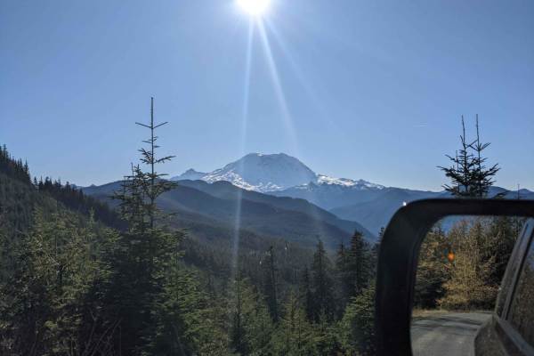
National Forest Development Road 310
Short and easy out and back track that leads to an epic open area campsite that would fit 2-3 vehicles. Enjoy stellar views of Mt. Rainier with the benefit of good windbreak trees surrounding the site. There is a well-used stone fire ring if you manage to visit when there is not a burn ban.
Learn more about National Forest Development Road 310
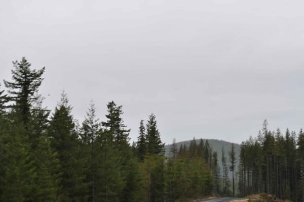
DNR 8 to Elbe Hills OHV
15 minutes outside of the quaint town of Eatonville, you'll find one of the locals' favorite OHV areas. This 8.1-mile trail accesses the Elbe Hills OHV Area from the west side and boasts several offshoots for dispersed camping. It has openings with amazing territorial views on a clear day, and moody...
Learn more about DNR 8 to Elbe Hills OHV
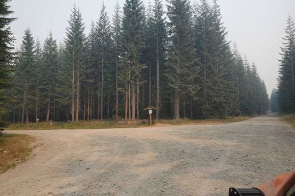
FS70 Greenwater to Cliffdell
You will find FS70 outside Greenwater, heading east off of SR410. This road is paved for the first 10 miles. There are many camping spots along the way. When you reach the sno-park, the gravel will start. In the winter, the road stops here and is only accessible to snowmobiles. The gravel is easy, w...
Learn more about FS70 Greenwater to Cliffdell
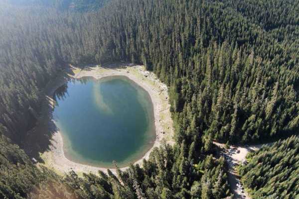
Lonesome Lake FS 75
Start this trail by turning onto Crystal River Ranch Road in Greenwater, Washington. This is an easy-to-travel, gravel logging road that takes you up to Lonesome Lake. The trip is about an hour one way and about 16 miles to reach the lake. You will start on the pavement in a residential area, so mak...
Learn more about Lonesome Lake FS 75

Road 99
This short 1-mile point-to-point trail gives access to several different trails in the Elbe Hills Trail System. This is a forest service road generally used by vehicles for the maintenance of the Elbe Hills off-road trail system. This trail is passable by 2WD, AWD, and 4WD vehicles.
Learn more about Road 99
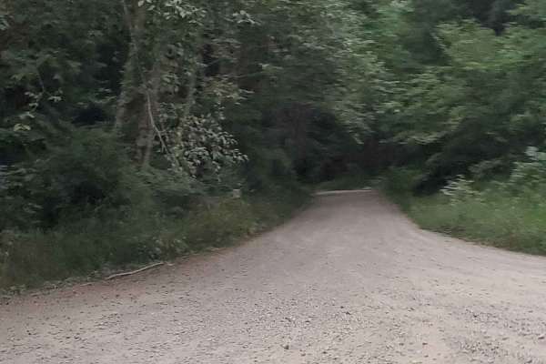
Last Regrets Lane
This is the gentlest trail you will find at Elbe ORV Park. Long and flat it's a great access point for tow trucks. Elbe park is a destroyer of rigs. You will find lots of camping sites along the main paths. With trails reaching level 10 in some places, those campsites are good to make note of. Let t...
Learn more about Last Regrets Lane
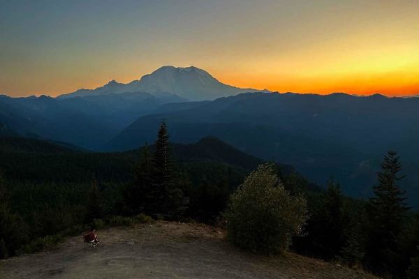
Suntop Fire Lookout
Suntop Fire Lookout is one of the 93 still-standing fire lookouts in Washington, the road to the top is opened seasonally when it is staffed by volunteers. The fire lookout can be visited anytime throughout the year. If the access gate is closed, you can access the lookout by hiking a short .6-mile ...
Learn more about Suntop Fire Lookout
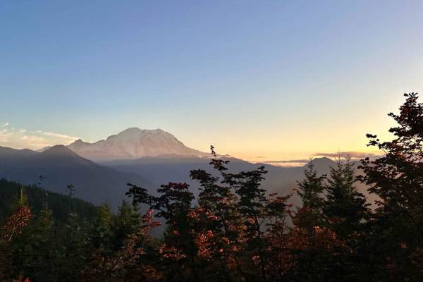
Twenty-Eight Mile Creek
This is a nicely forested road with pullouts that have views of Mount Rainier. The trail has a steady climb to the summit at 7.7 miles. After the summit at 8.2 miles, there is a large gravel shooting pit on the right-hand side. As you travel down the trail there are plenty of spur trails to explore ...
Learn more about Twenty-Eight Mile Creek
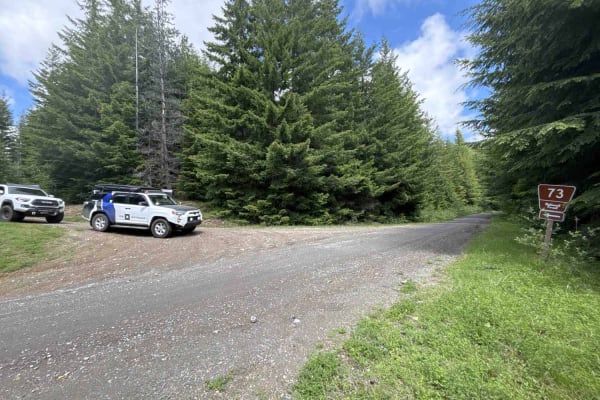
Huckleberry Creek Loop - FS 73
This 14.8-mile stretch of Forest Service road can be accessed either directly from SR410 or Forest Road 75, heading towards Lonesome Lake. If you start from the 410 side, a minefield of potholes will greet you. If you have the gear/ability to air down, we highly recommend it, which will significantl...
Learn more about Huckleberry Creek Loop - FS 73
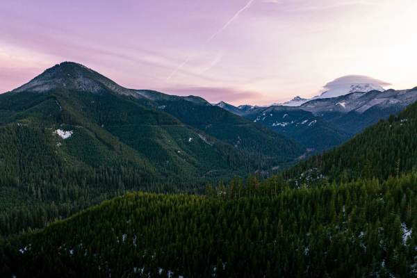
Dickman Mountain Lookout
This is a fairly easy trail that has smooth gravel, portions of large potholes, and a mix between very open areas and a few single-vehicle-width roads. This trail will take you up about 1,000 feet or so to a nice little camping spot for no more than 4 vehicles and a couple of tents. On the way, you'...
Learn more about Dickman Mountain Lookout
Beginner ATV trails near South Prairie, Washington
Explore ATV-friendly trails near you. These trails are accessible for vehicles up to 50 inches wide, perfect for ATVs and smaller off-road machines.
NF 7720000
This is a forest road leading from Wilkeson up into the mountains. The trail starts off nice and wide (approx 3 car widths) and continues up varying paths that wiggle down to a single lane. There is a variety of terrain in this section from dirt, gravel, loose rock, and mud. At this point in the sea...
Learn more about NF 7720000
NF 7720000 Spur
This is a well-maintained new branch of 7720000 that was opened in Spring of 2024. Every fork off this road is valid. These forks are much narrower and might require high-clearance 4x4 in some cases. There are a few spots open for day camping, but nothing worth staying overnight.
Learn more about NF 7720000 Spur
Evans Creek Campground/Trailhead
This 8.2-mile point-to-point trail begins as the pavement ends and continues to Evans Creek Campground and Trailhead. This is a well-maintained service road that is 2 vehicles wide. When open, the trail continues to Mowich Lake in Mount Rainier National Park. The campground has multiple primitive ca...
Learn more about Evans Creek Campground/Trailhead
Summit Lake Trailhead
This 26-mile out-and-back trail takes you from the Carbon River Valley up to the Summit Lake Trailhead. There will be a left turn onto an expansive paved bridge that will take you across the Carbon River. This road is known as FS 7810, Summit Lake Trailhead Road, and Cayada Creek. After crossing th...
Learn more about Summit Lake Trailhead
Beginner UTV/side-by-side trails near South Prairie, Washington
Find UTV and side-by-side trails near you. These trails accommodate vehicles up to 60 inches wide, ideal for UTVs, side-by-sides, and wider off-road rigs.
NF 7720000
This is a forest road leading from Wilkeson up into the mountains. The trail starts off nice and wide (approx 3 car widths) and continues up varying paths that wiggle down to a single lane. There is a variety of terrain in this section from dirt, gravel, loose rock, and mud. At this point in the sea...
Learn more about NF 7720000
NF 7720000 Spur
This is a well-maintained new branch of 7720000 that was opened in Spring of 2024. Every fork off this road is valid. These forks are much narrower and might require high-clearance 4x4 in some cases. There are a few spots open for day camping, but nothing worth staying overnight.
Learn more about NF 7720000 Spur
Evans Creek Campground/Trailhead
This 8.2-mile point-to-point trail begins as the pavement ends and continues to Evans Creek Campground and Trailhead. This is a well-maintained service road that is 2 vehicles wide. When open, the trail continues to Mowich Lake in Mount Rainier National Park. The campground has multiple primitive ca...
Learn more about Evans Creek Campground/Trailhead
Summit Lake Trailhead
This 26-mile out-and-back trail takes you from the Carbon River Valley up to the Summit Lake Trailhead. There will be a left turn onto an expansive paved bridge that will take you across the Carbon River. This road is known as FS 7810, Summit Lake Trailhead Road, and Cayada Creek. After crossing th...
Learn more about Summit Lake Trailhead
The onX Offroad Difference
onX Offroad combines trail photos, descriptions, difficulty ratings, width restrictions, seasonality, and more in a user-friendly interface. Available on all devices, with offline access and full compatibility with CarPlay and Android Auto. Discover what you're missing today!
Open Trail Map