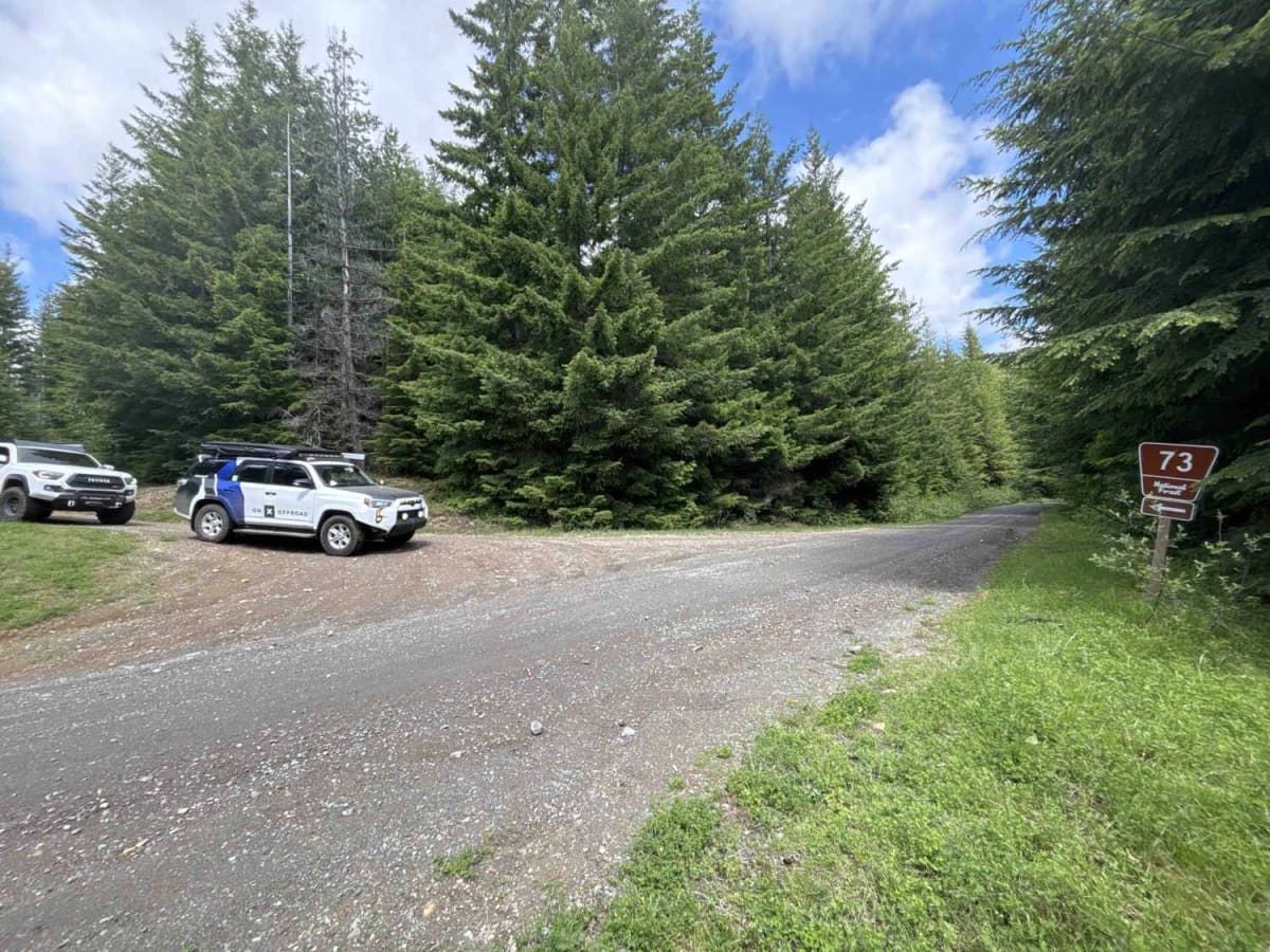
Huckleberry Creek Loop - FS 73

Total Miles 14.6
Technical Rating
2 Easy
Best Time Summer, Fall
Trail Type Full-Width Road
Accessible By
Open Trail Map

Trail Overview

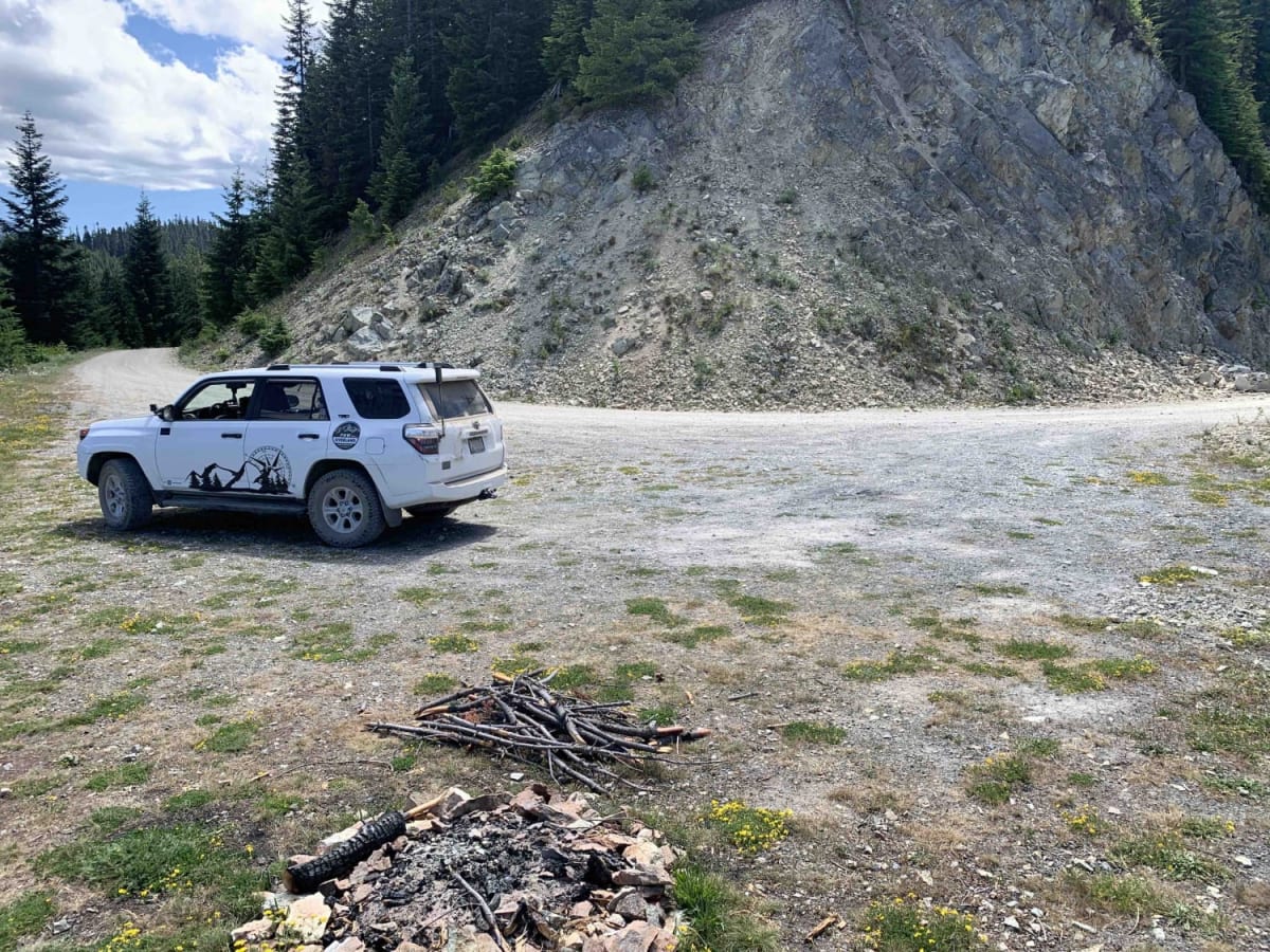
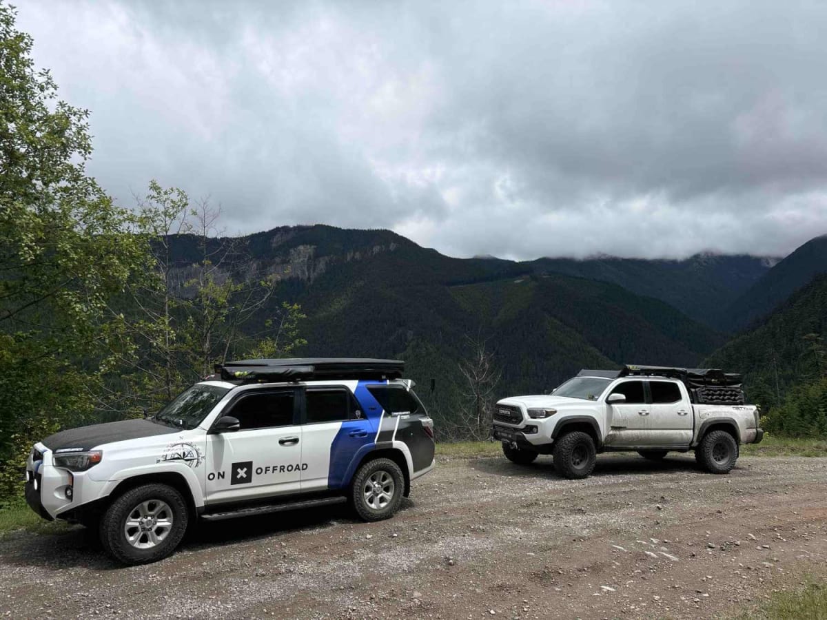
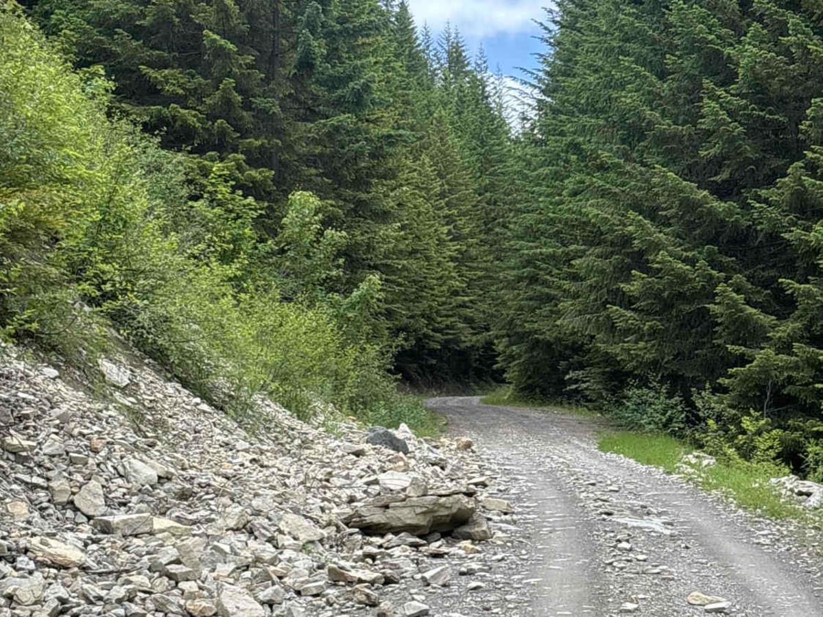
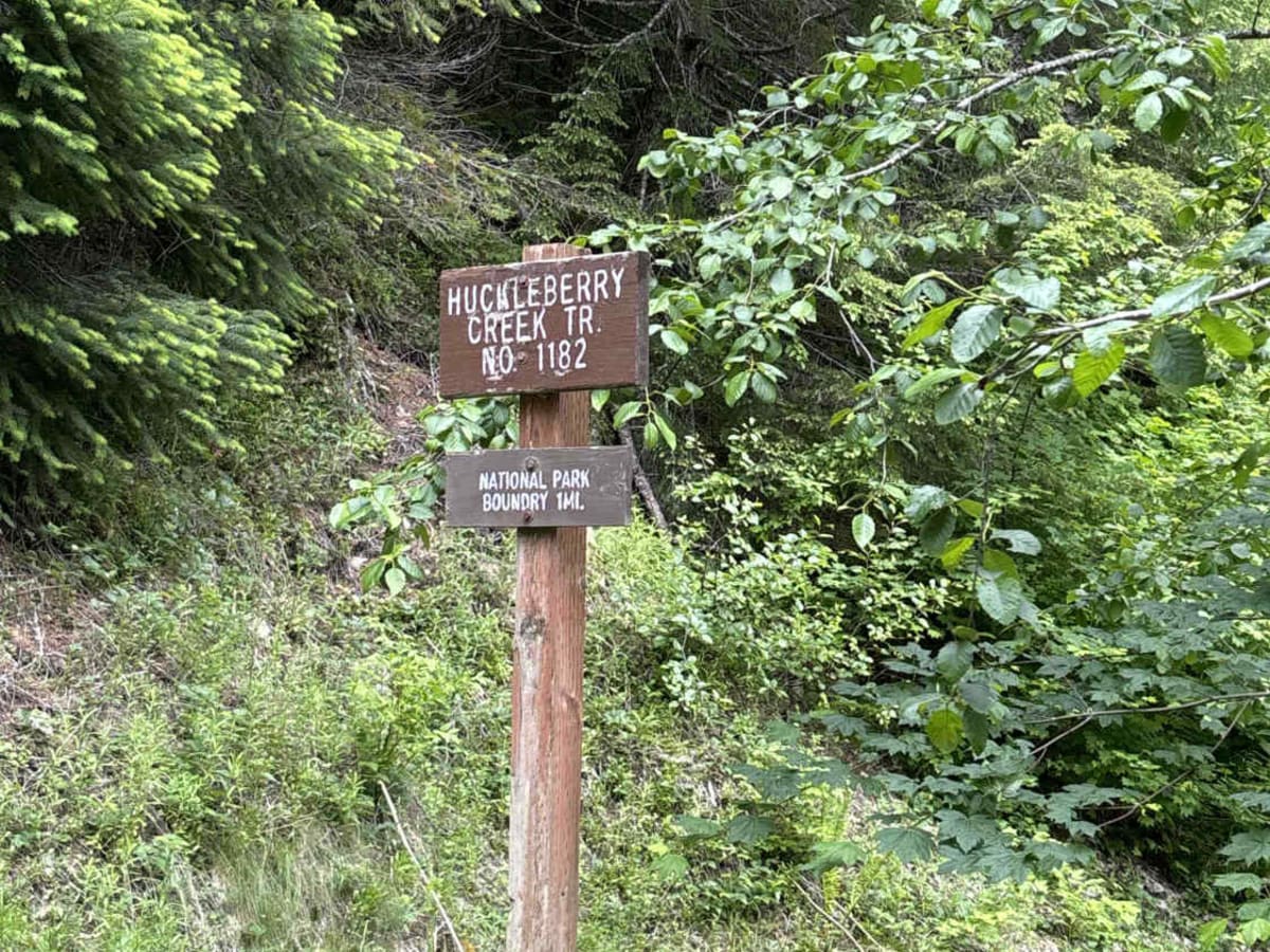
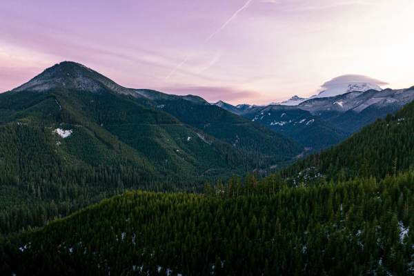
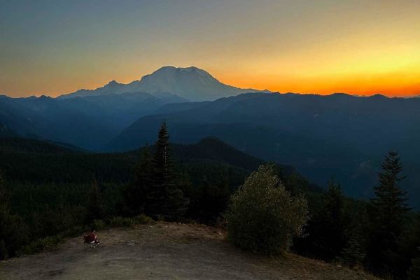
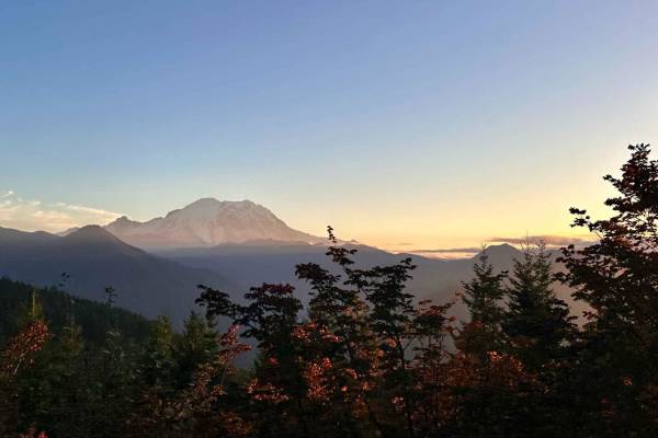
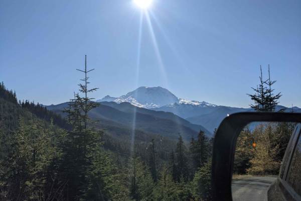
This 14.8-mile stretch of Forest Service road can be accessed either directly from SR410 or Forest Road 75, heading towards Lonesome Lake. If you start from the 410 side, a minefield of potholes will greet you. If you have the gear/ability to air down, we highly recommend it, which will significantly improve ride quality. Once you begin to climb up the elevation, the road smooths out slightly, but keep an eye out for fallen rocks that may fall from the cliffside above down to the road. Several miles in, you will reach a parking area for hiking trails that snake through the trees. Mind your speed;this area can be extremely crowded on weekends, and some turns are blind corners with sheer cliff edges on one side. As you climb higher in elevation, territorial views become more stunning, especially on sunny days. There are ample dispersed camping sites on the 410 side of the trail. As you gain elevation, one or two pull-offs would suffice for a day trip lunch spot, but I would not recommend camping in them as the dust from the road can be overtaking. There are occasional side spurs that are tricky to navigate with deep ruts and off-camber trails and will require 4WD, so venture off the main route at your own risk. Make sure your camera is charged and snap some amazing pictures!

Photos of Huckleberry Creek Loop - FS 73

Difficulty

This trail is an easy forest road with potholes, gravel, and occasional small rocks. Minor shelf sections and isolated rockfall areas require basic caution, but obstacles are easily avoided and suitable for most stock vehicles.

Technical Rating

2

Status Reports

Add Status Report
Stephen
Jun 20, 2026
Open
Still closed. It was heavily traveled when I was there. If you still want to visit this area, head up to Suntop Fire Lookout. Fantastic view of the mountain.
Brandon Wiederspohn
Jun 12, 2026
Open
Came in from the Lonesome Lake side. Came up to a off camber rock slide. Not crazy to pass at all. About a mile past that was a crazy washout. Passable with a 4x4. Then at the next road crossing it was posted closed.
Matthew Smith
Jun 12, 2026
Open
Sorry, but I went around posted signage due to previous comments. The washout was not far up the trail, and it was pretty significant. However, if you have a spotter and stay towards the uphill side, it is pretty easy to go around. The rest of the trail was no problem, with the exception of a minor rock/shale landslide which I drove over with no problems. We enjoyed beautiful views. Great trail.
Gavin Greene
Jun 06, 2026
Open
Road closure sign due to creek washout. 4x4 could still cross
Timothy Vazquez
Jun 02, 2026
Open
I made it through in a stock jeep
Micah Quinlisk
May 28, 2026
Open
The road is closed due to a washout up ahead. There are signs across the road. I came through the opposite way and had to cross the damaged section. It is washed out by a creek crossing the entire road. I was not aware the road was closed at the other end.
Joshua West
May 23, 2026
Open
Still some snow on this section of the trail. Highly recommend traction boards to get through just in case you get stuck. Passed a tow truck coming down on our way back. Give it a few more weeks and it will be clear.
Ben
Apr 25, 2026
Open
Gate closed and many trees are down past the gate, so it's going to take some work to get it back open.
Miah M
Apr 08, 2026
Open
Gate closed at Suntop split
James Vollrath
Feb 22, 2026
Open
Dirt road with potholes in the beginning, then ice and slush towards the end.
Soh Ishiguro
Feb 15, 2026
Open
It was just muddy and some potholes along the way but it's in the Sno park.... You need a permit
Jer
Jan 01, 2026
Open
Gates are open from FS7500 but closed from RT410. I didn't know that until I got there, so I did the trail both directions. Hard packed and slick. Closer to the RT410 side has a small washout, potholes, and a few smaller trees down.
Luka
Nov 26, 2025
Open
got there after sunset so dark drive lol, road got icy around 4 miles up and snow was maybe only 2-3" deep at worst. there is a slide that if youre in a tall vehicle is pretty sketchy, but we got by fine, other than that just some real deep potholes that are at times impossible to avoid, only one of them was deep enough to scrape a little but all good
Sabrina Gray
Sep 13, 2025
Open
Some small washouts, gravel
Mike Sands
Sep 01, 2025
Open
Not to many people out. Several hikers on the Mt. Rainier side parked in the side of the road on the south side of the route. Started on the 75 road side and was a very pleasant ride

Huckleberry Creek Loop - FS 73 Trail can be accessed by the following ride types:

  • High Clearance
  • Full Width

Huckleberry Creek Loop - FS 73 Map

The onX Offroad Difference

onX Offroad combines trail photos, descriptions, difficulty ratings, width restrictions, seasonality, and more in a user-friendly interface. Available on all devices, with offline access and full compatibility with CarPlay and Android Auto. Discover what you're missing today!

Open Trail Map