
Beginner Off-Road Trails
Near Republic, Missouri
Explore All Beginner Trails Near Republic, Missouri
Beginner Off-Road Trails Near Republic, Missouri
Discover the best beginner-friendly off-road trails near you. These easier, lower-rated trails are a great place to start — browse trail maps, check difficulty ratings, and find your next adventure.
129
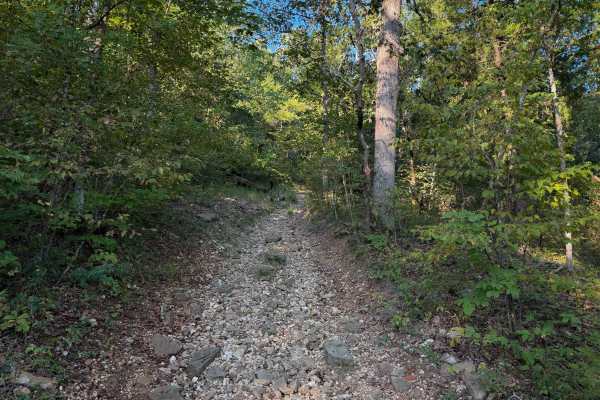
Chadwick Trail 129 is mostly a gradual climb from north to south, gaining about 260 feet in elevation over .8 miles. It’s a very narrow trail traversing up a hillside, with lots of chunky loose rock and slabs of rock. There are roots sticking out and tree gaps that would likely be quite narrow for a...
Learn more about 129
130
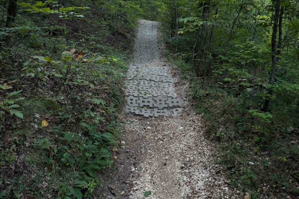
Chadwick Trail 130 makes a 1.2-mile loop off of Lookout Road in the Chadwick Motorized Trail System. Going clockwise, it starts off as a narrow ATV trail weaving through a tight forest above a ravine. It enters the ravine, riding on packed-down small loose rocks. This will likely be very tight for A...
Learn more about 130
132a
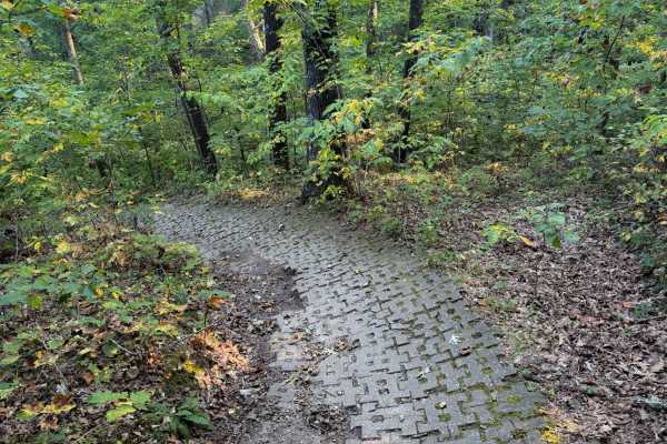
Chadwick Trail 132a is a 1.1-mile-long ATV trail that connects Trail 130 to the intersection with Trails 131 and 132. It mostly weaves through a tight forest on a narrow dirt path with minor loose rock and roots. There are cinder blocks reinforcing the path at times to prevent erosion, and the trail...
Learn more about 132a
Devreaux Ridge Road Cave
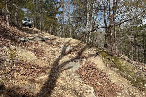
This is a short trail that branches off the Devreaux Ridge Road trail. It starts pretty smooth, but soon approaches a few drops (approximately 10 inches). It will then lead to a small cave that sits on a hill. Make sure you stop to check it out. After that, you will go through some tight turns, and ...
Learn more about Devreaux Ridge Road Cave

Round Mountain Road
Round Mountain Road is a gravel route in the Mark Twain National Forest. It is an excellent way to access the forest when coming from, or heading to the Branson area. This route is mostly gravel along a ridge through a very dense section of forest. Great views to the south occur in early spring, win...
Learn more about Round Mountain Road

Devreaux Ridge Road
A point-to-point trail providing access to ample camping, OHV, and hunting opportunities inside Mark Twain National Forest. Primarily gravel road with multiple optional connections to primitive trails throughout. Rolling and turning hills with one creek bed crossing approximately halfway. Can be tra...
Learn more about Devreaux Ridge Road
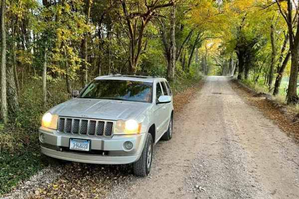
Farm Road 2025
Located in the Ozarks, Farm Road 2025 is not far from the city of Monett, with plenty of opportunity for fuel, food, and lodging. The path is also a shortcut to Farm Road 2022. The road has a spooky feeling no matter what time of day or year you go on it. The trees on both sides of the route meet ea...
Learn more about Farm Road 2025
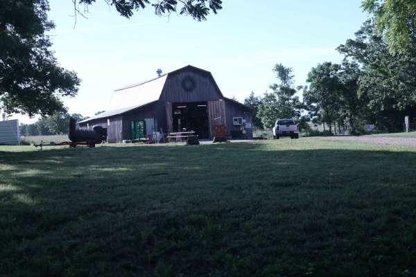
Bohmont Road
This is the main road into Soggy Bottoms MX Park and provides access to the main check-in barn, MX track parking lot, SxS flat track, camping area, and park trailhead. This road is primarily used for entering and exiting the MX and camping areas. A smaller rock trail runs alongside this road and is ...
Learn more about Bohmont Road
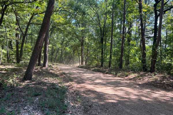
Smith Branch Trail
Smith Branch Trail is an ideal route for high-clearance four-wheel-drive vehicles and SxSs looking for a short, scenic drive through the Mark Twain National Forest to a waterfront destination. Spanning approximately 2.8 miles, this trail starts along the Rail Hollow Trail at FSR 1019 and descends fr...
Learn more about Smith Branch Trail
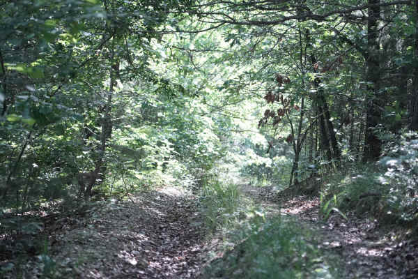
East Ridge Loop
This trail features a steep climb with loose rocks and small rock ledges, along with tight, off-camber turns and deep ruts. The trail is heavily overgrown in several areas, making the route difficult to follow at times. A 74-inch-wide machine can make it through, but some sections are very tight and...
Learn more about East Ridge Loop
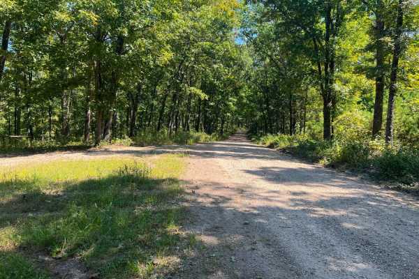
Piney Ridge
Piney Ridge is an easy-going, scenic gravel route perfect for beginners, families, and those looking for a relaxed drive through the Mark Twain National Forest. Stretching just over five miles, this wide, well-maintained two-lane road is highly accessible, requiring only a standard two-wheel-drive v...
Learn more about Piney Ridge
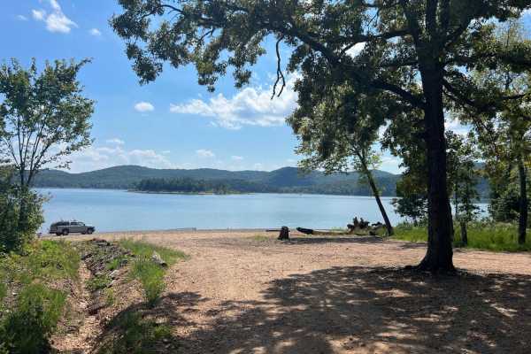
Rail Hollow
Rail Hollow starts out from Stallion Bluff Road/FSR2185 and descends along The Piney Creek Wilderness on 39-1M/FSR1018. It is a well-maintained gravel road freshly graded and wide enough for two vehicles to pass. Once passing the Smith Branch turn off FSR1019 the road becomes much steeper and loose ...
Learn more about Rail Hollow
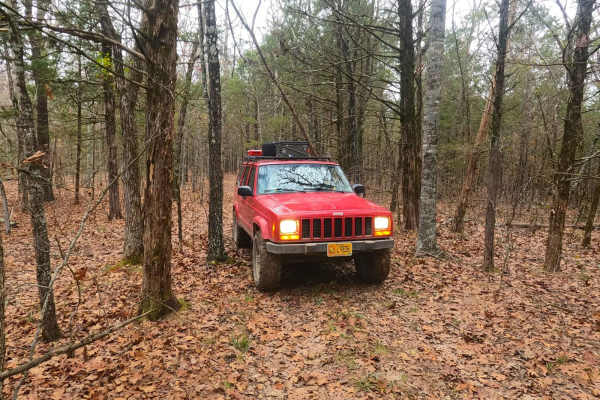
Surrott School - FS 591
Surrott School FS 591, featuring part of Prairie Dog Road, is a natural-terrain forest service road within the Mark Twain National Forest Ava Unit, which is part of the greater Glade Top area. The road leans into the identity of being a long-lost hunting track, featuring narrow widths amongst tight ...
Learn more about Surrott School - FS 591
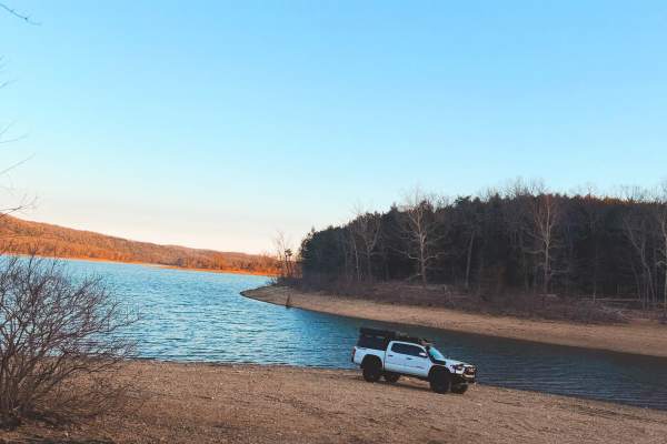
CarrLow Gap
This is an easy gravel access road that leads down to the shoreline of Table Rock Lake. The trail is well-maintained and suitable for stock 4x4s, AWD vehicles, and most high-clearance 2WD trucks or SUVs in dry conditions. The road gradually descends toward the lake with mild washboarding and small l...
Learn more about CarrLow Gap
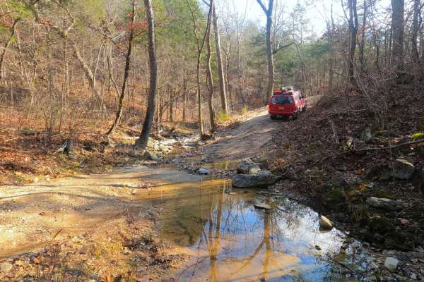
Fort Bald - FS 612
Fort Bald FS 612 is a gravel forest service road within the Mark Twain National Forest Ava Unit, as part of the greater Glade Top area. The road is meager in offroad prowess, with the track following up and down the ridge line, featuring mild coarse gravel terrain over mild-moderate graded hills, on...
Learn more about Fort Bald - FS 612
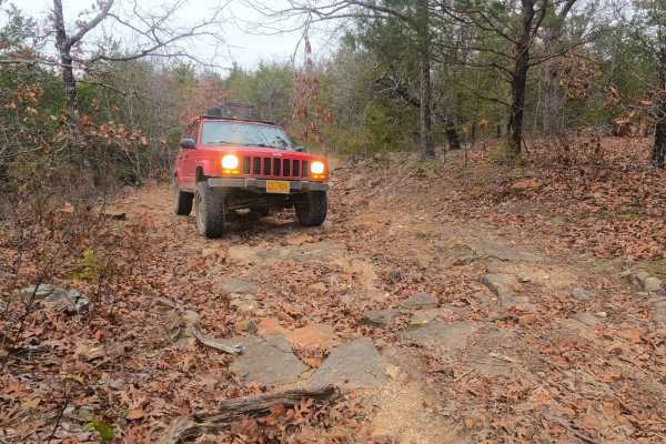
Fort Bald Spur - FS 612A
Fort Bald Spur FS 612A is the natural terrain Forest Service road within the Mark Twain National Forest Ava Unit, part of the greater Glade Top area. The road fits right in with the main road of Fort Bald FS 612, showing that its main purpose is in the hunting arena through the many offshoots, tight...
Learn more about Fort Bald Spur - FS 612A

FR 1182
This trail will take you from 76 to Farm Road 2185. The first half starts easy with little to no obstacles. Various parts have brush and bendy branches coming onto the trail, so some scratches on your rig can be expected. This trail is heavily wooded with no camping spots along it. Towards the middl...
Learn more about FR 1182
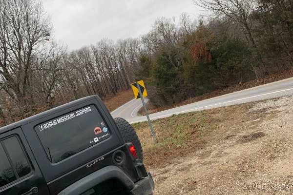
FR 1180 (Left Fork)
This is the perfect trail if you are looking to get out and enjoy the Mark Twain National Forest. This trail is very straightforward and can be easily completed solo. 4WD is not needed as this does not have any obstacles and the trail is very well maintained. There are some spots where it is a littl...
Learn more about FR 1180 (Left Fork)
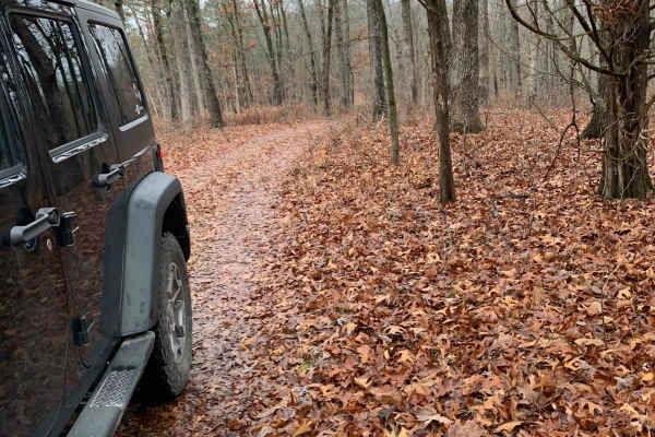
FR 1181 to Scroggins Ridge
If entering from 76, this trail will be on the right side of the fork and starts off easy, but if entering from Scroggins, the trail starts off difficult. This trail offers some gorgeous views of the Mark Twain National Forest. There are no spots to camp along this trail nor are there any clearings ...
Learn more about FR 1181 to Scroggins Ridge
Scroggins Ridge to Rock Creek
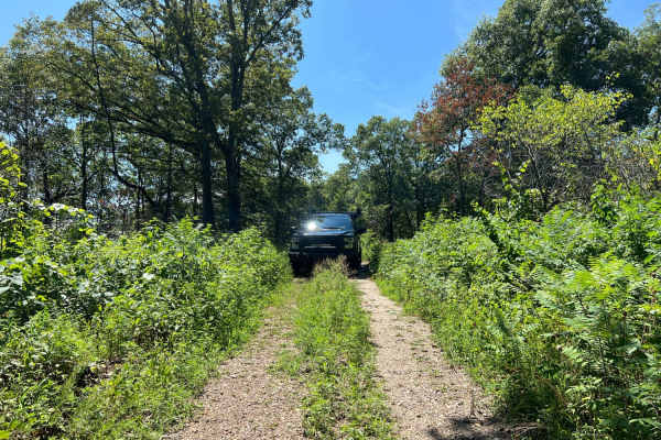
Scroggins Ridge to Rock Creek is an ideal route for stock four-wheel-drive vehicles and SxSs looking for a scenic and moderately challenging adventure through the Mark Twain National Forest. Spanning approximately 6.3 miles, this gravel forest road begins its descent south from Highway 76, weaving t...
Learn more about Scroggins Ridge to Rock Creek
Beginner ATV trails near Republic, Missouri
Explore ATV-friendly trails near you. These trails are accessible for vehicles up to 50 inches wide, perfect for ATVs and smaller off-road machines.
129
Chadwick Trail 129 is mostly a gradual climb from north to south, gaining about 260 feet in elevation over .8 miles. It’s a very narrow trail traversing up a hillside, with lots of chunky loose rock and slabs of rock. There are roots sticking out and tree gaps that would likely be quite narrow for a...
Learn more about 129
130
Chadwick Trail 130 makes a 1.2-mile loop off of Lookout Road in the Chadwick Motorized Trail System. Going clockwise, it starts off as a narrow ATV trail weaving through a tight forest above a ravine. It enters the ravine, riding on packed-down small loose rocks. This will likely be very tight for A...
Learn more about 130
132a
Chadwick Trail 132a is a 1.1-mile-long ATV trail that connects Trail 130 to the intersection with Trails 131 and 132. It mostly weaves through a tight forest on a narrow dirt path with minor loose rock and roots. There are cinder blocks reinforcing the path at times to prevent erosion, and the trail...
Learn more about 132a
Devreaux Ridge Road Cave
This is a short trail that branches off the Devreaux Ridge Road trail. It starts pretty smooth, but soon approaches a few drops (approximately 10 inches). It will then lead to a small cave that sits on a hill. Make sure you stop to check it out. After that, you will go through some tight turns, and ...
Learn more about Devreaux Ridge Road Cave
Beginner UTV/side-by-side trails near Republic, Missouri
Find UTV and side-by-side trails near you. These trails accommodate vehicles up to 60 inches wide, ideal for UTVs, side-by-sides, and wider off-road rigs.
Devreaux Ridge Road Cave
This is a short trail that branches off the Devreaux Ridge Road trail. It starts pretty smooth, but soon approaches a few drops (approximately 10 inches). It will then lead to a small cave that sits on a hill. Make sure you stop to check it out. After that, you will go through some tight turns, and ...
Learn more about Devreaux Ridge Road Cave
East Ridge Loop
This trail features a steep climb with loose rocks and small rock ledges, along with tight, off-camber turns and deep ruts. The trail is heavily overgrown in several areas, making the route difficult to follow at times. A 74-inch-wide machine can make it through, but some sections are very tight and...
Learn more about East Ridge Loop
CarrLow Gap
This is an easy gravel access road that leads down to the shoreline of Table Rock Lake. The trail is well-maintained and suitable for stock 4x4s, AWD vehicles, and most high-clearance 2WD trucks or SUVs in dry conditions. The road gradually descends toward the lake with mild washboarding and small l...
Learn more about CarrLow Gap
FR 1182
This trail will take you from 76 to Farm Road 2185. The first half starts easy with little to no obstacles. Various parts have brush and bendy branches coming onto the trail, so some scratches on your rig can be expected. This trail is heavily wooded with no camping spots along it. Towards the middl...
Learn more about FR 1182
The onX Offroad Difference
onX Offroad combines trail photos, descriptions, difficulty ratings, width restrictions, seasonality, and more in a user-friendly interface. Available on all devices, with offline access and full compatibility with CarPlay and Android Auto. Discover what you're missing today!
Open Trail Map