
Beginner Off-Road Trails
Near Preston, Oklahoma
Explore All Beginner Trails Near Preston, Oklahoma
Beginner Off-Road Trails Near Preston, Oklahoma
Discover the best beginner-friendly off-road trails near you. These easier, lower-rated trails are a great place to start — browse trail maps, check difficulty ratings, and find your next adventure.
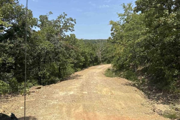
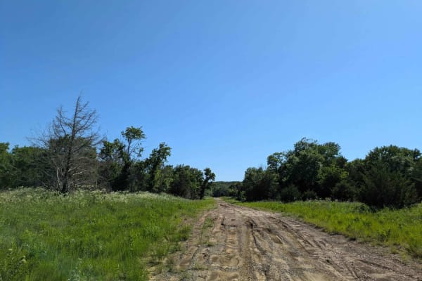
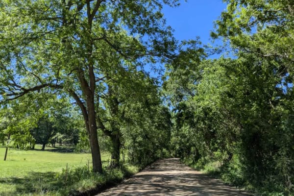
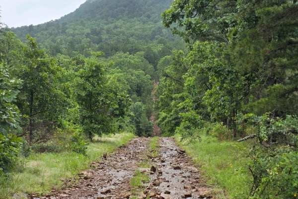
Lake Eufaula
This route is a mix of maintained gravel roads to Level B, non-maintained gravel roads. The trail is easy when dry but has multiple flash flood warnings so we would not recommend after/during rain. We did travel into CORPS of ENGINEERS land, which was marked as a road, but it quickly became swampy a...
Learn more about Lake Eufaula
Interceptor
Easy terrain, wide enough for a full-size vehicle, widens out halfway through, then single vehicle again. This trail begins in the powerline area and finishes at the county road that runs through the park. Fun to go one way, turn around, and go back the other way. Look for wildlife to the left and r...
Learn more about Interceptor
Bunker Hill Loop
Great trail that makes a loop, can do it over and over again! Several other trails branch off to other areas of the park. This is a relatively easy ride, but several tight squeezes between trees, Full-size rigs, beware! Be prepared for several left, right, left, and right turns to make it through th...
Learn more about Bunker Hill Loop
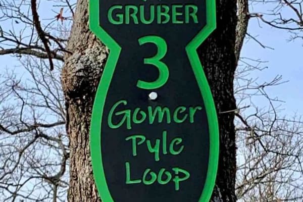
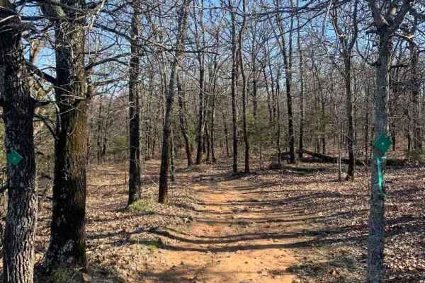
Gomer Pyle Loop
This trail is the Main Loop trail around the border of Gruber ORV Park. It is the easiest trail in the park and begins and ends near the entrance to the park. It has multiple types of terrain from rocks, dirt, berms, and ledges, and one of the most views of the Arkansas River and communities of Musk...
Learn more about Gomer Pyle Loop
Wild Horse
This trail begins with a smooth and easy drive, but conditions change quickly. As you continue, the route becomes more challenging with frequent climbs and descents, deep mud, and large puddles scattered throughout. Progress slows the farther you go due to rough, rocky sections and increasingly unev...
Learn more about Wild Horse

West 775
The trail is part of the Oklahoma Adventure Trail and begins as a remarkably smooth, straight stretch, lulling drivers into an easy rhythm before evolving into a progressively rougher track dotted with potholes and gentle bends. After fording a shallow creek, the trail threads between open fields an...
Learn more about West 775
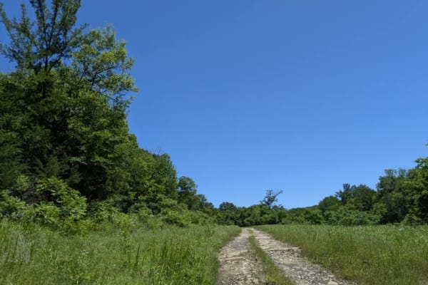
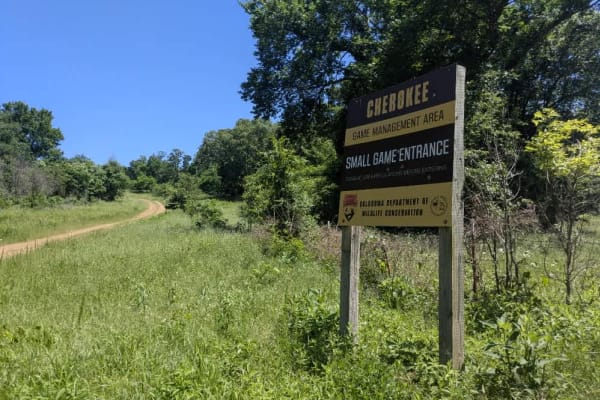
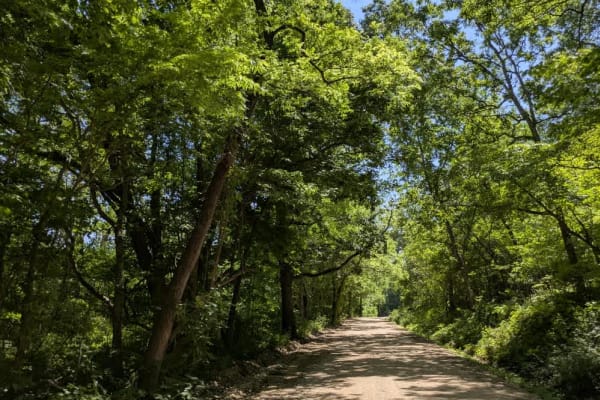
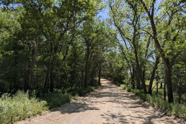
Small Game
This trail twists through the forest in a winding route that remains unmaintained and was extremely muddy when we drove it in May 2025. Several creek crossings break up the route, and the muddy patches are deeper and stickier than they look, so it's worth approaching with diffs locked and the right ...
Learn more about Small Game
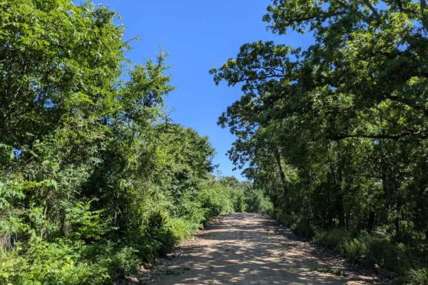
D0670
This trail is part of the Oklahoma Adventure Trail and follows a relatively well-maintained gravel road that winds through a wooded and shaded area, creating ideal conditions for the many potholes scattered along its length. The surface is dusty and shows signs of washboarding, particularly in drier...
Learn more about D0670
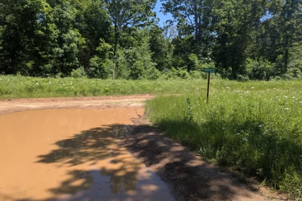
Hay Field
This trail is consistently muddy and may present a challenge for some vehicles, especially in the deeper sections. It's largely unmaintained, with rough, rocky stretches that add to the difficulty. As you approach the large creek crossing, the trail narrows and becomes more overgrown, and the mud in...
Learn more about Hay Field

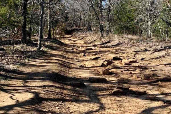
Black Hollow
This unmaintained trail has a bit of everything--rocky ledges, steady climbs and descents, long muddy sections, and a few creek fords along the way. It's an enjoyable drive, but after heavy rain, it can become especially challenging, as we found during our visit. Despite the rough patches, it's a sc...
Learn more about Black Hollow
N4450
This trail is fairly well maintained and wider than many of the larger routes in the Wildlife Management Area, with a smoother gravel surface that makes for a more relaxed drive. It doesn't appear to see much traffic, and several side trails branch off, many of them narrow and overgrown. While the t...
Learn more about N4450

Green Leaf
This trail follows a maintained gravel road that can be a bit bumpy in spots, but it winds through the forest and makes for a peaceful, scenic drive. Several side trails split off along the way, though most are fairly narrow and overgrown. While the main route is accessible, it's best to be cautious...
Learn more about Green Leaf

E0660
This rugged trail is part of the Oklahoma Adventure Trail and winds through a heavily wooded area and is only partially maintained, with narrow sections, uneven surfaces, and numerous potholes. Depending on your direction of travel, expect a steep climb or descent along the route. Several stream cro...
Learn more about E0660
West 680
This gravel trail is part of the Oklahoma Adventure Trail and is in relatively good condition compared to others in the area, though it still presents some challenges. It winds through dense forest and follows the river for stretches, but there appear to be no accessible pull-offs for enjoying the w...
Learn more about West 680
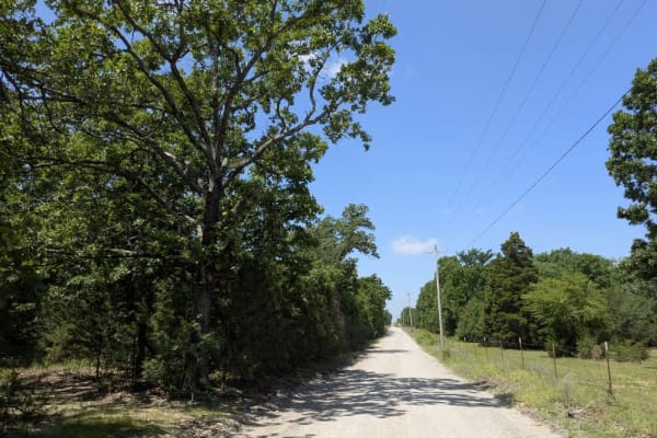
North 387
This gravel trail is part of the Oklahoma Adventure Trail and is in relatively good condition and gradually climbs into the wooded hills, eventually leading to a secluded monastery. Despite its scenic beauty, the trail is heavily used by local traffic, resulting in frequent potholes and noticeable c...
Learn more about North 387
West 780
The trail is part of the Oklahoma Adventure Trail and follows a maintained gravel but with bumps and potholes in sections. In several stretches, the roadway narrows, flanked by drainage ditches that leave little margin for error, so a cautious pace is essential when the possibility of meeting oncomi...
Learn more about West 780
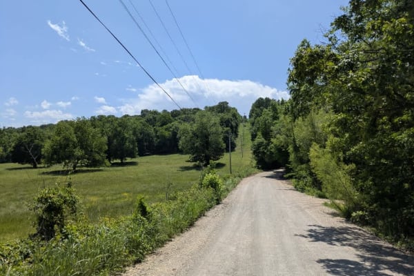
South 465
The trail is part of the Oklahoma Adventure Trail and follows a well-looked-after gravel road that still dishes out a fair share of washboard bumps and loose rattles, especially where it twists through the hills. Local pickups and farm rigs use it often, so keep your speed in check. A small country ...
Learn more about South 465
South 460
This gravel lane is part of the Oklahoma Adventure Trail and stays in decent shape overall, but it narrows where drainage ditches crowd the edges. The route rises and dips through rolling farmland, so plan on slowing for the occasional ranch truck or tractor that shares the road. When we rolled thro...
Learn more about South 460
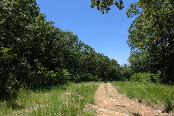
Persimmon Ridge
This long, scenic trail winds through a mix of terrain and throws just about everything at you--unmaintained gravel, rocky ridgelines, muddy sections, soft sand, and a fair share of climbs and drops. It's a bumpy ride throughout, with plenty of narrow, overgrown side tracks branching off. Wildlife i...
Learn more about Persimmon Ridge
North 440 Road
North 440 Road is part of the Oklahoma Adventure Trail, and this gravel trail is generally well-maintained, winding through shaded wooded areas before opening up to wide stretches of agricultural land and a scattering of well-kept rural homesteads. While the drive is scenic, the surface is far from ...
Learn more about North 440 Road
Beginner ATV trails near Preston, Oklahoma
Explore ATV-friendly trails near you. These trails are accessible for vehicles up to 50 inches wide, perfect for ATVs and smaller off-road machines.
Interceptor
Easy terrain, wide enough for a full-size vehicle, widens out halfway through, then single vehicle again. This trail begins in the powerline area and finishes at the county road that runs through the park. Fun to go one way, turn around, and go back the other way. Look for wildlife to the left and r...
Learn more about Interceptor
Bunker Hill Loop
Great trail that makes a loop, can do it over and over again! Several other trails branch off to other areas of the park. This is a relatively easy ride, but several tight squeezes between trees, Full-size rigs, beware! Be prepared for several left, right, left, and right turns to make it through th...
Learn more about Bunker Hill Loop
Gomer Pyle Loop
This trail is the Main Loop trail around the border of Gruber ORV Park. It is the easiest trail in the park and begins and ends near the entrance to the park. It has multiple types of terrain from rocks, dirt, berms, and ledges, and one of the most views of the Arkansas River and communities of Musk...
Learn more about Gomer Pyle Loop
West Boundry Trail
The dirt trail runs parallel to the boundary fence of a private land parcel in rural Oklahoma, cutting through a mix of open prairie and lightly wooded areas. The trail itself is about 8 to 10 feet wide, composed of compacted red clay and loose gravel, with patches of grass and sand depending on rec...
Learn more about West Boundry Trail
Beginner UTV/side-by-side trails near Preston, Oklahoma
Find UTV and side-by-side trails near you. These trails accommodate vehicles up to 60 inches wide, ideal for UTVs, side-by-sides, and wider off-road rigs.
Interceptor
Easy terrain, wide enough for a full-size vehicle, widens out halfway through, then single vehicle again. This trail begins in the powerline area and finishes at the county road that runs through the park. Fun to go one way, turn around, and go back the other way. Look for wildlife to the left and r...
Learn more about Interceptor
Bunker Hill Loop
Great trail that makes a loop, can do it over and over again! Several other trails branch off to other areas of the park. This is a relatively easy ride, but several tight squeezes between trees, Full-size rigs, beware! Be prepared for several left, right, left, and right turns to make it through th...
Learn more about Bunker Hill Loop
Gomer Pyle Loop
This trail is the Main Loop trail around the border of Gruber ORV Park. It is the easiest trail in the park and begins and ends near the entrance to the park. It has multiple types of terrain from rocks, dirt, berms, and ledges, and one of the most views of the Arkansas River and communities of Musk...
Learn more about Gomer Pyle Loop
West Boundry Trail
The dirt trail runs parallel to the boundary fence of a private land parcel in rural Oklahoma, cutting through a mix of open prairie and lightly wooded areas. The trail itself is about 8 to 10 feet wide, composed of compacted red clay and loose gravel, with patches of grass and sand depending on rec...
Learn more about West Boundry Trail
The onX Offroad Difference
onX Offroad combines trail photos, descriptions, difficulty ratings, width restrictions, seasonality, and more in a user-friendly interface. Available on all devices, with offline access and full compatibility with CarPlay and Android Auto. Discover what you're missing today!
Open Trail Map