
Beginner Off-Road Trails
Near Ovando, Montana
Explore All Beginner Trails Near Ovando, Montana
Beginner Off-Road Trails Near Ovando, Montana
Discover the best beginner-friendly off-road trails near you. These easier, lower-rated trails are a great place to start — browse trail maps, check difficulty ratings, and find your next adventure.
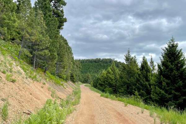
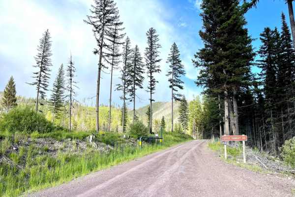
McCabe Creek
This narrow trail heads from the valley up into the hills providing access to the McCabe hiking trail. This is the more traveled and smoother way to access the hiking trail. The driving trail does narrow in some parts but has ample pullouts for oncoming traffic. There are a few offshoot trails where...
Learn more about McCabe Creek
Monture Creek
This well-traveled trail leads back into the main valley and to the Monture Trailhead and campgrounds. It's a beautiful drive just be sure to watch for cyclists as it appears to be a major cycling access route. The Monture trailhead is also a very popular equestrian trail area. A public corral, unlo...
Learn more about Monture Creek
McCabe Loop(Red Hills)
This narrow two-track loop is the less traveled access point to the McCabe Loop Hiking trailhead. This route offers amazing vistas and viewpoints as it crosses the higher hillside. There are outstanding views of the valley below as you climb higher and higher. There are some wet, muddy sections afte...
Learn more about McCabe Loop(Red Hills)
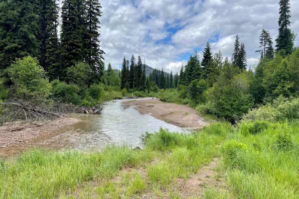
Cottonwood Lakes
This scenic trail runs across the valley and is an excellent jumping-off point to explore the many trails in the area. With a keen eye, one will spot many short pullouts with nice spots to disperse camp. Watch for bicycles on this trail, as this is a popular mountain biking route. Plenty of creek cr...
Learn more about Cottonwood Lakes
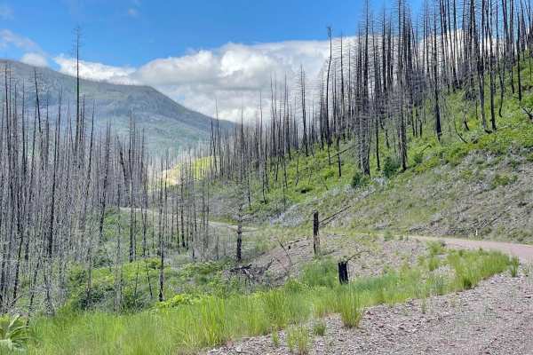
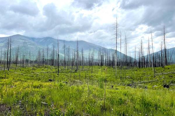
Dunham Creek
This well-maintained out-and-back trail is a pure treat to drive. Unfortunately, there was a large wildfire that swept through the canyon. But the views it left behind are spectacular. Rocky hillsides, waterfalls and creeks flowing. All these beautiful sights would have been hidden by the dense fore...
Learn more about Dunham Creek
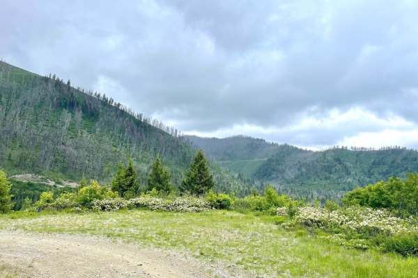
Stanley Creek
This route heads into the hills and is a nice out-and-back detour from the main Cottonwood Lakes trail. Overall it's narrow with pullouts and some potholes to navigate. The trail travels through a section of old burned forest, so be on the lookout or ready to clear deadfall, especially after a storm...
Learn more about Stanley Creek
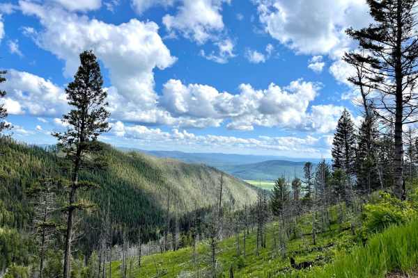
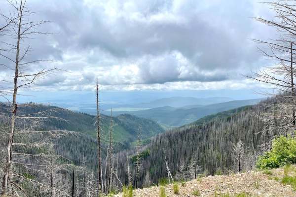
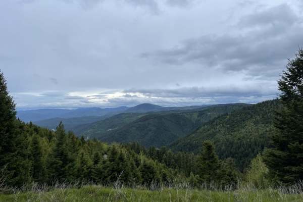
Black Canyon
What a great way to get from the valley high up to the ridges. The views lower down are nice and mostly of trees. As one climbs, the views become way more expansive. There are no good dispersed camping spots on this trail, but some old forestry cuts may offer an excellent spot for the night. There a...
Learn more about Black Canyon
Cottonwood Ridge
This route starts as a nice solid-packed old logging road with a few deeper mud holes and rutted-out sections. As it progresses up the ridge, it becomes narrower and more rutted. A few tighter switchbacks, looser ruts, and very narrow shrub sections may cause some paint damage. The views on this tra...
Learn more about Cottonwood Ridge
Lower Lil Stanley Cr
This lower section of Lil Stanley Creek is purely an access route. It sees a fair amount of deadfall, so be ready to clear trees if you plan to run it. A lower offshoot leads to an old rock Quarry that is very visible via satellite and would make for an excellent spot to do some target shooting or s...
Learn more about Lower Lil Stanley Cr
Little Stanley Creek
This old man forestry road is in amazing condition. It is smooth and solid as it runs along a shelf to the top of the ridge. The end has been filled in to allow for regrowth, but there is a great camping spot with a stunning view. Strange that there is no Verizon LTE here, so you're going to have to...
Learn more about Little Stanley Creek
South Cottonwood
This connector trail leads back out from or into Cottonwood Ridge. It has some steeper sections with loose rock, and some articulation may occur. Otherwise, it has the typical Montana forest road potholes full of mud and tight turns here and there. It's only wide enough for a single vehicle, but pul...
Learn more about South Cottonwood
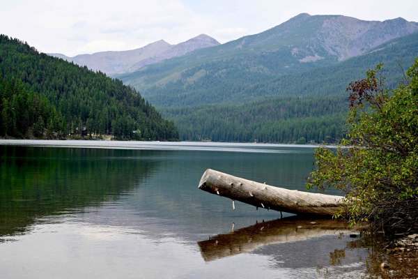
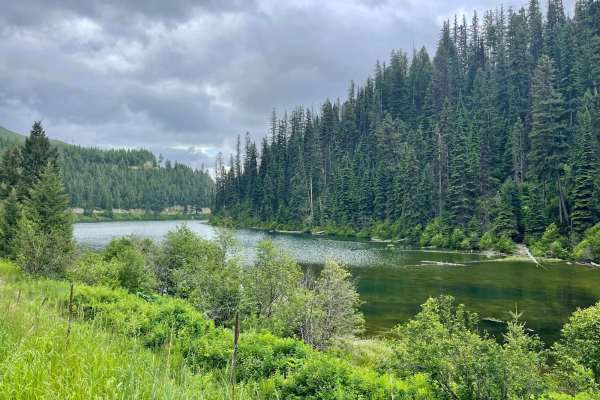
Coopers Lake
Great run between Lincoln, Montana, and Coopers Lake, which is an Alpine lake in Lolo National Forest. The lake is very reminiscent of Lake Macdonald in Glacier, to some extent. Generally smooth trail, well-maintained and graded. Lots of wildlife, we spooked a good-sized bear around one turn in the ...
Learn more about Coopers Lake
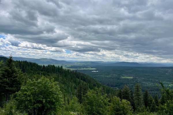
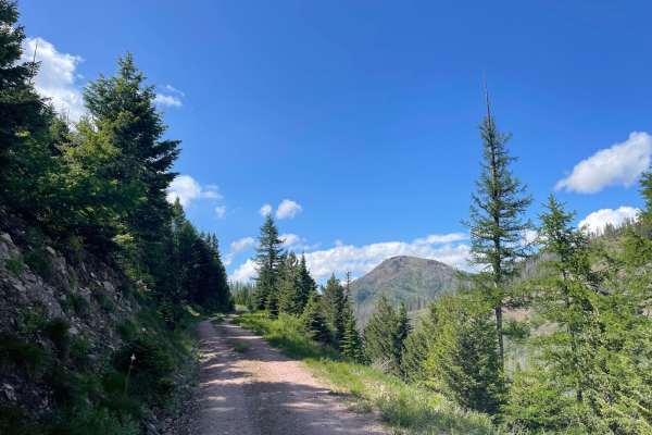
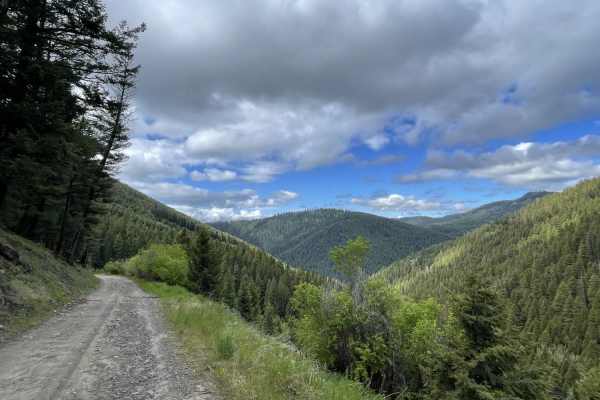
Morrell Mountain Lookout
This twisty, rocky shelf road offers some of the best vistas in the area as you climb your way to the top. It's a narrow shelf road most of the way, with a few pullouts here and there and some longer ones that may have camping. The trail passes through a vast section of burned-out forest and crosses...
Learn more about Morrell Mountain Lookout
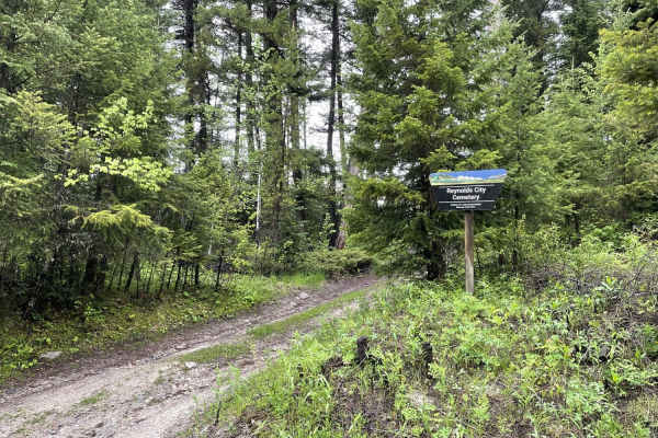
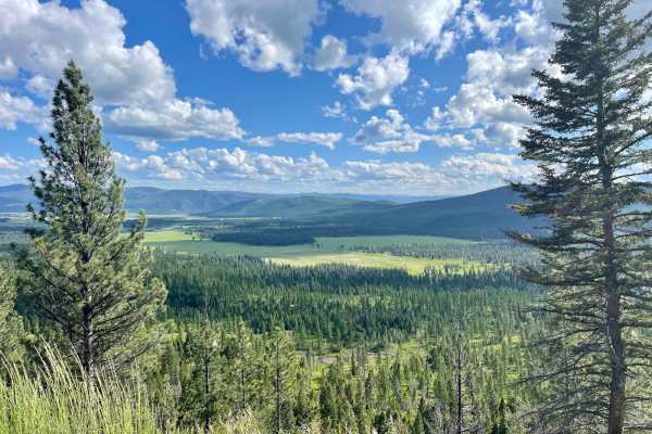
Eastern Garnet Range Road
This easy section twists and turns through the hills and offers a lot of offshoots that have been blocked off with gates and a few pullouts with evidence of camping. If that is your jam, then there are spots for you. The trail passes by the access to the old Reynolds city cemetery as it twists and t...
Learn more about Eastern Garnet Range Road
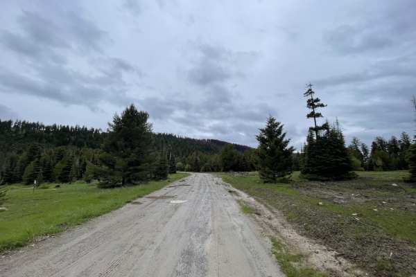
Jocko Road
Jocko Road is an easy, scenic dirt and gravel route perfect for beginners, overland rigs, SxSs, and standard SUVs looking for a direct but scenic passage connecting the Jocko Valley with the Seeley Lake area. Traversing both the Flathead Indian Reservation and Lolo National Forest, this route parall...
Learn more about Jocko Road
Summit Cabin Road
This narrow road cuts through a section of burned forest and passes through many private parcels. Please be respectful of their land and stick to the trail. On the map, there is one dispersed camping spot right along the outside of a private property line. Otherwise, there aren't too many places to ...
Learn more about Summit Cabin Road
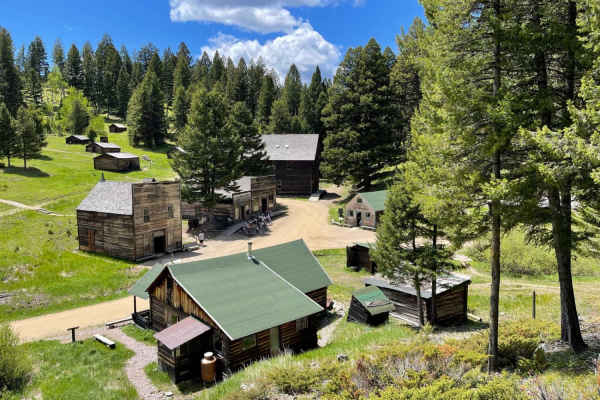
Garnet Ghost Town
This very potholed and deeply washboard trail leads from the beginning of the dirt section to Montana's best-preserved Ghost Town, Garnet. This site features some of the best-kept historical buildings of its kind. The trail ends at the parking area, and a three-dollar fee per person is well worth it...
Learn more about Garnet Ghost Town
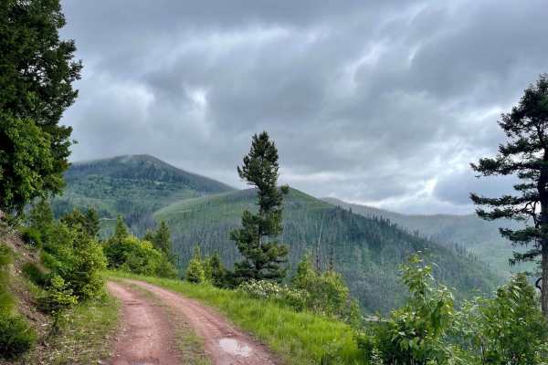
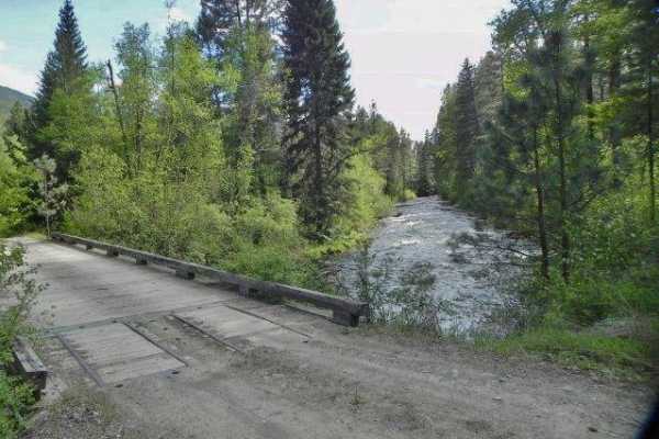
First Chance Gulch To Bear Gulch
This is a great connector trail with amazing views of the canyons below. It connects the well-preserved Garnet Ghost Town to Bear Town. There are plenty of switchbacks and a creek running alongside the whole way. There's even a lovely, well-preserved set of older buildings right in a switchback with...
Learn more about First Chance Gulch To Bear Gulch
Upper Cave Gulch Road
This narrow, short upper section leads into the hills to pass right by the well-preserved Garnet Ghost Town. It runs along a ridgeline with exceptional views of the valley below. It passes through a dense forest and massively deep potholes full of water when wet. There was one decent dispersed campi...
Learn more about Upper Cave Gulch Road
Blind Canyon
This scenic out and back runs through the lower valley and crosses a few streams. You spend most of the time passing through a sizeable burned-out forest section with monolithic trees burned to poles. They allow for a clear view of the beautiful mountains surrounding the valley. For side hikes, ther...
Learn more about Blind Canyon
Beginner ATV trails near Ovando, Montana
Explore ATV-friendly trails near you. These trails are accessible for vehicles up to 50 inches wide, perfect for ATVs and smaller off-road machines.
McCabe Creek
This narrow trail heads from the valley up into the hills providing access to the McCabe hiking trail. This is the more traveled and smoother way to access the hiking trail. The driving trail does narrow in some parts but has ample pullouts for oncoming traffic. There are a few offshoot trails where...
Learn more about McCabe Creek
Monture Creek
This well-traveled trail leads back into the main valley and to the Monture Trailhead and campgrounds. It's a beautiful drive just be sure to watch for cyclists as it appears to be a major cycling access route. The Monture trailhead is also a very popular equestrian trail area. A public corral, unlo...
Learn more about Monture Creek
McCabe Loop(Red Hills)
This narrow two-track loop is the less traveled access point to the McCabe Loop Hiking trailhead. This route offers amazing vistas and viewpoints as it crosses the higher hillside. There are outstanding views of the valley below as you climb higher and higher. There are some wet, muddy sections afte...
Learn more about McCabe Loop(Red Hills)
Cottonwood Lakes
This scenic trail runs across the valley and is an excellent jumping-off point to explore the many trails in the area. With a keen eye, one will spot many short pullouts with nice spots to disperse camp. Watch for bicycles on this trail, as this is a popular mountain biking route. Plenty of creek cr...
Learn more about Cottonwood Lakes
Beginner UTV/side-by-side trails near Ovando, Montana
Find UTV and side-by-side trails near you. These trails accommodate vehicles up to 60 inches wide, ideal for UTVs, side-by-sides, and wider off-road rigs.
McCabe Creek
This narrow trail heads from the valley up into the hills providing access to the McCabe hiking trail. This is the more traveled and smoother way to access the hiking trail. The driving trail does narrow in some parts but has ample pullouts for oncoming traffic. There are a few offshoot trails where...
Learn more about McCabe Creek
Monture Creek
This well-traveled trail leads back into the main valley and to the Monture Trailhead and campgrounds. It's a beautiful drive just be sure to watch for cyclists as it appears to be a major cycling access route. The Monture trailhead is also a very popular equestrian trail area. A public corral, unlo...
Learn more about Monture Creek
McCabe Loop(Red Hills)
This narrow two-track loop is the less traveled access point to the McCabe Loop Hiking trailhead. This route offers amazing vistas and viewpoints as it crosses the higher hillside. There are outstanding views of the valley below as you climb higher and higher. There are some wet, muddy sections afte...
Learn more about McCabe Loop(Red Hills)
Cottonwood Lakes
This scenic trail runs across the valley and is an excellent jumping-off point to explore the many trails in the area. With a keen eye, one will spot many short pullouts with nice spots to disperse camp. Watch for bicycles on this trail, as this is a popular mountain biking route. Plenty of creek cr...
Learn more about Cottonwood Lakes
The onX Offroad Difference
onX Offroad combines trail photos, descriptions, difficulty ratings, width restrictions, seasonality, and more in a user-friendly interface. Available on all devices, with offline access and full compatibility with CarPlay and Android Auto. Discover what you're missing today!
Open Trail Map