
Beginner Off-Road Trails
Near Helmville, Montana
Explore All Beginner Trails Near Helmville, Montana
Beginner Off-Road Trails Near Helmville, Montana
Discover the best beginner-friendly off-road trails near you. These easier, lower-rated trails are a great place to start — browse trail maps, check difficulty ratings, and find your next adventure.
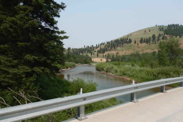
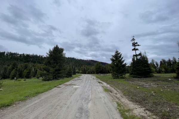
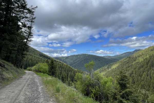
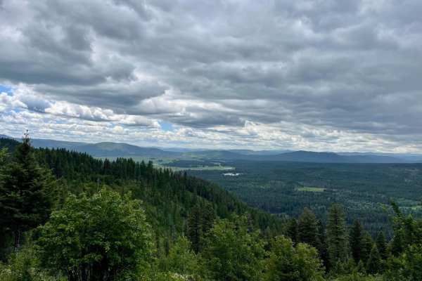
Nevada-Ogden Road
The Nevada-Ogden road is an thrilling, yet easy route that can be used to explore the Helena National Forest. While it is not routinely maintained, it sees enough seasonal use to be in good general condition. Just about any vehicle could be used to enjoy this trail with no fear of extreme terrain or...
Learn more about Nevada-Ogden Road
Blackfoot Mine Loop
Sometimes it's not about the trail, but the exploration! Montana has a rich and illustrious history of mining, dating back hundreds of years. This loop, accessed off of Nevada-Ogden Road (FS 1163), is a prime example of what's out there that you could easily drive by and never see unless you know it...
Learn more about Blackfoot Mine Loop

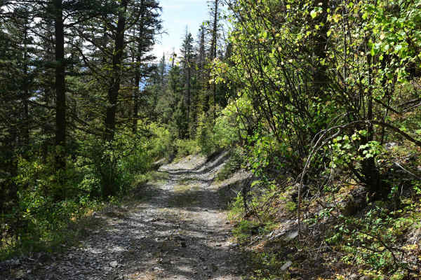
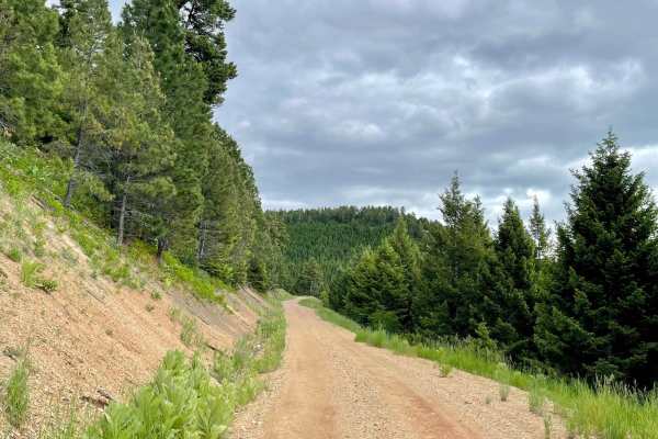
Lone Point Drive - FS 1824
Lone Point Drive is a nice, gravel, single-lane road that passes through beautiful dense stands of mixed conifers and occasional stands of aspen. As the road gains elevation, there are occasional openings that provide opportunities for panoramic views of the Lincoln Valley. Overall, this is a typi...
Learn more about Lone Point Drive - FS 1824
Lincoln View ATV Trail
Lincoln View ATV Trail is eleven miles of pure joy for ATV and motorcycle riders. This trail, numbered trail # 471, was created by joining some abandoned logging roads to some newly constructed ATV trails to form a substantial and enjoyable route specifically for motorized vehicles less than or equ...
Learn more about Lincoln View ATV Trail
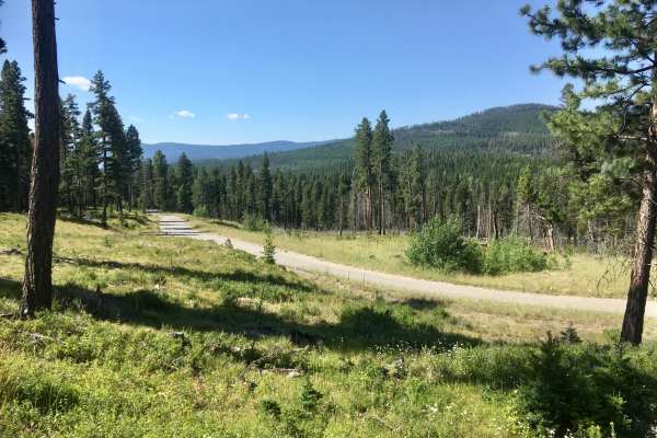
Dalton Mountain Road
The Dalton is an especially fun and scenic logging road for all modes of travel. Most fun on a large-class ADV bike. Nothing inherently difficult, just fast and flowy, depending on the season. Depending on your direction, it starts in the town of Lincoln, heads up into beautiful forest, over the mou...
Learn more about Dalton Mountain Road
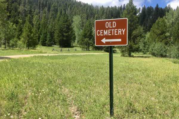
Lincoln Gulch Road
Lincoln Gulch Road is a well-maintained, gravel, two-lane road, with the exception of the last mile. However, that last mile is the most interesting of the route, with historical evidence of mining activity, an old cemetery, and the location of the remains of the old mining town of Lincoln Gulch. T...
Learn more about Lincoln Gulch Road
Park Creek Road - FS 607
Park Creek Road begins as a two-lane gravel road and gradually deteriorates to a wide single-lane dirt and rock surface. The road passes through mature stands of mixed conifers and occasional stands of alder. There are breaks in the trees that provide impressive overviews of the Lincoln Valley. A...
Learn more about Park Creek Road - FS 607
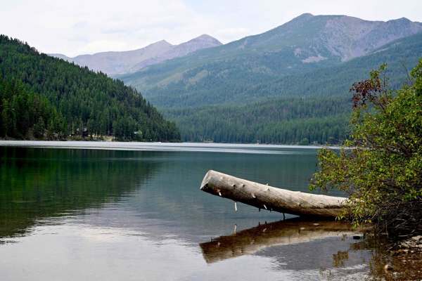
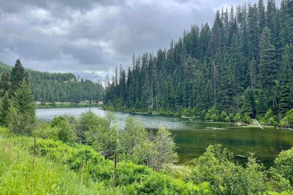
Coopers Lake
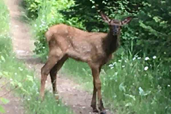
Great run between Lincoln, Montana, and Coopers Lake, which is an Alpine lake in Lolo National Forest. The lake is very reminiscent of Lake Macdonald in Glacier, to some extent. Generally smooth trail, well-maintained and graded. Lots of wildlife, we spooked a good-sized bear around one turn in the ...
Learn more about Coopers Lake
Stemple Pass
The Stemple Pass Road is a quick and scenic escape route to the small mountain town of Lincoln, Montana. The road, while well-maintained, does have things of which to be cautious. Loose gravel and numerous blind corners could be concerning to those on two wheels. In the summer months, this can be a ...
Learn more about Stemple Pass
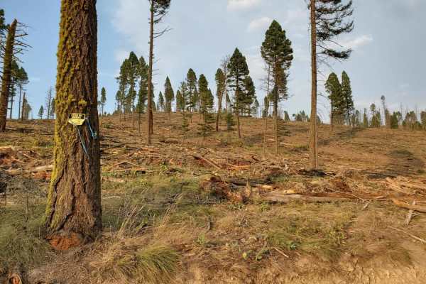
Summit Cabin Road
This narrow road cuts through a section of burned forest and passes through many private parcels. Please be respectful of their land and stick to the trail. On the map, there is one dispersed camping spot right along the outside of a private property line. Otherwise, there aren't too many places to ...
Learn more about Summit Cabin Road

Sucker Creek - FS 1800
As are most of the trails in the Lincoln, Montana area, this is a fairly smooth connector that branches into a series of other trails that traverse the Flathead Range north of Lincoln. Many of these trails evolve into snowmobile trails in the winter, which this area of Montana has no shortage of. Si...
Learn more about Sucker Creek - FS 1800
Stonewall Creek Road - FS 607E
The northern section of this Stonewall Creek (north of its intersection with Park Creek Road) is a fascinating climb into the mountains, ending in an old patented mining claim. The trail is a narrow single-lane road, surfaced with native material, mainly rocks. There are several loose rocky ascent...
Learn more about Stonewall Creek Road - FS 607E
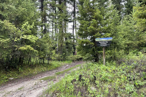
Eastern Garnet Range Road
This easy section twists and turns through the hills and offers a lot of offshoots that have been blocked off with gates and a few pullouts with evidence of camping. If that is your jam, then there are spots for you. The trail passes by the access to the old Reynolds city cemetery as it twists and t...
Learn more about Eastern Garnet Range Road
Upper Cave Gulch Road
This narrow, short upper section leads into the hills to pass right by the well-preserved Garnet Ghost Town. It runs along a ridgeline with exceptional views of the valley below. It passes through a dense forest and massively deep potholes full of water when wet. There was one decent dispersed campi...
Learn more about Upper Cave Gulch Road
First Chance Gulch To Bear Gulch
This is a great connector trail with amazing views of the canyons below. It connects the well-preserved Garnet Ghost Town to Bear Town. There are plenty of switchbacks and a creek running alongside the whole way. There's even a lovely, well-preserved set of older buildings right in a switchback with...
Learn more about First Chance Gulch To Bear Gulch
McCabe Creek
This narrow trail heads from the valley up into the hills providing access to the McCabe hiking trail. This is the more traveled and smoother way to access the hiking trail. The driving trail does narrow in some parts but has ample pullouts for oncoming traffic. There are a few offshoot trails where...
Learn more about McCabe Creek
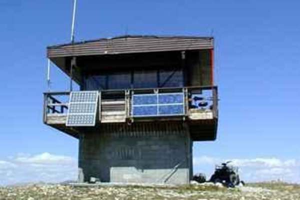
Stonewall Mountain Lookout
One of the more popular trails in the Lincoln Ranger District, the Stonewall Mountain trail takes visitors seemingly to the top of the world, with fantastic views of the Scapegoat Wilderness and the Upper Blackfoot Valley spread out below. The trail can either be started from the Keep Cool Connector...
Learn more about Stonewall Mountain Lookout
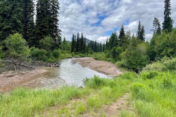
Monture Creek
This well-traveled trail leads back into the main valley and to the Monture Trailhead and campgrounds. It's a beautiful drive just be sure to watch for cyclists as it appears to be a major cycling access route. The Monture trailhead is also a very popular equestrian trail area. A public corral, unlo...
Learn more about Monture Creek
McCabe Loop(Red Hills)
This narrow two-track loop is the less traveled access point to the McCabe Loop Hiking trailhead. This route offers amazing vistas and viewpoints as it crosses the higher hillside. There are outstanding views of the valley below as you climb higher and higher. There are some wet, muddy sections afte...
Learn more about McCabe Loop(Red Hills)
Cottonwood Lakes
This scenic trail runs across the valley and is an excellent jumping-off point to explore the many trails in the area. With a keen eye, one will spot many short pullouts with nice spots to disperse camp. Watch for bicycles on this trail, as this is a popular mountain biking route. Plenty of creek cr...
Learn more about Cottonwood Lakes
Beginner ATV trails near Helmville, Montana
Explore ATV-friendly trails near you. These trails are accessible for vehicles up to 50 inches wide, perfect for ATVs and smaller off-road machines.
Nevada-Ogden Road
The Nevada-Ogden road is an thrilling, yet easy route that can be used to explore the Helena National Forest. While it is not routinely maintained, it sees enough seasonal use to be in good general condition. Just about any vehicle could be used to enjoy this trail with no fear of extreme terrain or...
Learn more about Nevada-Ogden Road
Blackfoot Mine Loop
Sometimes it's not about the trail, but the exploration! Montana has a rich and illustrious history of mining, dating back hundreds of years. This loop, accessed off of Nevada-Ogden Road (FS 1163), is a prime example of what's out there that you could easily drive by and never see unless you know it...
Learn more about Blackfoot Mine Loop
Lone Point Drive - FS 1824
Lone Point Drive is a nice, gravel, single-lane road that passes through beautiful dense stands of mixed conifers and occasional stands of aspen. As the road gains elevation, there are occasional openings that provide opportunities for panoramic views of the Lincoln Valley. Overall, this is a typi...
Learn more about Lone Point Drive - FS 1824
Lincoln View ATV Trail
Lincoln View ATV Trail is eleven miles of pure joy for ATV and motorcycle riders. This trail, numbered trail # 471, was created by joining some abandoned logging roads to some newly constructed ATV trails to form a substantial and enjoyable route specifically for motorized vehicles less than or equ...
Learn more about Lincoln View ATV Trail
Beginner UTV/side-by-side trails near Helmville, Montana
Find UTV and side-by-side trails near you. These trails accommodate vehicles up to 60 inches wide, ideal for UTVs, side-by-sides, and wider off-road rigs.
Nevada-Ogden Road
The Nevada-Ogden road is an thrilling, yet easy route that can be used to explore the Helena National Forest. While it is not routinely maintained, it sees enough seasonal use to be in good general condition. Just about any vehicle could be used to enjoy this trail with no fear of extreme terrain or...
Learn more about Nevada-Ogden Road
Blackfoot Mine Loop
Sometimes it's not about the trail, but the exploration! Montana has a rich and illustrious history of mining, dating back hundreds of years. This loop, accessed off of Nevada-Ogden Road (FS 1163), is a prime example of what's out there that you could easily drive by and never see unless you know it...
Learn more about Blackfoot Mine Loop
Lone Point Drive - FS 1824
Lone Point Drive is a nice, gravel, single-lane road that passes through beautiful dense stands of mixed conifers and occasional stands of aspen. As the road gains elevation, there are occasional openings that provide opportunities for panoramic views of the Lincoln Valley. Overall, this is a typi...
Learn more about Lone Point Drive - FS 1824
Lincoln View ATV Trail
Lincoln View ATV Trail is eleven miles of pure joy for ATV and motorcycle riders. This trail, numbered trail # 471, was created by joining some abandoned logging roads to some newly constructed ATV trails to form a substantial and enjoyable route specifically for motorized vehicles less than or equ...
Learn more about Lincoln View ATV Trail
The onX Offroad Difference
onX Offroad combines trail photos, descriptions, difficulty ratings, width restrictions, seasonality, and more in a user-friendly interface. Available on all devices, with offline access and full compatibility with CarPlay and Android Auto. Discover what you're missing today!
Open Trail Map