
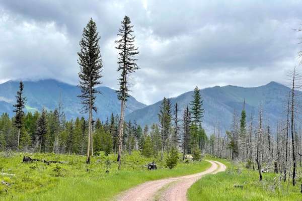
Beginner Off-Road Trails
Near Seeley Lake, Montana
Explore All Beginner Trails Near Seeley Lake, Montana
Beginner Off-Road Trails Near Seeley Lake, Montana
Discover the best beginner-friendly off-road trails near you. These easier, lower-rated trails are a great place to start — browse trail maps, check difficulty ratings, and find your next adventure.
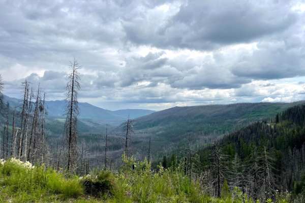
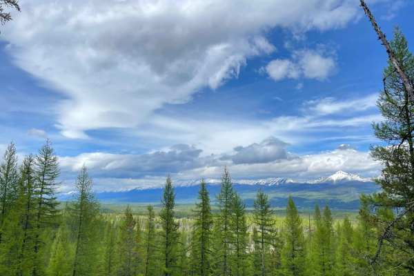
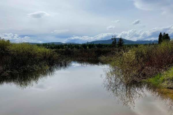
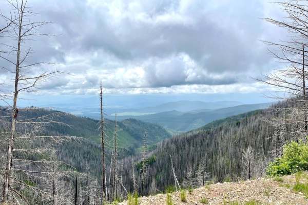
Morrell Clearwater
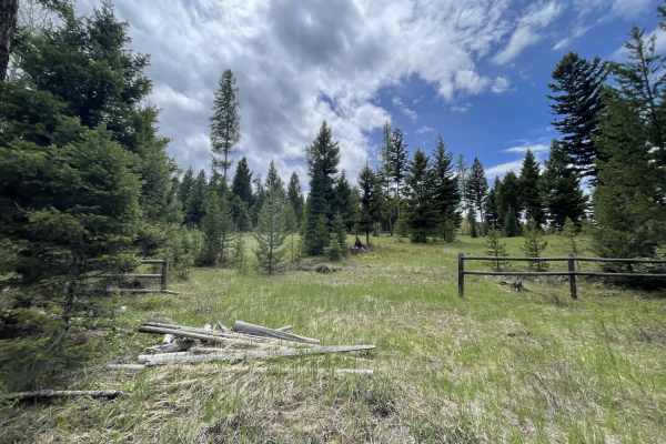
This trail runs up into the mountains from the Seeley Lake area and offers access to many great hiking and equestrian trails. There are a few offshoots and pullouts to make camp at and plenty of outstanding vistas and viewpoints as it twists its way into the mountains. The trail ends at a barricade ...
Learn more about Morrell Clearwater
Jocko Canyon
This is a scenic shortcut from Seeley Lake to Arlee. It is a rough and rocky dirt road that is 1-2 vehicles wide. The Jocko River and Lake system is visible for most of the trail. There's a waterfall that cascades next to and then under the road. Abundant undeveloped camping sites are available. Sev...
Learn more about Jocko Canyon
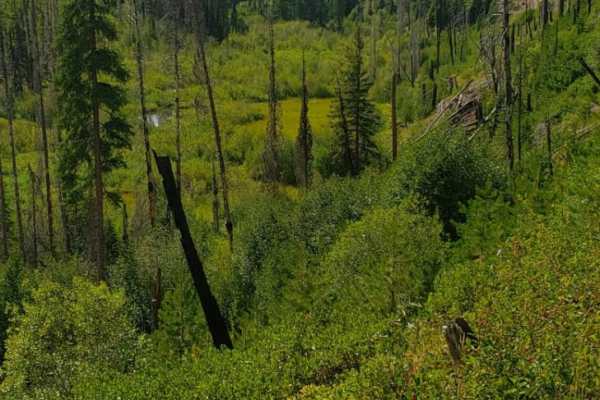
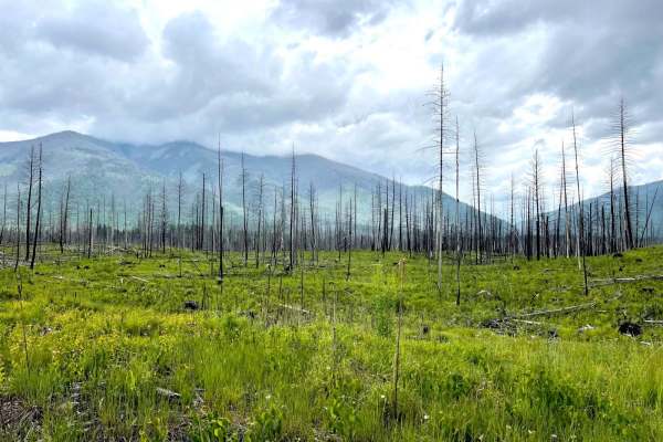
East Morrell
This easy out-and-back trail runs through the middle of the valley and appears to have been the fire line for the most recent big fire in the area. Burned to the South and East and lush to the Northwest. The mountain views are unbeatable as you twist your way along. There are a few marshy areas and ...
Learn more about East Morrell
Auggie Cutoff Trail
Auggie Cutoff TrailThis short cutoff trail is a great way to hop from Rice Ridge to Morrell Clearwater. There are plenty of pullouts to make camp close to town and a few bars of LTE cell service. The trail is heavily wooded to the west and transitions to clear burned-out forests to the east. Some se...
Learn more about Auggie Cutoff Trail
Archibald Loop
The stunning scenic trail rises far above Seeley Lake into the hills. There are incredible vistas of the lakes and surrounding mountains but no real places to camp unless a pullout in front of a locked gate is your jam. There is evidence of campers there based on the fire rings scattered about. This...
Learn more about Archibald Loop
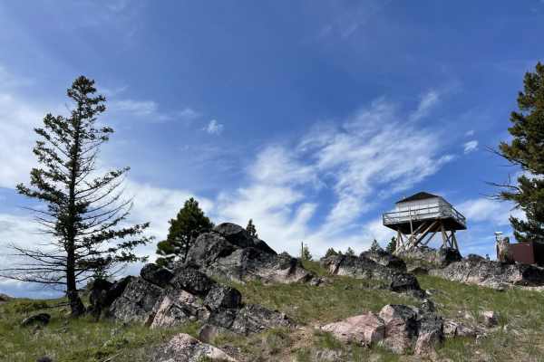
Double Arrow Lookout Tower
This short, scenic climb leads to a locked gate and a brief 1/4 mile hike to the lookout tower. You could take the road up, but the hiking trail offers excellent views of the surrounding mountains and lakes on your way up. At the time of recording, the tower itself was closed and under construction,...
Learn more about Double Arrow Lookout Tower
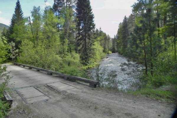
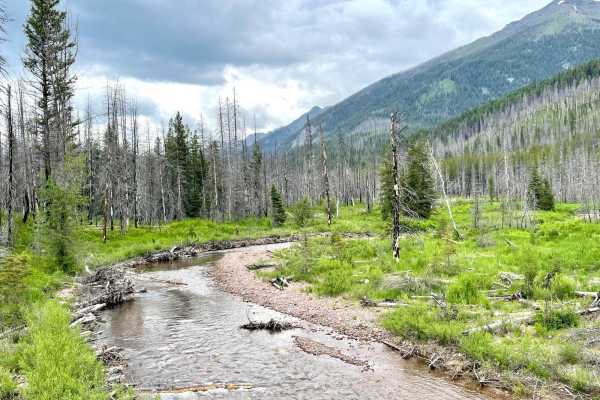
Blind Canyon
This scenic out and back runs through the lower valley and crosses a few streams. You spend most of the time passing through a sizeable burned-out forest section with monolithic trees burned to poles. They allow for a clear view of the beautiful mountains surrounding the valley. For side hikes, ther...
Learn more about Blind Canyon
Tupper Lake/River View Road
This 2.5-mile route offers a different alternative into the Seeley Lake area on a gravel road and through the trees. If you blink, you could miss the smaller 16-acre lake that was once stocked with Rainbow Trout, which is mostly blocked by the trees. Only a few decent campsites are found on the trai...
Learn more about Tupper Lake/River View Road
Clearwater Canoe Put In Trail
This easy graded trail leads to the fantastic Clearwater Canoe float trail. Put in there for a fantastic float down to the north end of Seely lake. The trail is easy, but please be respectful of the neighbors and keep it five mph to keep the dust down. There are two bars of LTE. There is no camping ...
Learn more about Clearwater Canoe Put In Trail
Jocko Road
Jocko Road is an easy, scenic dirt and gravel route perfect for beginners, overland rigs, SxSs, and standard SUVs looking for a direct but scenic passage connecting the Jocko Valley with the Seeley Lake area. Traversing both the Flathead Indian Reservation and Lolo National Forest, this route parall...
Learn more about Jocko Road
Placid Creek Road
This is a short side spur off of the Jocko Road that takes just under 30 minutes. The land on either side is private property with signs posted. There are no pull-offs or camping in this area with limited views. Cell services is also limited in this specific area.
Learn more about Placid Creek Road
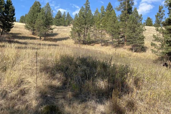
Fawn Peak
The scenic trail rises above Seeley Lake into the hills with a prominent Fawn Peak towering above you on this route. There is a short offshoot that can be taken to the top of the peak that offers some incredible vistas of the surrounding mountains and valleys below, but no real places to camp. Duri...
Learn more about Fawn Peak
Westside Bypass
This bypass takes you around Sealy Lake on dirt and through the trees. There is no view of the lake and no actual view of any kind unless you love looking at trees. Then, you're in luck. There are lots of trees. No real campsites are found on the trail, but some offshoots may have some options. The ...
Learn more about Westside Bypass
620 Character Ridge Road
This road winds along Character Ridge from Moon Saddle and down to the North Fork Coeur d'Alene River. Active logging operations have expanded and improved the existing road with new grading and plenty of room for two vehicles to pass. Keep an eye out for logging trucks and good luck keeping the dus...
Learn more about 620 Character Ridge Road
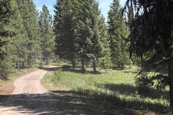
Sawyer Creek Road - FS 685
Sawyer Creek Road (FS 685) near Seeley Lake, Montana, is an easy-to-moderate forest route that provides access to scenic backcountry terrain. The road is primarily gravel with sections of loose rock, potholes, and occasional rough patches that may require high clearance. The trail winds through dens...
Learn more about Sawyer Creek Road - FS 685
Upper Trail Creek
This short out and back heads to multiple hiking trailheads and ends at the Pyramid Peak main trailhead. The route is generally wide enough for two rigs to pass and only has potholes for challenges. Since the trailhead at the top has exceptionally equestrian facilities, it makes sense for the road t...
Learn more about Upper Trail Creek
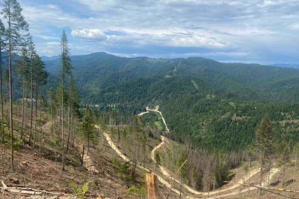
Morrell Mountain Lookout
This twisty, rocky shelf road offers some of the best vistas in the area as you climb your way to the top. It's a narrow shelf road most of the way, with a few pullouts here and there and some longer ones that may have camping. The trail passes through a vast section of burned-out forest and crosses...
Learn more about Morrell Mountain Lookout
South Cottonwood
This connector trail leads back out from or into Cottonwood Ridge. It has some steeper sections with loose rock, and some articulation may occur. Otherwise, it has the typical Montana forest road potholes full of mud and tight turns here and there. It's only wide enough for a single vehicle, but pul...
Learn more about South Cottonwood
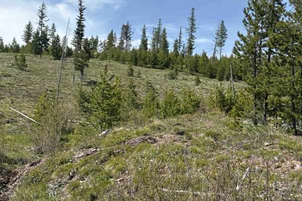
Finmore Cutover
This trail is an excellent choice to pop over from the Valley and Morrell Clearwater side and climb to Rice Ridge. It's a short steep climb with a few switchbacks. Be sure to look across the valley and soak in the outstanding view of Morrell Falls as you head up. It's most spectacular in the springt...
Learn more about Finmore Cutover
Findell Creek
What a lush green way to head down the mountain. Wildflowers and green forest fly by in a blur as you head up or down this great connector trail. It's pretty narrow for a single rig with the occasional pullout. Reversing will be necessary to pass oncoming. Some pullouts have fire rings and an outsta...
Learn more about Findell Creek
Beginner ATV trails near Seeley Lake, Montana
Explore ATV-friendly trails near you. These trails are accessible for vehicles up to 50 inches wide, perfect for ATVs and smaller off-road machines.
Morrell Clearwater
This trail runs up into the mountains from the Seeley Lake area and offers access to many great hiking and equestrian trails. There are a few offshoots and pullouts to make camp at and plenty of outstanding vistas and viewpoints as it twists its way into the mountains. The trail ends at a barricade ...
Learn more about Morrell Clearwater
Jocko Canyon
This is a scenic shortcut from Seeley Lake to Arlee. It is a rough and rocky dirt road that is 1-2 vehicles wide. The Jocko River and Lake system is visible for most of the trail. There's a waterfall that cascades next to and then under the road. Abundant undeveloped camping sites are available. Sev...
Learn more about Jocko Canyon
East Morrell
This easy out-and-back trail runs through the middle of the valley and appears to have been the fire line for the most recent big fire in the area. Burned to the South and East and lush to the Northwest. The mountain views are unbeatable as you twist your way along. There are a few marshy areas and ...
Learn more about East Morrell
Auggie Cutoff Trail
Auggie Cutoff TrailThis short cutoff trail is a great way to hop from Rice Ridge to Morrell Clearwater. There are plenty of pullouts to make camp close to town and a few bars of LTE cell service. The trail is heavily wooded to the west and transitions to clear burned-out forests to the east. Some se...
Learn more about Auggie Cutoff Trail
Beginner UTV/side-by-side trails near Seeley Lake, Montana
Find UTV and side-by-side trails near you. These trails accommodate vehicles up to 60 inches wide, ideal for UTVs, side-by-sides, and wider off-road rigs.
Morrell Clearwater
This trail runs up into the mountains from the Seeley Lake area and offers access to many great hiking and equestrian trails. There are a few offshoots and pullouts to make camp at and plenty of outstanding vistas and viewpoints as it twists its way into the mountains. The trail ends at a barricade ...
Learn more about Morrell Clearwater
Jocko Canyon
This is a scenic shortcut from Seeley Lake to Arlee. It is a rough and rocky dirt road that is 1-2 vehicles wide. The Jocko River and Lake system is visible for most of the trail. There's a waterfall that cascades next to and then under the road. Abundant undeveloped camping sites are available. Sev...
Learn more about Jocko Canyon
East Morrell
This easy out-and-back trail runs through the middle of the valley and appears to have been the fire line for the most recent big fire in the area. Burned to the South and East and lush to the Northwest. The mountain views are unbeatable as you twist your way along. There are a few marshy areas and ...
Learn more about East Morrell
Auggie Cutoff Trail
Auggie Cutoff TrailThis short cutoff trail is a great way to hop from Rice Ridge to Morrell Clearwater. There are plenty of pullouts to make camp close to town and a few bars of LTE cell service. The trail is heavily wooded to the west and transitions to clear burned-out forests to the east. Some se...
Learn more about Auggie Cutoff Trail
The onX Offroad Difference
onX Offroad combines trail photos, descriptions, difficulty ratings, width restrictions, seasonality, and more in a user-friendly interface. Available on all devices, with offline access and full compatibility with CarPlay and Android Auto. Discover what you're missing today!
Open Trail Map