
Beginner Off-Road Trails
Near Oljato-Monument Valley, Arizona
Explore All Beginner Trails Near Oljato-Monument Valley, Arizona
Beginner Off-Road Trails Near Oljato-Monument Valley, Arizona
Discover the best beginner-friendly off-road trails near you. These easier, lower-rated trails are a great place to start — browse trail maps, check difficulty ratings, and find your next adventure.
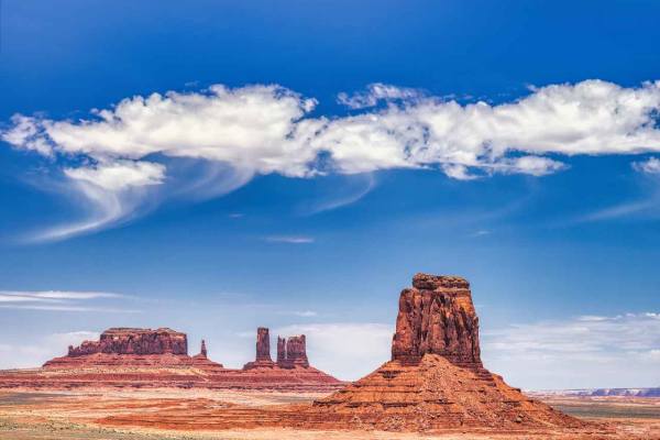
Monument Valley Loop
Mostly gravel with some rocky sections. Some washboard sections, but generally well maintained. This loop gets you up close to many of the classic scenes that Monument Valley offers. There are many overlooks and scenic points to stop at along the way. Ordinary cars are not allowed on the loop, but m...
Learn more about Monument Valley Loop
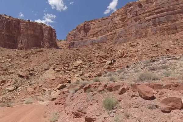
Johns Canyon Road - West
Johns Canyon Road - West is a 12.4-mile out-and-back (33.6-mile round trip from pavement) trail rated 2 of 10 located within the Glen Canyon National Recreational Area. The Johns Canyon Road is located near Mexican Hat, Utah. The road skirts the base of Cedar Mesa between Cedar Point and the Slickho...
Learn more about Johns Canyon Road - West
CR 244 Johns Canyon Road
This is a graded dirt road, maintained sometimes. There are several side roads you can take. You'll see open desert terrain but have views of the rims and cliffs as you drive down the road. This road starts from CR 316 heading west. CR 244 continues beyond this track, heading farther west and north....
Learn more about CR 244 Johns Canyon Road
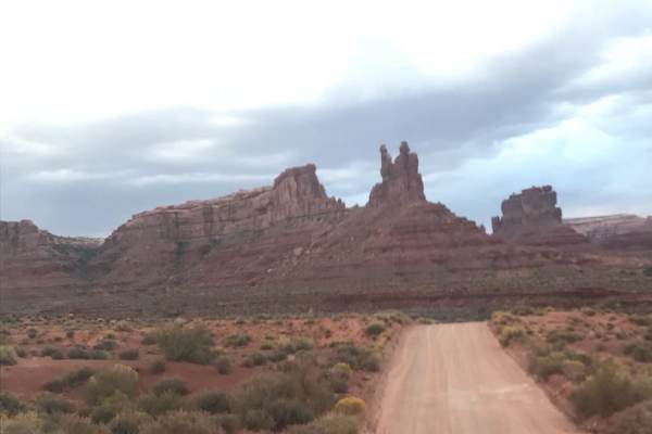
Valley of the Gods
Spectacular 17 mile route through iconic desert spires, buttes, and formations. Think Monument Valley that you can actually drive right next to the monuments and wild camp - for free. This route is not hard, but you MUST pay attention to weather - if it rains, it flashes very easily and you can be s...
Learn more about Valley of the Gods
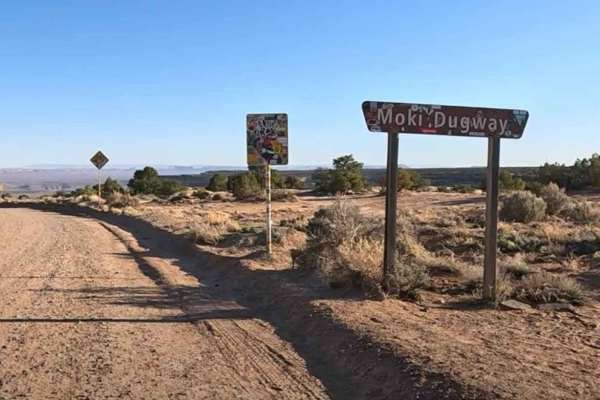
Moki Dugway
Moki Dugway (UT Highway 261) is one of the most memorable drives in southeast Utah, climbing the face of Cedar Mesa on a steep, winding stretch of unpaved road. This 2.7-mile section of Utah State Route 261 was carved directly into the cliffside in the 1950s and still feels raw today, with gravel su...
Learn more about Moki Dugway
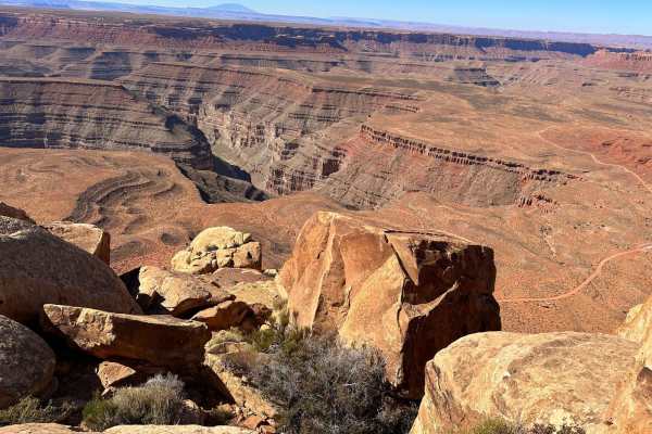
Muley Point
This route follows a gravel road that is easy to navigate when dry, but a high-clearance vehicle with 4WD is preferred. It offers great viewpoints of the San Juan River Canyon. Starting from Highway 261 on Cedar Mesa at the top of Moki Dugway, it is best traveled in dry conditions, as the road will ...
Learn more about Muley Point
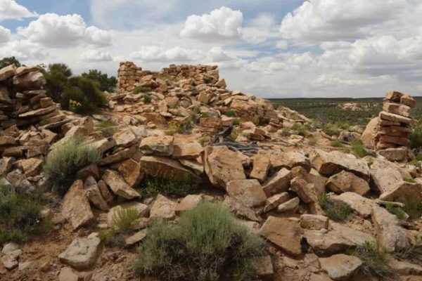
BLM B0057 - Lime Butte Ruins
BLM B0057 is a 1.3-mile out-and-back (2.6-mile round trip) trail rated 3 of 10 located in San Juan County. This is a destination trail to the Lime Butte Ruins located on Cedar Mesa and within the Bear Ears National Monument. The trail is a single-width sand track that leads to the boundary of the Ro...
Learn more about BLM B0057 - Lime Butte Ruins
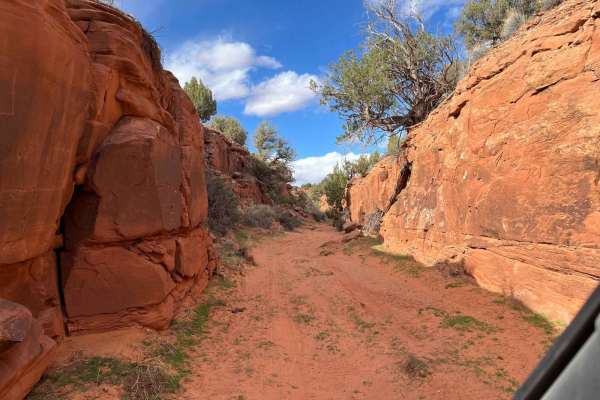
Mule Shoe
Mule Shoe is a sand wash that leads to a narrow canyon. It has a few gates to open and close due to it being in an open range. It's very interesting to see what ranchers use to hold up their solar panels for the water wells throughout the area. This is a fun little in-and-out trail; it probably goes...
Learn more about Mule Shoe
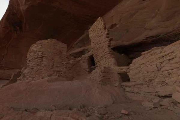
Comb Ridge
Comb Ridge is a 5.6-mile (11.2-mile round trip) out-and-back trail rated 3 of 10 located on the southern end of the Bear Ears National Monument. This trail is also known as the road to River House. This trail is rich in history both in Pre-Puebloan as well as the early Mormon settlers. This mostly h...
Learn more about Comb Ridge
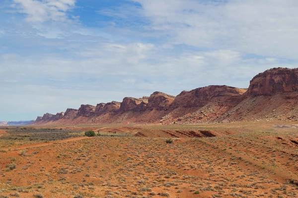
Comb Wash Road
Comb Wash Road follows the iconic Comb Ridge. The road itself is on BLM land and is suitable for most all-terrain vehicles. There are some water crossings in the Spring or when storms are nearby, so be careful to pay attention to weather reports. There are many side trails that lead to petroglyphs a...
Learn more about Comb Wash Road
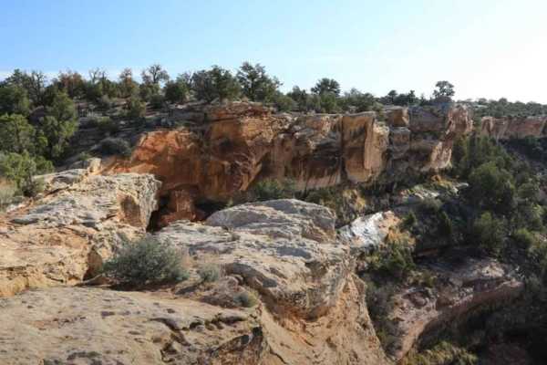
Baulie's Road - San Juan County B236
Baulie's Road is a 6.8-mile out-and-back trail (13.6-mile round trip) rated 3 of 10 located in San Juan County and falls within the Bears Ears National Monument. This is a destination trail also known as Dry Canyon Overlook and leads to a vista view of the Dry Wash and Comb Wash basin. In addition, ...
Learn more about Baulie's Road - San Juan County B236
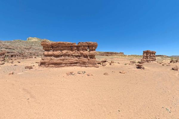
Recapture Pocket
This trail leads to Recapture Pocket, a scenic collection of hoodoos and cliffs. The trail north of Recapture Pocket is a very lightly used oil field access network, with rocky and sandy sections. Some of the more remote sections include rock ledges, sand dunes, and other challenges. A stock 4x4 or ...
Learn more about Recapture Pocket
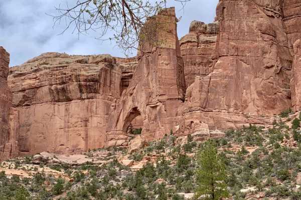
Arch Canyon
This 17.3 mile out and back box canyon trail features amazing Utah bluffs and rock formations and numerous water crossings. You will turn left before crossing the water that leads to Hotel Rock. There is a sign that shows Arch Canyon entrance. Depending on how much rainfall the area has received,...
Learn more about Arch Canyon
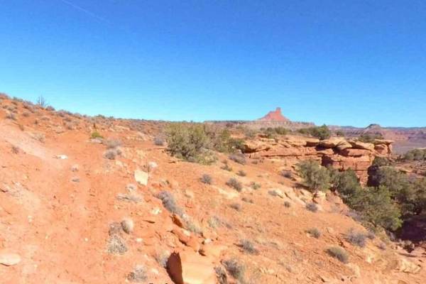
Jacobs Chair West
Jacobs Chair West is a 7.2-mile point-to-point trail rated 3 of 10 located in San Juan County. The trail runs entirely on the western side of Highway 95 and provides the connector trail between the Jacobs Chair and Short Canyon trailheads. The north end of the trail starts at the Short Canyon parkin...
Learn more about Jacobs Chair West
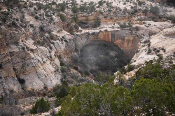
Butler Wash
This 3.4-mile 4x4 route starts on County Road 240 and goes south until it dead-ends at a cliff over Butler Wash. The cliff comes up suddenly, so don't go too fast at the end of the trail. This trail is less trafficked and more faint through soft dirt. It has lots of dips into ravines and washes with...
Learn more about Butler Wash
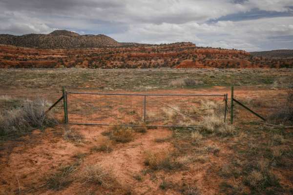
Fence Trail
This trail starts at Highway 95 through a fence. It's a faint trail in the beginning, going through pinyon pines and sagebrush. It's elevated above Butler Wash as it parallels the wash after leaving the highway, and steadily climbs up to the top of the mesa. It continues along the top of the mesa wi...
Learn more about Fence Trail
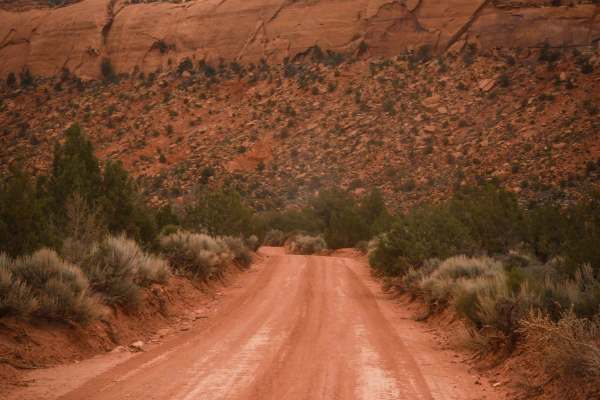
205
Road 205 starts off of Comb Ridge Descent and goes north for 2.2 miles on a full-width graded dirt road. As you drive north, you'll have views looking towards Comb Ridge and the tall red sandstone canyon walls. The road is flat and wide between sagebrush, with scenic views in every direction under t...
Learn more about 205
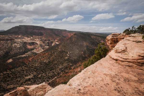
Comb Ridge View
This is a 2-mile spur off of County Road 240 that goes to a cool view of a canyon overlooking Comb Ridge. It's a dirt road with sandy sections and long sections of flat slick rock. It's bumpy and uneven, but it's all flat and easy with no ledges. It goes along the rim of the mesa in the pinyon pine ...
Learn more about Comb Ridge View
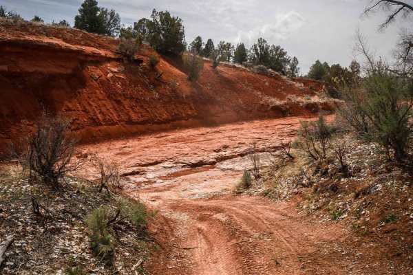
North Fork Whiskers Draw
This 3.6-mile route continues south from the graded road Whisker Draw South until it meets up with County Road 240. It starts at the intersection with Whisker Draw South at the point where it becomes narrow and off-camber, which is very different from the wide graded road. It's narrow between tall ...
Learn more about North Fork Whiskers Draw
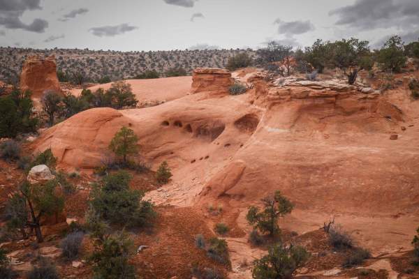
Chimney
This 4-mile scenic track starts from County Road 240 as a wider dirt trail on top of a desert mesa. As it goes south, it has lots of unmarked intersections for spurs you can explore. The trail is overall really easy but has features such as dips across ravines, wash crossings, tight turns, and ruts....
Learn more about Chimney
Beginner ATV trails near Oljato-Monument Valley, Arizona
Explore ATV-friendly trails near you. These trails are accessible for vehicles up to 50 inches wide, perfect for ATVs and smaller off-road machines.
Johns Canyon Road - West
Johns Canyon Road - West is a 12.4-mile out-and-back (33.6-mile round trip from pavement) trail rated 2 of 10 located within the Glen Canyon National Recreational Area. The Johns Canyon Road is located near Mexican Hat, Utah. The road skirts the base of Cedar Mesa between Cedar Point and the Slickho...
Learn more about Johns Canyon Road - West
CR 244 Johns Canyon Road
This is a graded dirt road, maintained sometimes. There are several side roads you can take. You'll see open desert terrain but have views of the rims and cliffs as you drive down the road. This road starts from CR 316 heading west. CR 244 continues beyond this track, heading farther west and north....
Learn more about CR 244 Johns Canyon Road
Moki Dugway
Moki Dugway (UT Highway 261) is one of the most memorable drives in southeast Utah, climbing the face of Cedar Mesa on a steep, winding stretch of unpaved road. This 2.7-mile section of Utah State Route 261 was carved directly into the cliffside in the 1950s and still feels raw today, with gravel su...
Learn more about Moki Dugway
Muley Point
This route follows a gravel road that is easy to navigate when dry, but a high-clearance vehicle with 4WD is preferred. It offers great viewpoints of the San Juan River Canyon. Starting from Highway 261 on Cedar Mesa at the top of Moki Dugway, it is best traveled in dry conditions, as the road will ...
Learn more about Muley Point
Beginner UTV/side-by-side trails near Oljato-Monument Valley, Arizona
Find UTV and side-by-side trails near you. These trails accommodate vehicles up to 60 inches wide, ideal for UTVs, side-by-sides, and wider off-road rigs.
Johns Canyon Road - West
Johns Canyon Road - West is a 12.4-mile out-and-back (33.6-mile round trip from pavement) trail rated 2 of 10 located within the Glen Canyon National Recreational Area. The Johns Canyon Road is located near Mexican Hat, Utah. The road skirts the base of Cedar Mesa between Cedar Point and the Slickho...
Learn more about Johns Canyon Road - West
CR 244 Johns Canyon Road
This is a graded dirt road, maintained sometimes. There are several side roads you can take. You'll see open desert terrain but have views of the rims and cliffs as you drive down the road. This road starts from CR 316 heading west. CR 244 continues beyond this track, heading farther west and north....
Learn more about CR 244 Johns Canyon Road
Moki Dugway
Moki Dugway (UT Highway 261) is one of the most memorable drives in southeast Utah, climbing the face of Cedar Mesa on a steep, winding stretch of unpaved road. This 2.7-mile section of Utah State Route 261 was carved directly into the cliffside in the 1950s and still feels raw today, with gravel su...
Learn more about Moki Dugway
Muley Point
This route follows a gravel road that is easy to navigate when dry, but a high-clearance vehicle with 4WD is preferred. It offers great viewpoints of the San Juan River Canyon. Starting from Highway 261 on Cedar Mesa at the top of Moki Dugway, it is best traveled in dry conditions, as the road will ...
Learn more about Muley Point
The onX Offroad Difference
onX Offroad combines trail photos, descriptions, difficulty ratings, width restrictions, seasonality, and more in a user-friendly interface. Available on all devices, with offline access and full compatibility with CarPlay and Android Auto. Discover what you're missing today!
Open Trail Map