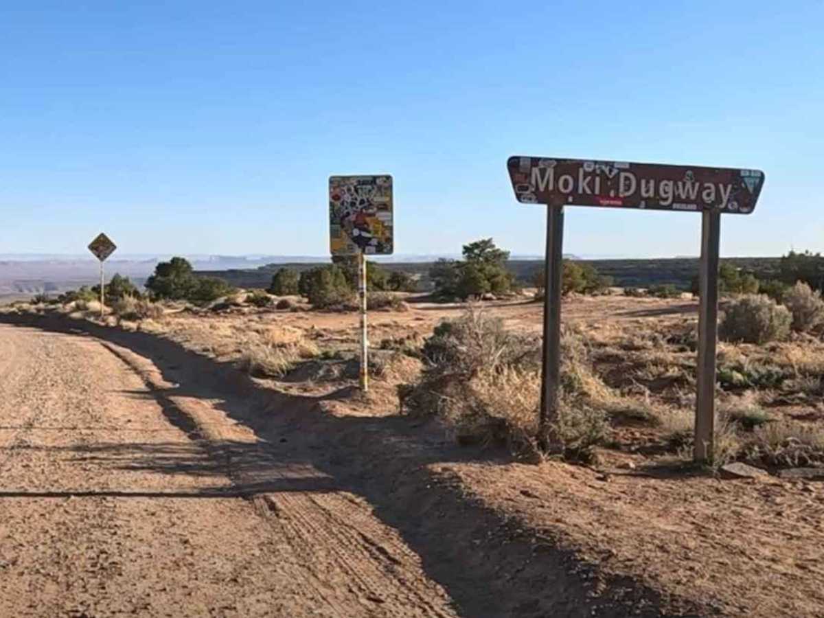
Trail Overview
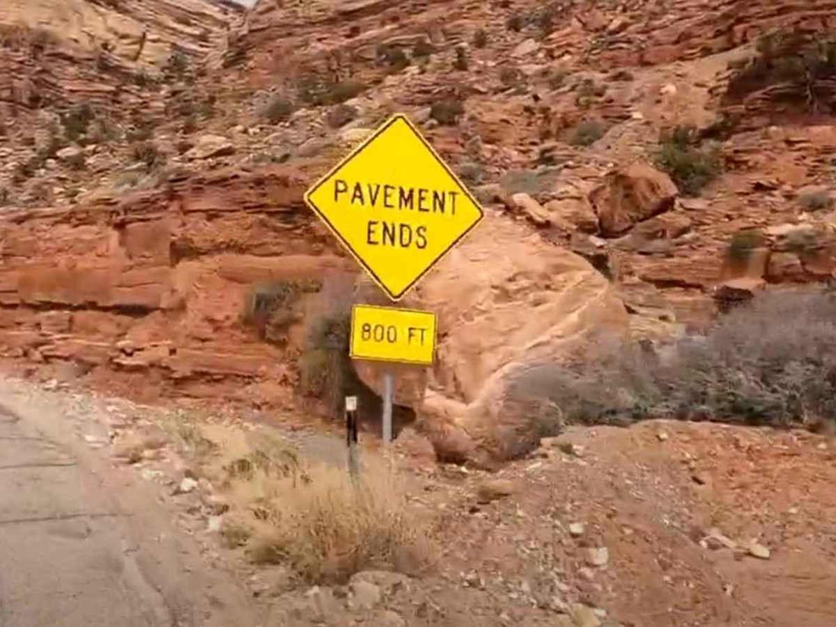
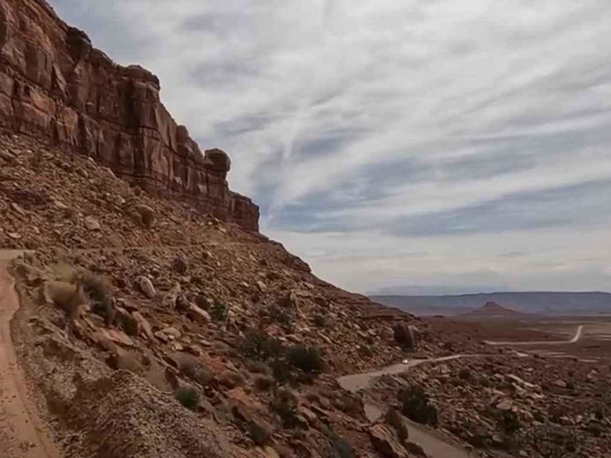
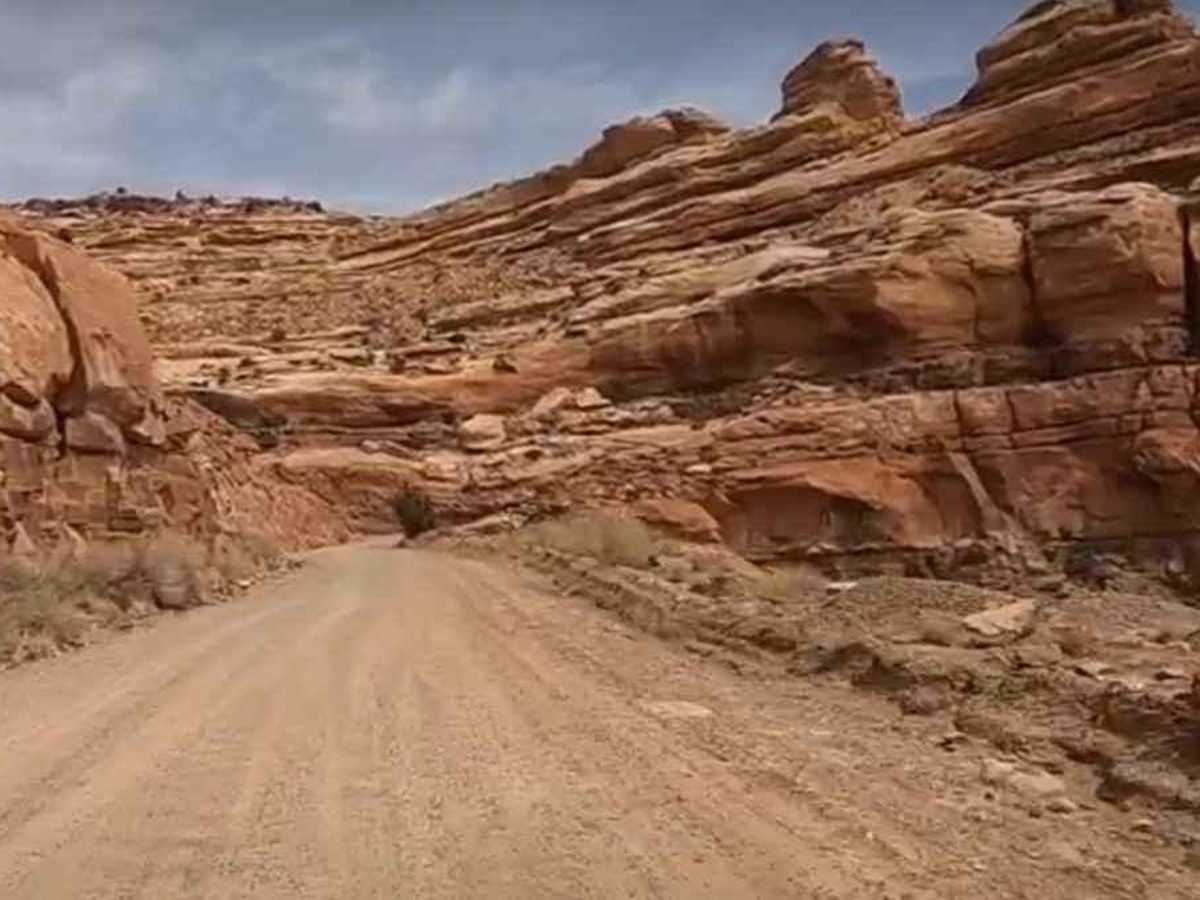
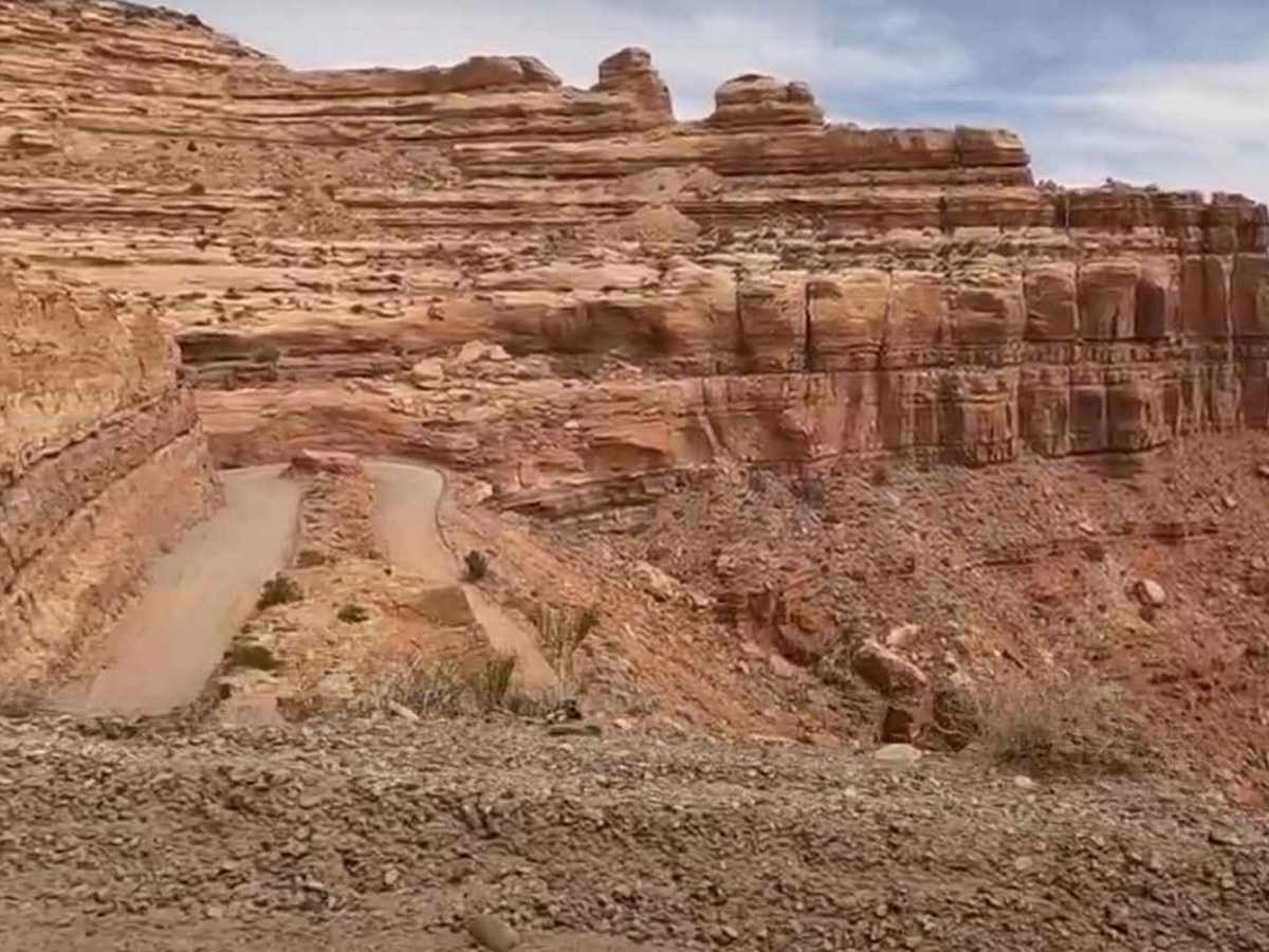
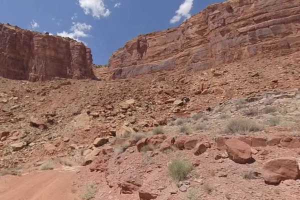
Moki Dugway (UT Highway 261) is one of the most memorable drives in southeast Utah, climbing the face of Cedar Mesa on a steep, winding stretch of unpaved road. This 2.7-mile section of Utah State Route 261 was carved directly into the cliffside in the 1950s and still feels raw today, with gravel surfaces, tight switchbacks, steep drop-offs, and big views across the desert below.
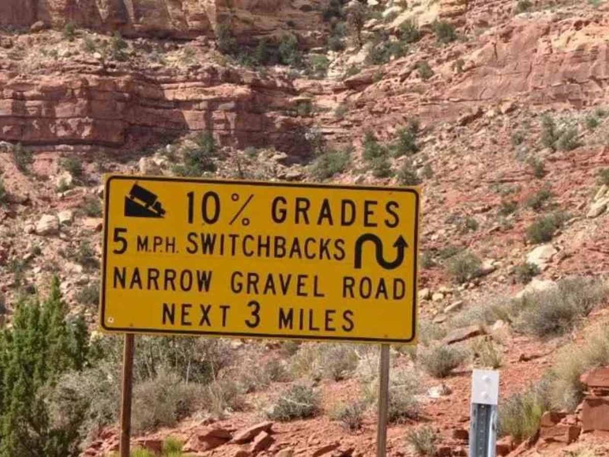
The dugway gains about 1,000 feet of elevation from bottom to top, with grades reaching up to 10%. Most of the road is gravel, with a few broken paved sections in the turns. It is generally wide enough for two vehicles to pass carefully, but drivers should take it slow, use lower gears, and be ready for oncoming traffic on blind corners. The posted speed limit is 15 mph, with some switchbacks recommended at 5 mph.
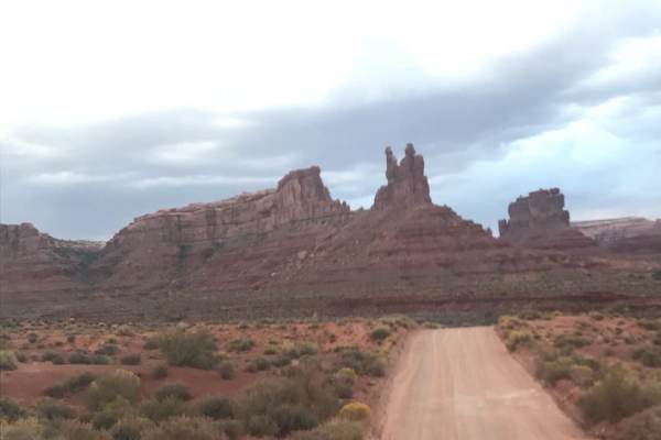
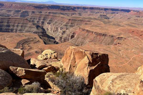
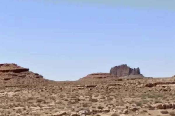
The reward for the climb is one of the best roadside viewpoints in the region. Near the top of Moki Dugway, a pullout offers sweeping views over Valley of the Gods, Monument Valley country, and the broad desert landscape of Utah, Colorado, and New Mexico. On clear days, you may be able to see Sleeping Ute Mountain in Colorado to the east and Shiprock in New Mexico to the southeast.
Moki Dugway was originally built by the Texas Zinc mining company to haul uranium ore from the Fry Canyon area to a processing mill near Mexican Hat. The name comes from “Moki,” a historic misspelling of “Moqui,” a term once used by Spanish explorers for Puebloan people in the region. Today, that term is considered offensive when used to refer to Puebloan communities, but the road’s name remains tied to the area’s older maps and mining-era history. “Dugway” refers to the way the road was cut into the hillside, using material from the uphill side to build and support the downhill edge.
This route is not technically difficult in dry weather, but it is exposed and demands attention. Large RVs, trailers, and drivers uncomfortable with steep grades or shelf roads may want to avoid it. There is no reliable cell service along the dugway. The nearest services are in Mexican Hat, about 10 miles south, with more options in Blanding to the northeast. Use onX Offroad to download maps before you go, check weather conditions, and avoid the route during storms, snow, ice, or heavy rain.