
Beginner Off-Road Trails
Near Morristown, Arizona
Explore All Beginner Trails Near Morristown, Arizona
Beginner Off-Road Trails Near Morristown, Arizona
Discover the best beginner-friendly off-road trails near you. These easier, lower-rated trails are a great place to start — browse trail maps, check difficulty ratings, and find your next adventure.
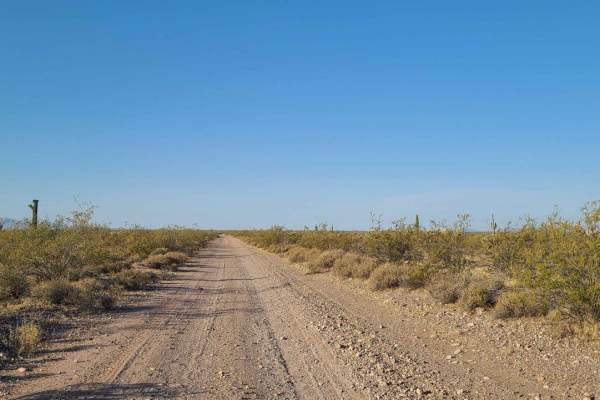
Ogden Road
This trail starts at Gates Road just off Grand Avenue. It is a fairly smooth trail for the first half--a full-width dirt road with some small washouts. The second half is split between narrow desert brush and full road. Pinstripes will happen. There are a few soft sandy sections and several deeper w...
Learn more about Ogden Road
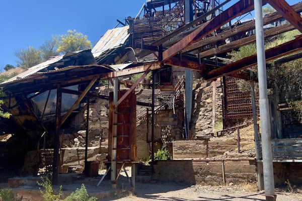
North Mine Road to Historic Anderson Mill
North Mine Road is an out-and-back trail to the Anderson Mill. Along the main route, the road winds up and down the lower Wickenburg Mountains with amazing views. Once you descend into the wash, you will see historic remnants such as a natural spring and an old water pump as you drive under the wate...
Learn more about North Mine Road to Historic Anderson Mill
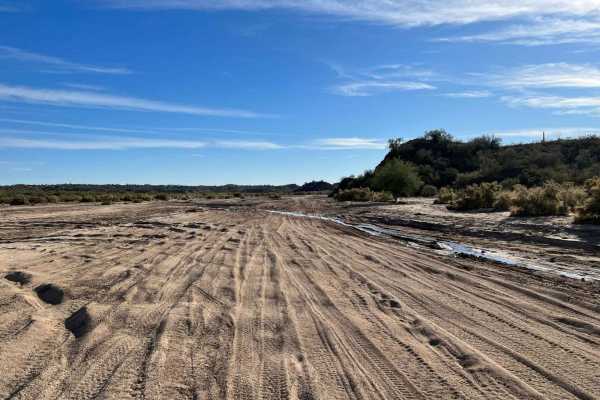
Hassayampa River
The Hassayampa River trail is a wide sandy wash. Great for playing around in the sand, with a lot of smaller shorter trails to explore. You will need an Arizona State Trust Land recreational permit, as a large portion of the land is State Trust land. If you are just passing through and do not stop, ...
Learn more about Hassayampa River
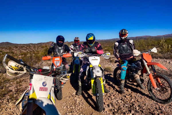
Ox Wash Singletrack
Ox Wash Singletrack is an excellent introductory route for beginner dirt bikers and dual-sport riders looking to build confidence on a scenic desert trail. Located near Morristown, Arizona, just north of State Route 74, this 15.9-mile loop winds through the rugged Sonoran Desert landscape, showcasin...
Learn more about Ox Wash Singletrack
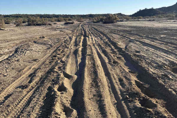
Running Wild
This trail starts at a gate that must be kept closed and climbs a gentle graded hill along a narrow, rocky road lined with saguaro cactus and open grazing areas with cattle. The route crosses State Trust land, and a valid permit is required for access. This is a scenic trail that passes a water tank...
Learn more about Running Wild
38116
Trail 38116 enters from the wash. You follow the trail through some overgrown vegetation. The surface is mostly rock and dirt, with only a few rocks under 12 inches. Along the way, you’ll find a hidden campsite tucked off the trail. There is a large rock located in the middle of the trail, but there...
Learn more about 38116

9066
At the intersection, Trail 9066 turns left and climbs a rocky gravel road that winds up to the top of a hill. Although the trail technically ends on the map, the road continues as a dirt road. High-clearance vehicles are recommended. The trail is only 0.6 miles long and leads to another intersection...
Learn more about 9066
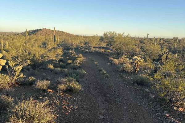
38116A
Trail 38116 picks up from the hilltop intersection with Trail 9066 and descends back down to the wash at the intersection. The hill features two off-camber sections that are washed out with ruts, along with a steep grade that requires 4x4 and high-clearance vehicles. The area is lined with saguaros ...
Learn more about 38116A
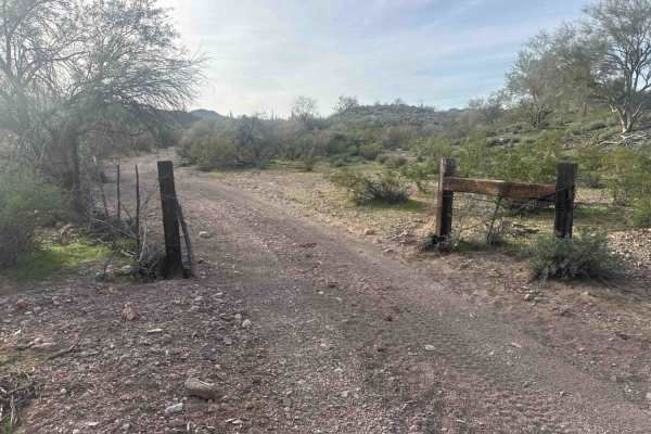
38068
This trail begins at a gate beyond the corral, where it narrows and winds through a rocky route before climbing a mild rocky hill. The surface consists of loose shale and rock with no technical obstacles, and it is suitable for high-clearance two-wheel drive vehicles. The route passes through dense ...
Learn more about 38068
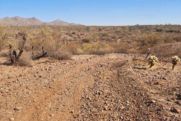
32137 - Single Track
This route starts just off of North Castle Hot Springs Road, adjacent to a popular camping area. It flows out through the desert valley floor across mostly level ground. You'll encounter some small ascents and descents, sandy washes, the usual cactus, and lots of whoops. Eventually, it will lead you...
Learn more about 32137 - Single Track
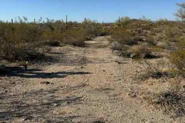
BLM 38069
BLM 38069 starts on Arizona State Trust Land and ends on Bureau of Land Management (BLM) land. A valid Arizona State Trust Land permit is required for the first portion of the trail before it transitions onto BLM-managed land. The trail is easy and suitable for most passenger vehicles under normal c...
Learn more about BLM 38069
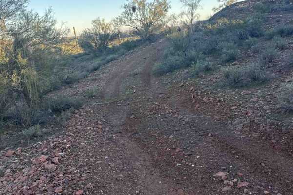
Cholla Fields
This trail is a connecting section that connects to at least three trails on the map. Rocky shale road, easy terrain. Nothing technical, just a rocky road with small loose rocks surrounded by amazing saguaro cactus and cholla cactus. A connector trail that leads to surrounding trails. A high clearan...
Learn more about Cholla Fields
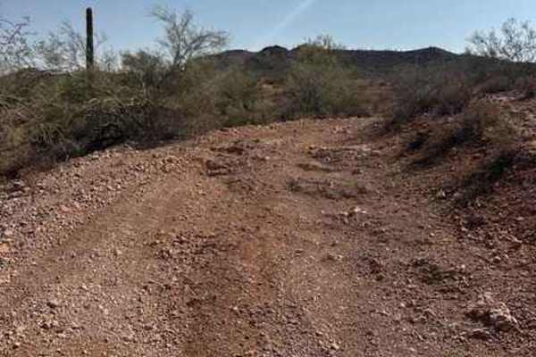
BLM 38070
BLM 38070 is a rocky trail that goes from wide to narrow in different sections on the trail. The narrow sections can be found on the hill sides. The middle of the trail has a few ledges with over hanging catus and branches. The trail goes down to a few wash areas. The trail also has some easy se...
Learn more about BLM 38070
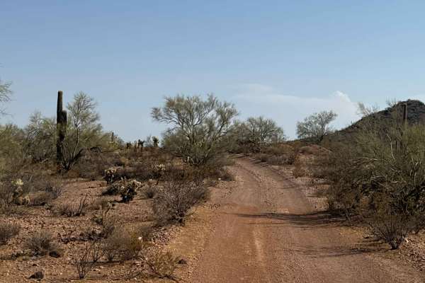
BLM 38064
BLM 38064 is a point-to-point rocky gravel trail that begins about .20 miles from Vulture Mine. We mapped it east to west through classic Sonoran Desert scenery filled with saguaros, yucca, cholla, and creosote.
The trail features two steep climbs/descents with exposed 12–18" rock shelves and multip...
Learn more about BLM 38064
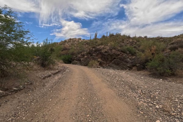
San Domingo Wash
Typical wash with sandy dirt bottom and beautiful views. This is an in-and-out trail with a couple of starting and ending points. You can make it as easy or as difficult as you would like. If traveling on a 2-wheel, you can cross over the rock ledge at one end and meet up with another 1-track trail ...
Learn more about San Domingo Wash
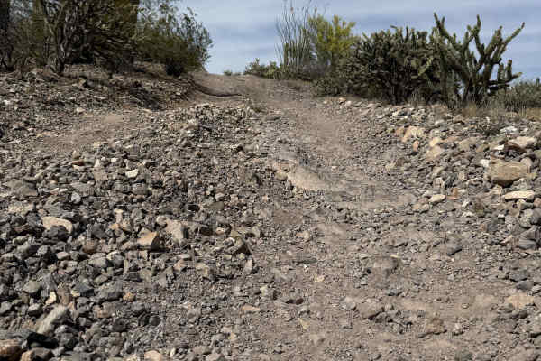
9231D
Trail 9231D serves as a point-to-point connector between San Domingo Wash and Old Stage Road. Due to its limited traffic, it offers an ideal spur trail for those seeking a quiet place to stop and relax. Both access points feature steep, loose rocky ascents leading to a relatively straightforward rou...
Learn more about 9231D
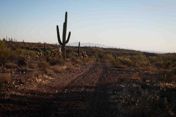
Castle Loop
This is a wide trail that makes a 3.4-mile loop on Arizona State Trust Land, accessed from North Castle Hot Spring Road. It's more like two-track width and is more gradual along the base of the mountains compared to the many steep trails in the area, making it one of the easier trails in the area. I...
Learn more about Castle Loop
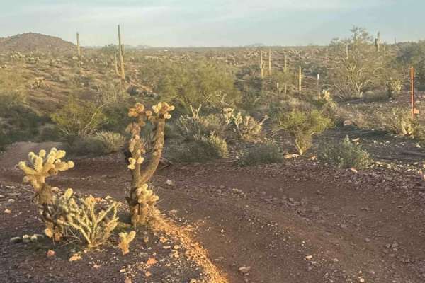
Fence Line Drop In
This trail turns left at the end of 38067 and follows the fence line to an open area. Then there is a steep, rutted, washed-out sand and rock hill. This steep grade hill requires 4WD and high clearance. The top section has a significant drop on one side, obviously created by heavy rain, and could b...
Learn more about Fence Line Drop In
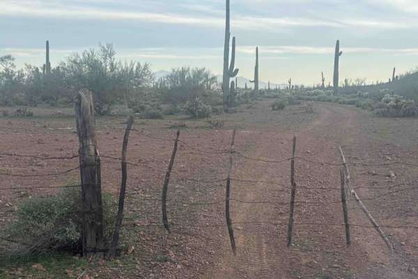
38067
This is a short trail that begins at a gate that must be kept closed and winds through cholla and saguaro along a flat valley floor. The route follows an easy dirt road with recent ruts from rainfall but no major obstacles. The trail dead-ends at a gate marking private property.
Learn more about 38067
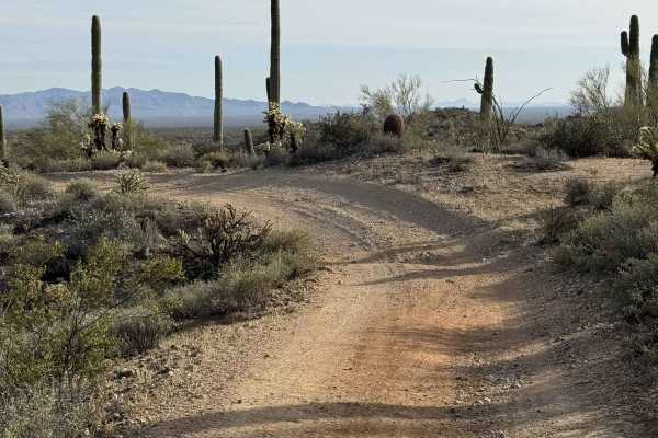
Trail 32022
The trail begins off North Castle Hot Springs Road and is a point-to-point route. Along the way, the trail intersects with several other trails that are mostly single track. At the starting point, there is a gate that users must pass. It is important to ensure that the gate remains closed after pass...
Learn more about Trail 32022
Beginner ATV trails near Morristown, Arizona
Explore ATV-friendly trails near you. These trails are accessible for vehicles up to 50 inches wide, perfect for ATVs and smaller off-road machines.
Ogden Road
This trail starts at Gates Road just off Grand Avenue. It is a fairly smooth trail for the first half--a full-width dirt road with some small washouts. The second half is split between narrow desert brush and full road. Pinstripes will happen. There are a few soft sandy sections and several deeper w...
Learn more about Ogden Road
North Mine Road to Historic Anderson Mill
North Mine Road is an out-and-back trail to the Anderson Mill. Along the main route, the road winds up and down the lower Wickenburg Mountains with amazing views. Once you descend into the wash, you will see historic remnants such as a natural spring and an old water pump as you drive under the wate...
Learn more about North Mine Road to Historic Anderson Mill
Hassayampa River
The Hassayampa River trail is a wide sandy wash. Great for playing around in the sand, with a lot of smaller shorter trails to explore. You will need an Arizona State Trust Land recreational permit, as a large portion of the land is State Trust land. If you are just passing through and do not stop, ...
Learn more about Hassayampa River
Running Wild
This trail starts at a gate that must be kept closed and climbs a gentle graded hill along a narrow, rocky road lined with saguaro cactus and open grazing areas with cattle. The route crosses State Trust land, and a valid permit is required for access. This is a scenic trail that passes a water tank...
Learn more about Running Wild
Beginner UTV/side-by-side trails near Morristown, Arizona
Find UTV and side-by-side trails near you. These trails accommodate vehicles up to 60 inches wide, ideal for UTVs, side-by-sides, and wider off-road rigs.
Ogden Road
This trail starts at Gates Road just off Grand Avenue. It is a fairly smooth trail for the first half--a full-width dirt road with some small washouts. The second half is split between narrow desert brush and full road. Pinstripes will happen. There are a few soft sandy sections and several deeper w...
Learn more about Ogden Road
North Mine Road to Historic Anderson Mill
North Mine Road is an out-and-back trail to the Anderson Mill. Along the main route, the road winds up and down the lower Wickenburg Mountains with amazing views. Once you descend into the wash, you will see historic remnants such as a natural spring and an old water pump as you drive under the wate...
Learn more about North Mine Road to Historic Anderson Mill
Hassayampa River
The Hassayampa River trail is a wide sandy wash. Great for playing around in the sand, with a lot of smaller shorter trails to explore. You will need an Arizona State Trust Land recreational permit, as a large portion of the land is State Trust land. If you are just passing through and do not stop, ...
Learn more about Hassayampa River
Running Wild
This trail starts at a gate that must be kept closed and climbs a gentle graded hill along a narrow, rocky road lined with saguaro cactus and open grazing areas with cattle. The route crosses State Trust land, and a valid permit is required for access. This is a scenic trail that passes a water tank...
Learn more about Running Wild
The onX Offroad Difference
onX Offroad combines trail photos, descriptions, difficulty ratings, width restrictions, seasonality, and more in a user-friendly interface. Available on all devices, with offline access and full compatibility with CarPlay and Android Auto. Discover what you're missing today!
Open Trail Map