
Beginner Off-Road Trails
Near Morganfield, Kentucky
Explore All Beginner Trails Near Morganfield, Kentucky
Beginner Off-Road Trails Near Morganfield, Kentucky
Discover the best beginner-friendly off-road trails near you. These easier, lower-rated trails are a great place to start — browse trail maps, check difficulty ratings, and find your next adventure.
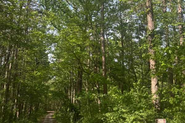
Cadiz Campground Trail
The Cadiz Campground Trail begins within Shawnee National Forest at Cadiz Campground, a primitive-style campground that offers designated campsites with fire pits, restroom facilities, and a water fill spigot. The route starts as a maintained gravel road and provides easy access from within the camp...
Learn more about Cadiz Campground Trail
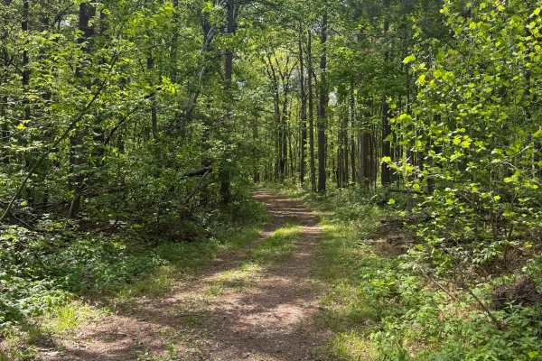
River to River Trail
River to River Trail is a gravel route within Shawnee National Forest that provides access to backcountry hiking and equestrian trails. The road is generally easy to follow and travels through a more remote section of the forest, offering a quieter experience for those looking to explore beyond main...
Learn more about River to River Trail

High Knob Trail
High Knob Trail is a gravel route within Shawnee National Forest that travels through an equestrian campground before climbing to a scenic overlook. Drivers should use caution when passing through the campground area, yielding to horses and minimizing speed and dust. The trail gradually gains elevat...
Learn more about High Knob Trail
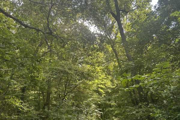
Kaskaskia Woods Trail
A fun, increasingly primitive forest trail that starts relatively easy with mild rock gardens, shallow muddy ruts, and occasional off-camber sections before steadily tightening as you travel deeper into the woods. Expect significant overgrowth and pinstriping throughout. About halfway in, the trail ...
Learn more about Kaskaskia Woods Trail
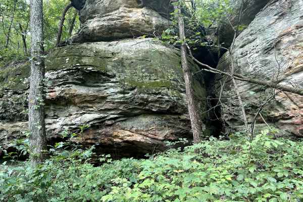
Golden Circle - FS 1621
Golden Circle Trail is a short, relatively easy route with beautiful scenery and plenty of reasons to slow down and explore. Near the entrance, striking layers of sandstone rise alongside the trail, softened by moss and vegetation, with several small caves and rock formations that are easily accessi...
Learn more about Golden Circle - FS 1621
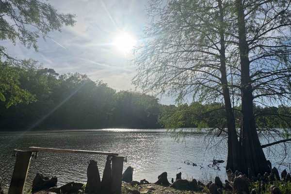
Whoopie Cat Lake Trail
Whoopie Cat Lake Trail is a gravel road within Shawnee National Forest that leads to a quiet lake access point with a small gravel boat ramp and parking area. The route is easy to follow and consists of typical forest gravel terrain. The launch area is best suited for small boats, kayaks, canoes, an...
Learn more about Whoopie Cat Lake Trail
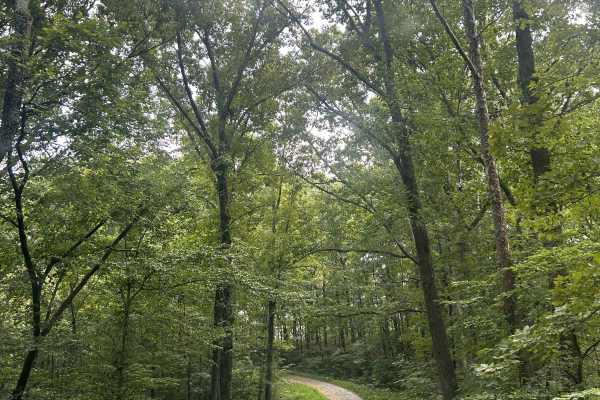
Richland Ridge Road
Richland Ridge Trail serves as a main north-to-south artery through this part of Shawnee National Forest, with several side trails branching off along the way that invite further exploration. The route travels through beautiful hardwood forest and is generally easygoing, making it more about enjoyin...
Learn more about Richland Ridge Road
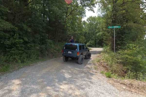
Eagle Mountain Fire Road
The Eagle Mountain Fire Road is a gravel service road through the Eagle Mountain area in the most northern section of the Hidden Springs sector of Shawnee National Forest. The road acts as a main artery road that most of the other trails in the area are connected to or even loop back to. It is mostl...
Learn more about Eagle Mountain Fire Road

Goose Ridge Trail
Goose Ridge Trail is a gravel route within Shawnee National Forest that offers a straightforward out-and-back drive through forest terrain. The road is generally easy to follow, with some ruts that may develop after rainfall and occasional tree limbs overhanging the route. This trail provides a rela...
Learn more about Goose Ridge Trail
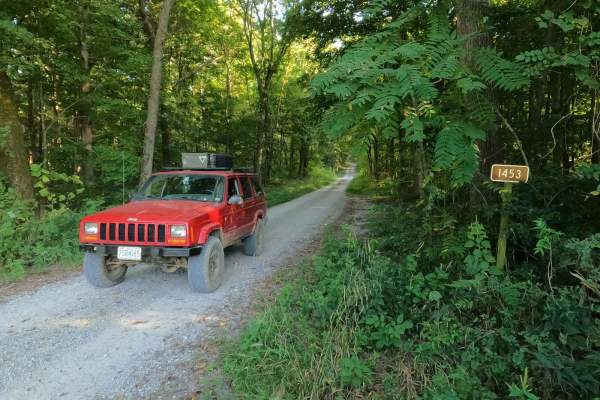
Stone Face Lane - FS 1453
Stone Face Lane/Recreation Area FS 1453 is a gravel access road to the hiking trail and scenic bluff rock overlook of the same name. It is a part of the Eagle Mountain area within the Hidden Springs sector of Shawnee National Forest. The lane is short but provides a great place to stage and meet up ...
Learn more about Stone Face Lane - FS 1453
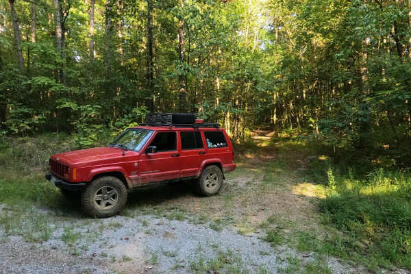
Wamble Mountain Spur Road - FS 707A
Wamble Mountain Spur Road FS 707A is a natural-improved trail in Shawnee National Forest near the Eagle Mountain area, within the Hidden Springs Sector. The FS 707A is best described as your uncle's secret hunting road; few know about it, and the entrance gives the vibe that no one uses it. However,...
Learn more about Wamble Mountain Spur Road - FS 707A

Shelby Cemetery Trail
Shelby Cemetery Trail is a route within Shawnee National Forest that begins as a gravel road before transitioning into a narrower path with mud, grass, and increasing vegetation overgrowth. At the beginning of the trail, there is an old cemetery along with access to hiking trails and a small primiti...
Learn more about Shelby Cemetery Trail
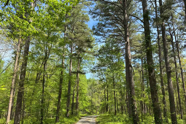
One Horse Gap Lake Trail
One Horse Gap Lake Trail is a gravel road within Shawnee National Forest that leads to a quiet lakeside access point with several primitive camping opportunities along the way. The route is easy to follow and suitable for most 2WD vehicles, though sections of tree overhang may limit clearance for ta...
Learn more about One Horse Gap Lake Trail

Dutton Chapel Road
Dutton Chapel Road is a gravel route within Shawnee National Forest that serves as a connector to other trails in the area, including Benham Hill Trail and One Horse Gap Lake Trail. The road is generally easy to follow and consists of typical forest gravel terrain. Along the route, drivers may encou...
Learn more about Dutton Chapel Road
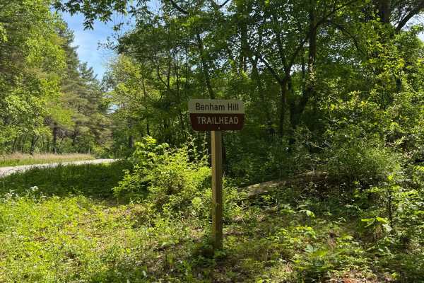
Benham Hill Trail
Benham Hill Trail is a gravel route within Shawnee National Forest that provides access to both recreational driving and nearby equestrian and hiking trail systems. The route begins at a large parking area designed for equestrian use, offering space for trailers and staging before entering the trail...
Learn more about Benham Hill Trail
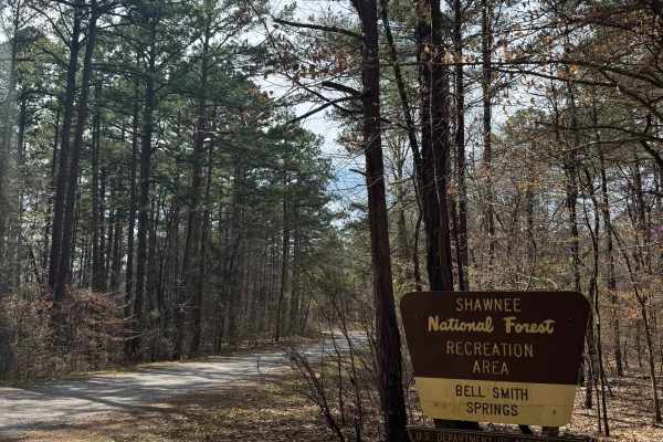
Bell Smith Spring Rope Swing Trail
Bell Smith Spring Rope Swing Trail is a gravel road within Shawnee National Forest that leads to a spring-fed swimming area known for its rope swings and deep water access. The route is easy to navigate and follows a typical forest gravel surface with minimal obstacles. At the end of the trail, visi...
Learn more about Bell Smith Spring Rope Swing Trail
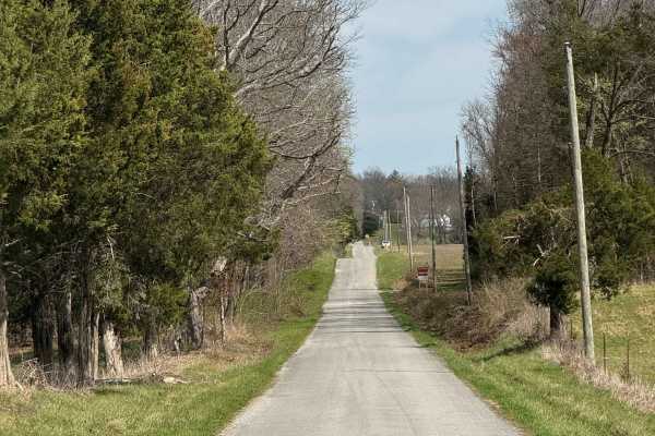
Burden Falls Trail
Burden Falls Trail is a gravel road within Shawnee National Forest that provides access to multiple hiking points leading to Burden Falls. The route is easy to follow and consists of typical forest gravel terrain with minimal obstacles. Along the trail, visitors will find several access points for h...
Learn more about Burden Falls Trail
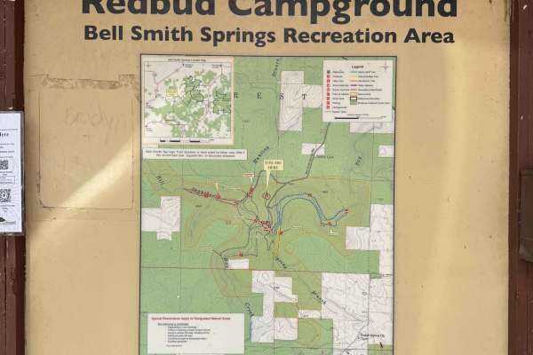
Bell Smith Spring Hiking Area
Bell Smith Springs Trailhead Access is a gravel and partially paved road within Shawnee National Forest that leads to the main hiking trailhead and campground area at Bell Smith Springs. The route is easy to navigate and suitable for most vehicles, making it a primary access point for visitors to th...
Learn more about Bell Smith Spring Hiking Area
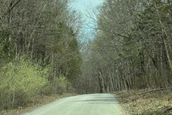
Burden Falls Road
Burden Falls Road is a gravel route within Shawnee National Forest that connects the small community of McCormick to Burden Falls Road (402). The road is generally easy to follow and consists of typical forest gravel terrain with occasional uneven sections. This route provides a quieter, more scenic...
Learn more about Burden Falls Road
Glen Street
Glen Street Trail is a scenic main artery through this section of Shawnee National Forest, providing access to dispersed campsites, numerous side trails and the spectacular Jackson Falls area. The trail is somewhat rougher than other primary routes nearby, with deeper puddles, rainwater erosion, exp...
Learn more about Glen Street
Beginner ATV trails near Morganfield, Kentucky
Explore ATV-friendly trails near you. These trails are accessible for vehicles up to 50 inches wide, perfect for ATVs and smaller off-road machines.
Kaskaskia Woods Trail
A fun, increasingly primitive forest trail that starts relatively easy with mild rock gardens, shallow muddy ruts, and occasional off-camber sections before steadily tightening as you travel deeper into the woods. Expect significant overgrowth and pinstriping throughout. About halfway in, the trail ...
Learn more about Kaskaskia Woods Trail
Golden Circle - FS 1621
Golden Circle Trail is a short, relatively easy route with beautiful scenery and plenty of reasons to slow down and explore. Near the entrance, striking layers of sandstone rise alongside the trail, softened by moss and vegetation, with several small caves and rock formations that are easily accessi...
Learn more about Golden Circle - FS 1621
Richland Ridge Road
Richland Ridge Trail serves as a main north-to-south artery through this part of Shawnee National Forest, with several side trails branching off along the way that invite further exploration. The route travels through beautiful hardwood forest and is generally easygoing, making it more about enjoyin...
Learn more about Richland Ridge Road
Glen Street
Glen Street Trail is a scenic main artery through this section of Shawnee National Forest, providing access to dispersed campsites, numerous side trails and the spectacular Jackson Falls area. The trail is somewhat rougher than other primary routes nearby, with deeper puddles, rainwater erosion, exp...
Learn more about Glen Street
Beginner UTV/side-by-side trails near Morganfield, Kentucky
Find UTV and side-by-side trails near you. These trails accommodate vehicles up to 60 inches wide, ideal for UTVs, side-by-sides, and wider off-road rigs.
Kaskaskia Woods Trail
A fun, increasingly primitive forest trail that starts relatively easy with mild rock gardens, shallow muddy ruts, and occasional off-camber sections before steadily tightening as you travel deeper into the woods. Expect significant overgrowth and pinstriping throughout. About halfway in, the trail ...
Learn more about Kaskaskia Woods Trail
Golden Circle - FS 1621
Golden Circle Trail is a short, relatively easy route with beautiful scenery and plenty of reasons to slow down and explore. Near the entrance, striking layers of sandstone rise alongside the trail, softened by moss and vegetation, with several small caves and rock formations that are easily accessi...
Learn more about Golden Circle - FS 1621
Richland Ridge Road
Richland Ridge Trail serves as a main north-to-south artery through this part of Shawnee National Forest, with several side trails branching off along the way that invite further exploration. The route travels through beautiful hardwood forest and is generally easygoing, making it more about enjoyin...
Learn more about Richland Ridge Road
Glen Street
Glen Street Trail is a scenic main artery through this section of Shawnee National Forest, providing access to dispersed campsites, numerous side trails and the spectacular Jackson Falls area. The trail is somewhat rougher than other primary routes nearby, with deeper puddles, rainwater erosion, exp...
Learn more about Glen Street
The onX Offroad Difference
onX Offroad combines trail photos, descriptions, difficulty ratings, width restrictions, seasonality, and more in a user-friendly interface. Available on all devices, with offline access and full compatibility with CarPlay and Android Auto. Discover what you're missing today!
Open Trail Map