
Beginner Off-Road Trails
Near LaVerkin, Utah
Explore All Beginner Trails Near LaVerkin, Utah
Beginner Off-Road Trails Near LaVerkin, Utah
Discover the best beginner-friendly off-road trails near you. These easier, lower-rated trails are a great place to start — browse trail maps, check difficulty ratings, and find your next adventure.
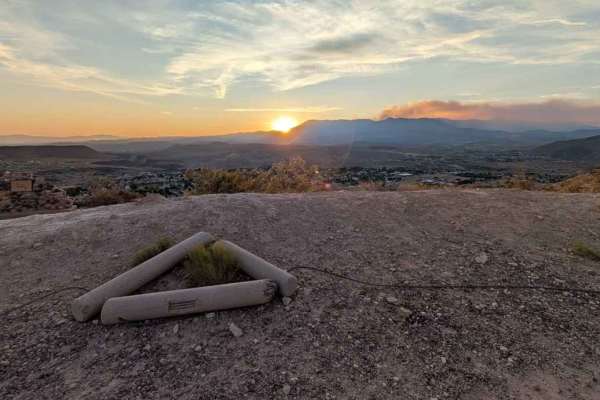
La Verkin Overlook - County Road 395
The La Verkin Overlook Road is a 1.5-mile (3-mile round trip) point-to-point trail rated 2 of 10 located in Washington County. The trail is popular with locals for its views of the Hurricane Valley at sunset, as well as being able to see both of the historic canals built in the late 1800s and early ...
Learn more about La Verkin Overlook - County Road 395
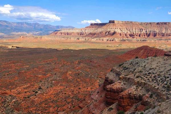
Oh The View - County Road 648
Oh The View is a 6.7-mile point-to-point trail rated 3 of 10 located on the Virgin Mesa within Washington County. The trail is a little-used ranch road consisting of hard-packed dirt, soft dirt washes, and a few rocky sections. The trail can be run in either direction, but is generally run from west...
Learn more about Oh The View - County Road 648
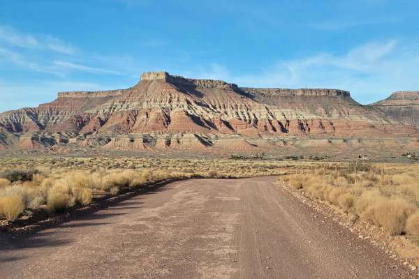
Sheep Bridge Road
This easy dirt road takes you across the valley and straight through the heart of mountain bike mecca. There is an endless network of trails in this area and is nearly all public BLM land. The road itself is not challenging and is easy enough for 2WD. Scenic desert landscape in every direction. Summ...
Learn more about Sheep Bridge Road
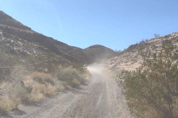
Mesa Top Cut-Across
This roughly 5-mile trail takes you from Goulds Rim Trail or Honeymoon Trail across the top of the mesa to Virgin, Utah. From Virgin, you can access Smith Mesa or Rattlesnake Gulch to Toquerville Falls Trails. It's a great way to get from Hurricane, UT, to Virgin, UT, without having to take the high...
Learn more about Mesa Top Cut-Across

Smith Mesa To Rattlesnake Gulch
This 3-mile trail takes you along the side of Highway 9 between Smith Mesa and Rattlesnake Gulch or the Valley Gun Club without getting on the pavement. It follows the powerline in some areas, and there are a lot of hills. Some of the inclines and declines are steep. When riding in the Utah mountai...
Learn more about Smith Mesa To Rattlesnake Gulch
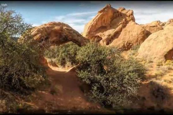
Backdoor to Babylon
Backdoor to Babylon OHV trail is a 3 of 10 rated trail that provides a cross-country track connecting the Babylon Road (900 North) and the community of Toquerville. The trail starts in Toquerville and ends in the primitive campgrounds and parking area for the hike to the Babylon Arch. The trail is m...
Learn more about Backdoor to Babylon
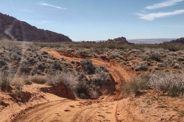
Rocky Sandbox Loop
Come and explore the Red Cliffs Recreation Area. This track takes you east of Backdoor to Babylon, in the shadow of the red cliffs this area is famous for, and loops through some deep sandy areas mixed in with some rocky areas. It will get you close to the hiking trail that goes to Sandstone Mountai...
Learn more about Rocky Sandbox Loop
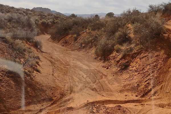
Backdoor to Babylon Wash
This wash runs parallel to the Backdoor to Babylon Trail, and it's a good option in places where the Backdoor is eroded enough that the off-camber might cause a rollover. Just drop into the wash and pass the eroded area, then get back on the Backdoor Trail. Or you can take the wash all the way for a...
Learn more about Backdoor to Babylon Wash
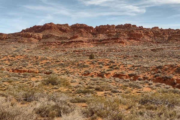
Backdoor to Babylon Trail
This sandy trail in the Red Cliffs Recreation Area runs from the parking area by Sand Cove to the southwest. The trail is a good trail in most areas, but in a couple of places, the trail is off-camber, and the downside slides into the wash below. Depending on recent traffic, rain, and/or wind, the t...
Learn more about Backdoor to Babylon Trail
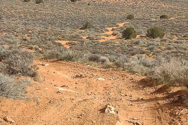
Backdoor to Babylon Loop
Whether the Backdoor to Babylon Trail is crowded, and you want to avoid the traffic, or you're just looking for a different way around, this loop takes you through BLM lands and rejoins Backdoor to Babylon a little further down the trail. Getting off of the main trail is the best way to see some of ...
Learn more about Backdoor to Babylon Loop
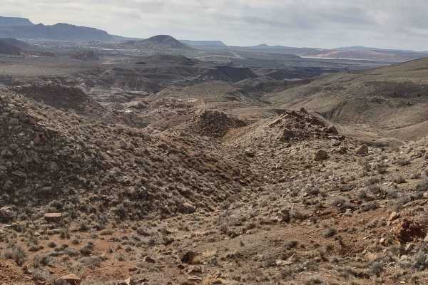
Red Cliffs Hidden Canyons View
This trail in the Red Cliffs Recreation Area takes you northeast off of Red Cliffs Rec Area to Virgin River Trail to an overlook of some of the canyons in this area that aren't visible from any other location we've been to. The trail accommodated our 72" CanAm, but it is narrow in places with a stee...
Learn more about Red Cliffs Hidden Canyons View
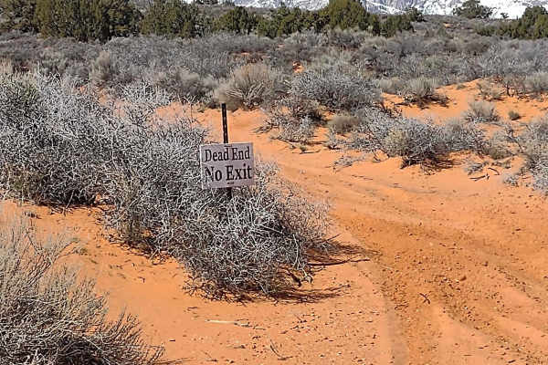
Dead End Leeds Overlook
Going up and over one of the high points in the north part of Red Cliffs Recreation Area, you find the overlook of Leeds, Silver Reef, and a fantastic view of Trail, Signal, and Burger Peaks. The trail has a sign that clearly says it's a dead end, and it, in fact, ends nearly in a "suburb" of Leeds....
Learn more about Dead End Leeds Overlook
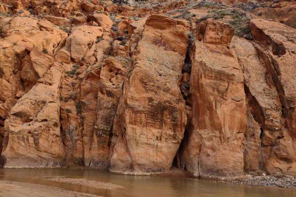
Red Cliffs Rec Area to Virgin River
Red Cliffs Recreation Area near Leeds, Utah, is an SXS and hiking mecca. This track, which starts out as pavement but turns to sand just a half mile down the trail, takes you to clear down through the Recreation Area to the Virgin River. Along the trail, you can stop and hike to the Old Toquerville ...
Learn more about Red Cliffs Rec Area to Virgin River
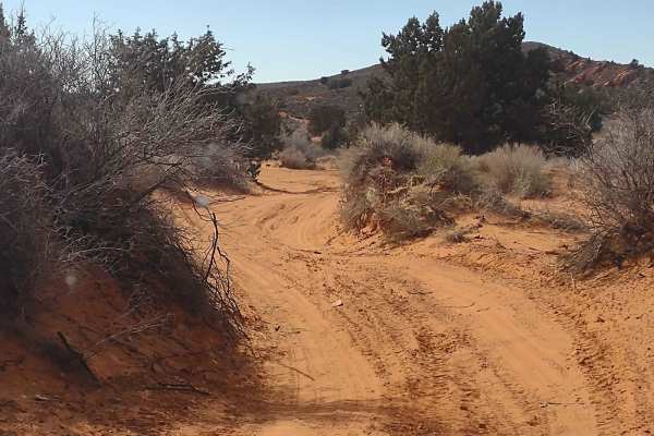
Northeast Access Red Cliffs Rec Area
Northeast Access takes you from North Old Highway 91 (Main Street in Leeds) south into the Red Cliffs Rec Area. There is a staging area at North Old Highway 91. Trail easily accommodated our 72" SXS. Travel south in a fun, sandy, whoop-filled track that takes you to the heart of the rock crawling pl...
Learn more about Northeast Access Red Cliffs Rec Area

Mollie's Nipple
This track takes you to the base of the famed Mollie's Nipple on the south end. Mollie's Nipple is a landmark that is visible from all over the valley, and this route takes you around behind it to a staging area on its south side where you can hike to the top. It's about a half-mile hike each way fr...
Learn more about Mollie's Nipple
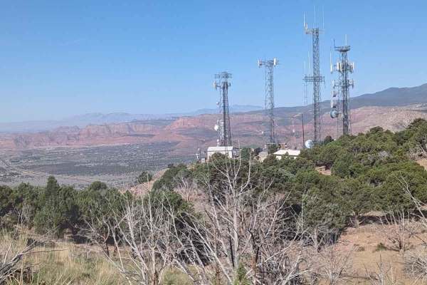
Toquerville Communication Towers Overlook
Toquerville Communication Towers Overlook is a 1.7-mile point-to-point trail rated 3 of 10 located in Washington County, Utah. The Toquerville Communications Tower Overlook trail is a destination trail on the way up to visiting Toquerville Falls. The trail rises about 1,000 feet in the first 1.5 mil...
Learn more about Toquerville Communication Towers Overlook
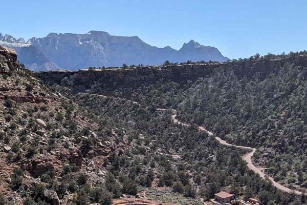
Dalton Wash Road
Dalton Wash Road is a 9-mile out-and-back dirt road that passes through Dalton Wash--a mix of red rock "canyon", dry desert slopes, juniper woodlands, and arid shrubland. Note: the best time of day to visit this trail is mid to late afternoon when the sun is to the west and shining on the mountain f...
Learn more about Dalton Wash Road
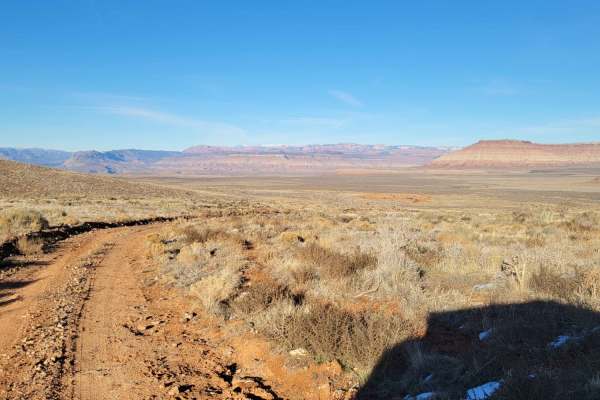
Hurricane Cliffs Trail
This trail takes you along the Hurricane cliffs and offers sweeping views of the desert landscape around you. Great views of the plateaus and Little Creek Mountain. Respect any and all gates - you are free to pass through closed ones so long as you close them after passing. Summer months may reach t...
Learn more about Hurricane Cliffs Trail
Gould's Rim Wanderings
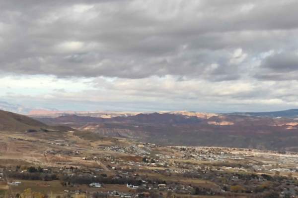
Gould's Rim on the east side of Hurricane is a mesa from which you can access Smith Mesa, Little Creek Mesa, Flying Monkey, and Rattlesnake Gulch to Toquerville Falls. You can go to Virgin or Toquerville for lunch, mostly on dirt, by using this path up and over Gould's Rim. Once on top of Gould's Ri...
Learn more about Gould's Rim Wanderings
Silver Reef - Leeds Canyon
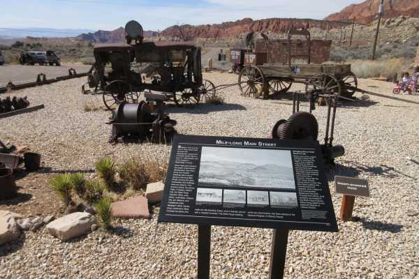
This is a fun outing for the family, especially in the heat of the summer, as you can climb up to the Oak Grove Campground and have a cool picnic or take some time to hike. Along the way, be sure to stop at Silver Reef to wander around the old town center where numerous artifacts are available for v...
Learn more about Silver Reef - Leeds Canyon
Beginner ATV trails near LaVerkin, Utah
Explore ATV-friendly trails near you. These trails are accessible for vehicles up to 50 inches wide, perfect for ATVs and smaller off-road machines.
La Verkin Overlook - County Road 395
The La Verkin Overlook Road is a 1.5-mile (3-mile round trip) point-to-point trail rated 2 of 10 located in Washington County. The trail is popular with locals for its views of the Hurricane Valley at sunset, as well as being able to see both of the historic canals built in the late 1800s and early ...
Learn more about La Verkin Overlook - County Road 395
Oh The View - County Road 648
Oh The View is a 6.7-mile point-to-point trail rated 3 of 10 located on the Virgin Mesa within Washington County. The trail is a little-used ranch road consisting of hard-packed dirt, soft dirt washes, and a few rocky sections. The trail can be run in either direction, but is generally run from west...
Learn more about Oh The View - County Road 648
Sheep Bridge Road
This easy dirt road takes you across the valley and straight through the heart of mountain bike mecca. There is an endless network of trails in this area and is nearly all public BLM land. The road itself is not challenging and is easy enough for 2WD. Scenic desert landscape in every direction. Summ...
Learn more about Sheep Bridge Road
Mesa Top Cut-Across
This roughly 5-mile trail takes you from Goulds Rim Trail or Honeymoon Trail across the top of the mesa to Virgin, Utah. From Virgin, you can access Smith Mesa or Rattlesnake Gulch to Toquerville Falls Trails. It's a great way to get from Hurricane, UT, to Virgin, UT, without having to take the high...
Learn more about Mesa Top Cut-Across
Beginner UTV/side-by-side trails near LaVerkin, Utah
Find UTV and side-by-side trails near you. These trails accommodate vehicles up to 60 inches wide, ideal for UTVs, side-by-sides, and wider off-road rigs.
La Verkin Overlook - County Road 395
The La Verkin Overlook Road is a 1.5-mile (3-mile round trip) point-to-point trail rated 2 of 10 located in Washington County. The trail is popular with locals for its views of the Hurricane Valley at sunset, as well as being able to see both of the historic canals built in the late 1800s and early ...
Learn more about La Verkin Overlook - County Road 395
Oh The View - County Road 648
Oh The View is a 6.7-mile point-to-point trail rated 3 of 10 located on the Virgin Mesa within Washington County. The trail is a little-used ranch road consisting of hard-packed dirt, soft dirt washes, and a few rocky sections. The trail can be run in either direction, but is generally run from west...
Learn more about Oh The View - County Road 648
Sheep Bridge Road
This easy dirt road takes you across the valley and straight through the heart of mountain bike mecca. There is an endless network of trails in this area and is nearly all public BLM land. The road itself is not challenging and is easy enough for 2WD. Scenic desert landscape in every direction. Summ...
Learn more about Sheep Bridge Road
Mesa Top Cut-Across
This roughly 5-mile trail takes you from Goulds Rim Trail or Honeymoon Trail across the top of the mesa to Virgin, Utah. From Virgin, you can access Smith Mesa or Rattlesnake Gulch to Toquerville Falls Trails. It's a great way to get from Hurricane, UT, to Virgin, UT, without having to take the high...
Learn more about Mesa Top Cut-Across
The onX Offroad Difference
onX Offroad combines trail photos, descriptions, difficulty ratings, width restrictions, seasonality, and more in a user-friendly interface. Available on all devices, with offline access and full compatibility with CarPlay and Android Auto. Discover what you're missing today!
Open Trail Map