Toquerville Communication Towers Overlook

Total Miles 1.7
Technical Rating
3 Easy
Best Time Spring, Summer, Fall, Winter
Trail Type Full-Width Road
Accessible By
Open Trail Map

Trail Overview

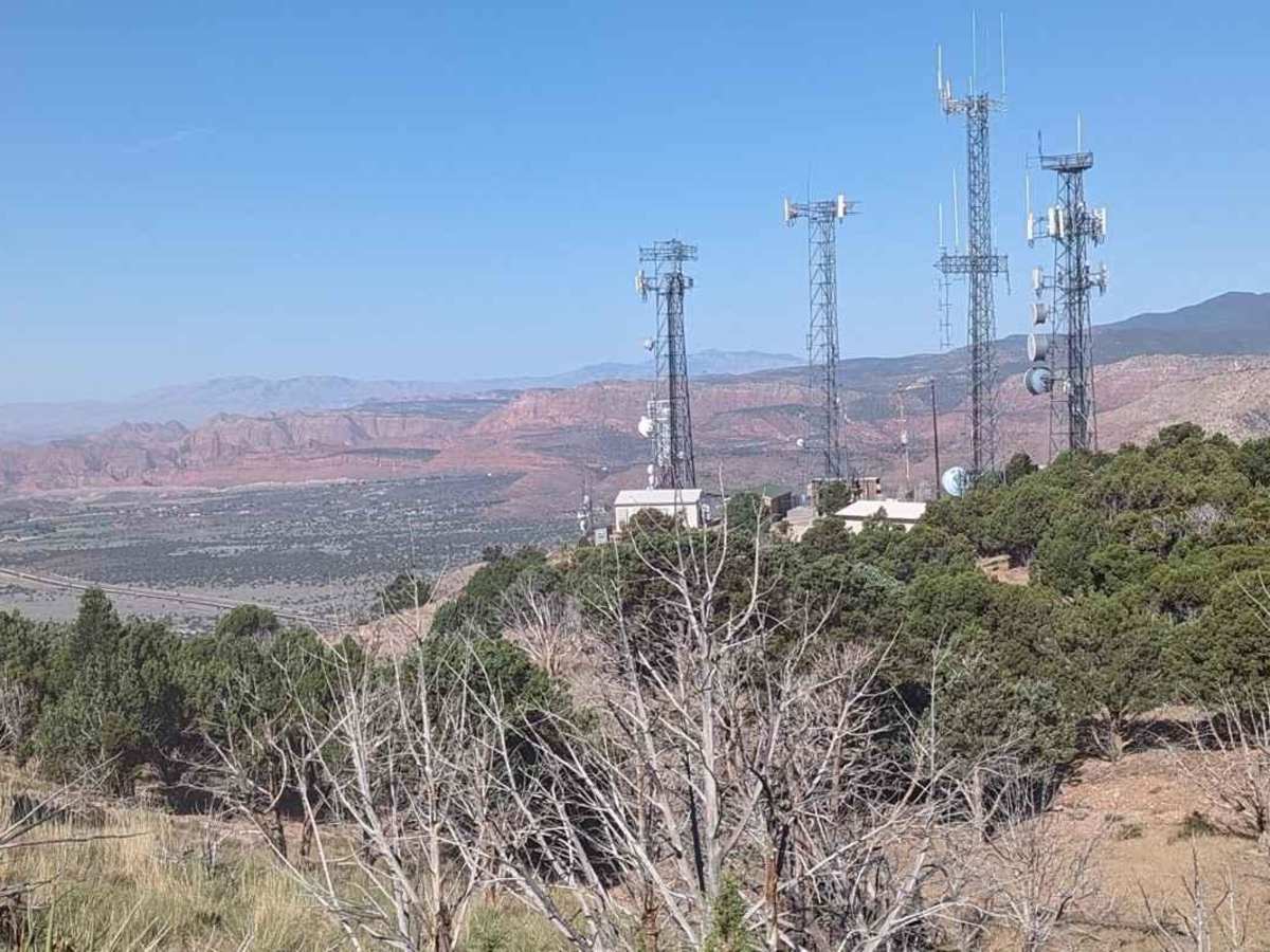
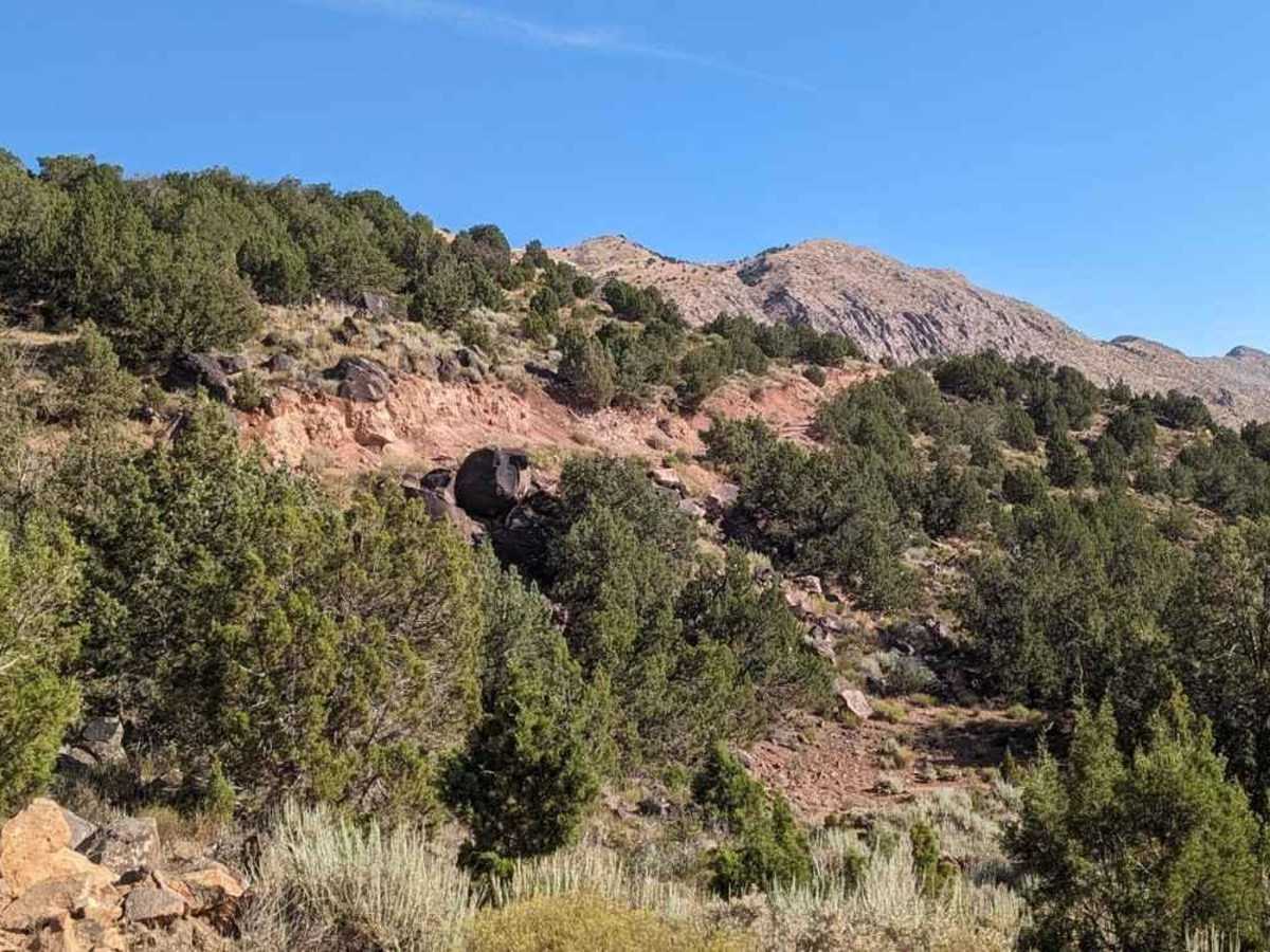
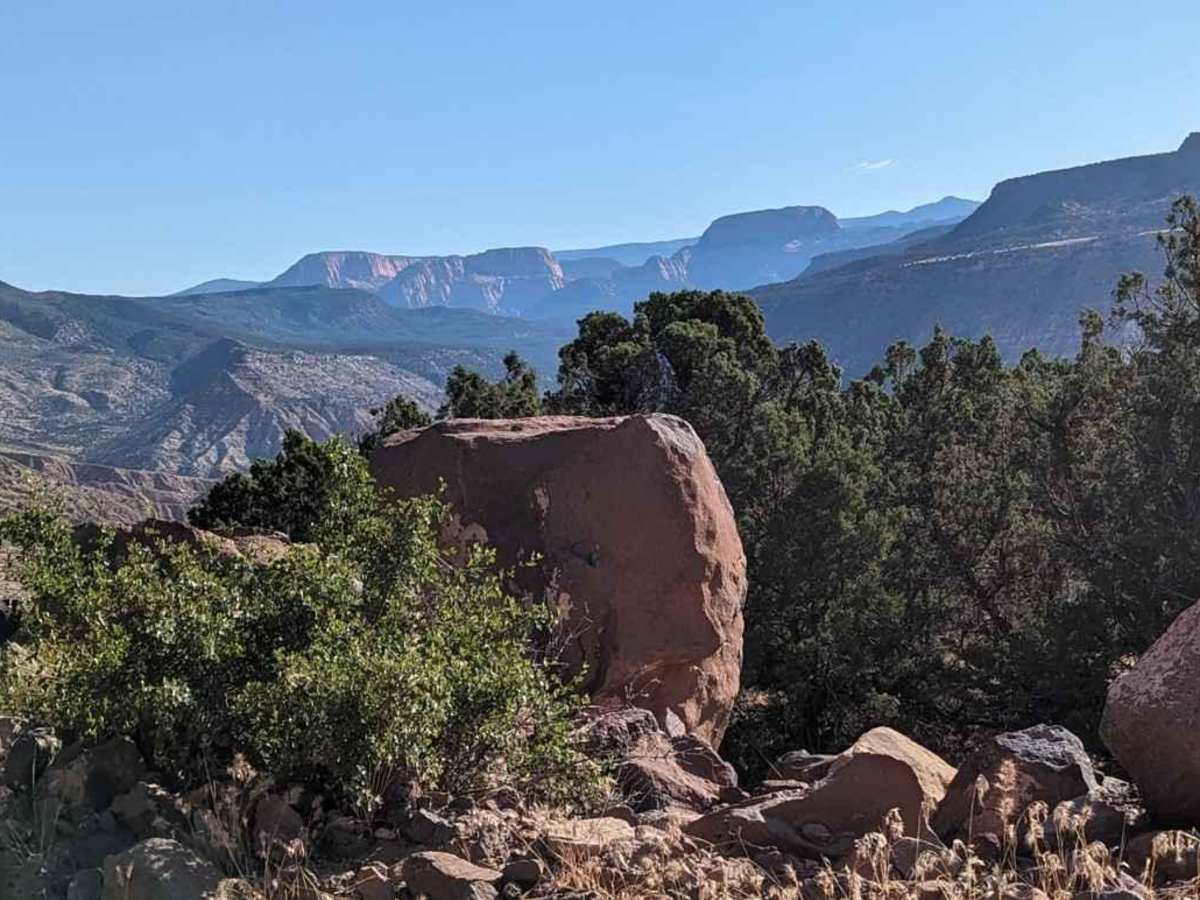
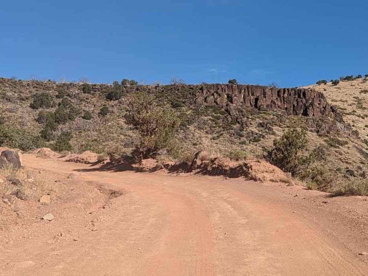
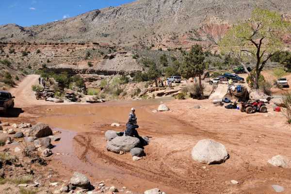
Toquerville Communication Towers Overlook is a 1.7-mile point-to-point trail rated 3 of 10 located in Washington County, Utah. The Toquerville Communications Tower Overlook trail is a destination trail on the way up to visiting Toquerville Falls. The trail rises about 1,000 feet in the first 1.5 miles and it is best traveled in late spring, summer, and early fall. During the monsoon seasons, care should be taken as the mud on this trail can get to be about a foot deep, and the steep climb or descent can become a safety issue. During the climb, the trail offers scenic views of basalt cliffs, lava flows, and the Zion National Park mountain range. Upon reaching the communications tower, enjoy the panoramic view of the Hurricane Valley, Pine Valley Mountain Range, and views of the communities of Leads, Toquerville, La Verkin, and Hurricane. Travelers should not attempt to reach the upper communications tower as there is little to no space and many off-road recoveries have been documented attempting to reach this spot. Cell phone service is intermittent and the nearest services are in La Verkin.

Photos of Toquerville Communication Towers Overlook

Difficulty

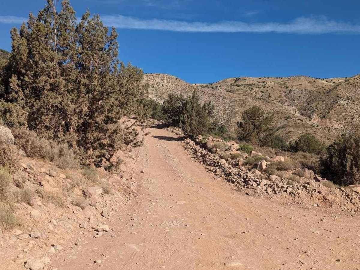
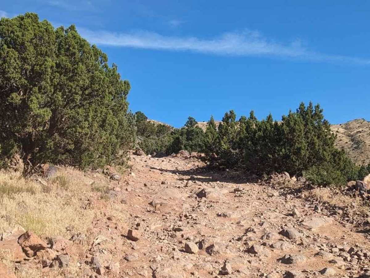
The trail consists of loose rocks, dirt, and sand with some slickrock surfaces. Mud holes are possible, but there are no steps higher than 12 inches. 4WD may be required, and aggressive are tires a plus.

Technical Rating

3

Status Reports

Add Status Report
Johnny Cash
May 31, 2026
Open
Wanted to take my truck to the top and take some photos, saw that it was 3/10 difficulty Green trail. Went up half way and it became way too rocky for my truck. I made it to the water fall no problem. Had to turn back down . I’m sure high clearance jeep or 4x4 can make it no problem.
Gene Potter
Apr 11, 2026
Open
This trail is more washed out than currently reported.
Kristian Brown
May 26, 2025
Open
Good amount of rocks on the first half of this trail, but nothing worse than the first mile of toquerville falls. After that there are some large washed out areas that aren’t too bad to avoid
Jerry Spikes
Dec 04, 2024
Open
trail was mild rocky. not technical at all. Just need to pay attention to the short section of washout ruts about half way to the towers. would not reccomend any vehicle with low clearance.
Josh Condie
Oct 26, 2024
Open
Trail was extremely rocky and had deep ruts. Would not recommend unless you have good skid plates, ground clearance, and good tires. Did it in a stock 07 4Runner but did bottom out a couple times.

Toquerville Communication Towers Overlook Trail can be accessed by the following ride types:

  • Single Track
  • 50 Inch
  • 60 Inch
  • High Clearance
  • Full Width

Toquerville Communication Towers Overlook Map

The onX Offroad Difference

onX Offroad combines trail photos, descriptions, difficulty ratings, width restrictions, seasonality, and more in a user-friendly interface. Available on all devices, with offline access and full compatibility with CarPlay and Android Auto. Discover what you're missing today!

Open Trail Map