
Beginner Off-Road Trails
Near Lamar, Oklahoma
Explore All Beginner Trails Near Lamar, Oklahoma
Beginner Off-Road Trails Near Lamar, Oklahoma
Discover the best beginner-friendly off-road trails near you. These easier, lower-rated trails are a great place to start — browse trail maps, check difficulty ratings, and find your next adventure.
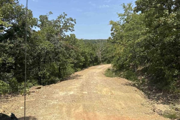
Lake Eufaula
This route is a mix of maintained gravel roads to Level B, non-maintained gravel roads. The trail is easy when dry but has multiple flash flood warnings so we would not recommend after/during rain. We did travel into CORPS of ENGINEERS land, which was marked as a road, but it quickly became swampy a...
Learn more about Lake Eufaula
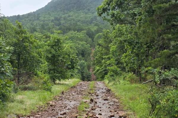
West Boundry Trail
The dirt trail runs parallel to the boundary fence of a private land parcel in rural Oklahoma, cutting through a mix of open prairie and lightly wooded areas. The trail itself is about 8 to 10 feet wide, composed of compacted red clay and loose gravel, with patches of grass and sand depending on rec...
Learn more about West Boundry Trail
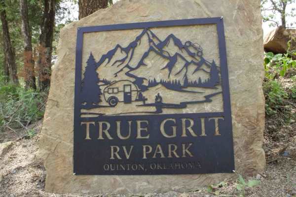
True Grit Lane
True Grit RV Park is a great place to stay if you need RV hookups. The road between the RV park and off-road park is paved, so don't worry about wearing out those sticky tires. Remember, people live on this road also, so please slow down to 10 miles per hour when in sight of houses and be courteous ...
Learn more about True Grit Lane
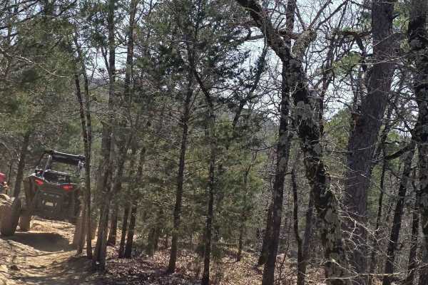
Lookout Access Trail
This is an easy way up the mountain for rigs of all sizes. There are some great lookout areas off the side of this mountain. Watch for wildlife while headed up; you never know when you might see a bear. Also, this is a great way for spectating friends coming up the more difficult trails.
Learn more about Lookout Access Trail
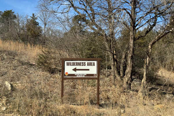
Wilderness Trail
***Special Note***: To access this trail, an Oklahoma Hunting or Fishing license is required. The Wilderness Trail is a short scene trail that ends at a parking area and entrance to a beautiful hiking trail along the Blue River. Low clearance vehicles and 2WD vehicles can have difficulty getting in ...
Learn more about Wilderness Trail
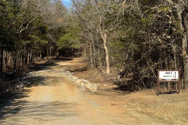
Area 2
***Special Note***: To access this trail, an Oklahoma Hunting or Fishing license is required. Area 2 trail leads to some amazing primitive campsites. Easy to traverse in any vehicle; however, side-by-sides are not allowed. Low clearance vehicles and 2WD vehicles can have difficulty getting in and ou...
Learn more about Area 2
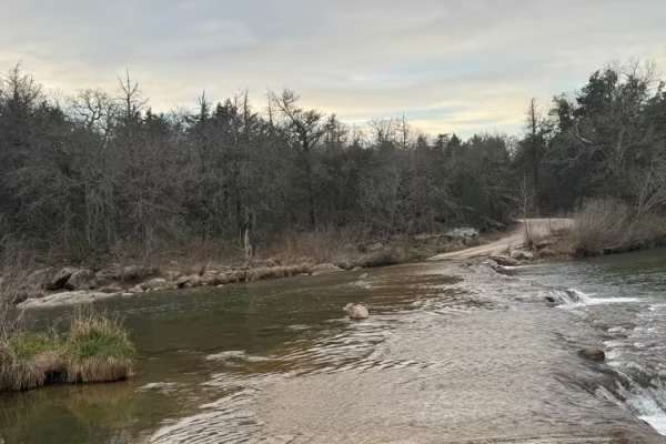
Area 3, 4, & 5
Special Note: To access this trail, an Oklahoma Hunting or Fishing license is required. Area 3,4&5 trail begins at the Hughes Crossing, one of the most famous river crossings in the state of Oklahoma. The crossing at normal water levels, any vehicle can cross, even motorcycles. This Crossing is 1 la...
Learn more about Area 3, 4, & 5
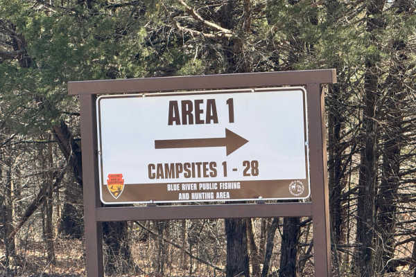
Area 1 Trail
***Special Note: To access this trail, an Oklahoma Hunting or Fishing license is required.*** Area 1 offers many choice primitive campsites along the Blue River. This trail is well-maintained. All vehicle types can easily explore this trail. However, side by sides are not allowed. Low clearance vehi...
Learn more about Area 1 Trail
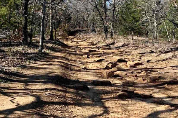
Interceptor
Easy terrain, wide enough for a full-size vehicle, widens out halfway through, then single vehicle again. This trail begins in the powerline area and finishes at the county road that runs through the park. Fun to go one way, turn around, and go back the other way. Look for wildlife to the left and r...
Learn more about Interceptor
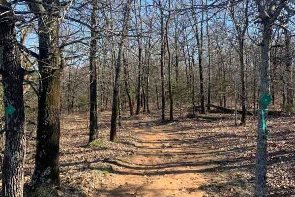
Bunker Hill Loop
Great trail that makes a loop, can do it over and over again! Several other trails branch off to other areas of the park. This is a relatively easy ride, but several tight squeezes between trees, Full-size rigs, beware! Be prepared for several left, right, left, and right turns to make it through th...
Learn more about Bunker Hill Loop
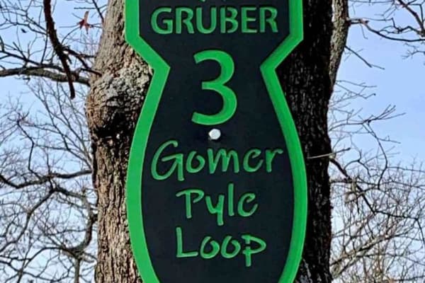
Gomer Pyle Loop
This trail is the Main Loop trail around the border of Gruber ORV Park. It is the easiest trail in the park and begins and ends near the entrance to the park. It has multiple types of terrain from rocks, dirt, berms, and ledges, and one of the most views of the Arkansas River and communities of Musk...
Learn more about Gomer Pyle Loop
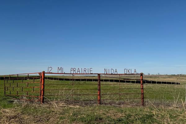
Twelve Mile Prairie Trail #1
The 12-mile Prairie Trail begins at Horse Creek Road and ends at Dunn Road or vice versa, and rolls out across open country that mixes prairie stretches, scattered timber, and gentle elevation changes. The route follows a series of old rural paths that feel untouched and authentic, giving the ride a...
Learn more about Twelve Mile Prairie Trail #1
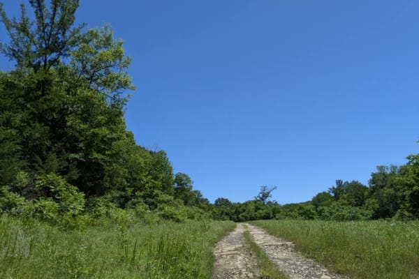
Small Game
This trail twists through the forest in a winding route that remains unmaintained and was extremely muddy when we drove it in May 2025. Several creek crossings break up the route, and the muddy patches are deeper and stickier than they look, so it's worth approaching with diffs locked and the right ...
Learn more about Small Game
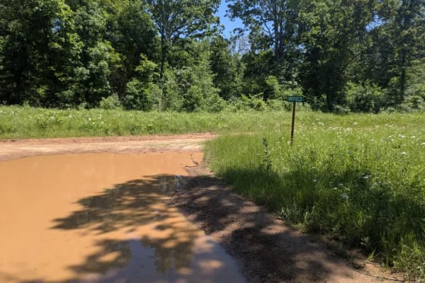
Hay Field
This trail is consistently muddy and may present a challenge for some vehicles, especially in the deeper sections. It's largely unmaintained, with rough, rocky stretches that add to the difficulty. As you approach the large creek crossing, the trail narrows and becomes more overgrown, and the mud in...
Learn more about Hay Field
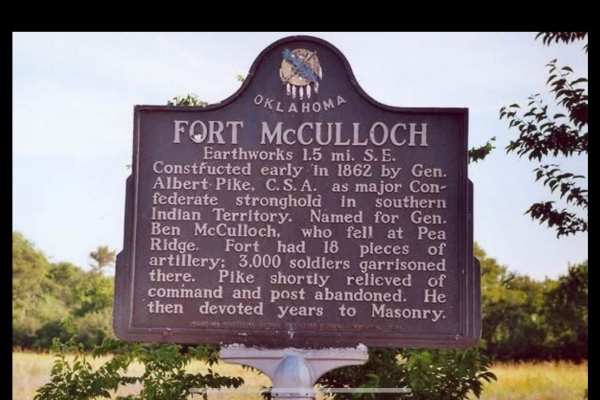
Fort McCulloch Road Trail
The Fort McCulloch trail system combines the Butterfield Trail, Valley Trail, and Prairie View Road into a scenic and enjoyable loop that showcases the diverse terrain of the area. Starting on Butterfield, you’ll wind through wooded sections with tight tree lines and mild rocky patches that keep the...
Learn more about Fort McCulloch Road Trail
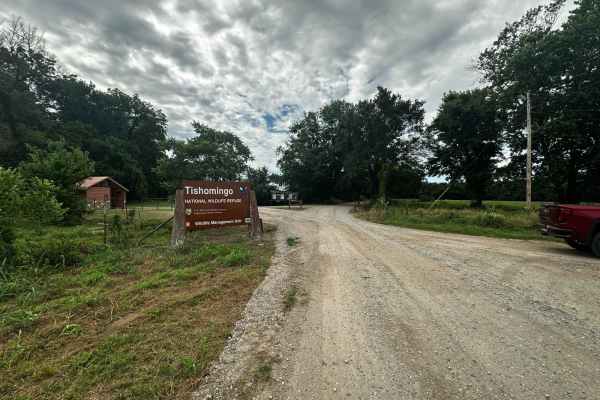
Unit Management Road
This is a well-maintained gravel route that runs from the north end of the Tishomingo National Wildlife Refuge Management Unit to the south end. The road is consistently graded but can become washed out quickly during heavy rain due to the large number of small lakes and rivers that run through the ...
Learn more about Unit Management Road
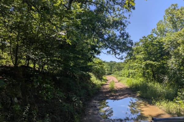
Black Hollow
This unmaintained trail has a bit of everything--rocky ledges, steady climbs and descents, long muddy sections, and a few creek fords along the way. It's an enjoyable drive, but after heavy rain, it can become especially challenging, as we found during our visit. Despite the rough patches, it's a sc...
Learn more about Black Hollow

E0959
Leaving the state park, the route threads through lakeside suburbs before shaking itself free of pavement and turning into a stretch of loose gravel that rattles beneath the tires. Potholes and washboard patches jostle the vehicle until the surface smooths and the windy track slides into a cool, for...
Learn more about E0959
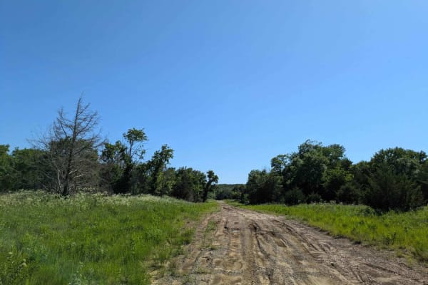
Wild Horse
This trail begins with a smooth and easy drive, but conditions change quickly. As you continue, the route becomes more challenging with frequent climbs and descents, deep mud, and large puddles scattered throughout. Progress slows the farther you go due to rough, rocky sections and increasingly unev...
Learn more about Wild Horse
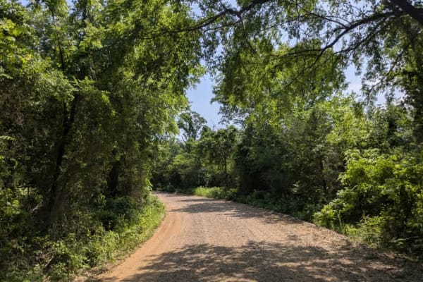
E0960
The route begins on a stretch of well-graded loose gravel that occasionally shakes occupants with small washboard ridges but generally rolls along easily. It meanders past tidy farmhouses and grassy fields, giving drivers plenty to admire before tapering off beyond a rather uninspiring RV park at th...
Learn more about E0960
Beginner ATV trails near Lamar, Oklahoma
Explore ATV-friendly trails near you. These trails are accessible for vehicles up to 50 inches wide, perfect for ATVs and smaller off-road machines.
West Boundry Trail
The dirt trail runs parallel to the boundary fence of a private land parcel in rural Oklahoma, cutting through a mix of open prairie and lightly wooded areas. The trail itself is about 8 to 10 feet wide, composed of compacted red clay and loose gravel, with patches of grass and sand depending on rec...
Learn more about West Boundry Trail
Interceptor
Easy terrain, wide enough for a full-size vehicle, widens out halfway through, then single vehicle again. This trail begins in the powerline area and finishes at the county road that runs through the park. Fun to go one way, turn around, and go back the other way. Look for wildlife to the left and r...
Learn more about Interceptor
Bunker Hill Loop
Great trail that makes a loop, can do it over and over again! Several other trails branch off to other areas of the park. This is a relatively easy ride, but several tight squeezes between trees, Full-size rigs, beware! Be prepared for several left, right, left, and right turns to make it through th...
Learn more about Bunker Hill Loop
Gomer Pyle Loop
This trail is the Main Loop trail around the border of Gruber ORV Park. It is the easiest trail in the park and begins and ends near the entrance to the park. It has multiple types of terrain from rocks, dirt, berms, and ledges, and one of the most views of the Arkansas River and communities of Musk...
Learn more about Gomer Pyle Loop
Beginner UTV/side-by-side trails near Lamar, Oklahoma
Find UTV and side-by-side trails near you. These trails accommodate vehicles up to 60 inches wide, ideal for UTVs, side-by-sides, and wider off-road rigs.
West Boundry Trail
The dirt trail runs parallel to the boundary fence of a private land parcel in rural Oklahoma, cutting through a mix of open prairie and lightly wooded areas. The trail itself is about 8 to 10 feet wide, composed of compacted red clay and loose gravel, with patches of grass and sand depending on rec...
Learn more about West Boundry Trail
Interceptor
Easy terrain, wide enough for a full-size vehicle, widens out halfway through, then single vehicle again. This trail begins in the powerline area and finishes at the county road that runs through the park. Fun to go one way, turn around, and go back the other way. Look for wildlife to the left and r...
Learn more about Interceptor
Bunker Hill Loop
Great trail that makes a loop, can do it over and over again! Several other trails branch off to other areas of the park. This is a relatively easy ride, but several tight squeezes between trees, Full-size rigs, beware! Be prepared for several left, right, left, and right turns to make it through th...
Learn more about Bunker Hill Loop
Gomer Pyle Loop
This trail is the Main Loop trail around the border of Gruber ORV Park. It is the easiest trail in the park and begins and ends near the entrance to the park. It has multiple types of terrain from rocks, dirt, berms, and ledges, and one of the most views of the Arkansas River and communities of Musk...
Learn more about Gomer Pyle Loop
The onX Offroad Difference
onX Offroad combines trail photos, descriptions, difficulty ratings, width restrictions, seasonality, and more in a user-friendly interface. Available on all devices, with offline access and full compatibility with CarPlay and Android Auto. Discover what you're missing today!
Open Trail Map