
Beginner Off-Road Trails
Near Fallon, Nevada
Explore All Beginner Trails Near Fallon, Nevada
Beginner Off-Road Trails Near Fallon, Nevada
Discover the best beginner-friendly off-road trails near you. These easier, lower-rated trails are a great place to start — browse trail maps, check difficulty ratings, and find your next adventure.
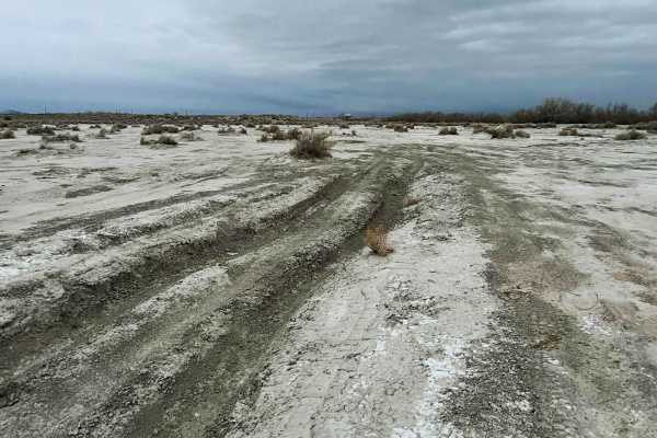
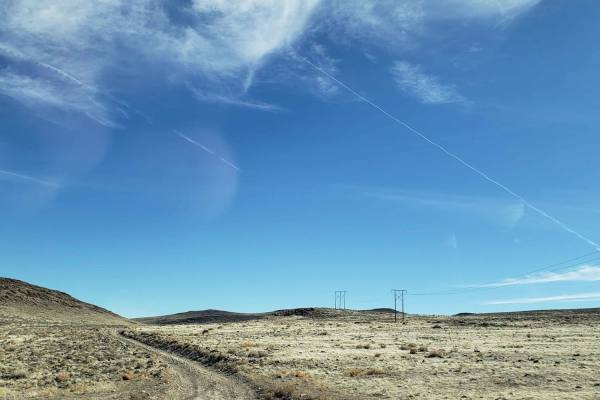
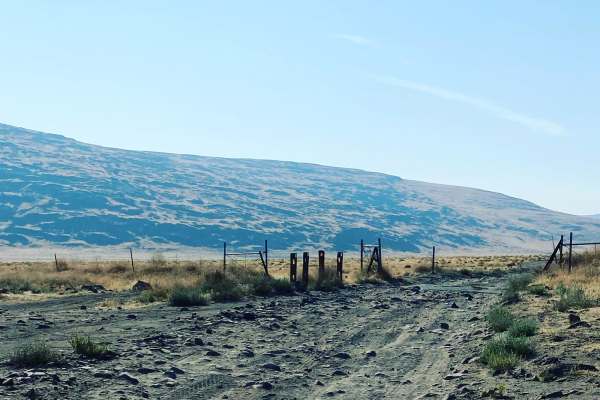
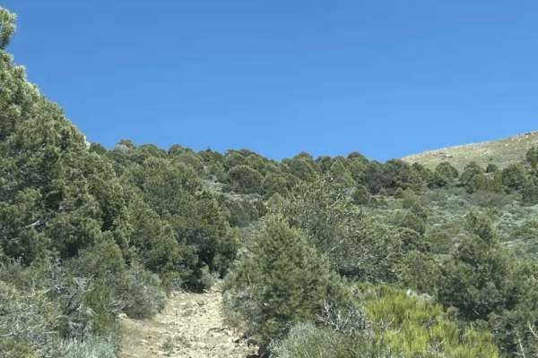
Lunchtime Rip
Lunchtime Rip is a short fun trail consisting of a sandy salt flat and packed dirt with many ruts and routes along with a short hill climb meeting up with Powerline Road. This a fun local spot commonly ran over lunchtime as a fun break from school or work.
Learn more about Lunchtime Rip

Six Mile Beach Trail
This route takes you from the trailhead located off Hwy 50, East of Silver Springs, Nevada to Six Mile Beach and loops back to the bridge over the Carson River below the Lahontan Reservoir Dam. Six Mile Beach is located on the east shore of Lahontan. The trail begins on a very wide, graded dirt road...
Learn more about Six Mile Beach Trail
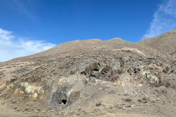
Red Ant Mine
The route takes you from Sand Mt. Recreational Area to the Red Ant Mine. Red Ant Mine was an old tungsten mine. Not much of the infrastructure is left. There is a head frame, a collapsed 50's era airstream trailer, and concrete foundations for a bucket line that once stretched across the valley. Did...
Learn more about Red Ant Mine
Hot Springs Mountains
The trail takes you by some of the sites in the Hot Springs Mountains. These sites include Eagle Rock, Eagle Salt Works site, an abandoned telecommunications building, Airway Beacon site, and a few mine sites. Spend some time exploring along the way, as well as enjoying the views of the 40-mile dese...
Learn more about Hot Springs Mountains
Apache Mercury Claims
This route takes you to a Mercury Prospect. Not many remains of the old mining buildings, just a concrete floor. The main road is a well-groomed wash until it turn off onto an old mining road. This track has moderate erosion but is wide enough to get heavy equipment up.
Learn more about Apache Mercury Claims

Historical and Petroglyph trail
An historical trail with Petroglyphs at the end
Learn more about Historical and Petroglyph trail
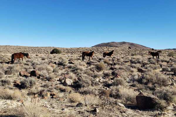
Clifton Flat Trail
Clifton Flat is a valley known for herds of wild horses and herds of Pronghorn Antelope. The trailhead starts at the unlocked barbed wire wild horse protection gate. Make sure to properly close and latch the gate. The trail begins on a graded dirt road. As you descend, the road narrows to a double-t...
Learn more about Clifton Flat Trail
Boyer Ranch
This trail has a lot of washboards, rocked gravel/dirt roads. You can go a comfortable 40 MPH, if you air down, the ride can be smoother. This takes you below the old ranch homestead of Boyer. There is a geothermal plant that sits behind it. Do not go there, they watch that road to the plant. You wi...
Learn more about Boyer Ranch
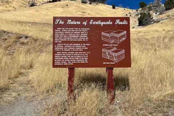
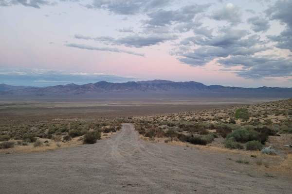
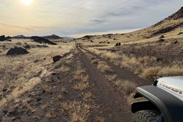
It's Not My Fault
The trail starts on Earthquake Road off of Highway 50. This is not a difficult trail as it follows dirt roads most of the way, but it provides some nice desert scenery and follows a fault line for the first portion of the trail. All wheel drive and decent tires are recommended as there are a lot of ...
Learn more about It's Not My Fault
Dixie Valley Tanks
There are 20+ military tanks left out in the desert of Dixie Valley. The road is flat and graveled. A car will have no problems. The tanks were placed on old homesteads by the Navy for pilots to train on "threat identification." If you walk around you will find 5.56 caliber blank cases and 50. calib...
Learn more about Dixie Valley Tanks
Wild Horse Trail
This route takes you from the outskirts of Dayton, Nevada to Clifton Flats. The trail head starts at the unlocked wild horse protection gate. Make sure to properly close and latch the gate. The trail begins on a graded dirt road. As you ascend, the road narrows to a double track trail. The surface v...
Learn more about Wild Horse Trail
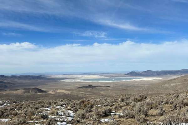
The Narrows
The Narrows is a pole line road that runs between Fernley Nevada, and Winnemucca Lake. Winnemucca Lake is a dry lake bed in northwest Nevada that features the oldest known petroglyphs in North America. It is quite remote once you get out of Fernley, cell service is spotty, and you may not see anyone...
Learn more about The Narrows

Julian Drive
Julian Drive, at its North end, intersects with US 95A (39.1609, -119.1922). At the South end, it intersects with Sunrise Pass, where the trail changes its name to Artesia Rd. Julian Drive is a graded dirt road and an easy drive. In places on the trail, there are a few embedded rocks, having bee...
Learn more about Julian Drive
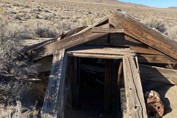
Nightingale Mine
These are old mining roads that weave their way through what was once the Nightingale Mine. Active in the 40s, the mine was extracting tungsten ore for the war effort. The are still a few structures on the site that can be explored. The road is a mix of sand and gravel. It's not maintained but it's ...
Learn more about Nightingale Mine
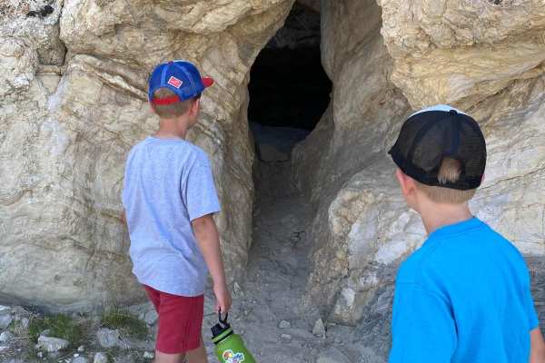
Lovelock Cave
This flat gravel road is well maintained. Lovelock Cave was in use as early as 2580 BC but was not intensively inhabited until around 1000 BC. People occupied Lovelock Cave for over 4,000 years. The initial discoveries of artifacts and excavations, in the early 20th century, were not very well execu...
Learn more about Lovelock Cave
Dry Lakes Loop
The trail starts at a cattle guard after you leave the staging area. The first few miles are soft sand with little to no obstruction. The area to the north side of the trail is a public access shooting area. Once past the shooting area, the trail narrows and drops down a dry creek valley before comi...
Learn more about Dry Lakes Loop
Old Como Road
This road begins at Dayton, Nevada, and gradually rises in elevation from 4367'' to 7128' into the Pine Nut Mountains and is located on mostly BLM lands. The trail starts off over a flat alluvial plain and then climbs out of the wash into the mountains. Sage, Juniper, and Pine trees are abundant as ...
Learn more about Old Como Road
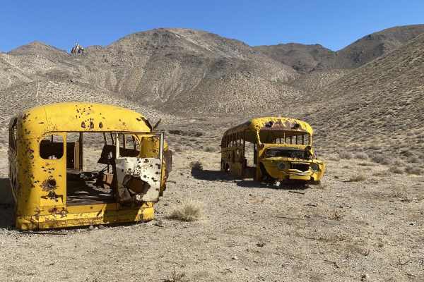
Winnemucca Lake School Buses
The route takes you along the east side of the dry lake bed and up into the Nightingale Range. Up in the hills are two, 1950s school buses that were used to transport workers to the mines in the area. You will also find the foundation of an ore processing mill. Not much is left of the mill. The road...
Learn more about Winnemucca Lake School Buses
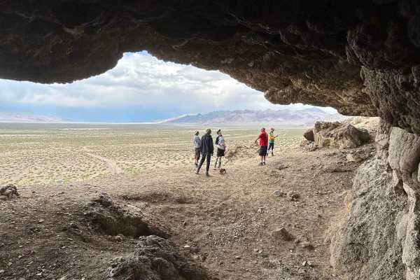
Winnemucca Lake Caves South Shore
This is a well-traveled gravel road. On the south end of the route, the road curves around a sand dune that can cover up the trail at times. Many of the caves on this end are overhanging. The major site is a tufa dome that is named Nicolarsen which is located near Highway 447.
Learn more about Winnemucca Lake Caves South Shore
Mineral Valley Trail
This trail can connect you from Big Buck Meadows Trail to the Saddle of two over 8,000-foot peaks with spectacular views all around. The trail is VERY narrow with lots of Pinon trees and some boulders 2-3 feet at most. It can be very overgrown, so bringing a chainsaw and trimmers is recommended. Pin...
Learn more about Mineral Valley Trail
Beginner ATV trails near Fallon, Nevada
Explore ATV-friendly trails near you. These trails are accessible for vehicles up to 50 inches wide, perfect for ATVs and smaller off-road machines.
Lunchtime Rip
Lunchtime Rip is a short fun trail consisting of a sandy salt flat and packed dirt with many ruts and routes along with a short hill climb meeting up with Powerline Road. This a fun local spot commonly ran over lunchtime as a fun break from school or work.
Learn more about Lunchtime Rip
Red Ant Mine
The route takes you from Sand Mt. Recreational Area to the Red Ant Mine. Red Ant Mine was an old tungsten mine. Not much of the infrastructure is left. There is a head frame, a collapsed 50's era airstream trailer, and concrete foundations for a bucket line that once stretched across the valley. Did...
Learn more about Red Ant Mine
Hot Springs Mountains
The trail takes you by some of the sites in the Hot Springs Mountains. These sites include Eagle Rock, Eagle Salt Works site, an abandoned telecommunications building, Airway Beacon site, and a few mine sites. Spend some time exploring along the way, as well as enjoying the views of the 40-mile dese...
Learn more about Hot Springs Mountains
Apache Mercury Claims
This route takes you to a Mercury Prospect. Not many remains of the old mining buildings, just a concrete floor. The main road is a well-groomed wash until it turn off onto an old mining road. This track has moderate erosion but is wide enough to get heavy equipment up.
Learn more about Apache Mercury Claims
Beginner UTV/side-by-side trails near Fallon, Nevada
Find UTV and side-by-side trails near you. These trails accommodate vehicles up to 60 inches wide, ideal for UTVs, side-by-sides, and wider off-road rigs.
Lunchtime Rip
Lunchtime Rip is a short fun trail consisting of a sandy salt flat and packed dirt with many ruts and routes along with a short hill climb meeting up with Powerline Road. This a fun local spot commonly ran over lunchtime as a fun break from school or work.
Learn more about Lunchtime Rip
Red Ant Mine
The route takes you from Sand Mt. Recreational Area to the Red Ant Mine. Red Ant Mine was an old tungsten mine. Not much of the infrastructure is left. There is a head frame, a collapsed 50's era airstream trailer, and concrete foundations for a bucket line that once stretched across the valley. Did...
Learn more about Red Ant Mine
Hot Springs Mountains
The trail takes you by some of the sites in the Hot Springs Mountains. These sites include Eagle Rock, Eagle Salt Works site, an abandoned telecommunications building, Airway Beacon site, and a few mine sites. Spend some time exploring along the way, as well as enjoying the views of the 40-mile dese...
Learn more about Hot Springs Mountains
Apache Mercury Claims
This route takes you to a Mercury Prospect. Not many remains of the old mining buildings, just a concrete floor. The main road is a well-groomed wash until it turn off onto an old mining road. This track has moderate erosion but is wide enough to get heavy equipment up.
Learn more about Apache Mercury Claims
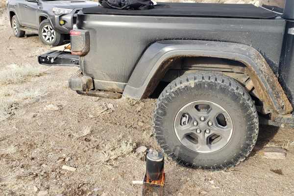
The onX Offroad Difference
onX Offroad combines trail photos, descriptions, difficulty ratings, width restrictions, seasonality, and more in a user-friendly interface. Available on all devices, with offline access and full compatibility with CarPlay and Android Auto. Discover what you're missing today!
Open Trail Map