
Beginner Off-Road Trails
Near Dutch John, Utah
Explore All Beginner Trails Near Dutch John, Utah
Beginner Off-Road Trails Near Dutch John, Utah
Discover the best beginner-friendly off-road trails near you. These easier, lower-rated trails are a great place to start — browse trail maps, check difficulty ratings, and find your next adventure.
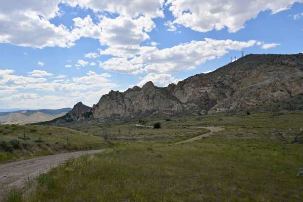
Rifle Range Road - FS 10542
Rifle Range Road (FS 10542) is a 1/10 out-and-back trail in Flaming Gorge Recreation Area. While its name and predominant claim to fame are a public shooting range, the geology in the canyon is worth the short trip out and back. The road is easily passable by all vehicles and is generally rocky dirt...
Learn more about Rifle Range Road - FS 10542
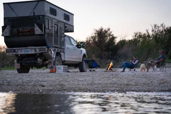
Pipeline East
Pipeline East is an easy, scenic 5.6-mile out-and-back route perfect for beginners, campers, and those looking to access the shores of Flaming Gorge Reservoir. Starting near Antelope Flat Road, this gravel and dirt track descends roughly 417 feet from a high point of 6,453 feet down to the reservoir...
Learn more about Pipeline East
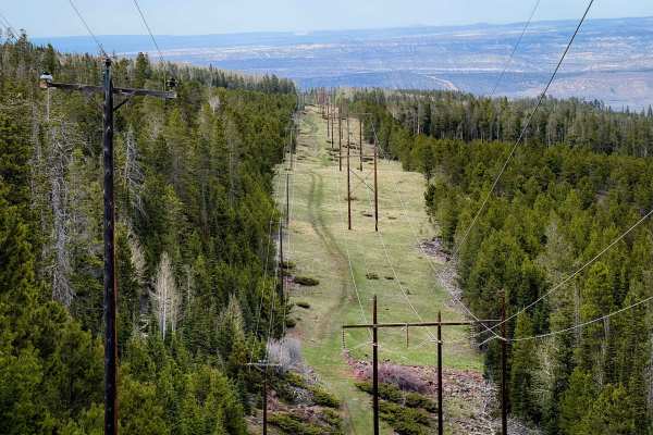
Don Hatch Memorial #1160
This is a primitive section of powerline trail that is accessible from the Red Spring Campground. It doesn’t connect to the rest of the trail system except via US Highway 191, for which you must be street legal. The trail is unmarked and a bit overgrown, entering the pine trees from the entrance of ...
Learn more about Don Hatch Memorial #1160
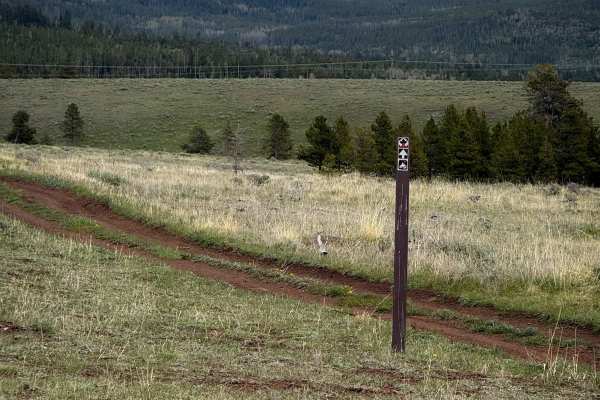
Bowden Draw Access Trail
This is a 1-mile section of ATV trail that accesses the trail system on both the east and west sides of US Highway 191, crossing the highway in the middle of the route. It helps connect the trail system on the west side of the highway to the many dispersed campsites and staging areas on the east si...
Learn more about Bowden Draw Access Trail
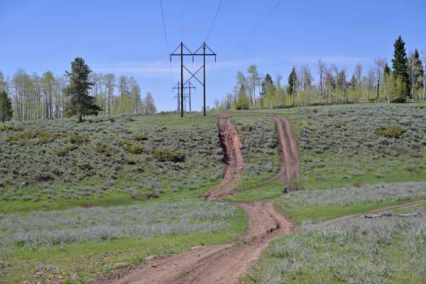
East McKee - FS 10045
East McKee is an unmaintained point-to-point dirt trail rated 2/10 in the Ashley National Forest. It is a single-lane dirt trail that runs generally parallel to and to the east of US 191. It is a varied surface, and at all times one lane wide. Variations in surface range from smooth dirt to heavily ...
Learn more about East McKee - FS 10045
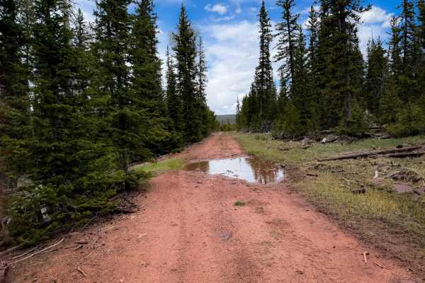
Big Park Lake Park #212
Trail 212 is a 2-mile-long easy ATV trail through the Ashley National Forest. The north end is a continuation of the road section of FS 212. It turns into ATV designation at the intersection with Trail 25, and continues south. It goes through the forest on a wide two-track covered in a light layer o...
Learn more about Big Park Lake Park #212
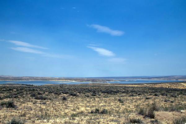
Pipeline Complex - FS 60086
This trail is a short out-and-back trail that heads north from Pipeline West Trail down to the shore of Flaming Gorge. This trail is an easy trail as it heads across the flats with a few sections with small rocks to navigate as it crosses over some small hilltops. This trail dead-ends right on the l...
Learn more about Pipeline Complex - FS 60086
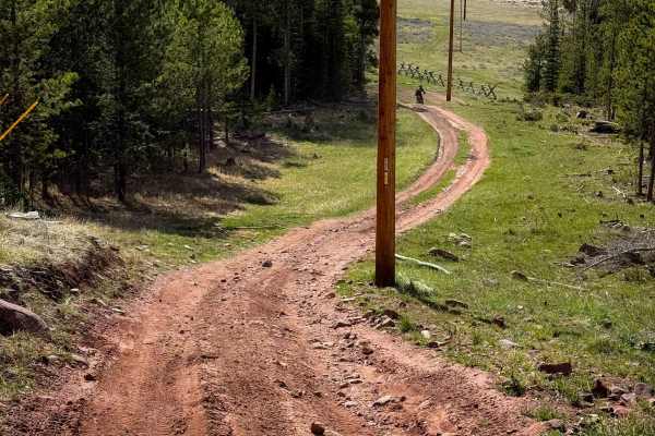
Grizzly Ridge North Spur #15
Trail 15 is a short powerline trail that connects the staging area on the east side of US Highway 191 to the rest of the trail system. The trail crosses the highway directly across from the staging area, then drops down a forested hillside on a wide dirt trail below a series of powerlines. The hill ...
Learn more about Grizzly Ridge North Spur #15
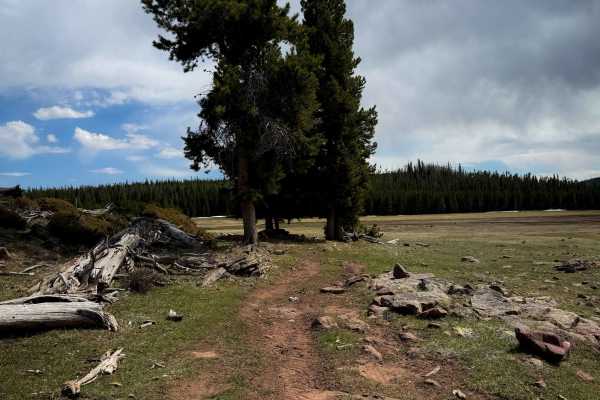
Lake Park #28
The Lake Park ATV trail starts on the west end next to the East Park Reservoir, and parallels the lake for the first bit. It’s a wide forested trail with several shallow ruts, with occasional muddy spots, and you can see the lake through the trees. There are several spots in the beginning to walk do...
Learn more about Lake Park #28
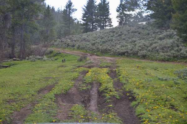
Pothole - FS 10256
Pothole - FS 10256 is an out-and-back trail rated 3/10 in Ashley National Forest. Its name comes from Pothole Creek, which runs alongside it, but it also fits the trail’s rugged surface. This two-track path features a long stretch of holes, dips, and deep mud pits. After navigating the first half, i...
Learn more about Pothole - FS 10256
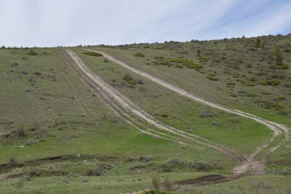
East Draw Diamond Ridge Connector - FS 122
East Draw Diamond Ridge Connector - FS 122 is a point-to-point connector trail between East Draw - FS 10255 to the west, and Limestone Ridge - FS 10257 to the east. Connector trail or not, it stands on its own as a fun excursion. For most of its length, it's a rutted, rocky trail that never loses it...
Learn more about East Draw Diamond Ridge Connector - FS 122
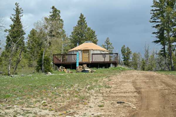
McKee Ridge - FS 10254
McKee Ridge - FS 10254 is an easy out-and-back route in the Ashley National Forest, rated 2/10. It serves as the access point to the Limber Flag Yurt on McKee Ridge. The road is a single lane with a mix of dirt and rocks. Recently, both sides of the trail were clear-cut for road construction, improv...
Learn more about McKee Ridge - FS 10254
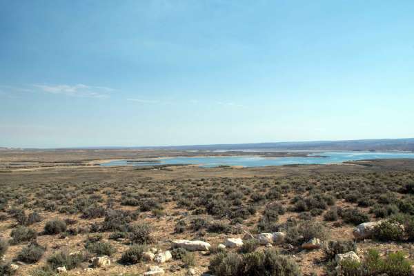
Pipeline Access - FS 60164
This trail starts off Wyoming Highway 530 and heads West towards Flaming Gorge, where it dead-ends at an intersection with Pipeline West Trail. This trail is a well-maintained gravel road that is wide enough for two vehicles except for the short climb up from the end of the trail, at which point it ...
Learn more about Pipeline Access - FS 60164
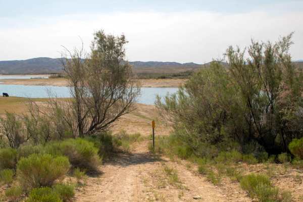
Twin Bridges
This trail is a short out-and-back trail that leads from Wyoming Highway 530 east to the shoreline of Flaming Gorge Reservoir. This trail is a well-maintained gravel road that is two vehicles wide throughout, with the only caution being that at the end of the trail, a metal pole has been placed, and...
Learn more about Twin Bridges
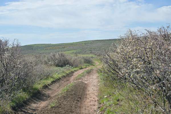
Bassett Creek - FS 10579
Basset Creek - FS 10579 is a 2/10 rated point to point trail in the Ashley National Forest. It is dirt two-track from start to finish and is exceptionally narrow in places for a larger vehicle. While the USFS MVUM states that it's usable for most vehicles, in reality, it's best suited for SxS or bel...
Learn more about Bassett Creek - FS 10579
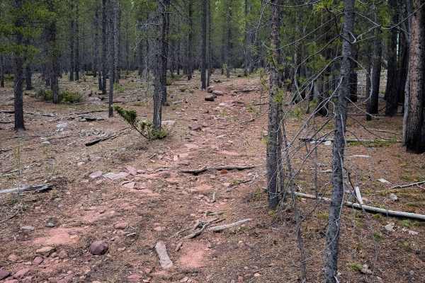
Round Park South #10
Trail 10 makes a short 1.5 mile loop off of Trail 17, and is mostly just a wide and gradual dirt trail that winds through the lodgepole pines. The trail has a light layer of embedded rocks in it, but is not nearly as rocky as some of the other nearby ATV trails. It is mostly smooth dirt and fast and...
Learn more about Round Park South #10
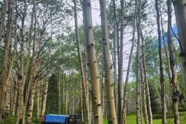
Grizzly Ridge Yurt
This beautiful trail takes you deep into the trees to a yurt that can be rented for camping. The yurt offers amazing views of the valley and rolling mountainsides. The trail starts off Highway 191 heading west. The beginning of the trail might be challenging as it involves a dirt road that winds thr...
Learn more about Grizzly Ridge Yurt
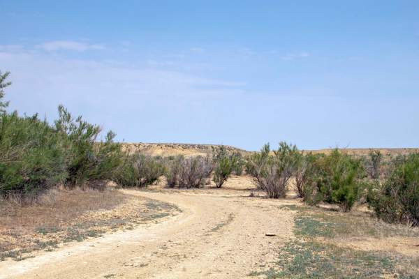
Badger West - FS 60160
This trail is an out-and-back trail that splits off of Anvil Draw and heads Southeast to the shore of Flaming Gorge, where it runs parallel through the shoreline brush for a ways before it dead-ends at a small point on the lake. This trail is well maintained up until it reaches the shoreline, at whi...
Learn more about Badger West - FS 60160
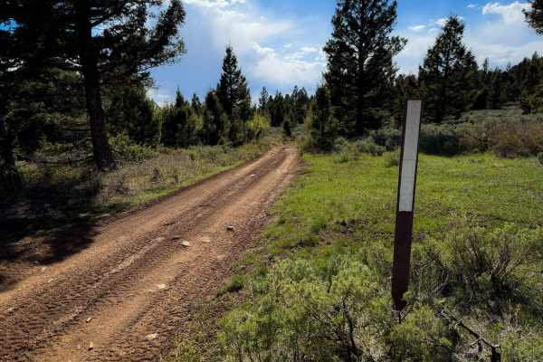
Little Brush Creek #153
This is a short section of ATV trail through a forest of pines and sagebrush, riding across a low hilltop. The two-track is mostly dirt, with small embedded rocks, shallow ruts and dips, and gradual curves. It goes through some wide open meadows on the hilltop that have nice views, then goes through...
Learn more about Little Brush Creek #153
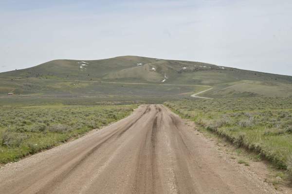
Diamond Mountain Road - FS 10048
Diamond Mountain Road, also known as FS 10048, is a point-to-point route that winds along the east side of Ashley National Forest, stretching in an east-west direction. It is rated 1/10 given normal circumstances, but road conditions after precipitation can increase this rating. It is 2 lanes wide f...
Learn more about Diamond Mountain Road - FS 10048
Beginner ATV trails near Dutch John, Utah
Explore ATV-friendly trails near you. These trails are accessible for vehicles up to 50 inches wide, perfect for ATVs and smaller off-road machines.
Rifle Range Road - FS 10542
Rifle Range Road (FS 10542) is a 1/10 out-and-back trail in Flaming Gorge Recreation Area. While its name and predominant claim to fame are a public shooting range, the geology in the canyon is worth the short trip out and back. The road is easily passable by all vehicles and is generally rocky dirt...
Learn more about Rifle Range Road - FS 10542
Pipeline East
Pipeline East is an easy, scenic 5.6-mile out-and-back route perfect for beginners, campers, and those looking to access the shores of Flaming Gorge Reservoir. Starting near Antelope Flat Road, this gravel and dirt track descends roughly 417 feet from a high point of 6,453 feet down to the reservoir...
Learn more about Pipeline East
Don Hatch Memorial #1160
This is a primitive section of powerline trail that is accessible from the Red Spring Campground. It doesn’t connect to the rest of the trail system except via US Highway 191, for which you must be street legal. The trail is unmarked and a bit overgrown, entering the pine trees from the entrance of ...
Learn more about Don Hatch Memorial #1160
Bowden Draw Access Trail
This is a 1-mile section of ATV trail that accesses the trail system on both the east and west sides of US Highway 191, crossing the highway in the middle of the route. It helps connect the trail system on the west side of the highway to the many dispersed campsites and staging areas on the east si...
Learn more about Bowden Draw Access Trail
Beginner UTV/side-by-side trails near Dutch John, Utah
Find UTV and side-by-side trails near you. These trails accommodate vehicles up to 60 inches wide, ideal for UTVs, side-by-sides, and wider off-road rigs.
Rifle Range Road - FS 10542
Rifle Range Road (FS 10542) is a 1/10 out-and-back trail in Flaming Gorge Recreation Area. While its name and predominant claim to fame are a public shooting range, the geology in the canyon is worth the short trip out and back. The road is easily passable by all vehicles and is generally rocky dirt...
Learn more about Rifle Range Road - FS 10542
Pipeline East
Pipeline East is an easy, scenic 5.6-mile out-and-back route perfect for beginners, campers, and those looking to access the shores of Flaming Gorge Reservoir. Starting near Antelope Flat Road, this gravel and dirt track descends roughly 417 feet from a high point of 6,453 feet down to the reservoir...
Learn more about Pipeline East
East McKee - FS 10045
East McKee is an unmaintained point-to-point dirt trail rated 2/10 in the Ashley National Forest. It is a single-lane dirt trail that runs generally parallel to and to the east of US 191. It is a varied surface, and at all times one lane wide. Variations in surface range from smooth dirt to heavily ...
Learn more about East McKee - FS 10045
Pipeline Complex - FS 60086
This trail is a short out-and-back trail that heads north from Pipeline West Trail down to the shore of Flaming Gorge. This trail is an easy trail as it heads across the flats with a few sections with small rocks to navigate as it crosses over some small hilltops. This trail dead-ends right on the l...
Learn more about Pipeline Complex - FS 60086
The onX Offroad Difference
onX Offroad combines trail photos, descriptions, difficulty ratings, width restrictions, seasonality, and more in a user-friendly interface. Available on all devices, with offline access and full compatibility with CarPlay and Android Auto. Discover what you're missing today!
Open Trail Map