
Beginner Off-Road Trails
Near Dover, Arkansas
Explore All Beginner Trails Near Dover, Arkansas
Beginner Off-Road Trails Near Dover, Arkansas
Discover the best beginner-friendly off-road trails near you. These easier, lower-rated trails are a great place to start — browse trail maps, check difficulty ratings, and find your next adventure.
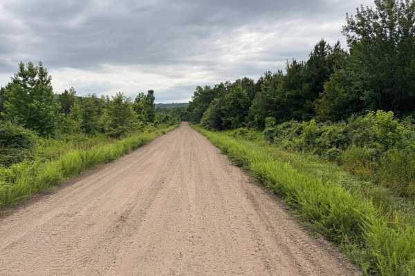
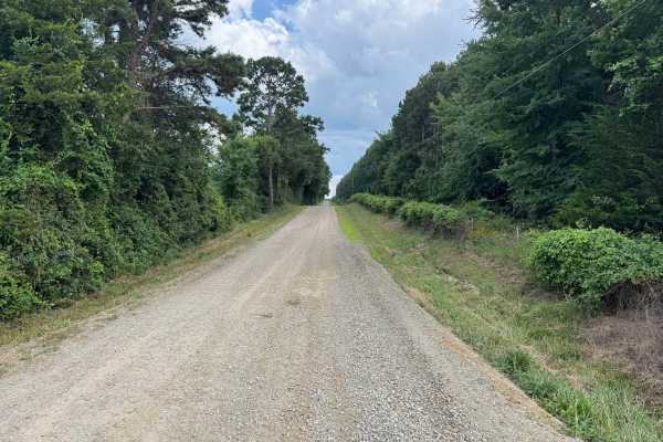
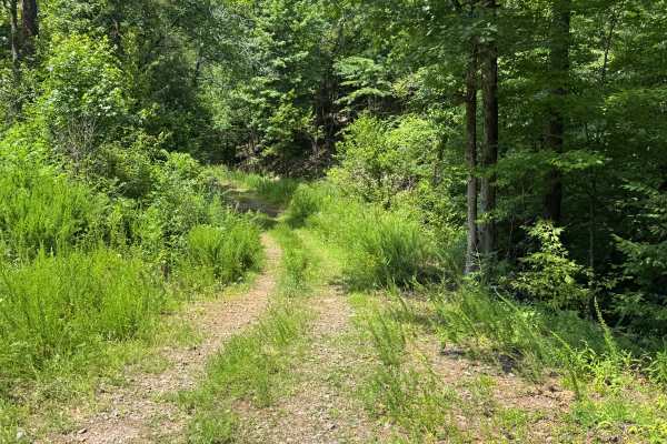
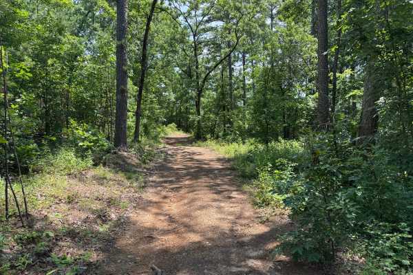
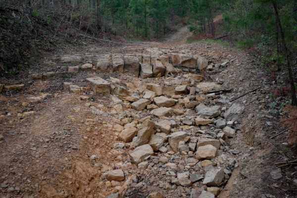
Ross Mountain
This maintained gravel route provides an easy drive through a diverse mix of open grassy fields and dense hardwood and pine forests. Long straightaways offer views toward the surrounding hills, while tree-lined sections create a secluded feel as the road winds through the countryside. The route is p...
Learn more about Ross Mountain
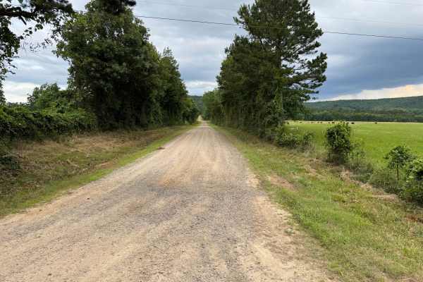
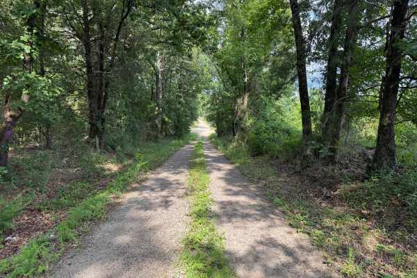
Worship Mountain
This maintained gravel route provides an easy drive through a mix of open farmland and dense pine and hardwood forests. Near Rushing Road, the road is wide enough for two vehicles to pass comfortably before gradually narrowing to a single-lane gravel road with occasional pull-offs. Long straightaway...
Learn more about Worship Mountain
Rushing Road
This maintained county road transitions from a smooth dirt surface on one end to well-maintained gravel on the other, making it an easy and relaxing drive through the Ozark countryside. Near County Road 3867, the road narrows to approximately one vehicle wide, although there are several locations wh...
Learn more about Rushing Road
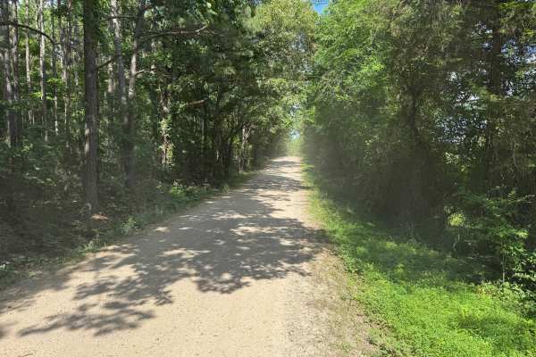
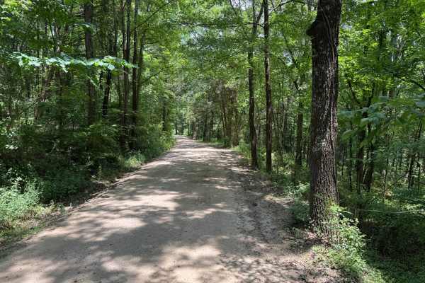
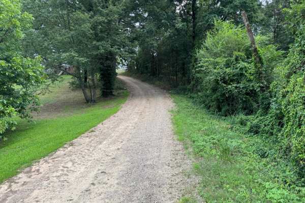
Silex Road
This route follows a well-maintained, graded gravel road through a peaceful section of the Ozarks, making it an enjoyable drive for any vehicle. Towering hardwoods and pines create long stretches of shaded roadway, with occasional openings that reveal small fields and private residences tucked along...
Learn more about Silex Road
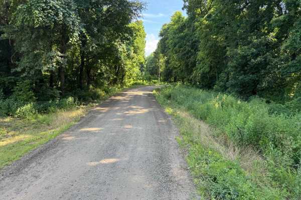
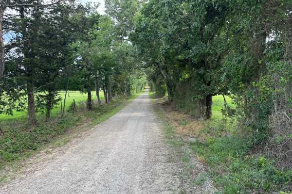
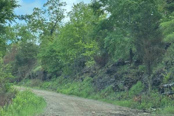
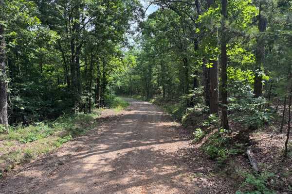
County Road 3851
This maintained gravel road offers a peaceful drive through the rolling hills of the Ozarks with no significant obstacles or technical challenges. The route is bordered by dense stands of mature hardwoods and tall pine trees that create long, natural walls of green on both sides of the road. In seve...
Learn more about County Road 3851
Slover Creek
This scenic forest route follows a narrow, single-vehicle-wide track with very few places to pull over, so be prepared to yield if you encounter oncoming traffic. Towering hardwoods and pines create a peaceful, shaded drive, with sections where the tree canopy nearly encloses the road. The route win...
Learn more about Slover Creek

Seymor Road
Seymor Road is a well-maintained graded dirt road providing access to ATV trails at its eastern terminus near Campbell Hollow. The 3.5-mile route features gentle grades and minimal obstacles, making it suitable for all vehicle types including toy haulers and horse trailers. While not technically cha...
Learn more about Seymor Road
Millsap
This route begins as a well-maintained gravel road that transitions into a dirt surface as it heads farther into the woods. It travels through a quiet forest setting and passes a few private residences near the beginning of the route. Please respect private property and remain on the designated road...
Learn more about Millsap
Melvin
This maintained gravel county route provides an easy drive through the rural Ozarks, with the roadway generally remaining one vehicle wide but offering occasional pull-offs where oncoming traffic can safely pass. The route winds between mature hardwoods and towering pines, creating long, shaded corr...
Learn more about Melvin
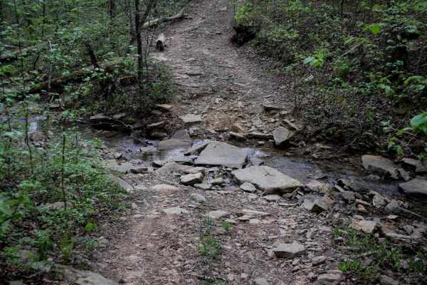
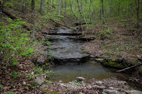
FS 93231A
This narrow forest connector winds through dense hardwoods and pines, creating a secluded drive with frequent stretches where brush and tree limbs crowd the trail. Pinstriping is likely, especially for full-size trucks. Along the way, you'll cross a shallow creek with a firm bottom that is not typic...
Learn more about FS 93231A

Black Oak Ridge Loop
This ATV loop in the Ozark National Forest is easy and scenic, but full of small features to keep the average rider on their toes. The southwest end of the trail starts at intersection N, and it descends through the forest through intersections S, Q, and P, until it ascends to the intersection L. T...
Learn more about Black Oak Ridge Loop
2307B
Beginning at the west end, this trail follows an easy two-track path through a forest of tall oaks and maples, with sharp curves weaving between the trees. Portions of the trail are covered with loose, flat cobblestone. The route descends to several small, rocky creek crossings, which feature large,...
Learn more about 2307B
Pilot Rock Mountain Road
Pilot Rock Mountain Road provides a thrilling off-road experience, weaving through the Ozark National Forest. This road offers amazing views without extensive technical terrain. This road is very well-maintained and does not require 4WD in most cases. Expect washouts and light mud after a good rain....
Learn more about Pilot Rock Mountain Road
County Road 3706
This semi-maintained gravel route offers a peaceful drive through the countryside of the Ozarks, with dense hardwoods and towering pines creating a scenic canopy for much of the route. As the road winds through the hills, it alternates between gentle curves and longer straight sections, providing oc...
Learn more about County Road 3706
FS 93234E
This route is primarily a single-vehicle-wide dirt road winding through the Pine Wildlife Management Area. Several sections provide enough room to pull over and allow oncoming traffic to pass, while recently logged areas open up the landscape with wider views before the route returns to dense pine f...
Learn more about FS 93234E
B
This trail starts at the west end with a wet and muddy stretch, winding through small rocks and rooty patches. Expect puddles and ruts up to a foot deep--picking the high points is key. Scattered small logs require a bit of technical handling, and steep little climbs add to the challenge as the trai...
Learn more about B
County Road 3880
This well-maintained graded gravel route winds through a mix of dense hardwood forest and scattered private properties, offering a quiet drive with plenty of Ozark scenery. Approximately half of the route is only wide enough for a single vehicle, though periodic pull-offs provide room for oncoming t...
Learn more about County Road 3880
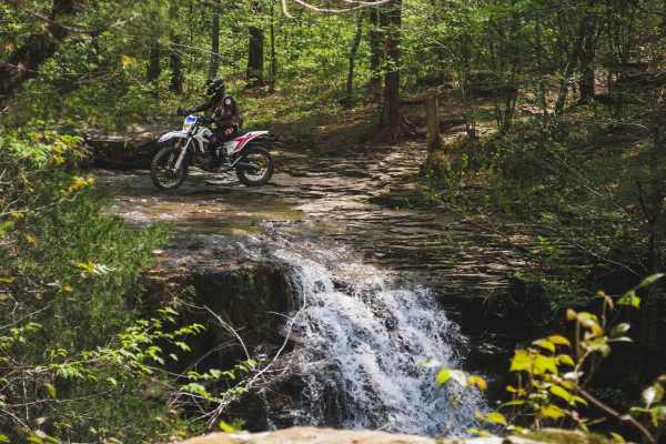
Stave Mill Falls
This loop is an easy ATV trail in the Ozark National Forest with a few features that make it more rugged and interesting for the average rider. The trail has several big downhills full of loose rocks with deep ruts and troughs, making it off-camber in sections, requiring careful navigation of the hi...
Learn more about Stave Mill Falls
High Mountain Loop B
This loop in the Ozark National Forest circles High Mountain has a 1,493-foot peak. It gradually ascends in the counterclockwise direction. It goes through a mix of open forest with small young pine trees, then through a more dense forest of maple trees. Expect mud and deep ruts, including a bypass ...
Learn more about High Mountain Loop B
County Road 3857
This maintained county gravel route travels through the rural countryside, connecting open fields, wooded sections, and scattered private properties. A gentle grade near one end adds a small change in elevation, while the remainder of the route consists of easy curves and straight stretches through ...
Learn more about County Road 3857
Beginner ATV trails near Dover, Arkansas
Explore ATV-friendly trails near you. These trails are accessible for vehicles up to 50 inches wide, perfect for ATVs and smaller off-road machines.
Seymor Road
Seymor Road is a well-maintained graded dirt road providing access to ATV trails at its eastern terminus near Campbell Hollow. The 3.5-mile route features gentle grades and minimal obstacles, making it suitable for all vehicle types including toy haulers and horse trailers. While not technically cha...
Learn more about Seymor Road
FS 93231A
This narrow forest connector winds through dense hardwoods and pines, creating a secluded drive with frequent stretches where brush and tree limbs crowd the trail. Pinstriping is likely, especially for full-size trucks. Along the way, you'll cross a shallow creek with a firm bottom that is not typic...
Learn more about FS 93231A
Black Oak Ridge Loop
This ATV loop in the Ozark National Forest is easy and scenic, but full of small features to keep the average rider on their toes. The southwest end of the trail starts at intersection N, and it descends through the forest through intersections S, Q, and P, until it ascends to the intersection L. T...
Learn more about Black Oak Ridge Loop
2307B
Beginning at the west end, this trail follows an easy two-track path through a forest of tall oaks and maples, with sharp curves weaving between the trees. Portions of the trail are covered with loose, flat cobblestone. The route descends to several small, rocky creek crossings, which feature large,...
Learn more about 2307B
Beginner UTV/side-by-side trails near Dover, Arkansas
Find UTV and side-by-side trails near you. These trails accommodate vehicles up to 60 inches wide, ideal for UTVs, side-by-sides, and wider off-road rigs.
Seymor Road
Seymor Road is a well-maintained graded dirt road providing access to ATV trails at its eastern terminus near Campbell Hollow. The 3.5-mile route features gentle grades and minimal obstacles, making it suitable for all vehicle types including toy haulers and horse trailers. While not technically cha...
Learn more about Seymor Road
FS 93231A
This narrow forest connector winds through dense hardwoods and pines, creating a secluded drive with frequent stretches where brush and tree limbs crowd the trail. Pinstriping is likely, especially for full-size trucks. Along the way, you'll cross a shallow creek with a firm bottom that is not typic...
Learn more about FS 93231A
Pilot Rock Mountain Road
Pilot Rock Mountain Road provides a thrilling off-road experience, weaving through the Ozark National Forest. This road offers amazing views without extensive technical terrain. This road is very well-maintained and does not require 4WD in most cases. Expect washouts and light mud after a good rain....
Learn more about Pilot Rock Mountain Road
FS 93234E
This route is primarily a single-vehicle-wide dirt road winding through the Pine Wildlife Management Area. Several sections provide enough room to pull over and allow oncoming traffic to pass, while recently logged areas open up the landscape with wider views before the route returns to dense pine f...
Learn more about FS 93234E
The onX Offroad Difference
onX Offroad combines trail photos, descriptions, difficulty ratings, width restrictions, seasonality, and more in a user-friendly interface. Available on all devices, with offline access and full compatibility with CarPlay and Android Auto. Discover what you're missing today!
Open Trail Map