
Beginner Off-Road Trails
Near Del Rey, California
Explore All Beginner Trails Near Del Rey, California
Beginner Off-Road Trails Near Del Rey, California
Discover the best beginner-friendly off-road trails near you. These easier, lower-rated trails are a great place to start — browse trail maps, check difficulty ratings, and find your next adventure.
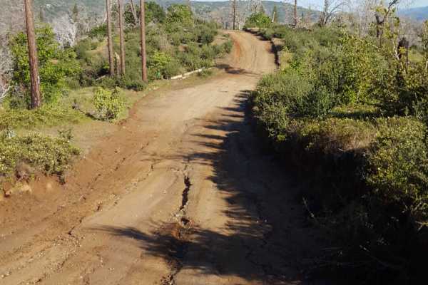
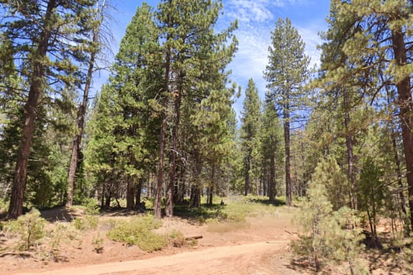
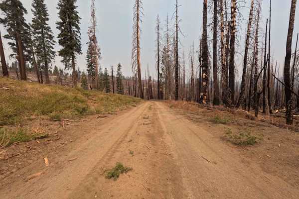
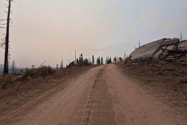
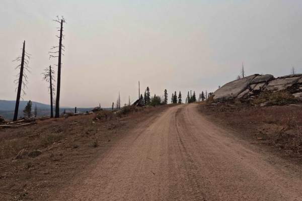
Jose Basin
This is the primary dirt road running through the Jose Creek Basin in the Sierra National Forest and connects the north end of Jose Basin Road to Auberry Road/Highway 168. It is wide enough in most places to allow vehicles to pass each other. Depending on the weather, there could be occasional muddy...
Learn more about Jose Basin
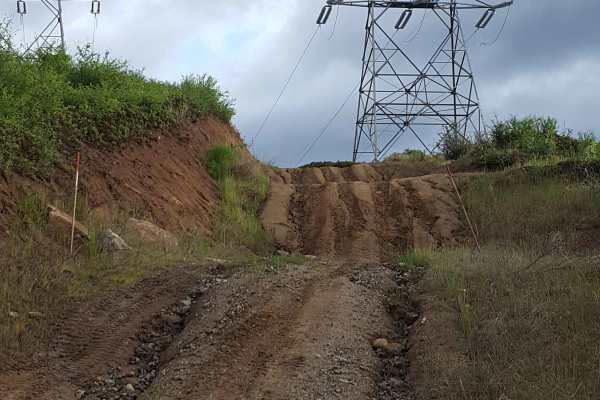
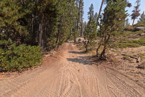
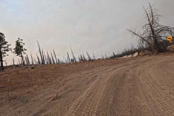
Rector Line 9S006
Rector Line (Forest Service Road 9S006) is a rugged backcountry route in the Sierra National Forest, best suited for high-clearance 4x4 rigs and seasoned drivers looking for a remote challenge near Shaver Lake. This trail stands out for its mix of decomposed granite, embedded rock, and steep, off-ca...
Learn more about Rector Line 9S006
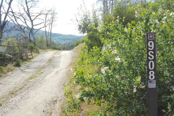
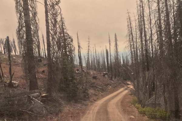
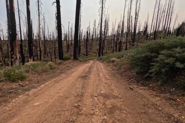
Sugarloaf - FS 9S08
This is a point-to-point single vehicle-width trail in the Jose Creek Basin area. The surface is primarily packed dirt with short stretches of gravel. There can also be shallow ruts and mud holes frequently along the route. This trail will pass through both a section of forest with fire damage and a...
Learn more about Sugarloaf - FS 9S08
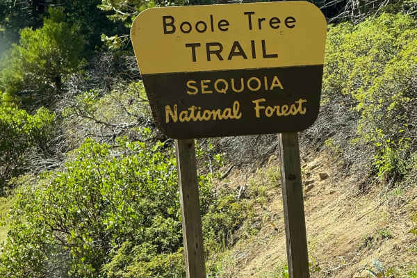
Boole Tree Trailhead
Enter through the National Park fee booth and follow the signs to Grant Grove Village and the Cedar Grove area. The signs for the Boole Tree Trailhead will be along road 180 just past the Cherry Gap OHV Staging Area. The pull-off will be on the driver's side when driving and heading towards Cedar Gr...
Learn more about Boole Tree Trailhead
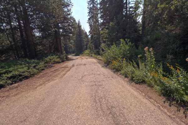
Converse - 13S07/13S50
This is a short loop dirt road in Sequoia National Forest. Along the loop, you can find a few spots perfect for tent camping, with plenty of room for up to 2 to 3 tents and vehicles. The trail is just next to/across from the Princess Campground and Indian Basin Grove off Highway 180.
Learn more about Converse - 13S07/13S50
Tower - FS 25E314
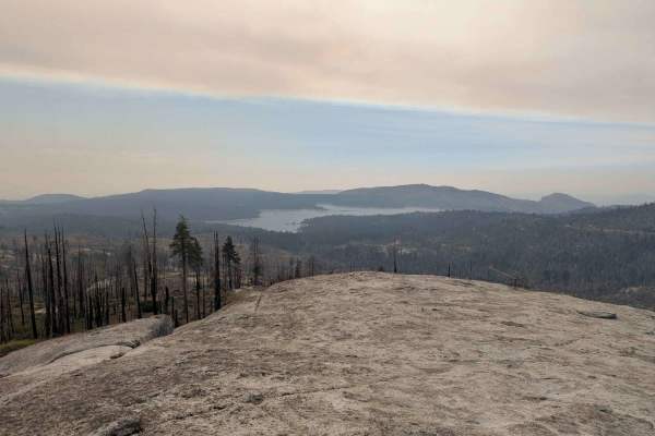
This is an extremely short, 0.7-mile spur trail that provides direct access to a spectacular summit and the Bald Mountain fire watchtower destination. The trail starts as a relatively clear two-track, but the difficulty ramps up quickly as it climbs. The final portion of the climb crests onto an exp...
Learn more about Tower - FS 25E314
Plain - FS 26E211
Don't let the name fool you—Plain (FS 26E211) is anything but boring. This delightful connector trail serves as a scenic bridge between the popular Bald Mountain (FS 26E219) route and the more technical Basecamp (FS 26E328) trail. The drive is a quintessential High Sierra experience, featuring a dyn...
Learn more about Plain - FS 26E211
45 Cutoff - FS 25E309
This 0.7-mile connector trail in the Bald Mountain trail network is a short, twisty, and fun two-track trail that is essential for linking the high-elevation roads in the area ( between Lazy M and Bow Tie). The trail features punchy climbs and minor off-camber bits that demand driver attention despi...
Learn more about 45 Cutoff - FS 25E309
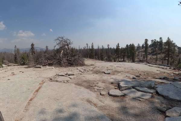
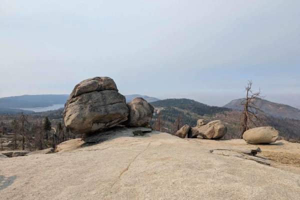
Azalea Creek - FS 9S014B
This is an essential, short 1.1-mile spur providing high-clearance access to a unique ridge-top viewpoint. The trail climbs rapidly through a mixed-severity 2020 Creek Wildfire burn zone, which has exposed the dramatic granite formations and opened up panoramic views. The surface is a mix of rock an...
Learn more about Azalea Creek - FS 9S014B
Woodcock Meadow - 14S13
FS 14S13 is part of the Sequoia National Forest. It is a sandy, dusty trail that takes you through a pine forest with rock formations. There are various sections that were recently burned by a forest fire. The last mile and a half opens up and treats you to beautiful views of the valley below as wel...
Learn more about Woodcock Meadow - 14S13
Peckinpah
Peckinpah Trail (FS Route 8S009) is a rugged backcountry route in the Sierra National Forest that challenges experienced offroaders with its rocky climbs and tight forested passages. Ideal for high-clearance 4WDs, dirt bikes, and ATVs, this technical trail offers a rewarding escape for those seeking...
Learn more about Peckinpah
Bow Tie - FS 25E208
Bow Tie (FS 25E208) is a classic High Sierra connector that feels like a "greatest hits" album of the Bald Mountain region. Starting from Rock Creek Road, this trail winds south, linking up with Tower (FS 25E314) and eventually terminating at Plain (FS 25E315). The tread is that signature Sierra mix...
Learn more about Bow Tie - FS 25E208
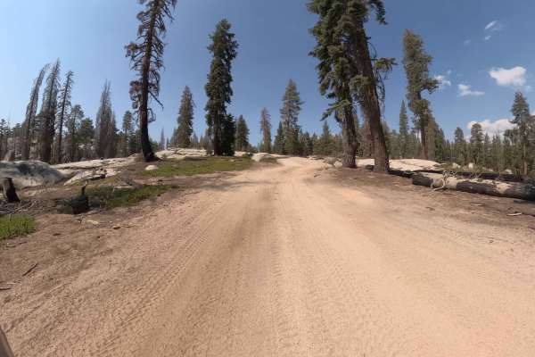
Lower Tamarack - FS 9s026
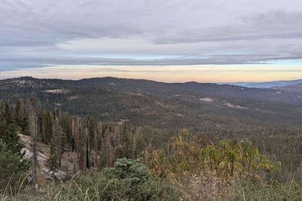
This is an easy, wide 2.1-mile dirt forest service road designed for fast transit through the high country. The road runs through a massive, high-severity burn scar from the 2020 Creek Wildfire (visible in photos), leaving the area wide open and exposed. The roadbed is predominantly smooth, loose du...
Learn more about Lower Tamarack - FS 9s026
Lower Tamarack - FS 9S014
This is an easy, short 2.6-mile spur that leads to a scenic access at a spectacular campsite at a rock grouping above Azeala Creek with regional views out over Shaver Lake. The trail is a loose two-track running through the highly exposed 2020 Creek Wildfire burn scar. The surface is loose dirt with...
Learn more about Lower Tamarack - FS 9S014
Upper South Fork Tamarack Creek - FS 9s023
This is a challenging, 2.2-mile drive defined by extreme surface conditions and environmental hazards. The route begins briefly in a healthy, shaded stand of trees before immediately entering a vast, exposed burn scar from the 2020 Creek Wildfire. The roadbed here is composed of deep, loose duff (de...
Learn more about Upper South Fork Tamarack Creek - FS 9s023
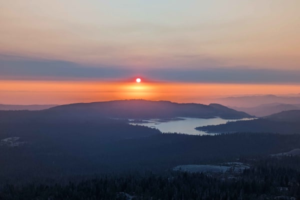
Rock Creek Road - FS 9S090
Rock Creek Road (FS 9S090) is the essential spinal cord of the Bald Mountain OHV area, a 12.7-mile journey that changes its personality more often than a moody teenager. Connecting Highway 168 at the Tamarack Ridge Snowpark to Dinkey Creek Road, this route is the primary artery for accessing the reg...
Learn more about Rock Creek Road - FS 9S090
Upper Tamarack Mountain - FS 9s028
This 1.1-mile two-track is a forest service road that provides a quick transit connector between other roads in this ridge system. The trail runs entirely through a vast, exposed landscape that was severely burned during the 2020 Creek Wildfire. The roadbed is wide and graded, consisting of smooth, ...
Learn more about Upper Tamarack Mountain - FS 9s028
Mountain Top - FS 9S040A
This 0.7-mile trail is a high-elevation, single-lane Forest Service road that connects the top of Lodgepole over to Bawdy around the peak of Tamarack Mountain. The entire trail traverses a highly exposed landscape within the 2020 Creek Wildfire burn scar, creating dramatic vistas but eliminating mos...
Learn more about Mountain Top - FS 9S040A
Lodgepole - FS 9s027
This 2.8-mile road is a key connector designed for efficient travel through the high country. The trail is a wide, smooth two-track that traverses a vast expanse of the 2020 Creek Wildfire burn scar (visible in photos), granting incredible exposure and panoramic views. The roadbed is predominantly s...
Learn more about Lodgepole - FS 9s027
Bawdy - FS 9s040
This 1.6-mile forest service road is a high-elevation, single-lane administrative road designed for access to maintain an overhead power line passing through the area. The entire road traverses a highly exposed landscape within the 2020 Creek Wildfire burn scar, creating dramatic vistas but eliminat...
Learn more about Bawdy - FS 9s040
Beginner ATV trails near Del Rey, California
Explore ATV-friendly trails near you. These trails are accessible for vehicles up to 50 inches wide, perfect for ATVs and smaller off-road machines.
Jose Basin
This is the primary dirt road running through the Jose Creek Basin in the Sierra National Forest and connects the north end of Jose Basin Road to Auberry Road/Highway 168. It is wide enough in most places to allow vehicles to pass each other. Depending on the weather, there could be occasional muddy...
Learn more about Jose Basin
Rector Line 9S006
Rector Line (Forest Service Road 9S006) is a rugged backcountry route in the Sierra National Forest, best suited for high-clearance 4x4 rigs and seasoned drivers looking for a remote challenge near Shaver Lake. This trail stands out for its mix of decomposed granite, embedded rock, and steep, off-ca...
Learn more about Rector Line 9S006
Sugarloaf - FS 9S08
This is a point-to-point single vehicle-width trail in the Jose Creek Basin area. The surface is primarily packed dirt with short stretches of gravel. There can also be shallow ruts and mud holes frequently along the route. This trail will pass through both a section of forest with fire damage and a...
Learn more about Sugarloaf - FS 9S08
Converse - 13S07/13S50
This is a short loop dirt road in Sequoia National Forest. Along the loop, you can find a few spots perfect for tent camping, with plenty of room for up to 2 to 3 tents and vehicles. The trail is just next to/across from the Princess Campground and Indian Basin Grove off Highway 180.
Learn more about Converse - 13S07/13S50
Beginner UTV/side-by-side trails near Del Rey, California
Find UTV and side-by-side trails near you. These trails accommodate vehicles up to 60 inches wide, ideal for UTVs, side-by-sides, and wider off-road rigs.
Jose Basin
This is the primary dirt road running through the Jose Creek Basin in the Sierra National Forest and connects the north end of Jose Basin Road to Auberry Road/Highway 168. It is wide enough in most places to allow vehicles to pass each other. Depending on the weather, there could be occasional muddy...
Learn more about Jose Basin
Rector Line 9S006
Rector Line (Forest Service Road 9S006) is a rugged backcountry route in the Sierra National Forest, best suited for high-clearance 4x4 rigs and seasoned drivers looking for a remote challenge near Shaver Lake. This trail stands out for its mix of decomposed granite, embedded rock, and steep, off-ca...
Learn more about Rector Line 9S006
Sugarloaf - FS 9S08
This is a point-to-point single vehicle-width trail in the Jose Creek Basin area. The surface is primarily packed dirt with short stretches of gravel. There can also be shallow ruts and mud holes frequently along the route. This trail will pass through both a section of forest with fire damage and a...
Learn more about Sugarloaf - FS 9S08
Converse - 13S07/13S50
This is a short loop dirt road in Sequoia National Forest. Along the loop, you can find a few spots perfect for tent camping, with plenty of room for up to 2 to 3 tents and vehicles. The trail is just next to/across from the Princess Campground and Indian Basin Grove off Highway 180.
Learn more about Converse - 13S07/13S50
The onX Offroad Difference
onX Offroad combines trail photos, descriptions, difficulty ratings, width restrictions, seasonality, and more in a user-friendly interface. Available on all devices, with offline access and full compatibility with CarPlay and Android Auto. Discover what you're missing today!
Open Trail Map